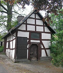
Sudeck (Diemelsee)
|
Sudeck
Diemelsee municipality
Coordinates: 51 ° 20 ′ 37 " N , 8 ° 45 ′ 52" E
|
|
|---|---|
| Height : | 409 m above sea level NHN |
| Area : | 6.62 km² [LAGIS] |
| Residents : | 135 (April 5, 2019) |
| Population density : | 20 inhabitants / km² |
| Incorporation : | December 31, 1971 |
| Postal code : | 34519 |
| Area code : | 05633 |
|
Location of Diemelsee in North Hesse
|
|
Sudeck is a district of the Diemelsee municipality in the Waldeck-Frankenberg district in North Hesse .
geography
Sudeck is located in the Upland in the Diemelsee Nature Park . Landesstrasse 3082 and Kreisstrasse 72 meet in the village . Sudeck lies between Dortmund and Kassel south of Paderborn , roughly in the middle of a triangle with the corner points Korbach , Brilon and Marsberg . The area assigned to the place is 662 hectares .
In terms of natural space , the place is assigned to the region "Ostsauerländer Gebirgsrand (No. 332)" and within it the " Vorupländer Hügelland " (No. 332.61).
history
Sudeck was first mentioned in writing in 1141. The spelling of the place name changed several times during the Middle Ages:
- Sudwich (1141) [Cop. Regesta of the Archbishops of Cologne 2, p. 66, no. 394]
- Sutwik (1194) [Cop. 14th century regests of the archbishops of Cologne 2, p. 299, no. 1488]
- Sudick (1332–1344) [Documents on the history of the principalities of Waldeck and Pyrmont, arr. by Louis Curtze, undated, copy in the service library of the Hessian State Archives Marburg, pp. 39–50, no. 31]
- Sudik (1336-1359) [Paul Wigand, in: Archive for History and Antiquity of Westphalia 7 (1838), p. 300, § 214]
- Sudeck (1537) [HStAM inventory 127 No. 3]
In 1730 Prince Karl August Friedrich von Waldeck-Pyrmont had the Carlsruhe hunting lodge built from wood and Giebringhausen marble . In 1781 the hunting lodge was owned by a Herr von Rheins, an illegitimate son of the builder. In 1789 the castle was described as devastated. In 1790 it was demolished.
The Ittlar desert lies in the district of Sudeck .
Territorial reform
As part of the regional reform in Hesse , Sudeck and twelve other communities formed the new Diemelsee community on December 31, 1971. For Sudeck, as for each of the municipalities that were absorbed into the municipality of Diemelsee, a local district with a local advisory board and local councilor was set up.
Attractions
The church , built in the late Romanesque style, dates from the 13th century.
Infrastructure
- There is a village community center in Sudeck .
Personalities
- Heinrich Bangert (1610–1665), born in Sudeck, scholar, philologist and historian of the Baroque era
- Christian Friedrich Biederbick (1819–1895), German farmer and politician, Mayor of Sudeck from 1854 to 1863
literature
- Wilhelm Köster: Sudeck . Arolsen: Waldeckischer Geschichtsverein 1998 (= Waldeckische Ortssippenbücher 60)
- Literature about Sudeck in the Hessian Bibliography
- Search for Sudeck (Diemelsee) in the archive portal-D of the German Digital Library
Web links
- The district on the website of the Diemelsee municipality (archive version)
- Sudeck, Waldeck-Frankenberg district. Historical local dictionary for Hessen. (As of July 1, 2016). In: Landesgeschichtliches Informationssystem Hessen (LAGIS).
Individual evidence
- ↑ Status: April 5, 2019 in “Facts and Figures” on the Diemelsee municipality's website ( Memento from April 5, 2019 in the Internet Archive ).
- ↑ a b Sudeck, Waldeck-Frankenberg district. Historical local dictionary for Hessen. (As of October 16, 2018). In: Landesgeschichtliches Informationssystem Hessen (LAGIS).
- ↑ As of: 30.06.2016 in "Facts and Figures" on the website of the Diemelsee municipality ( Memento from August 12, 2016 in the Internet Archive ).
- ↑ State of Hesse: The natural areas of Hesse and their main units ( Memento from March 27, 2019 in the Internet Archive )
- ^ Johann Friedrich Blumenbach: Reise ins Waldeckische , 1777 (accessed on November 15, 2010) ( Memento from April 16, 2014 in the Internet Archive )
- ^ Federal Statistical Office (ed.): Historical municipality directory for the Federal Republic of Germany. Name, border and key number changes in municipalities, counties and administrative districts from May 27, 1970 to December 31, 1982 . W. Kohlhammer, Stuttgart / Mainz 1983, ISBN 3-17-003263-1 , p. 408 f .


