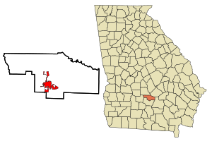
Fitzgerald (Georgia)
| Fitzgerald | |
|---|---|
|
County and state location
|
|
| Basic data | |
| Foundation : | December 2, 1896 |
| State : | United States |
| State : | Georgia |
| County : | Ben Hill County |
| Coordinates : | 31 ° 43 ′ N , 83 ° 15 ′ W |
| Time zone : | Eastern ( UTC − 5 / −4 ) |
| Residents : | 9,053 (as of 2010) |
| Population density : | 395.3 inhabitants per km 2 |
| Area : | 23.3 km 2 (approx. 9 mi 2 ) of which 22.9 km 2 (approx. 9 mi 2 ) is land |
| Height : | 110 m |
| Postal code : | 31750 |
| Area code : | +1 229 |
| FIPS : | 13-29528 |
| GNIS ID : | 0355809 |
| Website : | www.fitzgeraldga.org |
| Mayor : | Jim Puckett |
 |
|
Fitzgerald is a city and also the county seat of Ben Hill County in the US state of Georgia with 9053 inhabitants (as of 2010).
geography
Fitzgerald is on the southern border of Ben Hill County. A small portion to the south of the city is already in the Irwin County area . The nearest major cities are Tallahassee (180 km southwest), Jacksonville (220 km southeast) and Atlanta (260 km north).
history
The city was founded in 1896 by Philander H. Fitzgerald . After the Civil War , veterans of the formerly hostile armies were settled here. The nickname “Colony City”, which is still in use today, comes from this time. The streets were named after soldiers from both the Northern and Southern states . When Ben Hill County was founded in 1906, Fitzgerald became its capital.
In 1896 the place received a railway connection through the Abbeville and Waycross Railroad . In 1971 the section to Abbeville and in 1990 the section to Ocilla was closed.
Demographic data
According to the 2010 census, the then 9,053 inhabitants were distributed among 3,542 inhabited households, which gives an average of 2.47 people per household. There are a total of 4083 households.
64.9% of the households were family households (consisting of married couples with or without offspring or one parent with offspring) with an average size of 3.12 persons. Children under the age of 18 lived in 37.5% of all households and persons aged 65 or over in 27.1% of all households.
30.9% of the population were younger than 20 years, 25.2% were 20 to 39 years old, 24.5% were 40 to 59 years old, and 19.4% were at least 60 years old. The mean age was 35 years. 46.3% of the population were male and 53.7% were female.
43.2% of the population identified themselves as whites , 51.4% as African American , 0.4% as Indians and 0.9% as Asian Americans . 2.7% said they belonged to another ethnic group and 1.4% to several ethnic groups. 4.3% of the population were Hispanics or Latinos .
The average annual income per household was 25,688 USD , while 38.8% of the population lived below the poverty line.
Attractions
The following properties have been entered on the National Register of Historic Places :
- Ben Hill County Courthouse
- Ben Hill County Jail
- Dorminy-Massee House
- Holtzendorf Apartments
- Charles W. Kimball House
- South Main-South Lee Streets Historic District
- Miles V. Wilsey House
The former railroad depot now houses the Blue and Gray Museum with exhibits from the civil war.
Public facilities
The city has several public schools, including a high school and a college , the East Central Technical Institute (until 1996: Ben Hill-Irwin Area Vocational Institute ). A court , prison , town hall, post office and public library , the Fitzgerald-Ben Hill County Library , are also on site.
traffic
Fitzgerald is crossed by US Highways 129 and 319 and Georgia State Routes 90 , 107 and 125 . The nearest airport is Southwest Georgia Regional Airport (around 100 km west).
Personalities
- Forrest Towns (1914-1991), track and field athlete
- Morris B. Abram (1918-2000), lawyer
- Wayne Dowdy (born 1943), politician
Web links
- Website of the city (Engl.)
Individual evidence
- ^ Fitzgerald in the New Georgia Encyclopedia. Georgia Humanities Council, accessed November 18, 2008 .
- ^ Profile of General Population and Housing Characteristics: 2010 . United States Census Bureau . Retrieved February 7, 2019.
- ↑ GEORGIA - Ben Hill County. National Register of Historic Places , accessed February 7, 2019 .
