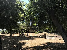
Friedrichshof (Rietzneuendorf-Staakow)
|
Friedrichshof
Rietzneuendorf-Staakow municipality
Coordinates: 52 ° 1 ′ 2 " N , 13 ° 38 ′ 40" E
|
||
|---|---|---|
| Height : | 54 m above sea level NHN | |
| Area : | 3.8 km² | |
| Residents : | 102 (Jan. 1, 2017) | |
| Population density : | 27 inhabitants / km² | |
| Incorporation : | 1st January 1974 | |
| Incorporated into: | Rietzneuendorf-Friedrichshof | |
| Postal code : | 15910 | |
| Area code : | 035477 | |
|
Location of Friedrichshof in Brandenburg |
||
Friedrichshof ( Frycowy Dwor in Lower Sorbian ) is a district of the municipality of Rietzneuendorf-Staakow in the Dahme-Spreewald district in Brandenburg . Since January 1, 1974 Friedrichshof together with the district Rietzneuendorf formed the municipality Rietzneuendorf-Friedrichshof , which was merged with the municipality Staakow on December 31, 2001 . Since then, Rietzneuendorf and Friedrichshof have been independent districts.
location
Friedrichshof is located on the outermost edge of the Unterspreewald almost ten kilometers north of Golßen . Surrounding towns are Staakow in the northeast, Rietzneuendorf in the east, the Golßen district of Prierow in the south, Golßen in the southwest, the glassworks belonging to the town of Baruth / Mark in the Teltow-Fläming district in the west and the Baruth district of Dornswalde in the northwest. In the north, Friedrichshof is surrounded by a forest area that extends until shortly before Königs Wusterhausen .
Friedrichshof is on Kreisstraße 6147 , which leads via Rietzneuendorf to Waldow / Brand . The state road 711 from Wahlsdorf to Krausnick runs about two kilometers southeast of the village. The closest motorway junction, Staakow, on federal motorway 13 is about three kilometers away. The Dahme and the Buschgraben , both tributaries of the Spree, flow in the area around Friedrichshof .
From Friedrichshof the bus route 476 goes to Lübben and Golßen. The routes are operated by the regional transport company Dahme-Spreewald (RVS) .
history
The former cottage community Friedrichshof was officially founded in 1745 by Friedrich Heinrich Graf zu Solms-Baruth together with a few other villages and belonged to the Baruth class . Even before the village was founded, a Vorwerk for Rietzneuendorf and a forester's house were built around 1720 . The Vorwerk was called Kolonie Friedrichshof and the forester's house Kolonie Rietze .
Friedrichshof was under the direct influence of the princes of Solms. Until the land reform in 1945 , when they were expropriated, the princes owned all the agricultural land and they also managed the forests in the village.
From 1945 the fields were cultivated by the Rietzneuendorfer cooperative and after the formation of the agricultural production cooperative in Rietzneuendorf. The Friedrichshofer population lived mainly from agriculture, forest work or they worked in the neighboring glassworks .
After the Congress of Vienna , the former Saxon Friedrichshof came to the Kingdom of Prussia and was located in the district of Luckau in the administrative district of Frankfurt . On July 25, 1952, the community was assigned to the newly formed Lübben district in the Cottbus district . On January 1, 1974, Friedrichshof merged with the neighboring Rietzneuendorf to form the municipality of Rietzneuendorf-Friedrichshof. After the reunification , Rietzneuendorf-Friedrichshof was in the Lübben district in Brandenburg . On October 26, 1992 the community joined the Unterspreewald office . After the district reform in Brandenburg on December 6, 1993 , the Rietzneuendorf-Friedrichshof finally came to the newly formed district of Dahme-Spreewald . On December 31, 2001, Rietzneuendorf-Friedrichshof merged with the Staakow community to form the new Rietzneuendorf-Staakow community. On January 1, 2013, the Unterspreewald office merged with the Golßener Land office , creating the Unterspreewald office .
Population development
| Population development in Friedrichshof from 1875 to 1971 | |||||||||||||
|---|---|---|---|---|---|---|---|---|---|---|---|---|---|
| year | Residents | year | Residents | ||||||||||
| 1875 | 256 | 1939 | 163 | ||||||||||
| 1890 | 263 | 1946 | 213 | ||||||||||
| 1910 | 158 | 1950 | 201 | ||||||||||
| 1925 | 172 | 1964 | 116 | ||||||||||
| 1933 | 155 | 1971 | 112 | ||||||||||
Web links
- Friedrichshof on the website of the Unterspreewald office
proof
- ↑ Unterspreewald Office - Residents' Registration Office (ed.): Population figures for the entire Unterspreewald Office (with municipalities and parts of towns and cities) as of January 1, 2017 . Schönwalde July 27, 2017 ( contact details [accessed July 28, 2017]).
- ↑ a b Municipality of Rietzneuendorf-Staakow. In: unterpreewald.de. Unterspreewald Office, accessed on July 28, 2017 .
- ^ Friedrichshof in the historical directory. Retrieved July 28, 2017 .
- ↑ Historical municipality register of the state of Brandenburg 1875 to 2005. (PDF; 331 kB) District Dahme-Spreewald. State Office for Data Processing and Statistics State of Brandenburg, December 2006, accessed on July 28, 2017 .


