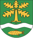
Gmina Damnica
| Gmina Damnica | ||
|---|---|---|

|
|
|
| Basic data | ||
| State : | Poland | |
| Voivodeship : | Pomerania | |
| Powiat : | Słupski | |
| Geographic location : | 54 ° 30 ' N , 17 ° 16' E | |
| Residents : | see Gmina | |
| Postal code : | 76-231 | |
| Telephone code : | (+48) 59 | |
| License plate : | GSL | |
| Economy and Transport | ||
| Street : | DK6 : Gdansk - Stettin , junction: Mianowice | |
| Rail route : | Railway station on the Stargard Szczeciński – Gdańsk railway line | |
| Next international airport : | Danzig | |
| Gmina | ||
| Gminatype: | Rural community | |
| Gmina structure: | 33 localities | |
| 18 school offices | ||
| Surface: | 167.81 km² | |
| Residents: | 6058 (June 30, 2019) |
|
| Population density : | 36 inhabitants / km² | |
| Community number ( GUS ): | 2212022 | |
| administration | ||
| Address: | ul.Górna 1 76-231 Damnica |
|
| Website : | www.damnica.pl | |
The Gmina Damnica is a rural community in the powiat Słupski of the Pomeranian Voivodeship in Poland . Its seat is in the village of the same name Damnica (German Hebrondamnitz , Kashubian Damnica ) with 1240 inhabitants (2006). The Gmina has an area of 167.8 square kilometers and about 6200 inhabitants.
geography
The rural community is located in Western Pomerania . The landscape is a wide plain east of Słupsk (Stolp) between the Słupia (Stolpe) and the Łupawa (Lupow) . The river Charstnica ( Karstnitz brook ) runs in a south-north direction through the western part of the municipality and flows into the Łupawa at Damno (Dammen) , which flows in the same direction through the eastern part of the municipality.
Neighboring municipalities are: Słupsk , Główczyce (Glowitz) , Potęgowo (Pottangow) and Dębnica Kaszubska (Rathsdamnitz) .
history
From 1975 to 1998 Gmina belonged to the Slupsk Voivodeship .
structure

The rural community Damnica is subdivided into 18 villages with school administration offices , to which 15 other localities are assigned:
|
|
In this Schulz offices, the villages spread: Dębniczka ( Damnitzow ) Domanice ( Friedrichshof ) Głodowo ( Gloddow ) Jeziorka ( Gesorke , 1938-45 small hydro ), Łężyca ( Grünhof ) Mrówczyno ( Jaegerhof ) Paprzyce ( Papritzfelde ) Skibin ( Franzhagen ), Wiatrowo ( Viatrow , 1938–45 Steinfurt ), Wiszno ( Vieschen ) and Zagórzyczki ( Sageritzheide ).
traffic
The Gdańsk - Stargard railway with the Damnica and Strzyżyno railway stations runs through the municipality .
The national road 6 Gdansk - Szczecin (also European route E28 ) leads through the south of the municipality with the villages Mianowice and Domaradz.
Web links
- Rural Municipality Website (Polish)
- The community of Hebrondamnitz in the former Stolp district (Gunthard Stübs and Pommersche Forschungsgemeinschaft, 2011)
literature
- Karl-Heinz Pagel : The district of Stolp in Pomerania . Lübeck 1989, pp. 563-567.
Individual evidence
- ↑ population. Size and Structure by Territorial Division. As of June 30, 2019. Główny Urząd Statystyczny (GUS) (PDF files; 0.99 MiB), accessed December 24, 2019 .
