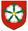
Gmina Dobiegniew
| Gmina Dobiegniew | ||
|---|---|---|

|
|
|
| Basic data | ||
| State : | Poland | |
| Voivodeship : | Lebus | |
| Powiat : | Strzelecko-Drezdenecki | |
| Geographic location : | 52 ° 58 ′ N , 15 ° 45 ′ E | |
| Height : | 58 m npm | |
| Residents : | s. Gmina | |
| Postal code : | 66-520 | |
| Telephone code : | (+48) 95 | |
| License plate : | FSD | |
| Economy and Transport | ||
| Street : | Berlin - Gdansk | |
| Rail route : | Szczecin – Poznan | |
| Next international airport : | Szczecin-Goleniów | |
| Gmina | ||
| Gminatype: | Urban-and-rural parish | |
| Gmina structure: | 51 localities | |
| 13 school authorities | ||
| Surface: | 350.99 km² | |
| Residents: | 6544 (Jun. 30, 2019) |
|
| Population density : | 19 inhabitants / km² | |
| Community number ( GUS ): | 0806013 | |
| Administration (as of 2018) | ||
| Mayor : | Sylwia Łaźniewska | |
| Address: | ul. Dembowskiego 2 66-520 Dobiegniew |
|
| Website : | www.dobiegniew.pl | |
The Gmina Dobiegniew [ dɔ'bʲɛgɲɛf ] is a town-and-country municipality in the powiat Strzelecko-Drezdenecki of the Lubusz Voivodeship in Poland . Its seat is the city and country municipality ( German Woldenberg ) with about 3050 inhabitants.
geography
The municipality is located in the far north of the voivodeship in the historic Neumark . It has an area of 351 km² and borders the West Pomeranian Voivodeship to the north and the Greater Poland Voivodeship to the east . The town of Gorzów Wielkopolski (Landsberg an der Warthe) is 35 kilometers southwest.
Its main town is on the national road DK22 and on the Szczecin – Poznan railway line .
The east of the municipality is part of the Drawa National Park .
structure
In addition to the city itself, the city-and-rural community Dobiegniew is divided into 13 school authorities, which include 51 villages, localities and residential areas:
Chomętowo ( Hermsdorf ) Chrapów ( Grapow ) Czarnolesie ( kettle base ), Derkacze ( Dicking ) Dębogóra ( Eichberg ) Głusko ( Steinbusch ) Grabionka ( Grabershof ) Grasy ( Grams field ), Jarychowo ( Neuhütte ) Kępa Zagajna ( Friedrichslust ) , Lipinka ( Jägersburg ), Lubiewko ( Brandsheide ), Łęczyn ( Lenzenbruch ), Ługi ( Lauchstädt ), Mierzęcin ( Mehrenthin ), Osiek ( Wutzig ), Ostrowiec ( Rohrsdorf ), Podlesiec ( Waldowshof ), Radachowo ( Heidekavel ), Radęcin ( Regenthin ) , Sarbinowo ( Schüttenburg ), Sławica ( Krügergrund ), Słonów ( Schlanow ), Słowin ( Lämmersdorf ), Stare Osieczno ( wedding ) and Wołogoszcz ( Wolgast ).
Personalities
- Hans von Strantz (1739–1815), Prussian major general, died in 1815 on his Grapow estate
- Karl Wilhelm von Waldow (1777–1836), Prussian major general, born on Wolgast.
Web links
- City and municipality website (Polish)
Individual evidence
- ↑ population. Size and Structure by Territorial Division. As of June 30, 2019. Główny Urząd Statystyczny (GUS) (PDF files; 0.99 MiB), accessed December 24, 2019 .
