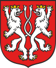
Gmina Kąty Wrocławskie
| Gmina Kąty Wrocławskie | ||
|---|---|---|

|
|
|
| Basic data | ||
| State : | Poland | |
| Voivodeship : | Lower Silesia | |
| Powiat : | Wrocławski | |
| Geographic location : | 51 ° 2 ′ N , 16 ° 46 ′ E | |
| Height : | 138 m npm | |
| Residents : | s. Gmina | |
| Postal code : | 55-080 | |
| Telephone code : | (+48) 71 | |
| License plate : | DWR | |
| Economy and Transport | ||
| Street : | A4 motorway | |
| Rail route : | Wrocław Świebodzki – Wałbrzych Głowny | |
| Next international airport : | Wroclaw | |
| Gmina | ||
| Gminatype: | Urban-and-rural parish | |
| Gmina structure: | 36 school offices | |
| Surface: | 176.50 km² | |
| Residents: | 24,927 (Jun. 30, 2019) |
|
| Population density : | 141 inhabitants / km² | |
| Community number ( GUS ): | 0223043 | |
| Administration (as of 2018) | ||
| Mayor : | Łukasz Zbroszczyk | |
| Address: | Rynek - Ratusz 1 55-080 Kąty Wrocławskie |
|
| Website : | www.katywroclawskie.pl | |
The Gmina Kąty Wrocławskie [ kˈɔ̃tɨ vrɔtswˈafskiɛ ] is an urban-and-rural municipality in the powiat Wrocławski of the Lower Silesian Voivodeship in Poland . Its seat is the city of the same name (German Kanth ) with about 6700 inhabitants.
geography
The municipality is located in Lower Silesia , 20 kilometers southwest of the city center of Wroclaw on the A4 motorway . It is crossed by the rivers Bystrzyca (Weistritz) and Strzegomka (Striegauer Wasser) . Geographically, the area belongs to the Wroclaw Plain, part of the Silesian lowlands.
history
In the post-war period the population increased sharply due to the proximity to Wroclaw. After the political change in Poland in 1989, many foreign companies, such as Scania , invested in the municipality, which mainly benefit from the proximity to the business and university location Wroclaw as well as the connection to the A4 motorway and the proximity to Wroclaw Airport . The municipality therefore made an area of 700 hectares available for new investments.
City and community partnerships
Kąty Wrocławskie has partnerships with the following locations:
- Biblis ( Hessen ) since June 29, 2003
- Żerków ( Greater Poland Voivodeship ) since May 2, 2005
Attractions
- Krieblowitz Castle in Krobielowice
- Romberg Castle in Samotwór
structure
The urban and rural municipality of Kąty Wrocławskie is divided into the following places in addition to the city:
- Baranowice-Bliż (Bahra ; 1939–1945 Baara)
- Bogdaszowice (Puschwitz)
- Cesarzowice (Blankenau)
- Czerńczyce ( Cape Village )
- Gniechowice (Gnichwitz ; 1937–1939 Yorckschwert , 1939–1945 Altenrode)
- Górzyce (Guhrwitz ; 1937–1945 Burgweiler)
- Gądów (Old Gandau)
- Jaszkotle (Jäschgüttel)
- Jurczyce (Jürtsch ; 1937–1945 Jürgen)
- Kamionna (Kammendorf near Kanth)
- Kębłowice (Kammelwitz ; 1937–1945 Kammfeld)
- Kilianów (Landau)
- Kozłów (Koslau ; 1937–1945 gravel ground)
- Krobielowice (Krieblowitz ; 1937–1945 Blüchersruh)
- Krzeptów (Kriptau)
- Małkowice (Malkwitz ; 1937–1945 Waldtal)
- Mokronos Dolny (Niederhof)
- Mokronos Górny (Oberhof)
- Nowa Wieś Kącka (Neudorf b. Kanth)
- Nowa Wieś Wrocławska (Polish Neudorf ; 1939–1945 Neudorf)
- Pełcznica (Polsnitz ; 1937–1945 Brückenfelde)
- Pietrzykowice (Polish Peterwitz ; 1937–1939 Peterwitz , 1939–1945 Petersweiler)
- Romnów (Rommenau)
- Rybnica (Reibnitz)
- Sadków (Groß Schottgau)
- Sadkówek (Klein Schottgau)
- Sadowice (Sadewitz ; 1937–1945 Schill)
- Samotwór (Romberg)
- Skałka (Schalkau)
- Smolec ( melt )
- Sokolniki (Zaugwitz ; 1937–1945 flood)
- Sośnica (Schosnitz ; 1937–1945 Reichbergen)
- Stary Dwór (Althof)
- Stoszyce (Stöschwitz ; 1937–1945 Eichdamm)
- Strzeganowice (Paschwitz ; 1937–1945 Fuchshübel)
- Szymanów (Simschütz)
- Wojtkowice (Woigwitz ; 1937–1945 Albrechtsau)
- Wszemiłowice (Schimmelwitz ; 1937–1945 Zweibach)
- Zabrodzie (Zweibrodt)
- Zachowice (Sachwitz ; 1937–1945 Martinsgrund)
- Zybiszów (Siebischau)
- the settlements Gniewoszów, Różaniec and Stradów; such as
- the hamlets of Bliż, Jaszkotle, Jurczyce, Sadkówek and Zybiszów.
Personalities
- Eberhard von Rothkirch (1852–1911), co-founder of the YMCA, born in Schottgau.
Web links
Remarks
- ↑ population. Size and Structure by Territorial Division. As of June 30, 2019. Główny Urząd Statystyczny (GUS) (PDF files; 0.99 MiB), accessed December 24, 2019 .
- ↑ Economy of the community: Archived copy ( Memento of the original from September 7, 2006 in the Internet Archive ) Info: The archive link was inserted automatically and not yet checked. Please check the original and archive link according to the instructions and then remove this notice.

