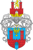
Gmina Prudnik
| Gmina Prudnik | ||
|---|---|---|

|
|
|
| Basic data | ||
| State : | Poland | |
| Voivodeship : | Opole | |
| Powiat : | Prudnik | |
| Geographic location : | 50 ° 19 ′ N , 17 ° 36 ′ E | |
| Height : | 265 m npm | |
| Residents : | s. Gmina | |
| Postal code : | 48-200 | |
| Telephone code : | (+48) 77 | |
| License plate : | OPR | |
| Economy and Transport | ||
| Street : |
Głuchołazy - Kędzierzyn-Koźle / Nysa - Krnov |
|
| Rail route : | Nysa – Kędzierzyn-Koźle | |
| Next international airport : | Wroclaw | |
| Gmina | ||
| Gminatype: | Urban-and-rural parish | |
| Gmina structure: | 11 school offices | |
| Surface: | 122.13 km² | |
| Residents: | 27,157 (Jun. 30, 2019) |
|
| Population density : | 222 inhabitants / km² | |
| Community number ( GUS ): | 1610043 | |
| Administration (as of 2018) | ||
| Mayor : | Grzegorz Zawiślak | |
| Address: | ul.Kosciuszki 3 48-200 Prudnik |
|
| Website : | www.prudnik.pl | |
The Gmina Prudnik [ 'prudɲik ] is a town-and-country municipality in the powiat Prudnik of the Opole Voivodeship in Poland . The seat of the municipality and the powiat is the city of the same name ( German Neustadt OS ) with more than 21,000 inhabitants.
geography
The community is located in the region of Upper Silesia between the Leobschützer Lößhügelland (Płaskowyż Głubczycki) and the ostsudetischem Opawskie Mountains (Opawskie Mountains). It borders the Czech Republic in the south , the voivodeship capital Opole (Opole) is about 50 kilometers north. The waters include the Prudnik River and the Złoty Potok .
Prudnik is on the national roads DK 40 and DK 41 .
history
In 1921, the municipality (with the western part of the Neustadt district) was not affected by the referendum on the state membership of Upper Silesia. As a result of the Second World War , this part of Upper Silesia also came to Poland. The German population was largely expelled. Some of the newly settled residents were displaced from eastern Poland .
Partnerships
- Northeim , Germany since 1990
- Bohumín , Czech Republic since 2000
- Nadvirna , Ukraine since 2000
- Krnov , Czech Republic since 2002
- San Giustino , Italy since 2002.
local community
The urban and rural community of Prudnik has around 27,500 inhabitants on an area of 122.13 km² and, in addition to the eponymous capital, is divided into the following school authorities (sołectwa):
- Chocim ( Kotzem ; 1936–1945 Linden )
- Czyżowice ( Zeiselwitz )
- Dębowiec ( Eichhäusel )
- Gajówka ( forestry )
- Łąka Prudnicka ( Count's Meadow )
- Mieszkowice ( Dittmannsdorf )
- Moszczanka ( Langenbrück )
- Moszczanka-Kolonia ( Langenbrück Colony )
- Niemysłowice ( Buchelsdorf )
- Osiedle
- Piorunkowice ( Schweinsdorf )
- Rudziczka ( Riegersdorf )
- Siemków ( Bohemian Village )
- Szybowice ( Schnellewalde )
- Trzebieszów (for yourself )
- Wierzbiec ( Wackenau )
- Wieszczyna ( Neudeck )
- Włóczno ( eight hatches )
- Zimne Kąty ( Kaltfuhr )
Web links
- City and municipality web presence (Polish)
Individual evidence
- ↑ population. Size and Structure by Territorial Division. As of June 30, 2019. Główny Urząd Statystyczny (GUS) (PDF files; 0.99 MiB), accessed December 24, 2019 .
- ↑ Biuletyn Informacji Publicznej Prudnik, Burmistrz Prudnika , accessed on December 19, 2018

