Goburg (mountain)
| Goburg | ||
|---|---|---|
|
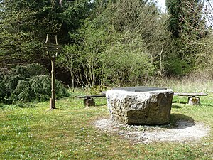
Information board on the highest Eichsfeld elevation |
||
| height | 543.4 m above sea level NHN | |
| location | at Volkerode ; Eichsfeld district , Thuringia ( Germany ) | |
| Mountains | Gobert , Thuringian Basin (with edge plates) | |
| Coordinates | 51 ° 15 '48 " N , 10 ° 3' 3" E | |
|
|
||
| rock | Shell limestone | |
The Goburg is 543.4 m above sea level. NHN the highest mountain in the Eichsfeld and the Eichsfeld-Hainich-Werratal nature park . It is located near Volkerode in Oberen Eichsfeld (Obereichsfeld) in the northwest Thuringian district of Eichsfeld on the border with Hesse ( Germany ).
geography
location
The Goburg rises on the western edge of the Upper Eichsfeld, from the northwest part of the Eichsfeld-Hainich-Werratal nature park and the Eichsfeld district. Its summit is 1.9 km west-northwest of Volkerode . The closest town, Bad Sooden-Allendorf , is 5.5 km to the west and Heilbad Heiligenstadt is 14 km to the north-northeast. Along the western edge of the mountain plateau runs the state border with Hesse, which corresponds to the former inner German border and where today's Green Belt Germany runs.
To the north the ridge leads in the direction of the Hesselkopf ( 506 m ) and to the southeast in the direction of the Pfaffschwender Kuppe ( 493.6 m ), and in the southwest it borders on the highest mountain of the Gobert, the Hohestein ( 569 m ). To the west it ends with a steep edge, like the rock formation at Uhlenkopf (approx. 520 m ) in the direction of Sooden-Allendorfer Werra Valley .
Natural allocation
The Goburg belongs to the natural spatial main unit group Thuringian Basin (with edge plates) (No. 48), in the main unit northwestern edge plates of the Thuringian Basin (483) and in the subunit Allendorfer Wald (483.1) to the natural area Gobert (483.10).
According to the structure within Thuringia ( The Natural Spaces of Thuringia ), it is assigned to the Werrabergland-Hörselberge unit. According to more recent classifications by the Federal Agency for Nature Conservation (BfN), it is also assigned to the Lower Werrabergland.
Nature and protected areas
On the Goburg there is a mixed beech forest with coniferous forests. As a result of the former inner-German border and the relative isolation, a diverse flora and fauna could develop. Parts of the Obereichsfeld landscape protection area ( CDDA no. 390325; designated 2009; 384.7677 km² ) are located in the Thuringian mountain areas . Parts of the fauna-flora-habitat area Stein-Rachelsberg-Gobert (FFH no. 4726-320; 7.16 km²) and the bird sanctuary (VSG) Werrabergland southwest of Uder (VSG no . 4626-420; 84.33 km²). The latter is followed by parts of the Hessian VSG rock cliffs in the Werra-Meißner district (VSG no. 4726-401; 48.343 km²) to the south of the summit region . In Hesse, parts of the two-part FFH area Kalkklippen der Gobert (FFH No. 4726-350; 2.8922 km²) are located on narrow strips north and south of the summit region ; This is followed by the Hessian FFH area Werra and Wehretal (FFH no. 4825-302; 244.8191 km²) in the west. North of the summit region there are parts of the nature reserve (NSG) Kalkklippen south of the Iberg (CDDA No. 163985; 1986; 46.92 hectares ) and to the south those of the NSG Hessian Switzerland near Meinhard (CDDA No. 163663; 1989; 2.4167 km²).
Origin of name and history
Origin of name
Goburg is an old place and mountain name. The first written mention is for the year 1328 ( Gaburg ). The base word of the castle name is apparently a term for "Gau, Land, Area" in Old or Middle High German. The name Gobert came about through changes in the language over the centuries and through dialect influences . Later the name was probably transferred to the entire range of hills. This may also explain why the mountain name "auf der Goburg" can still be found on historical maps (e.g. 1705–1715), but no mountain name is recorded on modern maps, only the mountain name. On the first topographic maps of the 19th century, the plateau above the property is also referred to as an ice field .
Desert Goburg
The noble family von Volkerode (including knight Albert von Cuborc in 1321), who owned a small castle or fortified courtyard there, also named themselves after the mountain. This also included a small village, presumably for the servants and servants ( In villa Goburg ; 1358). It is not possible to determine exactly where the castle was, presumably in the area of the later estate. In early documents an exact assignment of the name to the local place Goburg is not always given, a little further south near Hildebrandshausen the current mountain name Goyberg (1350) for another place (near the desert church) can be proven. In the 15./16. In the 19th century the place was abandoned, the residents and also the knights settled in Volkerode, where they already owned a courtyard with a residential tower . In the 16th century the family called von Volkerode called Goburg . In 1548 the village was mentioned as the Wüstung Goburg, when Konrad and Martin von Hanstein got the desert with 13 hooves of land from the Archbishop of Kurmainzer as a fief.
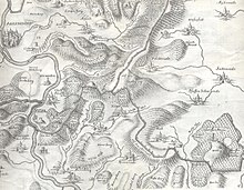
On an old, richly detailed Eichsfeldisch / Hessian border map from 1583, two empty areas are marked above Volkerode in the area of the Goburg with the designation "Gohburgs" for the desert site of the village and / or the castle. The neighboring Pfaffschwende is also shown as a desert and not as a built-up village.
Good Goburg
It is not certain whether buildings were rebuilt here at the end of the 17th century; none are recorded on the map from 1705. In the 19th century, despite the unfavorable natural conditions, the Goburg manor was built on the mountain with pasture and agriculture. After it had passed into the possession of Baron Georg von Lünink in 1928, it was converted into the Goburg forester's house with a small farm and a neighboring sawmill. In 1959, the last residents left the house: They fled to the west and overcame the existing border fence, including cattle. The former estate was demolished two years after this escape as part of the GDR's border security measures; Remnants of stables and cistern are still there.
Inner German border

The historical border between Eichsfeld in Electoral Mainz and the Landgraviate of Hessen-Kassel ran directly on the western edge of the demolition ; some historical boundary stones are still there. This border line also formed the inner German border after 1952 . The border fortifications on the mountain were expanded further in the 1960s and 1970s. Up to the actual border there was a 50 to 100 m wide cleared strip with the border fence and the column path. In a confusing place, a concrete pipe led under the border installations to the German territory, the so-called Stasi pipe . Here people could probably be smuggled undetected under the border fortifications; it is questionable whether it was intended to discharge surface water. At the edge of the forest above Volkerode at the foot of the mountain, another fence, the border security fence, was finally built, so the mountain was completely cordoned off from the population. On December 28, 1989, the border at the old sawmill was opened for the first time and the residents of Volkerode and Hitzelrode were able to meet again at the Goburg.
Worth seeing
The Goburg is located in the hiking area of the Gobert ridge and can be reached on forest trails and paths.
Sights are:
- On the summit there is a bronze plaque with information about the surrounding landscapes and mountains, although the summit region of the mountain does not offer any prospects due to forest cover.
- Remains of the ruins of the Goburg estate, which was later converted into the Goburg forester's house
- Marien-wayside shrine: The Virgin Mary statue originally came from the Georgshaus of Caritas in Cologne , which was destroyed in a bomb attack in 1943. A number of inmates of the house found accommodation in the Goburg forester's lodge, and the statue was placed nearby. After it became clear that the area was to come under Soviet occupation, the inmates left the forester's house, the statue was kept by a family from Volkerode. After German reunification, the wayside shrine was put up again in 1991.
- old forester grave
- Refuge with a memorial stone for the opening of the border in 1989 and a small piece of border fence near the former sawmill
- Hut (open on Sundays and public holidays) of the Volkerode Heimatverein; next door is the antenna house , a former radio station of the border troops, the current of radio amateurs is used
- Stasi tube (agent sluice from Uhlenkopf) : a 38 m long concrete tube near the Uhlenkopf under the column path of the former inner-German border , through which agents of the GDR State Security Service were probably smuggled into the Federal Republic.
literature
- Ernst Roth: Border and border opening at Volkerode. In: Eichsfelder Heimatzeitschrift. Issue 7/8 2007, Mecke Druck und Verlag, Duderstadt 2007, pp. 245–246
- Georg Freiher von Lüninck, Thomas Wölker: The Goburg - The fate of a manor house on the inner-German border. In: Burgen, Schlösser, Gutshäuser, Ed. Bruno J. Sobotka, Theiss Verlag Stuttgart 1995, pp. 237–240
- Thomas Wölker: The Goburg, a desolation of the 20th century. In: Journal for Agricultural History and Agricultural Sociology, Volume 40 (1992), pp. 43–52
- Thomas Wölker: The fate of the Goburg. In: Das Werraland 1992, Issue 2, pp. 30–32
Individual evidence
- ↑ a b c Map services of the Federal Agency for Nature Conservation ( information )
- ^ Hans-Jürgen Klink: Geographical land survey: The natural space units on sheet 112 Kassel. Federal Institute for Regional Studies, Bad Godesberg 1969. → Online map (PDF; 6.9 MB)
- ↑ Dr. Erhard Müller: The place names of the district of Heiligenstadt. Heilbad Heiligenstadt 1989, p. 20
- ↑ Levin von Wintzingeroda-Knorr : Die Wüstungen des Eichsfeldes: Directory of the desert areas, prehistoric ramparts, mines, courts of law and waiting areas within the districts of Duderstadt, Heiligenstadt, Mühlhausen and Worbis. O. Hendel, Göttingen 1903, p. 485
- ^ Complaint of Philipp von Volkerode called Goburg ... (1604), accessed on June 28, 2017, on deutsche-digitale-bibliothek.de
- ↑ Old and younger devastation of the Eichsfeld archives of the home studio Lengenfeld Unterm Stein
- ↑ a b c Modern desolation on the Green Belt ( Memento from April 14, 2016 in the Internet Archive ), in hiking guide on the Green Belt Hesse-Thuringia → From the death strip to the lifeline , on archive.org, from September 12, 2007, from bund.net (PDF; 190.25 KB)
- ↑ Vera Wölk: Winter hike to commemorate the opening of the border in 1989 ( TLZ ), from December 29, 2011, accessed on June 28, 2017, from tlz.de
Web links
- Modern desolation on the Green Belt ( Memento from April 14, 2016 in the Internet Archive ), in Hiking Guide on the Green Belt Hesse-Thuringia → From Death Strip to Lifeline , on archive.org, from September 12, 2007, from bund.net (PDF; 190 , 25 KB)


