
Kohlsdorf (Freital)
|
Kohlsdorf
Large district town of Freital
Coordinates: 51 ° 1 ′ 48 ″ N , 13 ° 38 ′ 3 ″ E
|
|
|---|---|
| Incorporated into: | Wurgwitz |
| Postal code : | 01705 |
| Area code : | 0351 |
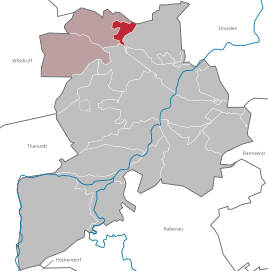  Location of the Kohlsdorf district in the Wurgwitz district and in the city of Freital
|
|
 View from Wurgwitz to Kohlsdorf
|
|
Kohlsdorf is a place that belongs to the Wurgwitz district of the Saxon major district town of Freital in the Saxon Switzerland-Eastern Ore Mountains district. Kohlsdorf is known from a legend according to which coal was said to have been discovered here. Together with the Hammer settlement , Kohlsdorf forms a subdivision within Freitals and, together with the towns of Wurgwitz and Niederhermsdorf, forms the Wurgwitz district.
geography
Kohlsdorf is in the north of the Freital city area and northeast of the main town of Wurgwitz. Old Franconia and Pesterwitz border in the east, and the Hammer settlement in the south is located in the district. Zöllmen is to the west of Kohlsdorf .
history
The place Kohlsdorf was first mentioned in writing in 1469. In 1485 the administrative affiliation was with the Dresden nursing home, from 1559 with the Stolpen office . From 1590 the place was part of the Dresden office . From 1856 to 1875 Kohlsdorf belonged to the Döhlen court office and later to the Dresden administration . When Kohlsdorf and Hammer came to the municipality of Wurgwitz is not known, but it was before Niederhermsdorf was incorporated in 1921. The Gasthof Kohlsdorf , which became well known at the beginning of the 20th century, was closed in 1958. In 1974, the municipality of Wurgwitz became a district of the city of Freital, which was founded in 1921, Kohlsdorf did not become a separate district of the new city, Wurgwitz remained assigned and only exists as a district.
Development of the population
| year | Residents |
|---|---|
| 1559 | 1 obsessed man |
| 1764 | 1 obsessed man |
| 1834 | 171 |
| 1871 | 174 |
| 1890 | 113 |
Place name forms
The documented forms of the place name of Kohlsdorf include:
- 1450: Colostorff
- 1469: Kolßdorff
- around 1470: Quolsdorff
- 1485: Coelßdorff
- 1514: Colßdorff
- 1587: Kuelßdorf
- around 1600: Kösldorf
- 1616: to Culßdorff
- 1791: Kohlsdorf
Hammer settlement

Hammer is a location in the valley of the Hammerbach , which flows into the Wiederitz in Zauckerode . Hammer is located in the Kohlsdorf district to the south of the town center below Zöllmener Strasse in the valley floor. According to contradicting statements, the place was either mentioned in writing in 1624 or was created around 1650. Except for one house, the buildings in Hammer have been demolished. The place name and the name of the brook suggest a pre- or early industrial hammer mill at this location. Water from the pond above the settlement, in which the Hammerbach is dammed, was used to operate the hammer that gave it its name . Ore mining and processing were therefore very close to one another.
literature
- Kohlsdorf . In: August Schumann : Complete State, Post and Newspaper Lexicon of Saxony. 5th volume. Schumann, Zwickau 1818, p. 43.
Web links
- City of Freital: Wurgwitz district with Niederhermsdorf, Kohlsdorf and Hammer
- Kohlsdorf in the Digital Historical Directory of Saxony
Individual evidence
-
↑ a b c Wurgwitz district with Niederhermsdorf, Kohlsdorf and Hammer. In: freital.de. Retrieved May 8, 2020 . As well as graphics in city chronicle. In: freital.de. Retrieved May 8, 2020 .
- ↑ a b c Cf. Kohlsdorf in the Digital Historical Directory of Saxony
Birkigt | Coßmannsdorf | Deuben | Döhlen | Großburgk | Hainsberg | Kleinburgk | Kleinnaundorf | Kohlsdorf | Ugly | Niederhermsdorf | Niederpesterwitz | Oberpesterwitz | Potschappel | Saalhausen | Schweinsdorf | Somsdorf | Under white | Whitish | Wurgwitz | Zauckerode | Zschiedge