High Peissenberg
| High Peissenberg | ||
|---|---|---|
|
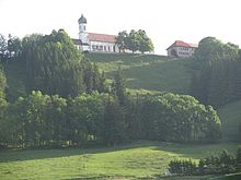
View from the southeast over Hohenpeißenberg |
||
| height | 988 m above sea level NHN | |
| location | near Hohenpeissenberg ; District of Weilheim-Schongau , Upper Bavaria ( Germany ) | |
| Mountains | Bavarian Alpine Foreland | |
| Coordinates | 47 ° 48 '3 " N , 11 ° 0' 48" E | |
|
|
||
| rock | conglomerate | |
| Age of the rock | Tertiary | |
| particularities | Alpine panorama | |


The Hohe Peißenberg near Hohenpeißenberg and Peißenberg in the Upper Bavarian district of Weilheim-Schongau is 988 m above sea level. NHN high elevation in the Bavarian Alpine Foreland .
Sometimes it is unofficially referred to as Hohenpeißenberg or, with its original name Peißenberg and in allusion to the Rigi in Switzerland , also called the Bavarian Rigi . In addition to the Auerberg ( 1055 m ) to the southwest, 22 km (as the crow flies ) , the Hohe Peißenberg is one of the highest elevations in the Bavarian Alpine Foreland.
geography
location
The Hohe Peißenberg rises in the center of the Weilheim-Schongau district in the Pfaffenwinkel , a hilly landscape of the Bavarian Alpine foothills. Its summit and most of its high elevations belong to the municipality of Hohenpeißenberg , whose core town is 900 m south-southwest of the summit. Parts of its eastern foothills belong to the market town of Peißenberg , whose core town is 3.5 km east of the summit. To the northeast of the mountain, along with other streams, the small Wielenbach rises as a southeastern Lech tributary and to the south the Ammer passes the mountain. The mountain extends in an east-west direction and is partly forested.
Natural allocation
The High Peißenberg heard in the physiographic feature unit group subalpine young moraine (no. 03), in the main unit Ammer-Loisach-Isar young moraine (037) and in the subunit hills and moorland of Ammersee (037.0) for natural space Peißenberg combs (037.09). Its landscape falls approximately north-northeast into the natural area of Wessobrunner Heights (037.04) and to the northwest over west to south into the natural area of Windacher Hügel (037.03).
geology
The Hohe Peißenberg is the result of debris flows from the upper freshwater molasse , which came from the south about 10 to 15 million years ago when the Alps rose. These coarse cones of debris today form characteristic mountains (including Tischberg, Irschenberg , Taubenberg ) in front of the exits of the former tertiary Alpine rivers. The ice later made them harder than their softer surroundings from fine sand and, like icebreakers, divided the ice flow into individual glacier tongues (praise) (e.g. Tischberg).
history
Two castles once stood on the slopes of the Hohe Peißenberg: Burg Peißenberg (with the castle chapel St. Georg ) and Burg Schlag (later the site of the abandoned St. Jais chapel ). They were built by followers of the Peitinger Guelphs, the Lords of Ravensburg in the 11th and 12th centuries, and passed to the Counts of Seefeld in the 13th century.
Between 1884 and 1892 there were three different projects, to build a rack railway leading from Bad Sulz to the mountain . In Bad Sulz, the end of the railway connection was at the Peißenberg station . One of these projects was to build a hotel near the summit. The road on the south side of the mountain was built from 1933 to 1935. The road got its current appearance through the expansion in 1961/62, since then the road has been paved. Before that, there was, among other things, a narrow road across the Frauenwald, on the north side up to the mountain.
In addition to the television tower and the transmission mast as its predecessor, there was a US Army transmitting and receiving station below the cemetery from the early 1950s . The lattice mast was demolished in 1995 and the small area was transferred to the Bundeswehr .
More about the history at: Hohenpeißenberg (history) .
Buildings and facilities
On the Hohen Peißenberg there is a pilgrimage church with a museum, a meteorological observatory, a radio transmission system and an inn:
Pilgrimage church
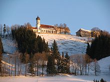
The pilgrimage church of the Assumption of Mary stands on the mountain . The first construction phase of the later double church is the chapel from 1514. At the beginning of the 17th century a larger church with a priest's house was added. The pilgrimage has a centuries-old tradition. A pilgrimage to traditional costumes takes place every year in summer. In 1990 the Treasury Museum was opened in the oratory above the sacristy of the church , which can be viewed by prior arrangement by telephone.
Hohenpeißenberg meteorological observatory
On the mountain there is also the Meteorological Observatory Hohenpeißenberg , where weather observations are carried out and research is carried out. This has its origins in the 18th century. Since January 1, 1781, the weather has been monitored there regularly and practically continuously and measured values recorded. The weather station is considered to be the oldest mountain weather station in the world.
Hohenpeissenberg transmitter
In addition, the Hohenpeißenberg transmitter is located on the mountain, a little below its summit in the Hohenpeißenberg hamlet of Pröbstlsberg - a radio transmitter. Its reinforced concrete tower, built in 1978, is 158.76 m high.
panorama
The island-like High Peißenberg provides for clear conditions to the south a look at the 200 km wide visible Alps , from Grünten in the west, over the Wettersteingebirge with the Zugspitze in the south, to the Bavarian Alps in the east. It is a popular excursion destination primarily because of its view of the Alps and can be seen from around 400 places (towns, villages, hamlets, districts). The view to the north extends over a plain. Three large lakes can be made out in the area, most clearly the north- northeastern Ammersee , in the east-northeast a smaller piece of Lake Starnberg is visible and to the southeast, the Staffelsee can be seen with a little effort .
Others
There are several hiking trails on the slopes of the mountain. The Spitzweg circular route is named after the painter, the König-Ludwig-Weg leads over the mountain, as does a route of the Jakobsweg , and there is the Stollenweg, which leads to various sites of the former Peißenberg mine . Until about the 1980s it was allowed to fly down from the mountain with hang gliders (kites), which is forbidden today for safety reasons. The overflight over the built-up area of Hohenpeißenberg was too dangerous. The starting point was at the church wall on the south side of the mountain. There was also a ski lift on the mountain.
There are coal reserves under the mountain ; from the 19th century to 1971 it was systematically dismantled in Hohenpeißenberg, Peißenberg and Peiting . Today some old tunnels can be visited again on certain dates and there is a mining museum in Peißenberg.
Geotope
The tunnel of the pitch coal seams is designated by the Bavarian State Office for the Environment as a low-value geotope (geotope number: 190G001) and by the Bavarian State Office for the Preservation of Monuments as an architectural monument (D-1-90-130-10).
literature
- Rolf K. Meyer , Hermann Schmidt-Kaler : In the footsteps of the Ice Age south of Munich - eastern part , in: Walks in the history of the earth , Volume 8, Pfeil Verlag , Munich 1997, ISBN 978-3-931516-09-3 .
- Geological map of Bavaria with explanations , M = 1: 500,000, Bavarian Geological State Office, 1998
- Peter Winkler: Early history of the Hohenpeißenberg mountain observatory: new findings and specifications , Deutscher Wetterdienst, Offenbach am Main 2015, ISBN 978-3-88148-481-7 ; including historical maps of the area on pp. 48–50.
References and comments
- ↑ a b Map services of the Federal Agency for Nature Conservation ( information )
- ↑ Bavaria Atlas of the Bavarian State Government ( notes )
- ^ Hansjörg Dongus : Geographical land survey: The natural space units on sheet 188/194 Kaufbeuren / Mittenwald. Federal Institute for Regional Studies, Bad Godesberg 1993. → Online map (PDF; 6.4 MB)
- ↑ Max Biller: Castles . In: Max Biller: Hohenpeißenberger Heimat-Lexikon , p. 167 to 173
- ↑ Christoph Ott, Georg Iblher: Der Hohenpeißenberg (called the Bavarian Rigi) , Weilheim 1877, p. 3
- ^ Hubert Assum, Max Biller: Ortportrait . In: Max Biller: Hohenpeißenberger Heimat-Lexikon , p. 434
- ↑ Ernst Ursel: A mountain railway to the Hohen Peißenberg? The development of the "Bavarian Rigi" for tourism . In: Lech-Isar-Land 1983, pp. 148 to 152
- ↑ Peter Rasch: The branch lines between Ammersee, Lech and Wertach. With the Ammerseebahn, Pfaffenwinkelbahn & Co around the Bavarian Rigi . EOS Verlag, St. Ottilien 2011, ISBN 978-3-8306-7455-9 , pp. 189f
- ^ A b Max Biller: Peißenberger Heimatlexikon , 2nd expanded edition from 1984, p. 341f, with source reference to: Dr. Ernst Ursel
- ↑ Max Biller: Hohenpeißenberger Heimat-Lexikon , p. 321
- ↑ Christoph Ott, Georg Iblher: Der Hohenpeißenberg (called the Bavarian Rigi) , Weilheim 1877, the locations are shown on a folding map at the end of this little book
- ↑ Max Biller, Peter Strauss: The Hohe Peißenberg - a mountain with a view . In: Max Biller: Hohenpeißenberger Heimat-Lexikon , 1998, pp. 259–261; there these place names are recorded in a list
- ^ Max Biller: Peißenberger Heimatlexikon , 2nd expanded edition from 1984, pp. 327–331; there these place names are recorded in a list
- ↑ Bavarian State Office for the Environment, Geotop Hauptstollen Hohenpeißenberg (accessed on October 22, 2017).
Web links
- History - The Hohe Peißenberg , on Hohenpeissenberg.de
- Hohenpeißenberg: Alpine panorama , on alpen-panoramen.de


