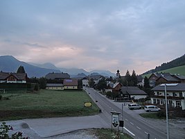
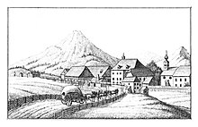
Hohentauern (municipality of Hohentauern)
| Hohentauern ( village ) | ||
|---|---|---|
|
|
||
| Basic data | ||
| Pole. District , state | Murtal (MT), Styria | |
| Judicial district | Judenburg | |
| Pole. local community | Hohentauern | |
| Locality | Hohentauern | |
| Coordinates | 47 ° 26 '3 " N , 14 ° 29' 1" E | |
| height | 1274 m above sea level A. | |
| Building status | 180 (addr. 2019, approx. ) | |
| Statistical identification | ||
| Counting district / district | Hohentauern (62010) | |
 Hohentauern |
||
| Source: STAT : index of places ; BEV : GEONAM ; GIS-Stmk | ||
Hohentauern is a place in the Niedere Tauern in Styria as well as the capital and locality of the municipality of Hohentauern in the Murtal district .
geography

|
Hohe Tauern town ( capital of the municipality )
|
|
|---|---|
| Basic data | |
| Pole. District , state | Murtal , Styria |
| Pole. local community | Hohentauern |
| Coordinates | 47 ° 26 ′ 3 ″ N , 14 ° 29 ′ 1 ″ E |
| Residents of the village | 309 (January 1, 2020) |
| Building status | 193 (2001) |
| Statistical identification | |
| Locality code | 15269 |
| Counting district / district | Hohentauern (62010 000) |
| with Hohentauern-Scattered Houses, Mining , Moscher Source: STAT : Ortverzeichnis ; BEV : GEONAM ; GIS-Stmk |
|
The place is 32 kilometers north of Judenburg , 6 km as the crow flies south of the city of Trieben in the Paltental . It is located on Triebener Straße (B114).
The village of Hohentauern is located directly on the saddle of the Triebener Tauern Pass ( 1270 m above sea level ). To the north rises the Triebenstein ( 1810 m above sea level ), south of the Geierkogel ( 2231 m above sea level ) the Wölzer Tauern , with the Wirtsgupf ( 1627 m above sea level ) as the local mountain of the place. It includes around 180 addresses. Next to the old village center there is the Wirtsalmsiedlung zum Wirtsgupf, and the settlements Almdorf , Herzogbichl , Gartengasse , Sonnenhang and Scheipplsiedlung to the west.
The village of Hohentauern , with a good 300 inhabitants (January 1, 2020: 309), also includes the old miners' village of Bergbau , and the scattered houses of the pass landscape (listed as Hohentauern-scattered houses ), including the Moscher holiday village and the mountain locations on Bösenstein ( 2448 m above sea level ) of the Rottenmanner Tauern , such as the Edelrautehütte , the Kreutbauernalm and the Scheibelalm .
The cadastral community of Hohentauern , on the other hand, comprises the entire community, including the Triebental .
|
|
Schwarzenbach (O, Gem. Trieben , District Liezen ) |
|

|
Foredrive valley | |
|
|
Sankt Johann am Tauern Sonnseite (O, Gem.Pölstal ) |
Triebental (O) |
- ∗ Behind the Bösenstein massif
History, infrastructure and sights
It is unclear whether the Roman road Virunum - Ovilava (Zollfeld - Wels), which goes back to pre-Roman old roads , actually led here over the pass and down the Triebental to Trieben; a more straight route over the Kreuzbergalm - Hölleralm area west of the Sunk also appears possible . The location of the post station (Mansio) Tartursanis , which is generally identified with Hohentauern, is also unknown, as there are no archaeological findings.
A first mention is also unclear, sites such as ultra Thaurum montem 1139 may have referred to mountains, passes or locations. The map from Vischer 1678 gives am Tauern.
In any case, the Altweg was used for the framing from the High Middle Ages . This is where the Tauernwirt, proven before 1300, stood . The first church was built in the 14th century (first documented mention in 1363); today's Bartholomäkirche was built in Gothic style around 1490. It was a branch of St. Lorenzen and belonged to the Admont Abbey . The vicarage was only moved here in the early 19th century from the old rectory on the shoulderer Höhe , which had previously been the archducal forester's house (now the Daxler inn ). The place only became a parish seat in 1892. Until the late 19th century the place - also called Oberthauern or written Hochenthauern - was only a small hamlet around the church. Of the few old farmsteads around, the Scheipplhof , which is a listed building, is particularly interesting.
The local growth did not begin until the 1960s, when the old mining settlement for magnesite and graphite mining was abandoned and relocated to the town. At that time, tourism began with the small Hohentauern ski area on the Wirtsgupf. Today the place operates winter and summer tourism.
The pile dwelling village of Hohentauern was built on the Weberteich, which documents the importance of the old path. The heritage-protected Scheibelalm on the Bösenstein, which has been preserved in its original appearance, is also worth seeing .
Scheibelalm with the Grosser Bösenstein
literature
- Walter Brunner: The Tauernwirt. 720 years of history of an Upper Styrian farm and inn. Collegium Columbinum, 2001 ( limited preview in Google Book Search).
- Gerhard Karl Lieb, Wolfgang Sulzer: Regional geographic aspects of the Hohentauern pass landscape. In: Communications from the Natural Science Association for Styria. Volume 122, 1992, pp. 49-63 ( PDF on ZOBODAT ).
Web links
- Website of the municipality (hohentauern.at).
- 62010 - Hohentauern. Community data, Statistics Austria .
Individual evidence
-
↑ Erik Hilzensauer: The road from Rottenmanner Tauern to Trieben and the way over the Hölleralm and Kreuzbergalm in the light of archival sources. In: Find reports from Austria 43, 2004, pp. 725–740; similar also:
dsslb .: The road from Rottenmanner Tauern to Trieben in the light of archival sources. In: Alois Leitner (Ed.): Contributions to the culture and local history of Hohentauern. No. 49, Oct. 2006. - ↑ The Altwegesystem Kreuzbergalm - Hölleralm is a designated ground monument .
- ↑ Otto Michael Schinko: From Achner to Zugal: mountain, water, house, reed and settlement names in the upper Murtal. disserta Verlag, 2015, ISBN 978-3-95425-968-7 , entry Tartursana, Tartursanis , p. 142 f ( limited preview in Google book search).
- ↑ Ulla Steinklauber: Roman times (and late antiquity) - from the turn of the ages to the 5th century. In: Bernhard Hebert (Ed.): Prehistory and Roman times in Styria. Volume 1 of the history of Styria. Ed. on behalf of the Historical Commission for Styria, 2nd edition, Böhlau Verlag, Vienna / Cologne / Weimar 2018, ISBN 978-3-205-23253-7 , p. 709 f (full article 701-807; limited preview in Google Book search).
- ↑ Upper Austrian document book, secular part (540-1399) 1139 X 10. Archbishop Chunrat of Salzburg returns the tithe in Lungau to Admont Monastery, which Otto von Machlant refused to use (gift of Weng to Admont, south of Sankt Johann: “ Apud Wenge ultra Thaurum montem mansum unum ”) in the European document archive Monasterium.net .
- ^ Georg Matthäus Vischer: Topographia Ducatus Stiriae 1768/71.
- ^ Extensive reference. Brunner: Der Tauernwirt. 2001.
- ↑ A. Leitner: Der Wirth am Tauern (= Der Tauern. Contributions to the culture and local history of Hohentauern. No. 17). March 1992.
- ^ "D. [orf] Hohentauern or Oberthauern". Josephine land survey , around 1780.
- ^ Franziszäischer Cadastre , Hohentauern sheet , 1823.
- ↑ A. Leitner: The Scheipplgut am Tauern (= Der Tauern. Contributions to the culture and local history of Hohentauern. No. 18). July 1992.
- ↑ skiing. Website of the municipality, hohentauern.at.
- ^ Website of the Hohentauern pile dwelling village .


