Hoonah-Angoon Census Area
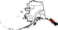
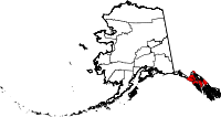
The Hoonah-Angoon Census Area is a census area in the US state of Alaska in the northwest of the Alaska Panhandle . In 2006 the population was 3,100 (still including Skagway ). Hoonah-Angoon belongs to the Unorganized Borough and therefore has no administrative headquarters. The census area has an area of 29,466 km², of which 20,452 km² is land and 9,014 km² is water. The largest city in the region is Hoonah , the second eponymous place is Angoon , 36% of the residents belong to the Tlingit people .
geography
The north of the region is part of Glacier Bay National Park , the rest is up to the settlements in the Tongass National Forest , a national forest managed by the United States Forest Service . The extensive nature reserve Admiralty Island National Monument is embedded in the national forest.
To the east, the Census Area borders the Stikine Region and the Regional District of Kitimat-Stikine in the Canadian province of British Columbia .
history
Until September 22, 1992, when Yakutat became an independent borough , the Census Area was called Skagway-Yakutat-Angoon . Until 2007, Skagway was part of the Census Area, the name of which was Skagway-Hoonah-Angoon until then . In an election on June 5, 2007, the citizens of Skagway decided to make their city an independent borough as well. Two weeks later, the Census Area with its current name was formed.

20 structures and sites in the Census Area are listed on the National Register of Historic Places (NRHP) (as of April 28, 2020), including the Big Shaheen Cabin , the Point Retreat Light Station and St. John the Baptist Church .
Individual evidence
- ^ Municipality of Skagway Borough Incorporation Document. (PDF) (No longer available online.) Municipality of Skagway, formerly in the original ; accessed on July 1, 2008 . ( Page no longer available , search in web archives ) Info: The link was automatically marked as defective. Please check the link according to the instructions and then remove this notice.
- ↑ Charles Curry Aiken, Joseph Nathan Kane: The American Counties: Origins of County Names, Dates of Creation, Area, and Population Data, 1950-2010 . 6th edition. Scarecrow Press, Lanham 2013, ISBN 978-0-8108-8762-6 , p. 140.
- ↑ Big Shaheen Cabin in the National Register Information System. National Park Service , accessed April 28, 2020.
-
↑ Search mask database in the National Register Information System. National Park Service , accessed April 28, 2020.
Weekly List on the National Register Information System. National Park Service , accessed April 28, 2020.
Web links
- QuickFacts on census.gov (English)
- Hoonah-Angoon Census Area in the Geographic Names Information System of the United States Geological Survey (English)
- Skagway-Hoonah-Angoon Census Area (historical) in the Geographic Names Information System of the United States Geological Survey (English)
Coordinates: 58 ° 0 ′ N , 135 ° 30 ′ W


