Kalinga Province
| Basic data | |
|---|---|
| Region : | Cordillera administrative region |
| Capital : | Tabuk City |
| Population : | 212,680 August 1, 2015 census
|
| Population density : | 67 inhabitants per km² |
| Area : | 3,164.3 km² |
| PSGC : | 143200000 |
| Official website: | http://www.kalinga.gov.ph |
| structure | |
| - Highly urbanized cities | |
| - provincial cities | 1 |
| - municipalities | 7th |
| - Barangays | 152 |
| - electoral districts | |

|
|
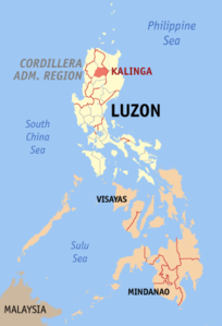
Coordinates: 17 ° 45 ′ N , 121 ° 12 ′ E Kalinga is a landlocked Philippine province in the administrative region of Cordillera on the island of Luzon .
It has 212,680 inhabitants (2015 census) and an area of 3,164.3 km². The main town is Tabuk City . The Balbalasang Balbalan National Park is located in the northwest of the province. Clockwise, it borders the provinces of Mountain Province in the south, Abra in the west, Apayao in the north, Cagayan in the northeast and Isabela in the east. The province lies in the eastern central sector of the Cordillera Central .
Kalinga was created in 1995 by dividing the previous province of Kalinga-Apayao into the two new provinces of Kalinga and Apayao. The former Filipino dictator Ferdinand Marcos has repeatedly changed the borders of Kalinga-Apayao during his reign over the years in order to gradually change them as part of a personality cult so that the province resembles the silhouette of his own head on a map , with the view should be directed towards his home province of Ilocos Norte . When Marcos fell in 1986, this project was not yet completed.
Kalinga is a word from the language of the province and means "headhunter".
Cities and municipalities
Cities:
Municipalities:
