Donk (Mönchengladbach)
|
Donk
City of Mönchengladbach
Coordinates: 51 ° 14 ′ 15 ″ N , 6 ° 27 ′ 45 ″ E
|
||
|---|---|---|
| Height : | 34–38 m above sea level NN | |
| Incorporation : | 1921 | |
| Incorporated into: | Mönchengladbach | |
| Postal code : | 41066 | |
| Area code : | 02161 | |
|
Location of Donk in Mönchengladbach |
||
Donk is a small street village in rural exterior of the independent city Mönchengladbach in the west of North Rhine-Westphalia . It is the northernmost town in the Mönchengladbach urban area, only approx. 500 meters southeast of the Mönchengladbach city limits with Viersen in the area of the Viersener Donk and approx. 500 meters southwest of the city limits with Willich in the area of the Neersener Cloerbruchallee . Despite its northern location, Donk has belonged to the eastern district of Mönchengladbach since October 22, 2009, and to the official district of Bettrath-Hoven and not to the Neuwerk-Mitte district within this district . Within North Rhine-Westphalia, the village also belongs to the Lower Rhine region and, as a district of Mönchengladbach, belongs to the Rhine-Ruhr metropolitan region . Opperdonc , Opper Donc , Donc , Dunc and Donck have also been handed down as earlier names for the area . From a postal perspective, Donk belongs to the Mönchengladbach zip code area 41066, which is largely identical to the former Neuwerk district .


Etymology, settlement structure and history
The name Donk is widespread in the Lower Rhine and indicates a comparatively dry elevation in an otherwise swampy or damp environment. There are various theories about the origin of the word Donk , according to which the term is derived either from Old High German , Old Dutch or, even further back in time, from Celtic .
The Neuwerker Donk is a small, sparsely populated agricultural area that is slightly elevated compared to the neighboring Niers lowlands , and thus offered its residents a certain protection from the earlier frequent floods and the resulting shifting of the Niers riverbed . Settlement of the Donk is documented as early as 1333, in the French times around 1800 the area consisted of relatively scattered individual farms and in this respect was similar to the Viersen Donk . While this settlement structure has largely been preserved on the Viersen side to this day, today's street village has gradually developed along today's Donker Straße over the past 200 years.
In terms of local politics, the area was part of the formerly independent municipality of Neuwerk and, through its incorporation in 1921, became the district of Mönchengladbach, where it then belonged to the Neuwerk district until 2009. The Neuwerk district was dissolved in 2009 and merged with other districts to form the new eastern district.
In the northwest, the Viersener Donk, an area of the same name, borders directly on the Neuwerker Donk. Only about three to four kilometers north of the neighboring Neersen is the Anrather Donk , another area known as the Donk .
traffic
Road traffic
The main traffic artery of the Neuwerker Donk is the Donker Straße coming from neighboring Neersbroich , the Kreisstraße 6 , which becomes Donker Weg beyond the Mönchengladbach city limits in Viersen and continues over the Viersener Donk to Düpp . In addition, the Donk is connected to the neighboring Willich district of Neersen via Niersdonker Straße (further on in Willich's urban area: An der Landwehr ) and via Asdonkstraße to Fuchshütte , Hoven and Bettrath .
In addition, the A 52 runs through the middle of the area in a north-east-south-west direction , but the nearest junction Mönchengladbach-Neuwerk can only be reached via Neersbroich.
Rail transport
The Krefeld – Rheydt railway used to run on the eastern edge of the Donk . Although there was no train station in the Donk itself , the former Neersen and Neuwerk stations were only about one kilometer from the southeast end of the Neuwerker Donk. Passenger traffic on the route ceased in 1982 and freight traffic in 1994. The track of this route is still available between the Donk and the Fuchshütte area.
In the Neuwerker Donk area, the Neersen - Viersen branch branched off the former Neuss – Viersen line , with passenger traffic between Kaarst and Viersen station initially ceased in 1968, and freight traffic from 1984, after which this line was largely dismantled. The course of the former railway line is still clearly visible, however, in the Neuwerker Donk there is a bridle path , in sections parallel to it a cycle path along the former railway line . In addition, between 1911 and 1954 there was also a tram connection from the nearby Neersen train station to Mönchengladbach city center and beyond to Rheindahlen .
The train stations closest to the Neuwerker Donk are now Viersen train station , Mönchengladbach central train station and Anrath train station .
Bus transport
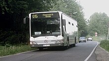
As a district of Mönchengladbach, Donk belongs to the tariff area of the Verkehrsverbund Rhein-Ruhr and, despite its small population, is served by the Mönchengladbacher Verkehrsbetriebe with a bus line, every 40 minutes on weekdays, every hour in the evening and on Sundays:
| Type | line | route |
|---|---|---|
| 015 | Neuwerk-Donk - Neersbroich - Neuwerk Markt - Hoven - Bettrath - Eicken - Kaiser-Friedrich-Halle - Hbf / Europaplatz - Bismarckplatz - Waldhausen - Holt - Hehn - Hardt |
Bike trails
The Neuwerker Donk is extremely well developed by cycle paths, a total of five officially designated cycle paths lead through the area:
- The international cycling route Fietsallee on the north canal on the way from Schiefbahn towards Viersener Donk
- The main route of the NiederRheinroute on the way from Lockhütte to the Viersener Donk
- The branch line No. 59 of the Niederrheinroute from here to Neersen
- The international Niers cycle route on the way from Erkelenz - Kuckum to Gennep in the Netherlands
- A section of the Euroga cycle path system also runs here .
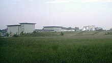
On a hill next to the sewage treatment plant complex, there is a small rest area for cyclists on Fietsallee on the north canal with seating and an information board about the sewage treatment plant.
Attractions
Euroga adventure bridge
As part of Euroga 2002/2003, a North Rhine-Westphalian state horticultural show that was decentralized at the time , the 24.3-meter-long suspension railway Euroga-Erlebnisbrücke ( ⊙ ) over the Niers was built in 2003, which is easy to use for everyone . It stands between Neuwerker Donk and Neersener Cloerbruchallee. The ferry, known as a work of art, with its 6.3 meter high pylons, can be used free of charge at any time, even bicycles can be transferred with it; the facility is part of the international Fietsallee cycle path on the north canal and the Euroga cycle path network.
Mönchengladbach-Neuwerk sewage treatment plant
On the northeastern edge of the Neuwerker Donk, right on the banks of the Niers, the Mönchengladbach-Neuwerk sewage treatment plant operated by the Niersverband is located . The sewage treatment plant complex extends over an area of approx. 22.5 hectares and serves to purify the wastewater from a total of over ½ million inhabitants from the surrounding cities of Mönchengladbach, Korschenbroich , Willich, Viersen and Tönisvorst . The Niersverband plans to invest a total of 184 million euros between 2017 and 2035.
Association and social life
- Schützenbruderschaft: Honschaft Neersbroich-Donk of the St. Barbara Brotherhood Neuwerk e. V.
Neuwerker Donk and Viersener Donk
The Viersen Donk, which belongs to Viersen, connects to the Neuwerker Donk in the northwest, beyond the city limits. In contrast to other rural villages in the area, such as Holterhöfe or Clörath , which were both split up and divided up between two and three towns as part of the local reorganization at the time, the separation between the Neuwerker and the Viersener Donk is not the result of a local reform more recently. The border between Alt-Viersen on the one hand and Mönchengladbach or Neuwerk on the other hand is rather an ancient territorial border that has remained almost unchanged in its course for centuries since the Middle Ages . The current city and district border between Alt-Viersen and the northern Mönchengladbach districts still largely corresponds to the former state border between the Duchy of Geldern (Alt-Viersen) and the Duchy of Jülich (Mönchengladbach) from the 15th century . Therefore, the division into a Viersener and a Neuwerker Donk goes back at least to that era.
The closer environment
|
VIE-Düpp Viersener Donk |
Vennheide Anrather Donk Neersen |
Inclined path |
| VIE Heimer |

|
Airport |
|
Lockhütte Fuchshütte Bettrath Hoven |
Neuwerk-Mitte | Neersbroich |
Web links
- mönchengladbach.de (official website of the city of Mönchengladbach)
- Honschaft Neersbroich Donk
- Information and picture album about the transporter bridge
Individual evidence
- ↑ moenchengladbach.de: City districts and city districts (official website of the city of Mönchengladbach, accessed on May 13, 2011)
- ↑ a b c d Honschaft Neersbroich-Donk: History of Honschaft (Internet presence of Honschaft Neersbroich-Donk, accessed on May 15, 2011)
-
↑ a b Map of the Rhineland 1: 25000 by Tranchot and v. Müffling (1803-1820), sheet 42 (Viersen) ( page no longer available , search in web archives ) Info: The link was automatically marked as defective. Please check the link according to the instructions and then remove this notice. (Reprint, published in 1966 by the Land Surveying Office of North Rhine-Westphalia, Bonn-Bad Godesberg (now: Cologne District Government), accessed on May 13, 2011)
- ↑ Deutsche Post: Postcode search (online service of Deutsche Post AG , accessed on May 13, 2011)
- ^ Hans Georg Kirchhoff: Office Korschenbroich . History of the municipality of Korschenbroich and Pesch. B. Kühlen, Mönchengladbach 1974, p. 20 .
- ↑ Lowlands Talk: Dutch (German, accessed May 13, 2011)
- ^ Clörath story ( Memento from August 4, 2012 in the Internet Archive ) (website of the Slickers family, accessed on May 13, 2011)
- ^ Philipp Coenen: Donk in the green area . In: RP Online, September 15, 2008, accessed May 15, 2011
- ^ Jürgen Lehmann : Tram in Mönchengladbach, published by: Verlag Kenning , Nordhorn 1997, ISBN 3-927587-62-1
-
↑ a b c d e Cycling in the district of Viersen , cycling map 1: 50,000, 4th edition 2009
(published by Bielefelder Verlag GmbH & Co. KG; Bielefeld and Wirtschaftsförderungsgesellschaft für die Kreis Viersen mbH, Viersen , ISBN 978-3-87073- 122-9 ) - ↑ a b c d e ADFC regional map: Niederrhein-Süd , 1: 75,000, Bielefelder Verlag, ISBN 978-3-87073-318-6
- ↑ Flyer: The Niers-Radwanderweg in Mönchengladbach (published by the Niersverband, Viersen, accessed on May 15, 2011; PDF; 4.3 MB)
- ↑ Flyer: The Niers Cycle Path in the Viersen district (published by the Niersverband, Viersen, accessed on May 15, 2011; PDF; 1.7 MB)
- ↑ Flyer: The Niers-Radwanderweg Kreis Kleve - Gennep (NL) (published by the Niersverband, Viersen, accessed on May 15, 2011; PDF; 1.8 MB)
- ↑ Mönchengladbach-Neuwerk sewage treatment plant (website of the Niersverband, Viersen, accessed on May 15, 2011)
- ^ Rheinische Post online December 30, 2016: Niersverband increases the contributions
- ↑ Internet presence of the Honschaft Neersbroich-Donk (accessed on May 15, 2011)
- ^ Ferdinand Dohr: The Viersener Landwehr . In: Karl Mackes (ed.): From the prehistory, early and settlement history of the city of Viersen . 1956, p. 228-245 .


