Clörath
|
Clörath district of Viersen , Willich and Tönisvorst |
|
|---|---|
| Coordinates | 51 ° 16 '38 " N , 6 ° 25' 32" E |
| height | 35 m above sea level NN |
| Incorporation | Jan. 1, 1970 |
| Post Code | 41749, 47877, 47918 |
| prefix | (0 21 56) |
| Transport links | |
| bus |
071 (Viersen ↔ Meerbusch) 094 (Viersen ↔ Kaarst) Citizen bus Anrath |
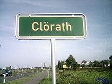
Clörath is a small rural town in the area of the Viersen district ( North Rhine-Westphalia ), where it is divided between the cities of Viersen , Willich and Tönisvorst .

history
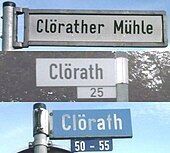
Until December 31, 1969, Clörath was part of the former municipality of Neersen . On January 1, 1970, the town of Clörath was divided into three parts as part of a municipal reorganization, in the following way:
- The area south-east of the Duisburg ↔ Mönchengladbach railway line took part in the incorporation of the previous municipality of Neersen into the new city of Willich.
- The area northwest of the railway line and west of Canal III3b was in the town of Viersen,
- the area northwest of the railway line and east of Canal III3b was incorporated into the new town of Tönisvorst.
Infrastructure
Road traffic
Four country roads that are open to general vehicle traffic cross or touch the area of the village of Clörath:
- The district road K 17 (from Hagen towards Neersen); In the urban area of Viersen this is "Anrather Straße", in the urban areas of Tönisvorst and Willich up to the intersection with "Viersener Straße" this street is simply called "Clörath".
- The state road L 29 (from Neersen towards Viersen); this is who recently Landesstrasse downgraded Federal Highway 7 , which here extend over Willicher area, also called " Venloer wearing street". In Viersen it is finally called “Krefelder Straße”.
- The "Viersener Straße" (from Anrath direction L 29).
- The "Brückenstraße" (from Clörath to Anrath station).
Rail transport
The town of Clörath is crossed by the Duisburg – Mönchengladbach railway line , but there was never a train station here. For regional trains , the closest stop is Anrath station , for regional express trains that do not stop in Anrath, it is Viersen station .
Bus transport
Clörath is in the area of the Rhein-Ruhr transport association and is served by two rail bus routes on the eastern and southern periphery of the Willich part, in detail:
- Line 071 with the stops “Grenzweg”, “Am Bökel” and “ Vennheide ”. It runs from Viersen via Anrath and Willich to Meerbusch , Haus Meer , where it has a connection to the Düsseldorf light rail lines U70 , U74 and U76 ( Krefeld ↔ Düsseldorf ).
- Line 094 with the stops "Grenzweg" and "Am Bökel". She drives of Viersen on Neersen and Schiefbahn to S - Bahnhof "Kaarster See ", where it has connection to the S-Bahn line S28 direction Dusseldorf and Mettmann .
In contrast to the two rail bus routes 071 and 094, the “Bürgerbus Anrath” on its route A not only passes the edge of Clörath, but also through the area. Taking into account the section of the route immediately adjacent to the Anrath area, the following stops are served:
- (Coming from “Anrath, Kirche”)… “Vennheide”, “Am Bökel”, “Grenzweg”, “Grenzweg West”, “Reiherweg”, “Hoffbruch”, “Clörath”, “Bengshof”, “Anrath, Brückenstraße” and "Anrath, Klörather Steg" ... (continue towards "Anrath, Bahnhof")

Bike trails
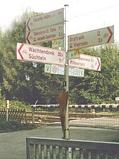
The town of Clörath is extremely well developed by cycle paths, a total of five officially designated cycle paths lead through the area on 2 axes:
- on a common road from northeast to southwest, past the Clörather mill :
- The German Football Route NRW on the way from Krefeld to M'gladbach .
- The branch route No. 58 of the NiederRheinroute on the way from Anrath to Viersen
- on a common road from southeast to northwest, along the Niers :
- The Niers cycle route on the way from Erkelenz - Kuckum to Gennep in the Netherlands
- The medlar route ( Alt-Viersen circular route )
- The [V] route (circular route in the city of Viersen)
The intersection of the “Clörather Weg”, located in the Viersen area, with the “Grenzweg”, which runs parallel to the Niers from the Willich side, right next to the railroad crossing, is also the junction of the two cycle path axes.
In addition to these officially designated cycle paths, there are many other field and farm roads in Clörath that are only conditionally permitted for normal vehicle traffic ( residents free ) and are therefore particularly suitable for cycling.
Waters
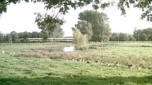
Large parts of Clörath consist of a quarry landscape in which there are a number of bodies of water and wetlands.
Flowing waters
The following rivers come from Clörath, flow through Clörath or limit it at the edge:
- The Niers : It limits Clörath to the southwest, in the Willicher part of Clörath it forms the city boundary to Viersen, in the Viersen part of Clörath it is in turn the border between the districts of Clörath and Rahser .
- The Flöthbach : In the Willich area it represents the border between Clörath and Anrath, in the Tönisvorster area it forms the border between Clörath and Vorst .
- The channel III3b : It flows from Neersen Coming Clörath lengthwise from southeast to northwest. To the north of the railway line, it then forms the border between the Viersener and Tönisvorster parts of Clörath.
- The channel III C : It has its origins in Viersen part Clöraths ranging from Clörather mill and Salbruch.
In addition, there are a number of smaller moats that are not officially designated or even listed in the water stationing map published by the State Office for Nature, Environment and Consumer Protection in North Rhine-Westphalia .
Standing waters
In addition to the running waters, there are also a number of standing waters in Clörath. Worthy of note are some here rehabilitated Niers- backwaters . These restored oxbow lakes no longer have a direct connection to today's Niers river bed, so the Niers no longer flows through them. When inspecting the site, however, it can be observed in the area of the Salbruch that Canal III C is also fed from the water of at least one of the oxbow lakes via various moats.
Attractions
building
Significant buildings in Clörath are:
- The Stockum House ; this is an old manor house (built in 1619) on the outskirts of Clörath near Vennheide .
- The Clörath Mill ; this was a watermill directly on the Niers until the river was relocated around 1929. It belonged to the medieval fortified complex of Haus Clörath , which was first mentioned in a document in 1230 and of which - with the exception of the mill - only remains of the wall are preserved today.
Boundary markings
Clörath is an old area of the Electorate of Cologne and was on the border with what was then the Duchy of Jülich . In this context, boundary stones were set up here in the 18th century to mark the Kurkölnisch-Jülich'sche border, of which the "boundary stone Nº1" in Salbruch, on the border to Hagen , is still there. Another example, the " Grenzstein Nº5 ", still exists in Hager Feld.
Individual evidence
- ^ The 1968 report by Rudolf H. Müller, Oberkreisdirektor des Landkreis Kempen-Krefeld , published in the Heimatbuch des Landkreis Kempen-Krefeld 1969 , Kempen (Ndrh) 1968, p. 66 ff.
- ↑ a b Topographic Map 1: 25000, sheet 4704 (Viersen), State of North Rhine-Westphalia 2010 ( Memento of the original from October 25, 2010 in the Internet Archive ) Info: The archive link was automatically inserted and not yet checked. Please check the original and archive link according to the instructions and then remove this notice.
- ^ Official Journal for the Reg.Bez. Düsseldorf, Volume 192 No. 1, January 14, 2010 (PDF; 3.6 MB)
- ↑ Rheinische Post from August 2nd, page C1 (Grenzland-Kurier): Farewell to the B 7 ( page no longer available , search in web archives ) Info: The link was automatically marked as defective. Please check the link according to the instructions and then remove this notice.
- ^ ADFC regional map : Niederrhein-Süd , 1: 75,000, Bielefelder Verlag, ISBN 978-3-87073-318-6
- ↑ Flyer: The Niers cycle path in Mönchengladbach , published by the Niersverband, Viersen (PDF; 4.3 MB)
- ↑ Flyer: The Niers cycle path in the Viersen district , published by the Niersverband, Viersen (PDF; 1.7 MB)
- ↑ Flyer: The Niers-Radwanderweg Kreis Kleve - Gennep (NL) , published by the Niersverband Viersen (PDF; 1.8 MB)
Web links
- City of Viersen
- City of Willich
- City of Tönisvorst
- Photo album and information about Neersen and Clörath
- Website of the Slickers family from Clörath (private website with further information on the town of Clörath)


