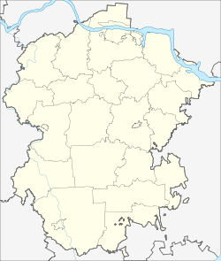
Komsomolskoye (Chuvashia)
Village
|
||||||||||||||||||||||||||||||||||||
|
||||||||||||||||||||||||||||||||||||
|
||||||||||||||||||||||||||||||||||||
Komsomolskoje ( Russian Комсомо́льское ; officially Chuvash Комсомольски , unofficially Каҫал Kaşal ) is a village (selo) in the Republic of Chuvashia in Russia with 4905 inhabitants (as of October 14, 2010).
geography
The place is about 100 km as the crow flies south of the republic capital Cheboksary mainly on the left bank of the left Swijaga tributary Kubnja .
Komsomolskoye is the administrative center of Komsomolsky Rajon and the seat of the rural municipality Komsomolskoyе selskoje posselenije, which also includes the six villages Baibachtino (5 km south), Dubovka (5.5 km north), Malyje Koschelei (2 km west), Novoye Bikmursino (4 km south-east) ), Novyje Koschelei (6 km north-northwest) and Vasilyevka (5 km north-northwest).
Most of the inhabitants are Chuvash , besides mostly Tatars and relatively few ethnic Russians (less than 5% in the whole Rajon).
history
The place has been known since the mid-16th century and was initially called Koschelei (Chuvash Каҫал Kaşal ). With the establishment of the village Malyje Koschelei ("Little Koschelei", Chuvash Кӗҫӗн Каҫал Kĕşĕn Kaşal ) a little to the west in the first quarter of the 17th century, the name Bolschije Koschelei (“Groß-Koschelei”, Chuvash Аслӑ Каҫал ) Aslă came into use. Initially, the village was a volost based in some 20 km north-east village Chosessanowo in Ujesd sviyazhsk assigned (today in Tatarstan ), but in the 17th century it came to Ujesd Tsivilsk and seating himself became a volost. The Ujesde were part of the Kazan Governorate from 1708 (1781–1796, in the meantime Kazan was governor).
On June 24, 1920, the place came with the Ujesd to the newly formed Chuvash Autonomous Oblast, in 1922 within this to the newly designated Ujesd Batyrewo , from the introduction of the rajon structure in the Chuvash ASSR formed on April 21, 1925 on September 5, 1927 Bolschebatyrevsky rajon, on May 19, 1935 renamed Batyrewski rajon. On February 22, 1939, the village received its current name after the communist youth organization Komsomol and at the same time became the seat of an appropriately named new Rajon. From December 20, 1962 to March 14, 1965, the Rajon was temporarily dissolved and its territory was annexed to the Kanaschski rajon (located in Kanasch ) to the north .
Population development
| year | Residents |
|---|---|
| 1795 | 311 |
| 1897 | 1270 |
| 1926 | 1624 |
| 1939 | 1616 |
| 1959 | 2346 |
| 1970 | 2868 |
| 1979 | 3608 |
| 1989 | 4673 |
| 2002 | 4839 |
| 2010 | 4905 |
Note: from 1897 census data
traffic
The federal highway A151 from Ziwilsk to Ulyanovsk passes on the eastern outskirts of Komsomolskoje . This is crossed by the regional road 97K-019 running through the village, which runs east to the border with the Republic of Tatarstan, which is just under 10 km away (there further in the direction of the district center Bolschije Kaibizy ), and to the south-west to 97K-004, which runs about 15 km away connecting the district centers of Wurnary , Ibressi , Batyrevo and Yalchiki . A few kilometers south of Komsomolskoye, another route branches off from the A151 with the regional road 97K-010 to the neighboring district center of Yalchiki to the east.
The nearest train station is about 30 km north in Kanasch, where further lines branch off from the main line Moscow - Kazan - Yekaterinburg to Cheboksary and towards Saransk .
Web links
- Official website of the municipal administration (Russian)
- Komsomolskoye in the Chuvash Encyclopedia (Russian)
Individual evidence
- ↑ a b Itogi Vserossijskoj perepisi naselenija 2010 goda. Tom 1. Čislennostʹ i razmeščenie naselenija (Results of the All-Russian Census 2010. Volume 1. Number and distribution of the population). Tables 5 , pp. 12-209; 11 , pp. 312–979 (download from the website of the Federal Service for State Statistics of the Russian Federation)


