Linden (Wiehl)
|
Linden trees
City of Wiehl
Coordinates: 50 ° 57 ′ 12 ″ N , 7 ° 30 ′ 55 ″ E
|
||
|---|---|---|
| Height : | 240 m above sea level NN | |
| Residents : | 278 (Dec. 31, 2008) | |
| Postal code : | 51674 | |
| Area code : | 02262 | |
|
Location of Linden in Wiehl |
||
|
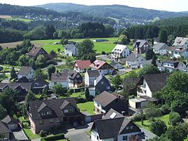
View of linden trees
|
||
Linden is one of 51 localities in the city of Wiehl in the Oberbergisches Kreis in the administrative district of Cologne in North Rhine-Westphalia .
Location and description
The place is about 2 km northwest of the city center of Wiehl. The neighboring villages are Hengstenberg and Mühlen . Linden currently has 278 inhabitants (as of 12/2008) Linden is located south of the federal motorway 4 .
history
First mention
In 1443 the place was mentioned for the first time in a document, namely in "Income and rights of the Cologne Apostelstift".
Spelling of the first mention: Lynden
The place can also be found in 1575 on the A. Mercator map of Zur Linden . Assembly and court place Thingstätte under a linden tree, today still called zoo Lingen ("Zelingen") in dialect .
In the fodder oat slip of the Homburg rulership of 1580, 3 Bergische subjects are counted as subject to tax.
Iron , copper and lead ore were already mined in earlier times (among other things, this is indicated by tunnel entrances that have been buried for a long time and the street names “Im Eiserner Berg” and “Auf der Brache”).
leisure
Hiking and biking trails
- The local circular route upside down T touches the place in the north.
- The local hiking trail O “Around Bielstein ” runs through the village.
literature
- Dieter Dresbach, Fritz Licht: Börnhausen and its neighboring towns - the history of the Bechtal. Castles - villages and farmsteads on an ancient high and high road. Gronenberg, Wiehl-Bomig 2004, ISBN 3-88265-251-9 .


