List of cultural monuments in Drei Gleichen (municipality)
The list of cultural monuments in Drei Gleichen (municipality) is as of July 14, 2016 and contains in accordance with the law on the maintenance and protection of cultural monuments in the state of Thuringia (ThüDSchG) in the current version of February 24, 2016 or the first Law amending the ThüDSchG of November 23, 2005, the cultural monuments of the community Drei Gleichen in the Thuringian district of Gotha .
Definitions
The protection of immovable cultural monuments already arises from the existence of the legal requirements of § 2 of the Thuringian Monument Protection Act and does not depend on the entry in the list of monuments of the state or the municipalities. This means that objects that are not included in a list of monuments can definitely be monuments.
Cultural monuments
According to § 2 of the Thuringian Monument Protection Act, cultural monuments are all things, aggregates or parts of things that are of public interest for historical, artistic, technical, scientific, folklore or urban planning reasons as well as for reasons of historical village image maintenance. Monument ensembles and ground monuments are also counted among the cultural monuments.
Monument ensemble
A monument ensemble can be:
- Overall structural systems: Overall structural systems are, in particular, groups of buildings, uniformly designed quarters and settlements and historical town centers including the plants, open spaces and water areas associated with them.
- Characteristic street, square or townscape: A characteristic street, square or townscape is given in particular if the appearance of the facility is indicative of a specific era or development or of a characteristic construction method with different styles.
- Characteristic local floor plans: A characteristic local floor plan is given if the appearance of the facility is characteristic of a certain epoch or development, in particular with regard to local and settlement forms, street layouts, plot structures and fortifications.
- Historic parks and gardens: Historic parks and gardens are works of horticultural art, the location of which, as well as the architectural and plant design, bear witness to the function of the complex as a living space and self-portrayal of earlier forms of society and the culture it supported. This also includes animal and botanical gardens, provided they have their own overall historical and architectural design.
- historical production sites and plants.
Not all parts of a monument ensemble have to be cultural monuments in order to be considered cultural monuments.
Ground monument
Movable or immovable objects that were or are hidden in the ground or under water and that provide information about animal or plant life (paleontological monuments) or that represent evidence, remains or traces of human culture (archaeological monuments) are soil monuments.
Historical background
Drei Gleichen is a municipality in the Thuringian district of Gotha. It lies between the cities of Erfurt , Gotha and Arnstadt and is named after the castles of the Three Equals .
history
The oldest place in the community that can be documented is Mühlberg, which was first mentioned in 704.
The first community of Drei Gleichen was created on January 1, 2009 from the merger of the previously independent communities of Grabsleben , Mühlberg , Seebergen and Wandersleben , all of which belonged to the Drei Gleichen administrative community. Until the merger, the districts of Großrettbach and Cobstädt , which now belong to the municipality of Drei Gleichen, belonged to Grabsleben , whereby this administrative community was dissolved. On July 6, 2018, the municipalities Günthersleben-Wechmar and Drei Gleichen merged to form the rural municipality Drei Gleichen, the second municipality with this name.
The seat of the community is Wandersleben . However, some offices are also located in Mühlberg.
Note: In the course of the reorganization of the municipality by amalgamating the 6 villages mentioned above, some streets were renamed. These are listed here with their current names. It affects the roads:
- Church square in Cobstädt: now school square
- Karl-Marx-Strasse in Seebergen: now Hauptstrasse
- Main street in Wandersleben: now Menantesstraße (from the town center to the eastern end of the town) and Schulstraße (from town center to the west to the Alte Schäferei junction), from there Wechmarer Straße
- New alley in Wandersleben: now Kirchstrasse
Monument ensembles
Overall structural systems
The following monument ensembles are listed as "characteristic street, square and townscape" according to § 2 Paragraph (2) No. 2 and Paragraph (4) ThürDSchG:
| image | designation | description | Remarks | location |
|---|---|---|---|---|
 |
Mühlburg including Radegundis Chapel ("See Archaeological Monuments") | 8-110 / 1 layer |
||
 |
Ringhofen 1 | Ringhofen estate | The farm on the outskirts in the direction of Wechmar is one of the oldest mentioned individual farms in Thuringia. It was built in the 10th century as the Vorwerk of Gleichen Castle. In 1816 the Prussian king donated the estate to Karl von Müffling, an officer who was highly deserved in the wars of liberation. He spent the last four years of his life here and in Erfurt. [3] Today there is a riding stables and a golf resort with a restaurant and hotel on the estate. | 17-100 / 5, 249, 18-20 / 2, 3-226 / 1 location Gut Ringhofen at Wikipedia |
Characteristic street scene
| image | designation | Remarks | location |
|---|
Individual features § 2 Paragraph (1) No. ThürDSchG
Sacred buildings
| image | address | Monument designation | comment | Corridor / parcel location coord. Web link |
|---|---|---|---|---|
 |
Schulplatz 9, Cobstädt | Church (no name) and furnishings | The church emerged from a chapel that was expanded and converted into a church after the Reformation. The tower bears the year 1581 on its east side. The interior includes the organ, an octagonal, cup-shaped, wooden baptismal font from the Renaissance, a Renaissance pulpit with a sound cover that was renewed in 1850, a Luther painting, an old offering box and a beautiful church window. | 1-14 Location Cobstadt Church at Wikipedia |
 |
Schulgasse 1, Grabsleben | Church of St. Magdalena and furnishings | A previous church was demolished in 1696 due to dilapidation and the new one was built. Of the three former bells, the es bell still rings today, while the others had to be given in 1940 for armament purposes. The organ by the organ builder Johann Christoph Thielemann was installed in 1738. In 1749 the tower received a new striking clock. The interior of the church impresses with beautiful paintings on the pulpit and the balustrade fields of the gallery. The view upwards is limited by a mighty wooden barrel vault with painted angels and biblical scenes from the beginning of the 20th century. The gallery painting dates from the time the nave was built, the beginning of the 18th century, and clearly shows the style of painting that is overgrown with the village and the peasantry. The three-winged altar kept in the church is a particular treasure. | 1-55 / 1 Location St. Magdalena Church at Wikipedia |
 |
Pfarrgasse, Großrettbach | St. Gotthard Church and furnishings | Today's church is the successor to a church that was demolished in 1821. The new church was inaugurated on November 4th of the same year. | 1 layer |
 |
Günthersleben, Kirchstrasse | Church of St. Petri | Presumably a Romanesque church stood here as early as the 10th century, but a large part of it was demolished due to its dilapidation. The current church was built in 1694 on the old foundation walls. Recently it was found during grouting work that the central part of the nave dates from the Romanesque period. | 1-149 Location of St. Petri Church at Wikipedia |
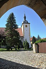 |
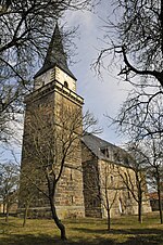
Goethestrasse 4, Mühlberg | Church of St. Luke | A church in Mühlberg was first mentioned in 726. In 1200 a small Romanesque church building can be proven. The present church is a medieval church, which was built around 1300 as a fortified church with a churchyard and served as a refuge for people in times of war. The late Gothic figural wall paintings above the pulpit altar are impressive. They were created around 1450 as a Secco painting, but were not rediscovered until 1977 during a renovation. The center of the painting are the apostles Peter and Paul, who hold the handkerchief of Christ in their hands. The church contains the Radegundis chapel in the lower part of the tower. |
21-97 Location of St. Luke's Church on Wikipedia |
 |
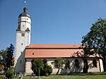
Main street, Seebergen | Church of St. George and fittings, remains of the defensive wall and old gravestones | The church was built from 1511 to 1587 using Seeberger sandstone. On June 11, 1610, a fire severely damaged the church. It was completely restored just a year later, with plaster and new wall paintings. The new equipment was in the Renaissance style. A wall inscription and the year 1611 above the arch of the tower door inside the church attest to this. | 1-215 Location of St. George's Church on Wikipedia |
 |
Menantesstrasse 3, Wandersleben | Church of Saint Peter and equipment | The church of St. Petri was originally Romanesque, as evidenced by walled-in Romanesque windows and a doorway from the same period. The church was first mentioned in a document in 1143. At that time, Wandersleben was named as the ecclesiastical administrative seat of the deanery, to which the parishes of Ermstedt, Kleinrettbach and Mühlberg also belonged. In 1527 the place became Protestant in the course of the Reformation by the Counts of Gleichen. Today's church stands on the Romanesque foundation walls. The tower, which was presumably built in the 15th century, burned out in 1655 and in 1671 its upper area got its present appearance. It was in danger of collapsing before it was renovated in 1997. The roof, facade and organ were also renovated, not least thanks to the efforts of the church building association. |
Location St. Petri Church at Wikipedia
|
 |
Wechmar, Kirchplatz 11 | St. Viti Church | In 1843 the people of Wechmar built one of the largest village churches in Thuringia on the foundations of the previous church, the Sankt-Viti-Kirche. | 1-224 Location St. Viti Church at Wikipedia |
Castle and parks, cemeteries
| image | address | Monument designation | comment | location |
|---|
Secular buildings (by streets)
Cobstädt
| image | address | Monument designation | comment | location |
|---|---|---|---|---|
 |
Schenkstrasse 1 | Waidmühlstein | The millstone lies on the ground in front of the entrance to the former restaurant "Zur Linde". A linden tree grows from its center. | 1-52 / 3 position |
 
|
School place 8 | Parish homestead | Upper picture: south side, lower picture north side at the cemetery | 1-19 position |
 |
School place 11 | Homestead | 1-14 location |
|
 |
School place 12, | Farmhouse | 1-23 position |
Grave life
| image | address | Monument designation | comment | location |
|---|---|---|---|---|
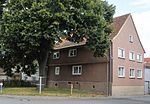 |
Great Alley 26 | Barn with portico | 1-69 / 1 layer |
|
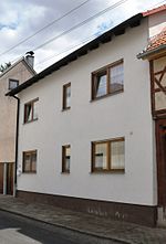 |
Little Alley 72 | House | 1-111 location |
|
 |
Little Alley 73 | House | 1-112 location |
|
 |
Little Alley 81 | House | The building was demolished in 2006 due to its disrepair. | 1-118 location |
 |
In front of the jetty 18 | House and stable building | 1-71 / 2 position |
Großrettbach
| image | address | Monument designation | comment | location |
|---|
Günthersleben
| image | address | Monument designation | comment | Corridor / parcel location web link |
|---|---|---|---|---|
 |
Backhausstrasse 10 | Half-timbered house | 1-183 / 2 position |
|
 |
At Wasserburg 1 (formerly Gothaer Straße 1) | Bridge and former moated castle | 1-7 / 1, 1-7 / 3 location Wasserschloss Günthersleben at Wikipedia |
|
 |
Kirchstrasse 4 | Rectory with enclosure | The enclosure was restored in 2015/16. | 1-124 location |
 |
Mittelstrasse 10 (formerly No. 21) | old school | 1-158 location |
|
 |
In the seven enclosure | Archaeological monument: barrow field in the Siebenhög corridor (now the Siebengehege settlement area) |
location |
|
 |
unnamed | Archaeological monument: moated castle | 1-7 / 1 location Günthersleben moated castle at Wikipedia |
Muhlberg
| image | address | Monument designation | comment | Corridor / parcel location coord. Web link |
|---|---|---|---|---|
 |
On spring 5 | House, barn | 21-132 position |
|
 |
On Spring 22 and 20 | Residential houses | 21-27 / 1, 21-28 / 1 layer |
|
 |
At the Untertor / property wall of Wanderslebener Straße 8 | Remains of the village fortifications | 20-70 / 2 layer |
|
 |
Clara-Zetkin-Strasse 9 | Gölitzenmühle (mill building) | Mühlberg had seven mills, which were operated by the Weidbach , which was mainly fed by the Spring . The Gölitzenmühle is a water mill on the Spring, immediately after the well-known karst spring, with 2 overshot water wheels, first mentioned in 1528, technology: 2 grist, 1 grinding, 1 roller mill and squeezer, technology not functional, the mill wheels were renewed in 1993. | 21-66 / 1 Location information on Arnstadt-Ferienwohnungen.de |
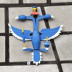 |
Ernst-Thälmann-Strasse 1 | Archery eagle | The archer's eagle is about 2 m high and 1.5 m wide and consists of 2 heads, 2 necks, 2 wings and a trunk with a tail. He holds a scepter and orb in his claws, and 1 ring in each of the two beaks. Above the heads is a crown with a wreath. The eagle was attached around 1900 by the then owner of the property, Oskar Nußbicker. In 1477 the first rifle company in Mühlberg was mentioned. | 10-120 / 2 position |
 |
Ernst-Thälmann-Strasse 7 | Residential building, gate entrance | 21-111 location |
|
| Ernst-Thälmann-Strasse 17 | Residential building | 21-113 / 1 layer |
||
 |
Ernst-Thälmann-Strasse 25 | Courtyard | 21-123 / 3 position |
|
| Ernst-Thälmann-Strasse 31 | House and stable building | 21-113 / 1 layer |
||
 |
Ernst-Thälmann-Strasse 32 | Residential building | 21-221 / 72 position |
|
| Ernst-Thälmann-Strasse 33 | Courtyard | 21-128 / 1 layer |
||
| Geschwister-Scholl-Strasse 1 | Remains of the village fortifications | According to the house owner, Judith Kohla, the remains of the wall have not existed since a major fire in the 1970s, not even on property no.3 | 20-103 position |
|
 |
Geschwister-Scholl-Strasse 2 | Courtyard | 20-109 / 2 layer |
|
| Geschwister-Scholl-Strasse 3 | Remains of the village fortifications | See description of house no.3 | 20-104 position |
|
 |
Geschwister-Scholl-Strasse 12 | Courtyard | 20-150 / 1 layer |
|
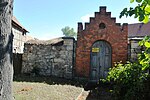 |
Geschwister-Scholl-Strasse 16 | Remains of the village fortifications | Remnants of the village fortifications on the left (no longer recognizable) Former entrance gate to Hellbach's courtyard |
20-151 location |
 |
Geschwister-Scholl-Strasse 20 | Hellbachs-Hof | The Hellbachs-Hof area comprises several buildings between Geschwister-Scholl-Strasse, Thomas-Müntzer-Strasse and Burgbach-Graben. Individual buildings are being rebuilt. The von Hellbach family was a Thuringian aristocratic family that was made nobility by Lothar von Sachsen in the 12th century "because of proven bravery" and temporarily had the Mühlburg as a fief. Hellbach's farm is her former manor. At the northern end of the property, where Thomas-Müntzer-Straße branches off to the Kulturscheune, the Untertor (also known as the “Niedertor”) stood until the 18th century, which, apart from the Obertor in Goethestraße, was the only access to the place and part of the former village fortifications . |
20-153 / 1, 20-153-2 position |
 |
Goethestrasse / Obertor | Remains of the village fortifications | At this point was the upper gate of the former village fortifications, of which only the remains of the wall are preserved today. The gate was originally 7 m wide and had a wall thickness of about 1.6 m. It was first mentioned as the Obertor in 1248. The gate was used as a prison in the 18th century and demolished in 1830. | 20-34 / 2-3 position |
|
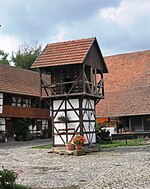
Goethestrasse 1 | Courtyard and pigeon house | "Edelhof". Upper picture: Pigeon house Lower picture: Arched gate to property Goethestrasse 1 (left) and gate entrance to property 3 (right) |
21-88 / 3 position |
 |
Goethestrasse 2 | Rectory | 21-94 / 1 layer |
|
 |
Goethestrasse 3 | Homestead | "Witternscher Hof" (also "Beckisches Gut" or "Gudenisches Gut"): A Witterda family is first mentioned in a fiefdom in 1555. In 1619 the Mühlberger line changed its name to von Wittern . 1755 is named as the owner Johann Heinrich Beck; the family's tombstone can still be seen in the Mühlberg cemetery today. From 1953 to 1990 the property was acquired by the LPG and is now used as a privately owned farm. | 21-87 / 1 layer |
|
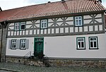
Goethestrasse 4 | House with barn, outbuildings and fencing | Upper picture: street side Lower picture: courtyard side |
21-95 / 7 position |
 |
Goethestrasse 4 | Gatehouse including paving | 21-95 / 6 position |
|
 
|
Goethestrasse | Cemetery with mourning hall and enclosure | 21-150, 95 / 4-5 position |
|
 |
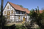
Haarhäuser Strasse 2 | Complete Steigmühle facility with a ditch | The oldest and largest mill in town is the Steigmühle (also known as “Stickmüllen” or “Stickmolen”). It was first mentioned in 1249, making it probably the oldest mill in town. It operated until 1970. It changed hands 28 times. The overshot mill wheel has a diameter of five meters. Gustav Freytag mentions the mill in his novel The Nest of the Wrens. | 20-207 / 4, 207/5, 303/1 position |
 |
Haarhäuser Strasse 23 | Oil and pearl mill with ditch | The mill was first mentioned in 1528 in a hereditary interest book. It was also operated with the water of the spring spring, which at that time did not yet merge with the water of the castle stream at the “viaduct”. In 1728 the mill fell victim to a major fire. The mill has a stamping and pressing plant from the 18th century and is the only functioning mill of its kind in Thuringia. From 1990 it was expanded into a museum by the then owner. | 20-204 / 2, 305/1 layer |
| Johann-Sebastian-Bach-Strasse 12-18 | Village fortification | The remains of the village fortifications on plots 12 and 14 have not existed since 1973. | 20-362 / 40 position |
|
 |
Karl-Liebknecht-Strasse 2 | Remains of the village fortifications | Note: It is currently (August 2016) not guaranteed that the base of the house is actually the remains of the former village fortifications. | 20-92 / 1 layer |
 |
Karl-Liebknecht-Strasse 9 | Residential building | 20-84 position |
|
 |
Karl-Marx-Strasse 16 | House and outbuildings | 20-123 / 1 layer |
|
 |
Market 2 | Complete system with market mill | The market mill was first mentioned in 1546. It was operated with the water of the spring spring. It was a flour mill until 1922, in operation until 1928 and in 1930 it was converted into a residential building. | 20-63 location |
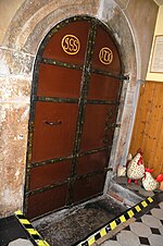 |
Market 3 | Cellar entrance of the inn "Zum Weisse Roß" | The arched sandstone gate with keystone leads to a barrel-vaulted cellar made of tufa limestone. The cellar probably dates from the 17th century. The cellar contains a 5 m deep house well. The basement access is in the hallway. The metal-clad door shows the initials of the former homeowners in the arched fields. The door hinges are designed in the form of goat horns. The names of the previous owners have been carved into the sandstone arches since 1618. Today, as before, the cellar is used as a cool beer cellar. | 20-95 location |
 |
Market 8 | Courtyard | 20-55 position |
|
 
|
Market 14 | Courtyard, sundial | 20-59 / 1 layer |
|
 |
Market 15 | town hall | Mentioned for the first time in 1525, it was the victim of a fire in 1894 and was rebuilt two years later. In 1992/93 it was completely renovated and modernized. Today it houses a restaurant, private apartments and club rooms. | 20-390 / 60/1 layer |
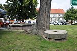 |
Market 15 | Waidmühlstein with fountain | The Waidmühlstein probably comes from a Waidmühle, which stood near the Spring, on the so-called Gänsewaid. The millstone, carved from a piece of sandstone, has a diameter of 1.85 m and a thickness of 37 cm and a serrated running surface. The millstone is a testament to the woad milling, which was particularly important in Mühlberg, as in other places in Thuringia, from the 13th to the 16th century. | 20-310 location |
 |
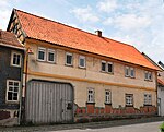
Market 17 | Residential building | 20-101 position |
|
 |
Market 19th | Residential building | 20-100 position |
|
 |
Market 23 | Residential building | 20-98 location |
|
 |
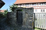
Thomas-Müntzer-Str. 4th | Vorwerk | The Vorwerk is the former farm yard of the Mühlburg. It was first mentioned in 1278 as a farm yard belonging to the Mühlburg. The associated land was cultivated by the farmers in forced labor. The farm once belonged to the farm with a dwelling house, barn, stables, ancillary room and a well. In 1736 there was a partial rebuilding. The castle was in bad shape in the meantime. In the 19th and 20th centuries the Vorwerk was used as a sheepfold and a harvest barn. In 1801 it was leased to the community of Mühlberg, which later also became its owner. With funding from the state, state and municipality, a complex, step-by-step renovation of the Vorwerk with youth and senior citizens' club, residential building, building yard, gym and art and culture barn (inauguration 1999) including the open spaces has been carried out since 1990. | 20-213, 20-368 / 214 position |
|
Wanderslebener Strasse 1 | Residential house, gate, enclosure | 20-34 / 3, 34/2 position |
|
 
|
Wanderslebener Strasse 3 | Residential house, gate, gatehouse | In detail: inscription stone with the year 1581 and the Erfurt wheel in a coat of arms | 20-34 / 3, 34/2 position |
| At the Burgbach | Stone cross III. | On September 8, 2013, the Open Monument Day 2013, a replica of a stone cross was ceremoniously erected on the outskirts in the direction of Röhrensee, commemorating a tragic accident on June 8, 1842, in which the 32-year-old miller Friederike Thiel (b. Steubert, daughter of Steigmüller) and her 10-year-old daughter Albertine were struck by lightning. The original stone cross (around 1450), declared a protected ground monument in 1957, disappeared without a trace in 1982 and has not yet been found despite all efforts. The replica was made on the basis of old photographs on the initiative of a Mühlberg cultural association in a stonemason in Wechmar . Originally the Mühlberg teacher Karl Heepe (1861–1951) described the stone cross in 1916 in the journal of the Thuringian Forest Association and made it widely known. In 1964 the cross was photographed intact for the last time. In 1971 it was badly damaged and demolished. | location |
Seamounts
| image | address | Monument designation | comment | Corridor / parcel location coord. Web link |
|---|---|---|---|---|
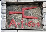 |
Main street 15 / corner of Alleestraße | Inscription stone | 1-237 location |
|
| Main Street 133 | Inscription stone | Inscription stone is not available (August 2016) | 1-179 / 1 layer |
|
 
|
Main Street 164 | Parts of the defensive wall and ... ... arched passage |
The old enclosure wall probably belonged to a former monastery courtyard. It was built from Seeberg sandstone and has an old, now closed, arched entrance. In the vicinity of this monastery courtyard, in the section between the market and the “Untere Tor” (formerly the confluence of the main street with Wechmarer / Wanderslebener Straße), there were once several monastery courtyards that were owned by the monasteries Georgenthal, Bad Hersfeld and Stadtilm. The "lower gate" with a passage width of only 1 vehicle no longer exists today. |
1-210 location |
 
|
Main Street 165 | Community tavern with inscriptions | Inscriptions are not available (August 2016) | 1-211 location |
 |
Lohbankgasse 155 | Residential building | 1-205 location |
|
 |
Röhrengasse 75 | Courtyard | 1-90 / 1 layer |
|
 |
Seebergen, Güntherslebener Strasse | Wayside shrine | A signpost that shows the way to Günthersleben. | 6-1278 / 2 position |
 |
Seebergen, Wanderslebener Strasse | Wayside shrine | It probably belongs to what was once a way of the cross with 14 stations. (Field name "Stichelsee") | 6-1394 location |
|
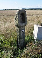
Cobstadt hall | Wayside shrine | Field name "Steinfeld", the wayside shrine stands in a lonely hallway due to the abandonment of the field path that once ran here. | 4-997 location |
Hiking life
| image | address | Monument designation | comment | Corridor / parcel location coord. Web links |
|---|---|---|---|---|
 |
August-Bebel-Strasse 4 | Residential building, entrance gate, enclosure | 10-144 location |
|
 |
August-Bebel-Strasse 6 | Residential building | 10-146 / 4 position |
|
 |
Kirchstrasse 1 | House, barn, wall | 10-125 / 3 position |
|
 |
Menantesstrasse 1 | Former office building | Today houses the community library | 10-184 location |
 
|
Wandering life, Menantesstrasse 4 | Medieval residential tower | The coat of arms stone is set into the wall of the house in whose courtyard the residential tower is located. The coat of arms stone with the "lioned leopard" of the Counts of Gleichen and the year 1597 originally comes from the Henningshof . When the former outbuilding of the Henningshof was demolished in 1985, the coat of arms stone was recovered from the foundation wall. The "HG" refers to the last Count Hans Ludwig von Gleichen († 1631). | 10-190 / 5 position |
 
|
Menantesstrasse 5 and 6 | House and archway, stable and barn building | 10-191 / 4 and 10-192 / 2 position |
|
  Details on the house wall |
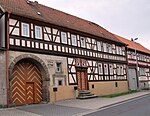
Menantesstrasse 13 | Residential building | "Hunoldhaus": stone tablet with the year 1541, the upper script ("VDMIE") means Verbum Domini Manet In Aeternum ("The word of God exists in eternity"). Including IHS , the Christ monogram. The signs "HH1711" above the window stand for "Hieronymus Hunold", the bailiff and mill owner who moved in here in 1711. He was perhaps a relative of Menantes , whose father Tobias Hunold was also a mill owner and High Count Hatzfeldic bailiff. The lintel with the year 1605 bears the initials "CK" , which have not yet been interpreted . The coat of arms stone originally comes from the Henningshof . When the former outbuilding of the Henningshof was demolished in 1985, the coat of arms stone was recovered from the foundation wall. | 10-201 location |
 |
Menantesstrasse 14 | Residential building | 10-656 / 202 location |
|
 |
Menantesstrasse 31 | Rectory , seat of the Menantes Memorial | 10-126 / 1 layer |
|
 |
Schulstrasse 1 | town hall | 10-99 location |
|
 
|
Schulstrasse 6 | School building with a landmark in the courtyard | The boundary stone bears the year 1754 and the Erfurt wheel. | 10-35 / 4 position |
 |
Schulstrasse 16 | Part of the shop zone | 10-791 / 164 location |
|
 |
Schulstrasse 19 | House with gate entrance, fence and outbuildings | "Henningshof" | 10-168 / 1 Location Henningshof at Wikipedia |
 |
Wandering life, Gleichen Castle | Castle ruins Gleichen including Vorwerk Freudenthal | 10-20 / 6 position |
|
 
|
Wandersleben, between the buildings Wechmarer Straße 28 and Lindenstraße 8: parts of the old village fortification wall | 10-868 / 89 location |
||
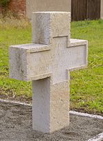
| Hiking life | Stone cross I. | The original cross was moved in 1931 by the Wandersleben domain tenant Loth to the moon garden on Burgberg, about 700 m south. It was stolen from there in 1991. A replica of the cross was erected there in 1993. The current (pictured) cross from the middle of the 15th century was found in March 1998 while excavating the old ford through the apple town in Wandersleben. Since a stone cross had previously stood at the current location of the cross, the found cross was placed here on May 21, 1998. It has the dimensions 90 cm (above ground) height, 60 cm width over both arms and 30 cm thickness. | 10-47 / 7 position | |
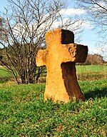
| Hiking life | Stone cross II. | The second stone cross from the late 15th century is popularly called "Bishop's Cross" or "Murder Cross" because according to legend it is supposed to commemorate the murder of the Bishop of Lausanne, Burkhard von Oltigen , during the siege of Gleichen Castle in 1089. There is also talk of a killed craftsperson, hence the name "Murder Cross". The cross is shown as a prominent point on numerous maps and views of Gleichen Castle. In the 19th century it was provided with signposts, which made old inscriptions unrecognizable. Today you can still decipher the somewhat destroyed writing: "Weg nach Wandersleben". In September 2009, after a renovation on behalf of the municipality of Drei Gleichen, it was erected again unchanged. | 10-84 / 5 position |
Archaeological and soil monuments
Muhlberg
| image | address | Monument designation | comment | Corridor / parcel location coord. |
|---|---|---|---|---|
| Muhlberg | Michaelis Chapel | 8-128 / 5 position |
||
 |
Mühlburg, Mühlberg | Radegundis Chapel | 1333 first evidence of a chapel on the Mühlburg. Out of ignorance, the remains of the building were demolished down to the foundation walls in 1945. | 8-110 / 1 layer |
| Muhlberg | Ramparts, castle gate | 8-112 / 8 position 16-20 position?
|
Hiking life
| image | address | Monument designation | comment | Corridor / parcel location coord. |
|---|---|---|---|---|
| Hiking life | Burial mound | |||
| Hiking life | Roadblock |
Wechmar
| image | address | Monument designation | comment | Corridor / parcel location web link |
|---|---|---|---|---|
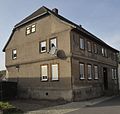 |
Auguststrasse 5 | House | 1-130 / 7 position |
|
 |
Bachstrasse 4 | Bach House | The old Oberbackhaus in the historic center of Wechmar is the world's oldest original place of residence and work for the Bach family. Veit and his son Hans Bach, a minstrel, lived here from 1590 to 1626. Both operated the bakery trade and were musicians on the side. | 1-202 location |
 |
Pfarrgarten 1 (formerly Bergstrasse 1) | Rectory | The former rectory is now an apartment building. | 1-222 / 7 (formerly 1-122 / 1) position |
 |
Goethestrasse 2 | domain | The manor house of the former domain in Wechmar was restored in 2009 and is now an apartment building. | 2-141 / 2 position |
 |
Hohenkirchenstrasse 13 | Studnitz House | The Gotha court marshal Hans Adam von Studnitz built this building right next to the Wechmar Sankt Viti church as his summer residence. Originally the property consisted of three parts of the house and two side wings, of which in 1997 only the central building and the west wing stood. | 1-251 / 2 Location of the Studnitz Villa at Wikipedia |
 |
Church square 2 and 4 | Old school | The building was erected in 1738 as a "boys and girls school". This makes it one of the oldest twin school buildings in Central Germany. From 1773 to 1818 Ernst Christian Bach (1747–1822) was the cantor and boys' school teacher here. Together with his brother Ernst Carl Gottfried Bach (1738–1801) - both were nephews of Johann Sebastian Bach's 2nd degree - he founded the return of the Bach family to Wechmar from 1767. The school house contained four classrooms and four apartments. At times over 150 students were taught. The most important pedagogue was Rector Bernhardt Mohrhardt, who served in school from 1850 to 1922, i.e. over 50 years. In 1995 classes were stopped. | 1-219, 1-220 layer |
 |
Church square 6 | Entire facility "Gut Weidensee" | The four-sided courtyard west of the church has been in the family for over 100 years. It could be kept in its original ambience. Access is through a gate at Hohenkirchener Straße 35, the building of which is number 33 according to Geoproxy, while the number Kirchplatz 6 is shown behind it. | 1-223 location website |
 |
Long Street 9 | Courtyard | 2-131 location |
|
 |
Long Street 21 | Residential building | 2-193 location |
|
 |
Long Street 41 | Residential building | 2-181 location |
|
 |
Market 1 | House | 1-268 location |
|
 |
Market 2 | House | 1-179 location |
|
 |
Mühlenstrasse 1 | Obermühle | The “Veit Bach Mill” could process 1.5 to 2 tons of grain in 24 hours. Rye and wheat were ground and ground for fodder purposes. Initially driven by a water wheel, later, when there was a lack of water, it was driven by a diesel generator, ultimately an electric motor. Mühlgraben, first mentioned in the 16th century, was filled in in 1975. The mill can be visited after making an appointment with the Bachhaus. | 2-13 / 9 (formerly 2-13 / 5) position |
 |
Mühlenstrasse 23 | formerly Niedermühle | (To be checked) The property is rather dilapidated, the mill building no longer exists, the farm buildings are currently (2016) used as living quarters. |
2-24 position |
| Monument ensemble "town center" characteristic town plan |
Marketplace | 1-179, 1-200, 1-265, 1-266, 1-268, 1-269 layer |
||
 |
Ernst-Thälmann-Strasse 1-15 (south side) |
House No. 17 is already on the southern corner of Bergstrasse. The house next to No. 15 is Kirchplatz 1. | 1-190, 1-192, 1-193 / 2, 1-194 to 1-199, 1-219 location (house no. 9) |
|
 
|
Ernst-Thälmann-Strasse 2-16 (north side) |
House no. 2 is the (former) guest house of the golden lion. In 1346, when Wechmar received brewing rights from the Counts of Gleichen, the first community tavern was built, but it had to be demolished in 1765. The new tavern was built two years later, was named "Gasthaus zum golden Löwen" in 1784 and remained the property of the municipality until 1868. In 1882 the property was sold to Otto Korbs from Martinroda, who rebuilt it and until 1914 the "Wechmarer Löwenbräu" "brewed. A dance hall was on the upper floor until 1920. In 1993 the building was restored. In the summer of 1998 it reopened as an inn with a hotel. (Currently, 2016, closed) | 1-180 to 1-183, 1-186 to 1-189 location (house no.10 ) |
|
| Kirchplatz 1-11 (south side) |
1-191, 1-214, 1-215, 1-217, 1-224 location (house no.7 ) |
|||
| Kirchplatz 2-6 (north side) |
1-218 to 1-221, 1-222 location (house no. 4) |
|||
| Bergstrasse 2-18 (north side) |
1-118 / 1, 1-119 / 1, 1-120 / 1, 1-121, 1-122, 1-122, 1-123 / 1, 1-124 / 3, 1-125 / 1, 1- 126 Location (house no.10) |
|||
| Bergstrasse 1 | (Address and parcel do not exist) | 1-222 / 1 |
||
 |
Hohenkirchenstrasse 1-33 (south side) |
1-225, 1-231 / 1, 1-232 / 1, 1-234 / 1, 1-236 / 1, 1-239 / 2, 1-239 / 3, 1-243 / 1, 1-244 / 1, 1-248 / 1, 1-249 / 1, 1-249 / 2, 1-251 / 1, 1-251 / 2, 1-252 to 1-256 location (house no. 13) |
||
| Hohenkirchenstrasse 2-14 (north side) |
1-191 / 2, 1-193 / 1, 1-204 to 1-211, 1-213 location (house no. 8) |
|||
| Bachstrasse 2-6 (south side) |
1-201, 1-202, 1-203, 1-257, 1-258, 1-261 location (intersection) |
|||
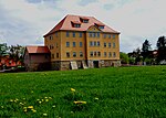 |
Archaeological monument: domain | Goethestrasse 2 | The manor house of the former domain in Wechmar was restored in 2009 and is now an apartment building. | 2-140 / 1, 2-141 / 2 to / 8 (nonexistent), 2-141 / 9 to / 10, 2-143 / 18 (nonexistent), 2-142 / 2 (nonexistent), 2- 138 (?), 2-139 (?) The list of monuments is missing: 2-141 / 11, 2-141 / 12, 2-141 / 14 bis / 29, 2-141 / 31 position |
Objects not listed
Various objects are not listed. The reasons can be:
- the property owners have requested that the property be removed from the list
- the object no longer exists
- the property was not up for listing
Individual monuments
Muhlberg
| image | address | Monument designation | comment | Corridor / parcel location coord. |
|---|---|---|---|---|
| Am Untertor 11 | Inscription plaque | Inscription panel with the year 1773, the Erfurt wheel under crossed swords and the initials of the house owner at the time | 20-172 position |
|
| At the spring | The spring | Actually a natural monument: Strongly bubbling karst spring, the water of which operated seven mills in earlier times. The spring, which is around 7,000 years old, never freezes over because of its constant 8 degrees. The spring is known for its color and light effects. | 21-69 / 1 layer |
|
| Arnstädter Strasse 4-6 | Courtyard | "Armstroff'scher Hof": The property was first mentioned in 1530 as a "free settlement yard near the churches". At that time, Antonius von Notteleben (also Notteleibin ) was a feudal bearer. Bastian Armstroff took over the farm in 1577. In 1725 there are already two "Armstroffische Freygüter" whose last male owners were: August Armstroff (house no. 4) († 1942) and Karl Armstroff (house no. 6) († 1934) . In 1989, when the road was being rebuilt, the doorway and ancillary buildings were torn down. The property is still owned by the family today. | 21-103 / 5 position |
|
| Goethestrasse / Obertor | Brewery fountain | The brewery fountain was first mentioned in 1741. It was a public fountain at the former brewery. Its capacity is 5,200 liters of water, which is fed from the natural inflow from the Gänseweide headwaters. Every year the village youth cleans and decorates the fountain for Pentecost according to an old tradition. | Western from 21-91-1 position |
|
| Goethestraße 15 (formerly Johann-Sebastian-Bach-Straße 6) |
Courtyard | "Vogel'scher Hof": In 1587 a Hans von Berga acquired the "Bergische Guth" in Johann-Sebastian-Bach-Straße 6. In 1656, Hans Heinrich John von Vogel was named as the owner. In 1826 the church took over the property and built a school building. The community built a second school building in 1913, which was used as a school until 2000 and then passed into private ownership. In 1988 the older school was rebuilt for use as a day care center for the community, which was named "Waidspatzen" on September 29, 2006. | 20-42 / 11 position |
|
| Karl-Marx-Strasse 26-28 | Courtyard | "Herrmann'scher Hof": The courtyard complex of today's two properties was first mentioned in 1496 as "Spitznasisches Guth". Around 1720 the Arnstadt city and country major Carl Heinrich von Spitznase was the last owner. The tombstone of Mrs. Julia Elisabeth von Spitznas is in the St. Lukas Church in Mühlberg . In 1800 the Herrmann family bought the farm, in 1861 the Walther family bought it. | 20-382 / 232, 20-383 / 232 position |
Seamounts
| image | address | Monument designation | comment | Corridor / parcel location coord. |
|---|---|---|---|---|
| Hauptstrasse 53 | Old Forge | After a car accident in which a vehicle drove into the property, the house was so damaged that it collapsed and had to be demolished. Today there is a new building. | 1-50 / 3 position |
|
| Hauptstrasse 134 | Rectory | The baroque style building with a mansard roof running on all sides has a style that is significantly different from the other farmsteads. Until 1825 it belonged to the bailiff appointed by the Prince of Schwarzburg-Rudolstadt and was also given its name as "Schuhmann'sches Amtshaus". In 1830, when Seebergen was handed over to Gotha, the building was redesigned as a parsonage and pastor's apartment. To this day it is the rectory of the church. | 1-180 location |
|
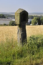 |
Weinbergstraße or Am Berg, field name "Heilige Lehne" | Wayside shrine | 6-1278 / 4 position |
|
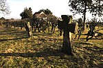 |
On the stone crosses, field name "Kreuzerhügel" | Two stone crosses in the shape of a Maltese | 4-919 location |
Hiking life
| image | address | Monument designation | comment | Corridor / parcel location coord. |
|---|---|---|---|---|
 |
Rosenstrasse 7 | "Grinder on the plan" | At the beginning of the 18th century, the grinding mill was owned by the bailiff Hieronymus Hunold, who was also the owner of the Hunold paper mill. The mill has been totally rebuilt. | 8-77 / 1 layer |
 |
Dammweg 20 | formerly "oil mill" | The mill has been completely rebuilt; a memorial inscription reminds of the original property. | 8-31 / 4 position |
| At the boundary Seebergen / Wandersleben | an area of about 30 m² with two landmarks and a survey stone | south. At the end of 1-23 Location |
||
| Wechmarer Strasse 21 | Hunold's paper mill | The mill was built around 1700 by the Count Hieronymus Hunold, who was also the owner of the grinding mill. In 1713 the Ohrdrufer Johann Andreas Stedekorn becomes the resident tenant of the mill. His son Hans Michael is mentioned in 1720 as a servant of Hunold. In 1730 Hans Michael Stedekorn became the owner of the mill, two years before his death. From 1740 to 1773 the Köhler family owned the mill, first Johann David, then Johann Gottfried. In 1774 the property passed to the neighbor, the brickworks owner Johann Joachim Reinhardt, who stopped the paper production. In the same year Johann Gottfried Köhler acquired the vacant Stedekorn mill near the Waidmühle. A frequent change of ownership followed with changes in the mill function. In 1928, the "lime mill" was finally stopped. Today the mill building has been restored and converted into a residential building. | location |
Individual evidence
- ↑ StBA: Area changes on 01/01/2009
- ↑ Thuringian Law and Ordinance Gazette No. 7 2018 of July 5, 2018 , accessed on July 6, 2018
- ^ Information board from Frank Störzner, Kleinmölsen, in the Kulturscheune, Mühlberg
- ↑ Gut Weidensee
- ↑ a b Information boards on the objects
Literature and Sources
- Municipal administration of the municipality of Drei Gleichen (as of July 2016)
- Hermann Kaufmann Prehistoric burial mounds in the area of the Gotha and Langensalza districts In: Alt-Thüringen 6th vol. 1962–63 digitized
