List of natural monuments in Hagen

This list of natural monuments in Hagen summarizes the natural monuments (ND) in the urban district of Hagen in North Rhine-Westphalia .
The legal basis of the natural monument designations are the Federal Nature Conservation Act and the State Nature Conservation Act NRW. Depending on the area of building law within the city, two different legal systems are relevant in Hagen: the landscape plan (LP) and a regulatory authority ordinance (Natural Monument Ordinance , ND VO). A total of 113 natural monuments are identified in Hagen (as of 11/2016). Of these, 62 are in the landscape plan area and 51 are in the area of application of development plans or within the districts built on in connection. V. a. distinctive trees and groups of trees as well as 23 i. w. S. geological objects.
Natural monuments in the outdoor area (landscape plan)
The following natural monuments are located in the outdoor area under building law (landscape outside of the "built-up districts"). They are protected by stipulations in the Hagen landscape plan, which came into force on September 10, 1994. The natural monument identifiers correspond to the serial numbers or subsections in the landscape plan.
Trees
In the landscape plan section 1.3.2.1, the following trees and groups of trees that are protected as natural monuments are recorded. In most cases it is a question of free-standing, landscape-defining or particularly powerful trees. In some cases, aspects of local history are also relevant (e.g. presumed court trees, old courtyard trees). The trees are characterized by their rarity, character or beauty in terms of type , growth form, age and size. The protective designation extends to the entire area below the treetop (eaves area).
| image | ND identifier (landscape plan) | designation | Details | District | location |
|---|---|---|---|---|---|

|
1.3.2.1.1 | English oak ( Quercus robur ) | Tree in agricultural area | Boele | Corridor 21, parcel 120 (between Schwerter Strasse and Malmkestrasse, on Boeler Ring) map |

|
1.3.2.1.2 | English oak ( Quercus robur ) | Tree at the roadside ditch or field edge | Boele | Corridor 21, parcel 120 (northwest Malmkestrasse) map |

|
1.3.2.1.4 | English oak ( Quercus robur ) | Tree at the roadside ditch or field edge | Boele | Corridor 21, parcel 120 (west of Malmkestrasse) map |

|
1.3.2.1.5 | 2 oaks ( Quercus robur ) | Tree couple in road embankment | Fley | Corridor 4, parcel 323 (south of the entrance to the courtyard from house number 23) map |

|
1.3.2.1.6 | English oak ( Quercus robur ) | Tree on pasture | Berchum | Corridor 7, parcel 62 (north of Tiefendorf) map |

|
1.3.2.1.7 | English oak ( Quercus robur ) | Tree at the "Saure Egge" house | Berchum | Corridor 8, parcel 125 (approx. 10 m southwest of house Tiefendorf 32) map |

|
1.3.2.1.8 | English oak ( Quercus robur ) | Tree on pasture | Heaps | Corridor 8, parcel 31 (south of the Krebsbach valley) map |

|
1.3.2.1.9 | 2 summer linden ( Tilia platyphyllos ) | Trees on both sides of the courtyard entrance of Gut Herbeck | Herbeck | Corridor 1, parcel 102 (courtyard entrance) map |

|
1.3.2.1.13 | Poplar ( Populus hybridus ) | Tree in Lenneaue "Auf der Haardt", with mistletoe in a crown | Herbeck | Corridor 1, parcel 82 (east of the railway line) map |

|
1.3.2.1.14 | English oak ( Quercus robur ) | Tree on embankment | Hohenlimburg | Corridor 5, parcel 157 (above the confluence of the Am Kronocken / Alter Henkhauser Weg) map |

|
1.3.2.1.15 | English oak ( Quercus robur ) | Tree on the site of the former Hohenlimburg sewage treatment plant | Hohenlimburg | Corridor 14, parcel 115 (edge of a gravel road) map |

|
1.3.2.1.16 | English oak ( Quercus robur ) | Tree on pasture "Am Tüßfeld" | Herbeck | Corridor 3, parcel 68 (south of Hohenlimburger Strasse) map |
| 1.3.2.1.17 | European beech ( Fagus sylvatica ) | Tree in a field hedge | Westerbauer | Corridor 3, parcel 15 (approx. 100 m west of Vogelsanger Strasse) map |
|

|
1.3.2.1.18 | English oak ( Quercus robur ) | Tree on an agricultural area on the Buscherberg | Westerbauer | Corridor 3, parcel 18 (approx. 50 m west of Haus Vogelsanger Str. 70) Map |

|
1.3.2.1.20 | English oak ( Quercus robur ) | Tree on embankment | Westerbauer | Corridor 4, parcel 402 (above the driveway to thistle piece 22) map |

|
1.3.2.1.21 | 5 + 1 ash trees ( Fraxinus excelsior ) | Ensemble of 5 trees on pasture and 1 tree on green space | Westerbauer | Corridor 4, parcel 430 + 432 (south of Twittingstrasse on the pasture of farm No. 25-29) and corridor 2, parcel 104 (north of the street in the green area in front of house no. 92) map |

|
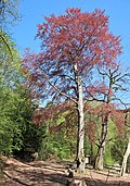
1.3.2.1.22 | Horse chestnut ( Aesculus hippocastanum ) | Tree on pasture | Westerbauer | Corridor 5, parcel 430 (pasture of the Twittingstrasse courtyard) map |
|
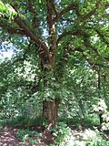
1.3.2.1.23 | 1 chestnut ( Castanea sativa ) 3 red beeches ( Fagus sylvatica ) |
Grove of trees on forest playground "Im Deerth" | Hagen | Corridor 21, parcel 16 (Im Deerth) map |
|
1.3.2.1.24 | Horse chestnut ( Aesculus hippocastanum ) | Tree at the edge of the path / forest | Hagen | Corridor 31, parcel 23 (Buntebachstrasse near house number 98) map |

|
1.3.2.1.25 | Winter linden ( Tilia cordata ) | Tree in the yard area | Hagen | Corridor 51, parcel 42 (homestead Auf dem Killing) map |

|
1.3.2.1.28 | Plane tree ( platanus acerifolia ) | Tree on Schlossberg (a maple, formerly the second tree of the ND, was felled) |
Hohenlimburg | Corridor 23, parcel 75 (below the palace garden terrace) map |
| 1.3.2.1.29 | 1 (originally 6) yew ( Taxus baccata ) | originally 3 pairs of multi-stemmed trees on the Schlossberg on the east, north and west side of the lower palace terrace; Protection status e.g. Partly canceled (1 yew tree broke apart in a winter storm at the end of 2004, 2 felled during the restoration of the baroque garden parterre) |
Hohenlimburg | Corridor 23, parcel 76 (lower palace garden terrace) map |
|

|
1.3.2.1.30 | 9 (originally 14) yew trees ( Taxus baccata ) 2 (originally 3) pods ( Ilex aquifolium ) 1 boxwood ( Buxus sempervirens ) |
Grove of trees on the Schlossberg northwest of the castle (some trees apparently missing) |
Hohenlimburg | Corridor 23, parcel 76 and 77 (below the castle wall) map |

|
1.3.2.1.31 | 2 (originally 7) yew trees ( Taxus baccata ) 2 pods ( Ilex aquifolium ) |
Grove of trees at Hohenlimburg Castle (partly felled) |
Hohenlimburg | Corridor 23, parcel 77 (courtyard of the castle) map |

|
1.3.2.1.33 | 2 summer linden ( Tilia platyphyllos ) | Trees at Hohenlimburg Castle | Hohenlimburg | Corridor 23, parcel 77 (southwestern courtyard) map |

|
1.3.2.1.35 | Chestnut ( Castanea sativa ) | Tree in embankment | Hohenlimburg | Corridor 23, parcel 36 (between Röhrenweg and Eselsweg opposite the gate entrance to the castle) map |
| 1.3.2.1.36 | Blood beech ( Fagus sylvatica 'Atropunicea') | Tree in the forest on Schlossberg | Hohenlimburg | Corridor 23, parcel 81 (on Röhrenweg approx. 300 m southwest of the castle) map |
|

|
1.3.2.1.39 | Grape oak ( Quercus petraea ) | Tree at Gut Kuhweide | Delstern | Corridor 12, parcel 62 (approx. 200 m south of the farm buildings) map |
| 1.3.2.1.40 | Ash ( Fraxinus excelsior ) | Tree at Gut Kuhweide | Delstern | Corridor 12, parcel 62 (approx. 200 m southwest of the farm buildings between the edge of the forest and coniferous trees) map |
|

|
1.3.2.1.41 | English oak ( Quercus robur ) | Tree on the way to Gut Kuhweide | Delstern | Corridor 11, parcel 88 (route between Volmetal and Gut) map |

|
1.3.2.1.42 | Horse chestnut ( Aesculus hippocastanum ) | Tree in front of the house | Delstern | Corridor 5, parcel 41 (Kattenohl 1a) map |

|
1.3.2.1.43 | Yew tree ( Taxus baccata ) | Tree in grassland area | Delstern | Corridor 10, parcel 20 (north of house in Lücköge 1) map |

|
1.3.2.1.44 | Grape oak ( Quercus petraea ) | Tree in the mountainside | Delstern | Corridor 10, parcel 179 (approx. 80 m west of the house) map |

|
1.3.2.1.46 | Winter linden ( Tilia cordata ) | Hofbaum | Delstern | Corridor 17, parcel 120 (Ribberthof near Dahl) map |

|
1.3.2.1.47 | English oak ( Quercus robur ) | Tree on top of the slope | Dahl | Corridor 13, parcel 585 (footpath below Altenheim / Volmehang) map |

|
1.3.2.1.48 | English oak ( Quercus robur ) | Tree at the edge of the forest | Dahl | Hall 13, Parcel 585 (below Garden House Am Horseney 11) Map |

|
1.3.2.1.51 | English oak ( Quercus robur ) | Tree on top of the slope | Dahl | Corridor 13, parcel 630 (between ditch and path in front of house Becke 1) map |
 |
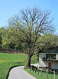
1.3.2.1.52 | European lime tree ( Tilia platyphyllos ) | Rumscheider Linde - old Femelinde ( court tree ) in the courtyard | Dahl | Corridor 6, parcel 1068 (Haus Rumscheid 85) map |
|
1.3.2.1.54 | Ash ( Fraxinus excelsior ) | Tree on the road near residential house | Dahl | Corridor 9, parcel 350 (west of Bölling, road to Röteldiek) map |
Caves, tunnels, boulders, quarry walls, sinkholes
The following geological objects protected as natural monuments are recorded in the landscape plan section 1.3.2.2 . These are natural caves , boulders and sinkholes as well as artificially created mining tunnels , bunkers and quarry walls . These are relevant for nature conservation . a. for scientific reasons, as special locations or as quarters for amphibians , reptiles and bats .
| image | ND identifier (landscape plan) | designation | Details | District | location |
|---|---|---|---|---|---|

|
1.3.2.2.1 | Kaisberg coal mine | "Stollen" in the Upper Carboniferous - meanwhile interpreted as a bunker from the 20th century (cf. Kaysbergerbank colliery ) - protection designation also includes the rock face at the foot of which the entrance is located | lobby | Corridor 2, parcel 50 (south-east of the sewage treatment plant vestibule) map |

|
1.3.2.2.2 | Gossmann tunnel | Approx. 6 m deep mutation tunnels in the Hagen strata of the Upper Carboniferous with clay slate, sandstone and greywacke | Berchum | Corridor 1, parcel 612 (north of Villigster Strasse on Kahlenberg) map |

|
1.3.2.2.3 | Tiefendorf tunnel | Zoologically significant, approx. 8 m deep mutation tunnels in the Hagen strata of the Upper Carboniferous with clay slate, sandstone and greywacke | Berchum | Corridor 8, parcel 125 (southeast of Tiefendorf) map |
 |
1.3.2.2.4 | Geological outcrop Quarry porch | "Kersberg wall" in the former brickworks vestibule - geological outcrop (quarry wall ) made of slate with embedded greywacke sandstone from silt-empty upper carbon ( type locality of the Vorhaller layers) | lobby | Corridor 6, parcels 165–169, 406, 601, 603 and corridor 7, parcel 23 (northwest Eckesey) map |

|
1.3.2.2.5 | Boulder vestibule | Boulder made of Revsund granite (Northern Sweden) | lobby | Corridor 9, parcel 516 (at the Hülsbergbach west of the lobby) map |

|
1.3.2.2.6 | Philippshöhe gallery | zoologically more important tunnel formerly used as a bunker | lobby | Corridor 7, parcel 18 (Volmehang near Eckesey) map |

|
1.3.2.2.7 | Klutert cave | Cave in reef limestone lens of the Upper Honsel Strata of the Middle Devon, 285 m long with 39 m difference in altitude | Hasp | Corridor 57, parcel 72 (west of the Hestert sports field) map |

|
1.3.2.2.8 | Bunker Hestert | 2 zoologically important, each 40 m long, tunnel-like bunkers | Hasp | Corridor 51, parcel 150 (near Hestert) map |

|
1.3.2.2.9 | Hüttenberg cave | Artificially enlarged, 7 m long cave in the reef limestone lens of the Upper Honsel strata of the Middle Devonian | Hagen | Corridor 10, parcel 555 (southwest Eilpe) map |

|
1.3.2.2.10 | Eilper caves I and II | Karst cave in limestones of the Upper Honsel strata of the Middle Devon with one entrance and several day openings, a total of 180 m long with a height difference of 7 m; also significant zoologically | Hagen | Corridor 13, parcel 454 (below Hüsteystraße near Eilpe) map |

|
1.3.2.2.11 | Iron cave | approx. 61 m long tunnel in the reef limestone lens of the Upper Honsel strata of the Middle Devonian, v. a. hydrologically remarkable and zoologically significant | Hagen | Corridor 14, parcel 151 (on B 54 west of Delstern) map |

|
1.3.2.2.12 | Milchenbach sinkhole | Buried sinkhole, lined with wood, over mass limestone of the upper Middle Devonian | Holthausen | Corridor 6, parcel 7 (won "Kuhlenstück" southwest of Holthausen) map |

|
1.3.2.2.13 | Holthauser Bach cave and tunnel | Cave system (Holthauser Bach cave, birthday cave) in the mass limestone with approx. 1030 m long fissure system and adjacent bunker with approx. 15 m tunnel length, which is zoologically significant (bats, moths, cave spiders) | Holthausen | Corridor 5, parcel 57 (at the Holthauser Bach) map |

|
1.3.2.2.14 | Badger hole | Artificially extended, approx. 14 m long karst cave in the limestone bank of the Upper Honsel strata of the Middle Devonian | Hagen | Corridor 20, parcel 218 (east of Selbecker Strasse) map |

|
1.3.2.2.15 | Copper mine gallery (pit field Julie II) | zoologically significant, approx. 80–100 m long, former copper ore mine tunnel in the Brandenberg strata of the Middle Devonian | Hagen | Corridor 18, parcel 97 (Dornscheider Bachtal east of the open-air museum ) Map |
| 1.3.2.2.16 | Pit field Julie I gallery | zoologically significant, former copper ore mine tunnel in the Brandenberg layers of the Middle Devonian (sandstone, siltstone, mudstone) | Hagen | Corridor 18, parcel 85 (foot of the hill Eilper Berg east of the open-air museum ) Map |
|
| 1.3.2.2.17 | Mäckinger Bach tunnel | Zoologically significant, former copper ore mine tunnel in the Brandenberg strata of the Middle Devon with a buried entrance | Hagen | Corridor 18, parcel 92 (east of the open-air museum ) map |
|

|
1.3.2.2.18 | Wammesberg tunnel | Zoologically significant, approx. 300 m deep tunnels in the lower Brandenberg strata of the Middle Devon with sandstone and clay slate | Delstern | Corridor 17, parcel 121 (foot of the rock face north of the Ambrock Clinic) map |

|
1.3.2.2.19 | Volmeufer Ambrock tunnel | zoologically important, approx. 150 m long tunnel in the Brandenberg layers of the Middle Devonian | Delstern | Corridor 17, parcel 205 (Volmeufer near Ambrock) map |

|
1.3.2.2.20 | Finking Cave | zoologically significant, approx. 7 m long cleft cave in sandstone and clay slate of the lower Brandenberg layers of the Middle Devonian | Delstern | Corridor 7, parcel 60 (steep slope to the Volme north of Dahl) map |

|
1.3.2.2.21 | Asmecke tunnel | zoologically significant, approx. 90 m long tunnel | Dahl | Corridor 7, parcel 281 (side valley Asmecke-Bach) map |

|
1.3.2.2.22 | Funkenhaus tunnel | closed tunnel | Dahl | Corridor 7, parcel 184 (behind Hotel Funkenhaus) map |

|
1.3.2.2.23 | Gallery Uffeln House | Zoologically significant, approx. 4–5 m deep exploitation tunnel in the Hobräcker layers of the Middle Devonian (clay, sand and siltstone with limestone lenses) | Dahl | Corridor 11, parcel 524 (north of Heedfelder Straße in Rummenohl) map |
Natural monuments in the interior (Natural Monument Ordinance)
The following natural monuments are to be found in the interior area under building law (areas of the "built-up districts"). They are protected by the Hagen Natural Monument Ordinance, which came into force on March 26, 2012. The drafting of the regulation began in 1999; a first change (extension / update) was decided in 2014. The ordinance has a term of 10 years, i. H. A continuation or a new protection ordinance will have to be decided by March 2022 . If this does not happen, the natural monument status automatically ceases to exist when the ordinance expires.
The background to the Natural Monument Ordinance was an order of the Arnsberg district government from 1997, with which the city of Hagen was informed of the pending repeal of the old natural monument ordinances of the Iserlohn district and the Ennepe-Ruhr district of 1974. This affected areas that have belonged to the Hagen city area since the regional reform in 1975 . The two old regulations contained a total of nine natural monuments (trees or groups of trees), two of which have meanwhile been placed under protection by the Hagen landscape plan as natural monuments.
Even before the Natural Monument Ordinance came into force in 2012, the tree protection statute of the city of Hagen was repealed in November 2007 following a majority decision by the council. This was v. a. justified with cost savings. The statutes in force since 1986 meant that older trees with certain trunk circumferences were fundamentally protected and could only be felled with permission. The repeal of the statute caused public protests, u. a. 1400 signatures were collected for maintaining tree protection. After the tree protection statute was repealed, there was, as expected, increased tree felling.
Trees
The following objects - exclusively trees or groups of trees - are recorded in the Natural Monument Ordinance. Most were as formative view provided individual trees under protection. Some are also interesting from a dendrological perspective (e.g. ginkgo) or particularly old (e.g. prior linden). Around a third of these natural monuments are owned by the city.
The identifiers of the natural monuments in the interior begin with N, M, ED or HO, followed by serial numbers. The letters stand for the northern, central, Eilpe / Dahl and Hohenlimburg districts of Hagen (there is no natural monument in the inner area of the Haspe district).
| image | ND identifier (regulation) | designation | Details | Borough | District | location |
|---|---|---|---|---|---|---|

|
N-1 | Plane tree ( Platanus × hispanica ) | distinctive single tree that characterizes the residential area | North | Eckesey | Herderstrasse 12 (garden) map |

|
N-3 | European beech ( Fagus sylvatica ) | stately single tree | North | Boele | Schwerter Strasse 147 (garden) map |

|
N-4 | Horse chestnut ( Aesculus hippocastanum ) | distinctive single tree that defines the townscape | North | Boele | Bonsmannstrasse 36 (front garden) map |
|
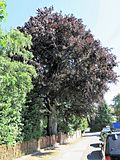
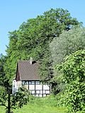
N-5 | Blood beech ( Fagus sylvatica 'Atropunicea') | distinctive single tree that defines the townscape | North | Boele | Batheyer Straße 89 (on the property wall) map |
|
N-7 (N-7.1 to N-7.3) |
3 oaks ( Quercus robur ) | distinctive row of trees that characterize the townscape | North | Fley | Feldmarkweg / Angerpfad (embankment head south of the rainwater retention basin) map |

|
N-8 | English oak ( Quercus robur ) | stately single tree | North | Fley | Feldmarkweg (embankment road side ditch) map |

|
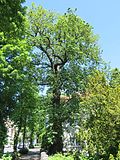
N-9 | Mountain elm ( Ulmus glabra ) | rare large copy | North | Boele | On the grass Kamp 27/29 (in the backyard of the apartment building east) Map |
|
M-1 | English oak ( Quercus robur ) | distinctive tree | center | Hagen | Fleyer Strasse 104 b (front garden) map |
 |
M-2 | Ginkgo ( Ginkgo biloba ) | Dendrologically interesting tree, oldest specimen in Hagen | center | Hagen | Märkischer Ring 101 / Rembergstraße 2 (edge of the parking lot behind CVJM-Heim) map |

|
M-3 | Wingnut ( Pterocarya fraxinifolia ) | distinctive tree that shapes the cityscape | center | Hagen | Märkischer Ring 101 (sidewalk in front of the YMCA home) map |

|
M-4 | Blood beech ( Fagus sylvatica 'Atropunicea') | stately single tree | center | Hagen | Volkspark (lawn opposite the Bahnhofstrasse junction) map |

|
M-5 | Wingnut ( Pterocarya fraxinifolia ) | distinctive single tree | center | Hagen | Volmepark (lawn north of the Sparkassenhaus) map |

|
M-6 (M-6.1 and M-6.2) |
2 horse chestnuts ( Aesculus hippocastanum ) | stately pair of eastern tree (M-6.2) largely dead, felling planned for winter 2016/17 |
center | Hagen | Funckepark (on the footpath in the middle of the green area) map |

|
M-7 | Blood beech ( Fagus sylvatica 'Atropunicea') | distinctive tree | center | Hagen | Funckepark (lawn in the western area of the green area) map |

|
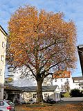
M-8 | Silver beech ( Fagus sylvatica 'Pendula') | distinctive tree, rarely a large specimen | center | Hagen | Funckepark (lawn in the western area of the green area) map |
|
M-9 | Plane tree ( Platanus × hispanica ) | stately, situation-defining single tree | center | Hagen | Bahnhofstrasse 30 (raised bed in the courtyard area) map |

|
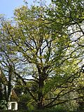
M-10 | European beech ( Fagus sylvatica ) | stately single tree | center | Eppenhausen | At the Egge 18 (yard area) map |
|
M-12 | English oak ( Quercus robur ) | stately, free-standing tree | center | Eppenhausen | At the Egge 17 (garden) map |

|
M-13 (M-13.1 to M-13.4) |
2 Dutch linden ( Tilia × vulgaris ) 1 winter linden ( Tilia cordata ) 1 horse chestnut ( Aesculus hippocastanum ) |
striking row of trees in a historic courtyard | center | Holthausen | Raiffeisenstraße 37 (garden west of the residential building on Schemmanshof) map |

|
M-14 | Horse chestnut ( Aesculus hippocastanum ) | distinctive single tree that defines the townscape | center | Holthausen | Raiffeisenstraße 15 (roadside west of the house) map |
|
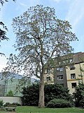
M-15 | Trumpet Tree ( Catalpa bignonioides ) | distinctive, dendrologically interesting tree | center | Hagen | Mariengasse 7 (garden) map |

|
M-16 | Plane tree ( Platanus × hispanica ) | stately, free-standing tree in the former garden of the Villa Post | center | Hagen | Wehringhauser Straße 38 (green area behind the villa) map |

|
M-17 | Horse chestnut ( Aesculus hippocastanum ) | distinctive single tree that defines the townscape | center | Hagen | Minervastraße 15 (front garden) map |

|
M-18 | Yew tree ( Taxus baccata ) | stately, multi-stemmed specimen in an old villa garden | center | Hagen | Dorotheenstraße 18 (park next to the entrance stairs) map |
| M-19 | European lime tree ( Tilia platyphyllos ) | distinctive tree in an old villa garden | center | Hagen | Dorotheenstraße 18 (park west of the footpath) map |
|

|
M-20 (M-20.1 and M-20.2) |
1 Norway maple ( Acer platanoides ) Sycamore maple ( Acer pseudoplatanus ) |
striking pair of trees in an old villa garden | center | Hagen | Dorotheenstraße 18 (park, north footpath) map |

|
M-21 | Horse chestnut ( Aesculus hippocastanum ) | stately single tree in an old villa garden | center | Hagen and Haspe | Dorotheenstraße 18 (park, approx. 6 m east of the house) map |

|
M-22 | Sycamore maple ( acer pseudoplatanus ) | stately single tree in an old villa garden | center | Hagen and Haspe | Dorotheenstraße 18 (garden, approx. 6 m from the northeast corner of the house) map |

|
M-23 | Sycamore maple ( acer pseudoplatanus ) | stately single tree in an old villa garden | center | Hagen and Haspe | Dorotheenstraße 18 (garden, approx. 12 m from the northeast corner of the house) map |
| M-24 | Sycamore maple ( acer pseudoplatanus ) | stately single tree in an old villa garden | center | Hasp | Dorotheenstraße 18 (park, approx. 30 m west of the house) map |
|
|
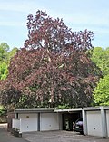
M-25 | Blood beech ( Fagus sylvatica 'Atropunicea') | distinctive single tree that characterizes the residential area | center | Hagen | Hochstraße 21 (courtyard next to the garage entrance) map |

|
ED-1 | European beech ( Fagus sylvatica ) | distinctive tree | Eilpe / Dahl | Hagen | Franzstrasse 51 (front garden of the kindergarten) map |

|
ED-2 | Horse chestnut ( Aesculus hippocastanum ) | distinctive tree | Eilpe / Dahl | Hagen | Franzstrasse 51 (front garden of the kindergarten) map |

|
ED-3 | English oak ( Quercus robur ) | distinctive tree that defines the townscape | Eilpe / Dahl | Delstern | Eilper Straße (street embankment opposite house no. 20) map |

|
ED-4 | Plane tree ( Platanus × hispanica ) | stately single tree, relic of the garden of the former Villa Vorster | Eilpe / Dahl | Delstern | Delsterner Straße 118 (property line, back garden No. 120) map |
| ED-5 | Sycamore maple ( acer pseudoplatanus ) | stately single tree, relic of the garden of the former Villa Vorster | Eilpe / Dahl | Delstern | Delsterner Straße 120 (garden behind the villa) map |
|

|
ED-6 (ED-6.1 to ED-6.4) |
4 blood beeches ( Fagus sylvatica 'Atropunicea' ) | distinctive grove of trees that characterize the townscape | Eilpe / Dahl | Dahl | ev. Dahl church (green area west and south of the church) map |

|
ED-7 | European lime tree ( Tilia platyphyllos ) | distinctive single tree in the park of Haus Dahl | Eilpe / Dahl | Dahl | Dahler Straße 67 (south of the quarry stone wall on the footpath between the church and the Märkischer Bank) map |
|
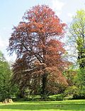
ED-8 | Blood beech ( Fagus sylvatica 'Atropunicea') | distinctive single tree in the park of Haus Dahl | Eilpe / Dahl | Dahl | Dahler Straße 67 (green area south of Märkischer Bank) map |

|
ED-9 | English oak ( Quercus robur ) | distinctive single tree | Eilpe / Dahl | Dahl | Map to Bollwerk 28 (eastern corner of the property on the way) |
 |
ED-10 | European lime tree ( Tilia platyphyllos ) | " Priorlinde " in the Priorei district , Alt-ND (Ennepe-Ruhr-Kreis, since 1974) - one of the oldest trees in the city (at least 500 years old) with a formerly conspicuous crown shape ( candelabra linden ), since the middle of the 20th century and unsuccessful "Care measures" increasing signs of death | Eilpe / Dahl | Dahl | Zur Priorlinde 14 (south of the restaurant "Zur Priorlinde") map |

|
HO-1 (HO-1.1 and HO-1.2) |
2 summer linden ( Tilia platyphyllos ) | stately single tree and striking pair of trees on an old house; Old-ND with originally 3 linden trees (a tree at the parking lot was severely shortened around 2010/11, since then no longer worthy of protection) |
Hohenlimburg | Hohenlimburg | Alter Schlossweg 17 (garden to the east of the residential building and the edge of the parking lot to the west of the residential building) Map |

|
HO-2 | Blood beech ( Fagus sylvatica 'Atropunicea') | distinctive single tree in the garden of the former villa Wälzholz / Bettermann | Hohenlimburg | Hohenlimburg | Stennertstraße 3 (garden behind the villa) map |

|
HO-4 | Yew tree ( Taxus baccata ) | distinctive single tree | Hohenlimburg | Hohenlimburg | In the Weinhof 16 (front garden) menu |

|
HO-6 | European lime tree ( Tilia platyphyllos ) | stately single tree | Hohenlimburg | Hohenlimburg | Am Boeckwaag (south-east corner of the cemetery of the Evangelical Reformed parish) map |

|
HO-7 | Norway maple ( Acer platanoides ) | stately tree | Hohenlimburg | Hohenlimburg | Am Boeckwaag (green space along the border to the cemetery of the Evangelical Reformed parish) map |

|
HO-8 | European lime tree ( Tilia platyphyllos ) | distinctive single tree that defines the townscape | Hohenlimburg | Hohenlimburg | Esserstraße (property line in gap in the wall and pavement bulge opposite houses 36/38) map |

|
HO-9 (HO-9.1 and HO-9.2) |
2 yew trees ( Taxus baccata ) | striking trees | Hohenlimburg | Hohenlimburg | In pen 37 (northeast and southeast next to building) map |

|
HO-11 | English oak ( Quercus robur ) | distinctive single tree that characterizes the residential area | Hohenlimburg | Hohenlimburg | Oeger Holz 1–7 (fallow garden north of Oeger Holz 1) map |

|
HO-12 (HO-12.1 to HO-12.12) |
12 sessile oaks ( Quercus petraea ) | unique grove of trees from an old agricultural farm | Hohenlimburg | Heaps | Wehbergstraße 3 (oak grove south of the courtyard) map |
| HO-13 | English oak ( Quercus robur ) | distinctive single tree, rare compact growth habit, relic of a small brook valley | Hohenlimburg | Heaps | Schwarzwaldstraße 48 (embankment in the eastern part of the garden) map |
|

|
HO-14 (HO-14.1 and HO-14.2) |
1 winter linden ( Tilia cordata ) 1 English oak ( Quercus robur ) |
distinctive single trees in the former Bleckschen Park | Hohenlimburg | Heaps | Lennestrasse 89–91 (Park des Arcadeon / House of Science and Further Education: northern area / footpath to Wehbergstrasse and north-eastern area / behind the supply building) map |
Natural monument identifiers that are not (no longer) assigned
Outdoor area (landscape plan)
The following list contains the former natural monuments in the outdoor area.
| comment | ND identifier | designation | Details | District | location |
|---|---|---|---|---|---|
| ? | 1.3.2.1.3 | ? | ? | ? | |
| like | 1.3.2.1.10 | English oak ( Quercus robur ) | Tree on pasture | Hohenlimburg | Corridor 2, parcel 32 (north of Reh) |
| like | 1.3.2.1.11 | Grape oak ( Quercus petraea ) | Tree on the edge of the forest near Henkhausen | Hohenlimburg | Corridor 2, parcel 478 (at Hasselbachstraße 46-50) |
| like | 1.3.2.1.12 | Blood beech ( Fagus sylvatica 'Atropunicea') | Tree on an agricultural area (grassland / grove) | Herbeck | Corridor 2, parcel 135 (northeast of the road junction with Sonnenfeld / Herbecker Weg) |
| like | 1.3.2.1.19 | European beech ( Fagus sylvatica ) | Tree on the edge of a green area | Westerbauer | Corridor 4, parcel 397 (north of Silscheder Straße) |
| Repealed in 1997 | 1.3.2.1.26 | Ash ( Fraxinus excelsior ) | Tree on pasture | Delstern | Corridor 3, parcel 219 (on Köhlerweg near Bissingheim) |
| Repealed in 1997 | 1.3.2.1.27 | European beech ( Fagus sylvatica ) | Tree on the green area of the Hagen-Süd motorway junction (A 45) | Holthausen | Corridor 1, parcel 489 (A-45 junction) |
| like | 1.3.2.1.28 | Sycamore maple ( acer pseudoplatanus ) | Tree on the Schlossberg (a plane tree as the second tree of the ND is still standing) | Hohenlimburg | Corridor 23, parcel 75 (below the palace garden terrace) |
| like | 1.3.2.1.32 | Yew tree ( Taxus baccata ) | Tree at Hohenlimburg Castle next to the "Nassauer Schlösschen" | Hohenlimburg | Corridor 23, parcel 77 (next to the castle gate) |
| Repealed in 2006 | 1.3.2.1.34 | 2 summer linden ( Tilia platyphyllos ) | Trees on the Schlossberg (shortened considerably for traffic safety reasons, no longer worthy of protection) | Hohenlimburg | Corridor 23, parcel 78 (front garden Fürstliche Revierförsterei, house Forstweg 29) |
| like | 1.3.2.1.37 | Blood beech ( Fagus sylvatica 'Atropunicea') | Street tree at Gut Kuhweide | Delstern | Corridor 12, parcel 12 (cow pasture 1–3a north of the estate) |
| like | 1.3.2.1.38 | English oak ( Quercus robur ) | Tree at Gut Kuhweide | Delstern | Corridor 12, parcel 12 (cow pasture 1–3a south of the estate) |
| overturned | 1.3.2.1.45 | Hornbeam ( Carpinus betulus ) | Single tree on pasture | Dahl | Corridor 1, parcel 186 (northwest of Hunsdiek) |
| Repealed in 1997 | 1.3.2.1.49 | European beech ( Fagus sylvatica ) | Tree at the fork in the road | Dahl | Corridor 13, parcel 554 (fork Hengstenbergweg / way to Bietinghausen) |
| Repealed in 1997 | 1.3.2.1.50 | Hornbeam ( Carpinus betulus ) | Tree at the edge of the forest | Dahl | Corridor 7, parcel 164 (west of Riepegelle) |
| Repealed in 1997 | 1.3.2.1.53 | Wild cherry ( Prunus avium ) | Tree in embankment in the middle of a field | Dahl | Corridor 9, parcel 336 (between Nimmerbach tributary and A 46 east of Rumscheid) |
Indoor area (Natural Monument Ordinance)
The following list shows the missing serial numbers in the Natural Monument Ordinance. These are interior objects that were initially proposed (planned) by the city's environmental agency, but were not identified in the Natural Monument Ordinance adopted in 2012. In most cases, the need for protection was no longer given due to changes in the meantime.
| comment | ND identifier | designation | Details | District | location |
|---|---|---|---|---|---|
| planned ND, still worthy of protection | N-2 | 2 plane trees ( Platanus sp.) | on the basis of a proposal by the SPD parliamentary group and a Council resolution (2005) removed from the draft list of the regulation; no natural monument protection but trees are to be preserved (afterwards new construction of the community center 2006–2008) | Boele | Property of the evangelical Melanchthon community (Philipp-Nicolai-Kirche on Schwerter Strasse) |
| planned ND, no longer worthy of protection | N-6 | Kastanienallee | The avenue was severely trimmed for traffic safety reasons (3 trees felled, 13 remaining trees no longer have a tree-typical habit), no longer worthy of protection | Boele | House Bush |
| planned ND, no longer worthy of protection | M-11 | Winter linden ( Tilia cordata ) | Part of the crown died in 2009 for unexplained reasons, the tree no longer met the natural monument criteria | Eppenhausen | At the harrow 8 |
| planned ND, please | HO-3 | Plane tree ( Platanus sp.) | Tree was felled to create a new overpass; priority was to be given to the stipulations of the legally binding development plan | Hohenlimburg | near Hohenlimburg train station |
| planned ND, no longer worthy of protection | HO-5 | Yew tree ( Taxus baccata ) | Tree fallen, no longer worthy of protection | Hohenlimburg | In the Weinhof 16 |
| planned ND, no longer worthy of protection | HO-10 | Lime tree ( Tilia sp.) | "Krimlinde"; one of two main shoots erupted in summer 2008 | Hohenlimburg | Cemetery of the Evangelical Reformed parish on Iserlohner Strasse |
| 2009 like | HO-15 | Oak ( Quercus sp.) | Alt-ND (Iserlohn district, since 1974), tree was no longer stable | Berchum | Berchumer Kirchplatz 7 a / b |
See also
Web links
- Landscape plan of the city of Hagen (PDF; natural monument determinations on pp. 293–341)
- Natural Monument Ordinance of the City of Hagen (PDF; text of legal regulation 60.69.01 without ND list)
- Citizen information system of the city of Hagen (possibility to research details of the Natural Monument Ordinance, amendment templates and resolutions)
Individual evidence
- ↑ a b c d e f g h i j k l m n o p q Landscape plan of the city of Hagen. (PDF) In: hagen.de. December 1994, pp. 293–341 , accessed on November 9, 2016 (updated 2010).
- ↑ a b Regulatory authority ordinance of the city of Hagen for the designation of natural monuments within the built-up districts and the areas of application of the development plans (Natural Monument Ordinance - ND VO), valid since 2012 (with changes), list available via the citizen information system of the city of Hagen
- ↑ Landscape plan statistics district-free city: Hagen - overview of the State Office for Nature, Environment and Consumer Protection North Rhine-Westphalia
- ↑ a b draft resolution 0626/2005 of the city administration of Hagen (environmental office), available via the citizen information system of the city of Hagen
- ↑ a b draft resolution 1120/2005 of the city administration of Hagen (environmental office), available via the citizen information system of the city of Hagen
- ↑ draft resolution 0317/2014 of the city administration Hagen (environmental office), available on the Citizens Information System of Hagen
- ↑ Resolution 0457/2005 of the city administration of Hagen (Environment Agency), available via the citizen information system of the city of Hagen
- ↑ a b c d e draft resolution 0785/2008 of the city administration of Hagen (environmental agency), available via the citizen information system of the city of Hagen
- ↑ Hagen tree protection is forced to save. In: derwesten.de . August 2, 2007, accessed November 9, 2016 .
- ↑ Volker Schulte: Controversial protection for special trees. In: derwesten.de . February 11, 2009, accessed November 9, 2016 .
- ↑ Volker Bremshey: Reher Bürger horrified: “My heart is bleeding”. In: derwesten.de . February 5, 2008, accessed November 9, 2016 .
- ↑ Anja Wetter: The chainsaw is now circling. In: derwesten.de . December 28, 2007, accessed November 9, 2016 .
- ↑ Volker Schulte: The lack of tree protection and the consequences. In: derwesten.de . February 13, 2009, accessed November 9, 2016 .
- ↑ Communication / template 0012/2012 from the city administration of Hagen (Environment Agency), available via the city of Hagen's citizen information system
- ↑ Report template 0895/2016 of the city administration of Hagen (real estate, building management and housing department), available via the citizen information system of the city of Hagen
- ↑ Jens Stubbe: On the slow death of the oldest tree. In: derwesten.de . April 20, 2011, accessed November 9, 2016 .
- ↑ Priorlinde - Hagen's oldest tree is doomed to die. In: derwesten.de . October 24, 2016. Retrieved November 9, 2016 .
- ↑ a b c d e f Report template 0650/2011 of the city administration of Hagen (Environment Agency), available via the citizen information system of the city of Hagen
- ↑ Template 1012/2005 (recommendation decision of the district representation Hagen-Nord), available via the citizen information system of the city of Hagen
Remarks
- ↑ a b Some information on parcel numbers may be out of date due to changes in the real estate cadastre in the meantime .
- ↑ According to other information, it is a winter linden ( Tilia cordata ), see z. B. Tree register entry "Femelinde in Rumscheid in Dahl" (baumkunde.de).
- ↑ There is no connection to the Ennepetal show cave of the same name. The Klutert Cave , used for tourism, is about 8 km to the southwest. It is from the small Hagener Kluterthöhle u. a. separated by the more than 100 deeply cut Hasper Bachtal .
- ↑ a b The delimitation of the five political city districts only partially follows the boundaries of the 16 Hagen districts . For example B. some parts of the Hagen district to the Mitte district and other parts to the Eilpe / Dahl district.
- ↑ a b c d e f g Re M-18 to M-24: Different information because the Hagen / Haspe district boundary runs across the property (4 parcels).
- ↑ The identifier 1.3.2.1.3 is not listed in the landscape plan (version from 2010); Information is still missing on this object. Notes welcome.