List of natural monuments in Essen
The list of natural monuments in Essen contains the natural monuments that have been determined according to the Lower Landscape Authority of the City of Essen's Environment Agency and based on the Essen Natural Monument Ordinance.
Lists
District I
| image | number | Fixing number | number | What | comment | location | Coordinates |
|---|---|---|---|---|---|---|---|

|
1 | 1 | plane | Trunk girth 4.97 m |
City center Burgplatz / Kettwiger Straße |
51 ° 27 ′ 20 "N, 7 ° 0 ′ 48" E | |

|
2 | 1 | Boulder | 1.80 m × 1.00 m × 1.40 m (granite gneiss) |
Südviertel Kruppstraße 5 (RWE high-rise) |
51 ° 26 ′ 58 "N, 7 ° 0 ′ 35" E | |

|
3 | 1 | Boulder | 200 cm × 160 cm × 120 cm (granite) |
Südviertel Grünanlage Kaupenstraße (near the playground) |
51 ° 26 ′ 36 ″ N, 7 ° 0 ′ 6 ″ E | |
| 4th | 1 | plane | Trunk girth 475 cm |
Südviertel Isenbergstrasse 30 (courtyard) |
51 ° 26 ′ 30 "N, 7 ° 0 ′ 58" E | ||

|
5 | 1 | Boulder | 125 cm × 180 cm × 105 cm (granite) |
Huttrop Vollmerskamp 2 |
51 ° 27 ′ 7 ″ N, 7 ° 2 ′ 19 ″ E | |

|
6th | 1 | buckeye | Trunk circumference 387 cm |
Huttrop Mathilde-Kaiser-Strasse / Plantenbergstrasse |
51 ° 26 ′ 51 ″ N, 7 ° 2 ′ 55 ″ E | |

|
7th | 1 | Maple , ash | Group of trees: 5 maples, 1 ash trunk circumference 1.91 m - 3.44 m |
Huttrop Mathilde-Kaiser-Strasse 40 |
51 ° 26 ′ 47 "N, 7 ° 3 ′ 15" E |
District II
| image | number | Fixing number | number | What | comment | location | Coordinates |
|---|---|---|---|---|---|---|---|

|
8th | 1 | Copper beech | Trunk girth 4.84 m |
Rüttenscheid Rüttenscheider Strasse 160 (in the courtyard) |
51 ° 25 ′ 48 ″ N, 7 ° 0 ′ 21 ″ E | |

|
9 | 1 | buckeye | Trunk circumference 3.68 m |
Rüttenscheid Wittekindstrasse opposite No. 7 |
51 ° 25 ′ 43 "N, 7 ° 0 ′ 30" E | |

|
10 | 1 | plane | Trunk girth 3.92 m |
Rüttenscheid Wittekindstrasse and Ursulastrasse |
51 ° 25 ′ 48 ″ N, 7 ° 0 ′ 21 ″ E | |
| 11 | 3.6.3 | 1 | Boulder | 120 cm × 80 cm × 67 cm (reddish granite) |
Stadtwald Sundernholz / Riesweg (forest access path) |
51 ° 25 '12 "N, 7 ° 1' 56" E | |

|
12 | 3.6.4 | 1 | buckeye | Trunk circumference 3.60 cm; 2012 like |
City forest Bottlenberg 74 |
51 ° 24 ′ 45 "N, 7 ° 1 ′ 47" E |

|
13 | 1 | Boulder | 0.70 m × 1.60 m × 0.60 m (Silgat granite) |
City forest Buschfeldweg |
51 ° 25 ′ 30 "N, 7 ° 0 ′ 53" E | |

|
14th | 1 | English oak | Trunk circumference 447 cm |
Bergerhausen Billebrinkhöhe 4 |
51 ° 26 '10 "N, 7 ° 3' 25" E | |

|
15th | 2 | Yew trees | 2 yew trees trunk circumference 1.48 m and 1.19 m |
Rellinghausen Rellinghauser Strasse (St. Lambertus green area) |
51 ° 25 ′ 34 "N, 7 ° 2 ′ 27" E | |

|
16 | Ivy trunk |
Rellinghausen Am Stift 9, at the Blücherturm |
51 ° 25 '29 "N, 7 ° 2' 29" E | |||

|
17th | 1 | Oak , boulder | 1 oak trunk circumference 5.51 m ("Lüstner oak") 1 boulder 135 cm × 105 cm × 50 cm (red granite) |
Rellinghausen Viereichenhöhe 4 |
51 ° 25 '17 "N, 7 ° 3' 12" E | |

|
18th | 2 | Linden trees | Trunk circumference 215 cm and 199 cm |
Rellinghausen Frankenstrasse 104 |
51 ° 25 ′ 34 "N, 7 ° 2 ′ 38" E |
District III
| image | number | Fixing number | number | What | comment | location | Coordinates |
|---|---|---|---|---|---|---|---|

|
19th | 1 | yew | Trunk circumference 133 cm |
Altendorf Nöggerathstraße (behind No. 90, at the crucifix) |
51 ° 27 ′ 26 "N, 6 ° 57 ′ 30" E | |

|
20th | 1 | Boulder | 220 cm × 180 cm × 140 cm (granite) |
Frohnhausen Onckenstrasse / Pottgießerstrasse |
51 ° 27 ′ 3 ″ N, 6 ° 57 ′ 50 ″ E | |

|
21st | 1 | Boulder | 100 cm × 95 cm × 72 cm ( Rapakiwi granite) |
Frohnhausen Margaretenstrasse 40, Alfred Krupp School |
51 ° 26 ′ 59 "N, 6 ° 58 ′ 58" E | |
| 22nd | 3 | Boulders | ( Brown coal - quartzite ) 155 cm × 40 cm × 95 cm; 80 cm × 70 cm × 95 cm; 95 cm × 20 cm × 65 cm |
Frohnhausen Westpark |
51 ° 26 ′ 46 "N, 6 ° 58 ′ 44" E | ||

|
23 | 1 | Boulder | 300 cm × 200 cm × 100 cm (Revsund granite) |
Frohnhausen Mülheimer Strasse 126 (Essen-West secondary school) |
51 ° 26 ′ 37 "N, 6 ° 58 ′ 12" E | |

|
24 | 3.6.7 | 1 | Ash | Trunk circumference 369 cm |
Margarethenhöhe forest edge north of the Hülsmannshof / Im Stillen Winkel |
51 ° 26 ′ 1 "N, 6 ° 58 ′ 16" E |

|
25th | 3.6.6 | 1 | pinnately leaved European beech | Trunk circumference 234 cm |
Fulerum Nachtigallental at Halbachhammer |
51 ° 25 ′ 43 "N, 6 ° 58 ′ 13" E
|

|
26th | 1 | Copper beech | Trunk circumference 313 cm |
Braid hair at Hatzper Strasse 119–125 |
51 ° 25 ′ 2 "N, 6 ° 58 ′ 2" E | |

|
27 | 1 | Copper beech | Trunk circumference 301 cm |
Haarzopf Raadter Straße 77, in the garden of the rectory |
51 ° 25 ′ 4 "N, 6 ° 57 ′ 28" E | |
|
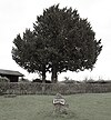
28 | 2 | Yew trees | Trunk circumference 232 cm and 121 cm |
Bunches Kleingartenanlage Hubrickshof / Eststraße |
51 ° 24 ′ 43 "N, 6 ° 57 ′ 45" E |
District IV
| image | number | Fixing number | number | What | comment | location | Coordinates |
|---|---|---|---|---|---|---|---|

|
29 | 1 | Sycamore maple | Trunk circumference 319 cm |
Schönebeck Heißener Strasse, entrance to the Catholic cemetery |
51 ° 27 ′ 15 "N, 6 ° 56 ′ 29" E | |
| 30th | 1 | Hawthorn hedge | approx. 200 m long |
Schönebeck railway line between Dreigarbenfeld and Herbrüggenstraße |
District V
| image | number | Fixing number | number | What | comment | location | Coordinates |
|---|---|---|---|---|---|---|---|

|
31 | 1 | plane | Trunk circumference 374 cm |
Altenessen -Nord Leseband (behind No. 31 on the hiking trail) |
51 ° 30 '18 "N, 7 ° 1' 48" E | |

|
32 | 2 | plane | Trunk girth 4.69 m and 5.10 m |
Altenessen -Nord Gladbecker Straße 413 (behind the Media Markt area) |
51 ° 29 ′ 13 ″ N, 6 ° 59 ′ 44 ″ E | |

|
33 | 1 | European beech | Trunk circumference 305 cm |
Altenessen -Nord Spritzenstrasse 3–5 |
51 ° 30 ′ 8 ″ N, 7 ° 0 ′ 30 ″ E | |

|
34 | 2 | Bald cypress trees | Trunk circumference 192 cm and 175 cm |
Altenessen -Süd in Kaiser-Wilhelm-Park on the south-western bank of the pond |
51 ° 29 ′ 21 ″ N, 7 ° 0 ′ 44 ″ E |
District VI
| image | number | Fixing number | number | What | comment | location | Coordinates |
|---|---|---|---|---|---|---|---|
|
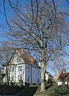
35 | 1 | European beech | Trunk circumference 341 cm |
Katernberg Bergebuschstrasse 2a |
51 ° 29 ′ 32 "N, 7 ° 3 ′ 0" E | |
| 36 | 1 | plane | Trunk circumference 413 cm |
Katernberg Viktoriastraße 33 |
|||

|
37 | 1 | buckeye | Trunk circumference 276 cm |
Schonnebeck Saatbruchstrasse 13 |
51 ° 29 ′ 3 ″ N, 7 ° 3 ′ 33 ″ E |
District VII
| image | number | Fixing number | number | What | comment | location | Coordinates |
|---|---|---|---|---|---|---|---|

|
38 | 1 | European beech | Trunk circumference 337 cm, felled due to fungal attack according to the resolution |
Kray Heinrich-Sense-Weg at Essen-Kray Nord train station |
51 ° 28 ′ 10 "N, 7 ° 4 ′ 54" E | |

|
39 | 3 | Linden trees | Trunk circumference 3.20 m - 5.59 m |
Leithe in the Volksgarten , between the pond and Ottostraße |
51 ° 28 ′ 8 ″ N, 7 ° 5 ′ 29 ″ E | |

|
40 | 1 | Wing nut , seven-stemmed | Trunk girth 1.92 m - 2.12 m |
Leithe in the Volksgarten , southeast of the small pond |
51 ° 28 '9 "N, 7 ° 5' 28" E | |

|
41 | 2 | Tree hazel |
Leithe in the Volksgarten , east part, near Ottostraße |
51 ° 28 ′ 12 "N, 7 ° 5 ′ 36" E | ||

|
42 | 1 | ginkgo | Trunk circumference 154 cm |
Leithe in the Volksgarten , on the northern border path |
51 ° 28 ′ 13 "N, 7 ° 5 ′ 38" E | |

|
43 | 1 | Sycamore maple | Trunk circumference 6.30 m |
Leithe Meistersinger Strasse, Isingpark |
51 ° 27 ′ 19 ″ N, 7 ° 5 ′ 20 ″ E | |

|
44 | 1 | plane | Trunk circumference 535 cm |
Steele Bochumer Strasse next to No. 50 |
51 ° 26 ′ 45 "N, 7 ° 4 ′ 46" E | |
| 45 | 2 | European beech | Trunk circumference 3.55 m - 3.65 m |
Freisenbruch Eibergweg 11 |
51 ° 26 ′ 59 ″ N, 7 ° 7 ′ 2 ″ E |
District VIII
| image | number | Fixing number | number | What | comment | location | Coordinates |
|---|---|---|---|---|---|---|---|
| 46 | 1 | Boulder | 2.20 m × 2.80 m × 1.00 m (white Sala granite) |
Überruhr Antropstraße (behind No. 19) |
51 ° 26 ′ 9 ″ N, 7 ° 4 ′ 28 ″ E | ||

|
47 | 1 | Boulder | 1.10 m × 1.00 m × 2.00 m |
Überruhr Hinseler field 1 |
51 ° 26 ′ 1 ″ N, 7 ° 4 ′ 39 ″ E | |

|
48 | 1 | Boulder | 1.30 m × 1.80 m × 0.70 m (silane granite) |
Überruhr Nockwinkel 62 / Lehmannsbrink |
51 ° 25 ′ 42 "N, 7 ° 4 ′ 39" E | |

|
49 | 1 | Boulder | 1.00 m × 0.70 m × 0.60 m (Perniö granite) |
Überruhr Nockwinkel 87 |
51 ° 25 ′ 44 "N, 7 ° 4 ′ 35" E | |
|
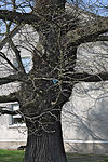
50 | 1 | Sweet chestnut | Trunk circumference 3.47 m |
Überruhr Dellmannsweg 101 |
51 ° 25 ′ 3 ″ N, 7 ° 5 ′ 27 ″ E | |

|
51 | 1 | Oak | Trunk circumference 3.38 m |
Burgaltendorf Laurastraße 3 |
51 ° 24 '52 "N, 7 ° 6' 26" E | |
| 52 | 1 | Oak | Trunk circumference 3.46 m |
Burgaltendorf Charlottenhöhe 37 |
51 ° 25 ′ 18 ″ N, 7 ° 6 ′ 35 ″ E | ||

|
53 | 3.6.33 | 2 | Book | Trunk girth 3.96 m and 4.17 m |
Burgaltendorf Deipenbecktal, junction of the road Pothsberg / Steingatt |
51 ° 24 '38 "N, 7 ° 5' 59" E |

|
54 | 3.6.30 | 1 | Geological outcrop , Sutan thrust | Rock wall with an exposed series of rocks from the Witten layers (carbon) and the Sutan thrust |
Heisingen Lanfermann ferry / Freiherr-Vom-Stein-Straße, west of the Carl Funke colliery |
51 ° 24 '14 "N, 7 ° 2' 59" E |

|
55 | 3.6.31 | 1 | Sweet chestnut | Log circumference 4.60 m |
Heisingen Wuppertaler Straße 456a (on the slope north of the house) |
51 ° 24 ′ 26 "N, 7 ° 4 ′ 25" E |

|
56 | 3.6.32 | 1 | Geological outcrop , geological wall | an approx. 300 m long outcrop with an exposed series of rocks from the Bochum strata with several hard coal seams (carbon) |
Heisingen Wuppertaler Straße, Kampmannbrücke / reservoir arch |
51 ° 23 ′ 56 "N, 7 ° 4 ′ 33" E |
| 57 | 1 | Sleeve | Trunk circumference 1.28 m and 0.57 m |
Heisingen Lelei 22 |
51 ° 23 '59 "N, 7 ° 3' 58" E | ||
| 58 | 1 | Geological outcrop |
Heisingen Freiherr-vom-Stein-Straße, north-west. No. 647 |
51 ° 24 ′ 20 "N, 7 ° 2 ′ 45" E | |||

|
59 | 3.6.35 | 3 | Oak trees | Trunk circumference 2.17 m - 3.08 m |
Byfang Niederweniger Strasse / Düschenhofer Wald 5 |
51 ° 23 ′ 38 "N, 7 ° 6 ′ 22" E |
| 60 | 3.6.34 | 1 | yew | Trunk girth 2.01 m |
Byfang Scheebredde 11a |
||
| 61 | 1 | Oak | Trunk circumference 2.62 m |
Byfang Düschenhofer Wald opposite No. 48 |
|||

|
62 | 1 | Oak | Trunk girth 3.11 m |
Byfang across from Deile 48 |
51 ° 23 ′ 34 "N, 7 ° 6 ′ 22" E | |
| 63 | 1 | yew | Trunk girth 2.03 m |
Kupferdreher Straße 251 |
51 ° 23 ′ 7 ″ N, 7 ° 5 ′ 12 ″ E | ||
| 64 | 3.6.39 | 1 | Hornbeam | Trunk circumference 2.94 m and 2.44 m |
Copper turning Priembergweg 132 / Sollwiesenbusch |
||
| 65 | 3.6.38 | 1 | Source pot |
Kupferdreh Vossnacker Weg |
|||
|
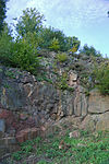
66 | 3.6.36 | 1 | Geological outcrop | small quarry with petrified tree trunks |
Copper turn on Kidneyhofer Strasse opposite No. 16 |
51 ° 23 ′ 1 ″ N, 7 ° 5 ′ 55 ″ E |
| 67 | 3.6.41 | 1 | Source pot | spring pot made of natural stone |
Copper turning Asbach valley |
District IX
| image | number | Fixing number | number | What | comment | location | Coordinates |
|---|---|---|---|---|---|---|---|
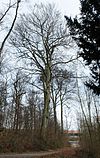
|
68 | 3.6.5 | 5 | European beech | Trunk circumference 263–475 cm |
Bredeney Beckmannsbusch (forest path east of the Beckmannsbusch forest house) near Norbertstraße |
51 ° 25 ′ 20 ″ N, 6 ° 59 ′ 25 ″ E |
| 69 | 3.6.19 | 1 | European beech | Trunk circumference 393 cm |
Bredeney confluence Krügerpfad / Walter-Sachsse-Weg "Krügerblick" |
||

|
70 | 1 | Sleeve | Trunk circumference 135 cm |
Bredeney Freiherr-vom-Stein-Straße 386a, ( Baldeney Castle in front of the chapel) |
51 ° 24 ′ 29 "N, 7 ° 1 ′ 25" E | |

|
71 | 4th | Silver linden | Trunk circumference 2.68 m - 3.38 m |
Bredeney Unity Street 67 |
51 ° 25 ′ 14 "N, 6 ° 59 ′ 39" E | |
| 72 | 1 | White elm | Trunk circumference 4.10 m |
Bredeney way to plate 33-35 |
|||

|
73 | 1 | Oak | Trunk girth 1.85 m |
Schuir Meisenburgstrasse 255, opposite Lutterbecks Busch 9, Bismarckeiche |
51 ° 23 ′ 18 "N, 6 ° 56 ′ 43" E | |

|
74 | 1 | Boulder | 0.95 m × 0.80 m × 0.90 m |
Schuir Rutherweg 39 |
51 ° 23 ′ 1 ″ N, 6 ° 57 ′ 53 ″ E | |

|
75 | 3.6.12 | 1 | Spring and waterfall | high yield |
Kettwig Werdener Strasse |
51 ° 21 ′ 27 "N, 6 ° 56 ′ 49" E |

|
76 | 1 | Boulder | 0.95 m × 1.05 m × 0.70 m (glazed Småland granite) |
Kettwig Graf-Zeppelin-Strasse north of the school |
51 ° 21 ′ 51 ″ N, 6 ° 56 ′ 40 ″ E | |

|
77 | 3.6.10 | 1 | Boulder | Granite, 170 × 135 × 120 cm |
Kettwig Ruhrpromenadenweg at the Kettwig lock |
51 ° 21 ′ 40 "N, 6 ° 56 ′ 14" E |

|
78 | 3.6.11 | 2 | Sweet chestnuts | Trunk circumference 491 cm and 598 cm |
Kettwig Sommersberg 4 |
51 ° 21 ′ 13 "N, 6 ° 55 ′ 46" E |
| 79 | 3.6.16 | 1 | Oak | about 400 years old, about 30 m high; Trunk circumference 460 cm |
Kettwig Oefte 5 (Hessenhof) |
51 ° 21 ′ 34 "N, 6 ° 57 ′ 46" E | |
| 80 | 3.6.14 and 3.6.15 | 1 | Sweet chestnut , pod | 1 sweet chestnut trunk circumference 459 cm; 1 sleeve trunk circumference 145 cm |
Kettwig Oefte 9 (House Hoheholz) |
51 ° 21 ′ 11 "N, 6 ° 57 ′ 49" E | |

|
81 | 3.6.17 | 1 | English oak | Trunk circumference 410 cm |
Kettwig Oefte 20 (at the Bücke farm) |
51 ° 21 ′ 54 "N, 6 ° 58 ′ 28" E |

|
82 | 1 | Tree Group | 2 copper beeches trunk circumference 3.45 m and 3.73 m; 2 plane trees trunk circumference 3.51 m and 4.27 m; 1 sickle fir trunk circumference 4.10 m |
Kettwig Ringstrasse 199 |
51 ° 21 '24 "N, 6 ° 55' 49" E | |

|
83 | 1 | yew | Trunk circumference 2.10 m |
Kettwig Hauptstrasse 8 |
51 ° 21 ′ 44 "N, 6 ° 56 ′ 43" E | |
| 84 | 1 | Geological outcrop |
Kettwig Ruhrtalstrasse / Mitzwinkel |
||||

|
85 | 3.6.43 | 1 | cedar | Trunk circumference 339 cm |
Become Ruhrtalstrasse 4-6 / Franzenshöhe |
51 ° 23 ′ 7 "N, 6 ° 59 ′ 44" E |
| 86 | 1 | Copper beech | Trunk girth 4.11 m |
Werden Ruhrufer north of the lido Werden |
|||
| 87 | 3 | Horse chestnuts | Trunk circumference 2.98 m - 3.64 m |
Will Dudenstrasse 8–18 |
51 ° 23 ′ 26 "N, 7 ° 0 ′ 12" E | ||
| 88 | 3.6.25 and 3.6.26 | 2 | Geological outcrop (sutan) | Quarry with an exposed series of rocks from the uppermost Sprockhövel strata |
Werden Klemensborn / Albermannstrasse (opposite) |
51 ° 23 ′ 5 ″ N, 7 ° 0 ′ 24 ″ E | |
| 89 | 3.6.20 and 3.6.21 | 2 | Geological outcrops | Quarry with an exposed series of rocks from the uppermost Sprockhövel and lower Witten layers (carbon) |
Become a footpath east of Anna-Linder-Weg (formerly Löwental street), the second about 200 m further south |
51 ° 23 ′ 30 "N, 6 ° 59 ′ 40" E | |

|
90 | 3.6.42 | 1 | Oak | Trunk circumference 425/449 cm |
Fischlaken Fischlaker Höfe 100 |
51 ° 24 '7 "N, 7 ° 1' 37" E |
| 91 | 3.6.27 | 1 | Boulder | 130 × 80 × 80 cm (quartz dion) |
Fischlaken Am Richrath 50 (approx. 150 m southeast); Forest edge area (approx. 450 m west-northwest of the Mittelhammerhof) |
51 ° 23 ′ 19 ″ N, 7 ° 2 ′ 40 ″ E |
See also
- List of landscape protection areas in Essen
- List of nature reserves in Essen
- List of bodies of water in Essen
Web links
Commons : Natural monuments in Essen - Collection of pictures, videos and audio files
- Extract of the landscape plan of the city of Essen from June 4, 1992 (PDF)
- City of Essen brochure, status 2009 (PDF)
Individual evidence
- ↑ a b c d e f g h i brochure of the city of Essen ; accessed on March 16, 2016
- ↑ a b c d e f g h i excerpt from the landscape plan of the city of Essen ; accessed on March 16, 2016
- ↑ DerWesten.de of February 14, 2012: Natural monument in Essen Stadtwald died ; accessed on March 16, 2016
- ↑ https://ris.essen.de/sdnetrim/UGhVM0hpd2NXNFdFcExjZZ0Qy5GwR3jjl2PY5HDxEovymK1ZCqJjuOp8KwwAgsEV/Vorlage_1519-2016-6A.pdf