
List of natural monuments in Bad Karlshafen
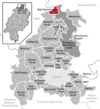

The list of natural monuments in Bad Karlshafen calls on the territory of the town Bad Karlshafen in the district of Kassel, in Hesse located natural monuments . There are currently 6 trees in 4 locations.
Trees
| image | designation | District, location | description | Art | No. |
|---|---|---|---|---|---|
 more pictures |
1 oak |
Helmarshausen 51 ° 37 ′ 26.7 " N , 9 ° 26 ′ 6.1" E |
Pedunculate oak approx. 1.5 km west of the outskirts of Helmarshausen. The impressive tree stands directly on the north side of Kreisstraße 72. Its asphalt extends almost to the tree roots of the natural monument. In the east side of the trunk a lightning channel runs along its entire length. In the crown of the old oak, safety measures were carried out using ropes. However, the crown is only preserved in fragments, it was mutilated by numerous saw cuts. Trunk circumference: 7.50 m Height: 25 m Planting year: approx. 1505 OSM -Link to the map display: Old oak near Helmarshausen |
Quercus robur | 6.33.031 |
 more pictures |
1 linden tree |
Helmarshausen 51 ° 37 '49.6 " N , 9 ° 27' 17.1" E |
Summer linden tree on the northwestern outskirts of Helmarshausen. The linden tree stands in the churchyard of the Evangelical City Church, east of the church building, on Poststrasse. Trunk circumference: 4.15 m Height: 32 m Planting year: approx. 1885 OSM -Link to the map display: Summer linden tree in Helmarshausen |
Tilia platyphyllos | 6.33.032 |
 more pictures |
2 oaks |
Helmarshausen 51 ° 37 ′ 5.2 ″ N , 9 ° 25 ′ 5.1 ″ E |
Pedunculate oak approx. 2.5 km southwest of the outskirts of Helmarshausen. The two oaks stand directly next to each other on a green strip approx. 300 m south of the county road 72, north of the Höllebach, next to a farm road. The northern oak: trunk circumference: 4.20 m height: 22 m planting year: approx. 1885 OSM -Link to the map display: the northern oak near Helmarshausen The southern oak: trunk circumference: 4.85 m height: 24 m planting year: approx. 1885 OSM -Link to the map display: the southern oak near Helmarshausen |
Quercus robur | 6.33.033 |
 more pictures |
2 yew trees |
Bad Karlshafen 51 ° 38 '35.6 " N , 9 ° 27' 22.4" E |
Yew trees on the eastern edge of the city center of Bad Karlshafen. The two old trees stand next to each other, difficult to find and grown in on a wooded slope between Gallandstrasse and C.-D.-Stunz-Weg. The northern yew: trunk circumference: 3.35 m height: 15 m year of planting: approx. 1705 OSM -Link to the map display: the northern yew tree in Bad Karlshafen The southern yew: trunk circumference: 3.15 m height: 15 m planting year: approx. 1705 OSM link to the map display: the southern yew tree in Bad Karlshafen |
Taxus | 6.33.035 |
Web links
Commons : Natural monuments in Bad Karlshafen - Collection of images, videos and audio files
Supporting documents and footnotes
- ↑ According to the official cadastre of the Lower Nature Conservation Authority of the district of Kassel and on-site research in April 2017.
- ↑ Measurement 2017-04-14 in h = 1.30 m
- ↑ a b c d e f Information on height and planting year according to Rüdiger Germeroth, Horst Koenies, Reiner Kunz: Natural cultural assets - past and future of natural monuments in the Kassel district. Editor: District Committee of the District of Kassel, Lower Nature Conservation Authority, Wolfhagen, 2005, Appendix "Trees" p. 186 ff. The year of planting was calculated back using the age estimated there and the year of publication (2005) of the publication.
- ↑ Measurement 2017-04-14 in h = 1.30 m
- ↑ Measurement 2017-04-14 in h = 1.30 m
- ↑ Measurement 2017-04-14 in h = 1.30 m
- ↑ Measurement 2017-04-14 in h = 1.30 m
- ↑ Measurement 2017-04-14 in h = 1.30 m
Ahnatal | Bad Emstal | Bad Karlshafen | Baunatal | Breuna | Calden | Espenau | Fuldabrück | Fulda Valley | Grebenstein | Habichtswald | Helsa | Hofgeismar | Immenhausen | Kaufungen | Liebenau | Lohfelden | Naumburg | Nieste | Niestetal | Reinhardshagen | Reinhardswald Manor District | Schauenburg | Söhrewald | Trendelburg | Vellmar | Wesertal | Wolfhagen | Zierenberg