List of natural monuments in Lohfelden
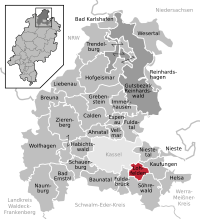
The list of natural monuments in Lohfelden called on the municipality Lohfelden in the district of Kassel, in Hesse located natural monuments . These are currently trees at 4 locations as well as the extensive natural monument "Sandgrube" near Vollmarshausen.
Trees
| image | designation | District, location | description | Art | No. |
|---|---|---|---|---|---|
 more pictures |
2 mulberry trees |
Crumbach 51 ° 16 '14.5 " N , 9 ° 32' 13.7" E |
Two mulberry trees on a green area in the center of Crumbach. The two trees stand side by side on a slope, directly to the west and below the walled churchyard, in the vicinity of the "Lutherlinde". A planting of this tree species is mentioned in the church book of Crumbach in 1790. The leaves of the mulberry trees were used as fodder for silkworms , and in the 19th century there was a silk mill in Crumbach. In 1854, the cotton weaver Jakob Becker laid out plantations with mulberry trees. It is assumed that the two surviving trees on the church date from this time. Upper tree trunk circumference: 2.90 m Lower tree trunk circumference: 2.50 and 2.25 m Height: 10 m Planting year: 1854 OSM -Links to the map display: upper mulberry tree , lower mulberry tree |
More | 6.33.491 |
 more pictures |
1 oak "meadow oak" |
Crumbach 51 ° 16 ′ 42.7 " N , 9 ° 31 ′ 42.8" E |
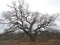
Pedunculate oak directly north of the Kassel Mitte motorway junction . The trunk of the imposing oak divides at a height of about 1.00 m. The tree stands on the edge of a small field, a place with the old field name “Die Teichwiesen”. Today this is a remaining area without ponds or meadows, enclosed by the motorway junction in the south and an industrial area in the north. Trunk circumference: 6.00 m Height: 19 m Planting year: approx. 1905 OSM -Link to the map display: "meadow oak " at the motorway junction |
Quercus robur | 6.33.492 |
 more pictures |
1 linden tree " court linden tree " |
Vollmarshausen 51 ° 15 '42.2 " N , 9 ° 33' 52.2" E |
The 260-year-old, after shortening, still 16 m high summer linden tree with a trunk circumference of 3.80 m in the center of the village on the former court square in Vollmarshausen had to be felled in 2015 due to fungal attack. A newly planted linden tree has been in its place since 2016. | Tree no longer exists | 6.33.494 |
 more pictures |
1 oak |
Vollmarshausen 51 ° 15 ′ 37.3 " N , 9 ° 34 ′ 12.7" E |
Pedunculate oak on the eastern outskirts of Vollmarshausen. The tree is on a green area in a residential area, in front of the Heupel 26 building. The trunk divides into two main branches just above the root. The crown of the oak is secured with ropes. Trunk circumference: 5.35 m Height: 21 m Planting year: approx. 1885 OSM link to the map display: Oak in Vollmarshausen |
Quercus robur | 6.33.495 |
 more pictures |
1 wild pear |
Ochshausen 51 ° 17 '7.4 " N , 9 ° 33" 42.1 " E |
Wild pear northeast of the outskirts of Ochshausen, on the Lindenberg, south of Kaufungen paper mill. The tree stands on a dirt road between two fields and is still producing fruit. Trunk circumference: 2.50 m Height: 12 m Planting year: approx. 1905 OSM link to the map display: Wild pear near Ochshausen |
Pyrus pyraster | 6.33.496 |
Extensive natural monuments
| image | designation | District, location | description | No. |
|---|---|---|---|---|
 more pictures |
Sand pit |
Vollmarshausen 51 ° 15 ′ 48.6 " N , 9 ° 34 ′ 47.7" E |
Opened sand pit approx. 600 m east of the outskirts of Vollmarshausen, "Before the peak width". About 100 m further east, the Franzosenstrasse hiking trail leads past the site. It was placed under protection as a natural monument in 2005. Area: approx. 0.37 ha OSM -Link to the map display: "Sand pit" near Vollmarshausen |
6.33.497 |
Web links
Commons : Natural monuments in Lohfelden - Collection of images, videos and audio files
supporting documents
- ↑ According to the official cadastre of the Lower Nature Conservation Authority of the district of Kassel and on-site research 2016 - May 2017.
- ↑ Paragraph according to the local information board Eco Path Kulturgeschichte Lohfelden , 2018-05-05, cf. http://www.eco-pfade.de/PDF/Tafel-Lohfelden-Kirche-Crumbach.pdf
- ↑ Measurement 2018-05-05 in h = 1.30 m at the middle of the slope
- ↑ Measurement 2018-05-05 in h = 1.30 m at the middle of the slope
- ↑ a b c d e Information on trunk circumference (if no own measurement), size and planting year according to Rüdiger Germeroth, Horst Koenies, Reiner Kunz: Natural cultural assets - past and future of natural monuments in the Kassel district , publisher: District Committee of the Kassel District, Lower Nature Conservation Authority , Wolfhagen, 2005, Appendix "Trees" p. 186 ff. The year of planting was calculated back using the age estimated there and the year of publication (2005) of the publication.
- ↑ HNA: 250-year-old linden tree in Lohfelden must give way , accessed on June 24, 2016
- ↑ Information according to Rüdiger Germeroth, Horst Koenies, Reiner Kunz: Natural cultural assets - past and future of natural monuments in the district of Kassel , publisher: District Committee of the district of Kassel, Lower Nature Conservation Authority, Wolfhagen, 2005, appendix " Large-scale natural monuments" p. 162 ff.

