
List of natural monuments in Helsa
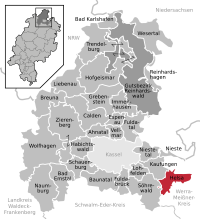

The list of natural monuments in Helsa called on the municipality Helsa in the district of Kassel, in Hesse located natural monuments . These are currently 4 trees and 2 areal natural monuments, including the "Basalt cone Bielstein Church" near Helsa.
Trees
| image | designation | District, location | description | Art | No. |
|---|---|---|---|---|---|
 more pictures |
1 maple |
Helsa 51 ° 15 ′ 34.3 " N , 9 ° 40 ′ 52.7" E |
Norway maple on the western outskirts of Helsa. The tree stands on a bushy area in the northern part of the station. Trunk circumference: 3.35 m Height: 27 m Year planted : approx. 1855 OSM -Link to map display: Maple at Helsa train station |
Acer platanoides | 6.33.332 |
 more pictures |
1 linden tree |
Wickenrode 51 ° 15 '17.7 " N , 9 ° 44' 50.7" E |
Winter linden tree on the eastern outskirts of Wickenrode. The huge tree stands between the historic buildings of a former colliery site. Trunk circumference: 4.80 m Height: 30 m Planting year: approx. 1825 OSM link to the map display: Linden tree on the outskirts of Wickenrode |
Tilia cordata | 6.33.333 |
 more pictures |
1 oak "Friedenseiche 1870/71" |
Wickenrode 51 ° 15 ′ 19.3 ″ N , 9 ° 44 ′ 8.5 ″ E |
Pedunculate oak on the southern outskirts of Wickenrode. The tree is located in a meadow on Ringenkuhler Straße, near the training soccer field. The trunk is enclosed by a bench. There is currently no evidence on site that the oak was planted in memory of the Franco-Prussian War from 1870 to 1871 . Trunk circumference: 2.75 m Height: 25 m Planting year: approx. 1875 OSM link to the map display: Oak at the sports field in Wickenrode |
Quercus robur | 6.33.334 |
 more pictures |
1 pyramidal oak |
St. Ottilien 51 ° 13 ′ 5.2 ″ N , 9 ° 38 ′ 52.8 ″ E |
Pyramid oak on the southern outskirts of St. Ottilien. The tree is in the cemetery at its eastern entrance, on the street "Jungfernborn". The Märchenlandweg hiking trail also leads along there. Immediately next to the oak is the grave of Christian Schintze, the former mayor, who died in 1886, and his wife Friedericke. The trunk of the tree has a vertical gap about 1.5 m long above the root. Trunk circumference: 4.05 m Height: 23 m Planting year: approx. 1875 OSM -Link to map display: Pyramid oak in St. Ottilien |
Quercus robur 'Fastigiata' | 6.33.336 |
Extensive natural monuments
| image | designation | District, location | description | No. |
|---|---|---|---|---|
 more pictures |
Basalt cone Bielstein Church |
Helsa 51 ° 15 ′ 8.5 ″ N , 9 ° 39 ′ 49.6 ″ E |
Mighty basalt rocks in the beech forest southwest of Helsa. The impressive basalt formation runs over a length of over 300 m in a north-south direction. In the east beech forest is in front of the basalt rocks, in the west there is a coniferous forest. The natural monument is now on the eastern edge of the "Stiftswald wind farm". A forest path runs east of the rocks and is part of the local hiking trails E2 and H5. Area: approx. 1.8 ha OSM -Link to the map display: "Basalt cone Bielsteinskirche" southwest of Helsa |
6.33.331 |
 more pictures |
Tiefenbach sand pit |
Wickenrode 51 ° 14 ′ 37.3 " N , 9 ° 44 ′ 11.8" E |
Former sand pit approx. 1.5 km south of Wickenrode. The pit is bordered by a small forest to the west; its base is still largely open. A farm path runs around 250 m west of the natural monument and is part of several hiking trails, including the Grimmsteig . A farm road branching off from there leads west and south around the abandoned pit. In the south of the site, a meadow borders the sand pit, from where the area is clearly visible. Area: approx. 0.58 ha OSM link to the map display: "Sandgrube Tiefenbach" south of Wickenrode |
6.33.335 |
Web links
Commons : Natural monuments in Helsa - collection of images, videos and audio files
supporting documents
- ↑ According to the official cadastre of the Lower Nature Conservation Authority of the district of Kassel and on-site research 2016/2017.
- ↑ a b c d Information on trunk circumference (if no own measurement), size and planting year according to Rüdiger Germeroth, Horst Koenies, Reiner Kunz: Natural cultural assets - past and future of natural monuments in the Kassel district , publisher: District Committee of the Kassel District, Lower Nature Conservation Authority, Wolfhagen, 2005, Appendix "Trees" p. 186 ff. The year of planting was calculated back using the age estimated there and the year of publication (2005) of the publication.
- ↑ Measurement 2017-10-01 in h = 1.30 m
- ↑ Measurement 2017-08-25 in h = 1.30 m
- ↑ Measurement 2020-08-29 in h = 1.00 m
- ↑ a b Information according to Rüdiger Germeroth, Horst Koenies, Reiner Kunz: Natural cultural assets - past and future of natural monuments in the district of Kassel , publisher: District Committee of the district of Kassel, Lower Nature Conservation Authority, Wolfhagen, 2005, appendix "Extensive natural monuments" p. 162 ff.
Ahnatal | Bad Emstal | Bad Karlshafen | Baunatal | Breuna | Calden | Espenau | Fuldabrück | Fulda Valley | Grebenstein | Habichtswald | Helsa | Hofgeismar | Immenhausen | Kaufungen | Liebenau | Lohfelden | Naumburg | Nieste | Niestetal | Reinhardshagen | Reinhardswald Manor District | Schauenburg | Söhrewald | Trendelburg | Vellmar | Wesertal | Wolfhagen | Zierenberg