List of natural monuments in Habichtswald (municipality)
The list of natural monuments in Habichtswald called on the Municipality of Habichtswald in Kassel district in Hesse located natural monuments . These are currently trees in 6 locations.
Trees
| image | designation | District, location | description | Art | No. |
|---|---|---|---|---|---|
 more pictures |
1 pyramidal oak |
Dörnberg , Wolfhager Strasse 51 ° 20 ′ 30.6 ″ N , 9 ° 20 ′ 33.7 ″ E |
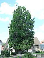
Pyramid oak in the center of Dörnberg. The tree is on Wolfhager Strasse, by the portal of the Dörnberg church. Trunk circumference: 3.65 m Height: 17 m Year planted : approx. 1925 OSM -Link to map display: Pyramid oak in Dörnberg |
Quercus robur 'Fastigiata' | 6.33.301 |
 more pictures |
1 oak |
Dörnberg 51 ° 20 ′ 57.6 ″ N , 9 ° 21 ′ 36.1 ″ E |
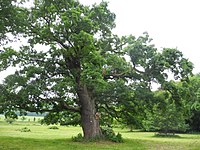
Pedunculate oak approx. 1.0 km northeast of the outskirts of Dörnberg. The location is a pasture approx. 300 m southwest of the top of the hollow stone . About 50 m west of the oak, a farm road leads along the pasture, which is part of the Dörnberger "Rundweg 1". Trunk circumference: 4.00 m Height: 24 m Year of planting: approx. 1855 or earlier OSM link to the map display: Pedunculate oak north-east of Dörnberg |
Quercus robur | 6.33.302 |
 more pictures |
1 oak |
Dörnberg 51 ° 21 ′ 6.9 ″ N , 9 ° 21 ′ 23 ″ E |
Pedunculate oak approx. 1.0 km northeast of the outskirts of Dörnberg. The oak with twin trunk stands in a pasture, about 500 m west of the summit of the hollow stone . About 30 m west of the tree, a farm path leads along the pasture, which is part of several hiking trails, including the Kassel-Steig . Trunk circumference: 3.30 m and 3.40 m height: 25 m Planting year: approx. 1855 OSM -Link to the map display: Pedunculate oak with twin trunk northeast of Dörnberg |
Quercus robur | 6.33.303 |
 more pictures |
Oak and beech group (3/8 pieces) |
Dörnberg 51 ° 19 ′ 51.6 ″ N , 9 ° 21 ′ 19 ″ E |
Grove of oaks and beech trees approx. 1.1 km southeast of Dörnberg. The trees are on a pasture in Habichtswald , approx. 300 m southeast of the Haide forester's house. A forest path runs south of the group of trees and is part of the Märchenlandweg and other hiking trails. From the path, the southernmost beech, where numerous branches have been sawed off, is clearly visible.
The other trees are in a bushy area further north, difficult to see and reach. In the far north there are 3 common oaks and 1 common beech. In the middle of the area there is a red beech with twin trunk, there are also 4 dead trunks, 2 of which are still standing dead wood . In this respect, it cannot be assumed that the 11 trees recorded in the official cadastre are all still alive. Trunk circumference: up to 4.50 m in height: up to 30 m year of planting: approx. 1805 OSM -Link to the map display: The southernmost European beech on the forest path |
Quercus robur + Fagus sylvatica |
6.33.304 |
 more pictures |
1 beech, 1 oak |
Dörnberg 51 ° 19 ′ 55.4 ″ N , 9 ° 21 ′ 8.2 ″ E |
European beech and English oak approx. 800 m south of the outskirts of Dörnberg. The two trees are close to each other on a meadow in the Habichtswald , approx. 200 m southwest of the Haide forester's house. A farm road runs along the western edge of the meadow and is part of the Märchenlandweg and other hiking trails. The common beech: trunk circumference: 3.40 m height: 18 m planting year: approx. 1905 OSM link to the map display: red beech in the Habichtswald The pedunculate oak: trunk circumference: 2.90 m height: 21 m planting year: approx. 1875 OSM link to the map display : Pedunculate oak in the Habichtswald |
Fagus sylvatica + Quercus robur |
6.33.305 |
 more pictures |
1 oak |
Ehlen 51 ° 20 ′ 18.6 ″ N , 9 ° 18 ′ 11.5 ″ E |
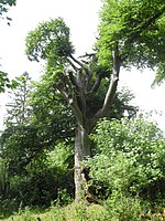
Pedunculate oak approx. 1.0 km north of the outskirts of Ehlen. The old oak stands on a private meadow on the Bodenhausen estate , directly east of the L 3220. The tree has probably lost the upper part of its crown in recent years. Trunk circumference: 7.05 m Height: 18 m (2005: 28 m) Planting year: approx. 1705 OSM link to the map display: Pedunculate oak at Gut Bodenhausen |
Quercus robur | 6.33.307 |
Web links
Commons : Natural monuments in Habichtswald - Collection of images, videos and audio files
supporting documents
- ↑ According to the official cadastre of the Lower Nature Conservation Authority of the district of Kassel and on-site research 2016 - August 2017.
- ↑ Measurement 2017-08-13 in h = 1.30 m
- ↑ a b c d e f g Information on trunk circumference (if no own measurement), size and planting year according to Rüdiger Germeroth, Horst Koenies, Reiner Kunz: Natural cultural assets - past and future of natural monuments in the Kassel district , publisher: District Committee of the Kassel District, Lower Nature Conservation Authority, Wolfhagen, 2005, Appendix "Trees" p. 186 ff. The year of planting was calculated back using the age estimated there and the year of publication (2005) of the publication.
- ↑ In 2005, the Lower Nature Conservation Authority gave the tree height as 28 m, cf. Rüdiger Germeroth, Horst Koenies, Reiner Kunz: Natural cultural assets - past and future of natural monuments in the district of Kassel , publisher: District Committee of the District of Kassel, Lower Nature Conservation Authority, Wolfhagen, 2005, Appendix "Trees" p. 188.
- ↑ Information on trunk circumference and height from monumentale-eichen.de, https://www.monumentale-eichen.de/hessen/gut-bodenhausen/ , accessed 2017-06-23.


