
List of natural monuments in Hofgeismar
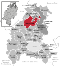

The list of natural monuments in Hofgeismar called the in the field of city Hofgeismar in Kassel district in Hesse located natural monuments . These are currently trees at 14 locations, including several impressive oaks near Beberbeck , as well as 4 areal natural monuments.
Trees
| image | designation | District, location | description | Art | No. |
|---|---|---|---|---|---|
 more pictures |
Group of old hat trees (6 oaks, 1 wild apple) |
Beberbeck 51 ° 32 '2.8 " N , 9 ° 29" 56.1 " E |
Pedunculate oak approx. 1.5 km northeast of Beberbeck. The old hat oak stands in a field north of the central axis. Of the original 6 oaks in the group, only 4 are currently preserved; they are among the oldest trees in the Kassel district. Trunk circumference: 7.20 m Planting year: approx. 1555 OSM link to the map display: Huteeiche 1 on the field near Beberbeck |
Quercus robur | 6.33.361 |
 more pictures |
Group of old hat trees (6 oaks, 1 wild apple) |
Beberbeck 51 ° 32 '6.9 " N , 9 ° 29' 52.8" E |
Pedunculate oak approx. 1.5 km northeast of Beberbeck. The old hat oak stands in a field north of the central axis. Of the original 6 oaks in the group, only 4 are currently preserved; they are among the oldest trees in the Kassel district. Trunk circumference: 7.60 m Planting year: approx. 1555 OSM link to the map display: Huteeiche 2 on the field near Beberbeck |
Quercus robur | 6.33.361 |
 more pictures |
The thickness Margaret , part of a group of old Hutebäume (6 oaks, 1 Wild apple) |
Beberbeck 51 ° 32 ′ 3.9 " N , 9 ° 29 ′ 40.7" E |
Pedunculate oak approx. 1.5 km northeast of Beberbeck. The old hat oak stands in a field north of the central axis. Of the original 6 oaks in the group, only 4 are currently preserved; they are among the oldest trees in the Kassel district. Trunk circumference: 8.75 m Planting year: approx. 1555 OSM link to the map display: Huteeiche 3 on the field near Beberbeck |
Quercus robur | 6.33.361 |
 more pictures |
Group of old hat trees (6 oaks, 1 wild apple) |
Beberbeck 51 ° 32 '12.1 " N , 9 ° 29' 40.8" E |
Pedunculate oak approx. 1.5 km northeast of Beberbeck. The old hat oak stands in a field north of the central axis. Of the original 6 oaks in the group, only 4 are currently preserved; they are among the oldest trees in the Kassel district. At first glance, the tree only consists of an approx. 3 m high, dead trunk residue. However, there is currently a small living branch on the east side. Trunk circumference: 7.60 m Planting year: approx. 1555 OSM link to the map display: Huteeiche 4 on the field near Beberbeck |
Quercus robur | 6.33.361 |
 more pictures |
Group of old hat trees (24 oaks) |
Beberbeck 51 ° 31 '43.9 " N , 9 ° 30' 1.2" E |
Pedunculate oak approx. 1.5 km east of Beberbeck. The hat oaks are spread out on a pasture north of the central axis. Of the original 24 oaks in the group, only 18 are currently preserved, including 1 tree as a dead trunk. Trunk circumference: up to 6.55 m in height: up to 24 m. Planting year: before 1705 OSM -Link to the map display: The central tree from the group of hat oaks |
Quercus robur | 6.33.362 |
 more pictures |
Group of old hat trees (13 oaks) |
Beberbeck 51 ° 31 '31.5 " N , 9 ° 30' 20.1" E |
Pedunculate oaks approx. 2.0 km east of Beberbeck. The hat oaks are spread out on a pasture south of the central axis. Of the original 13 oaks in the group, only 9 are currently preserved. Trunk circumference: up to 5.60 m in height: up to 23 m year of planting: before 1705 OSM -Link to the map display: The easternmost tree from the group of hat oaks |
Quercus robur | 6.33.363 |
 more pictures |
2 old hat oaks |
Beberbeck 51 ° 31 '39.1 " N , 9 ° 29' 47.3" E |
2 English oaks approx. 1.5 km east of Beberbeck. The two hat oaks stand in a pasture west of the stable building, south of the central axis. The northern tree: trunk circumference: 4.30 m height: 20 m planting year: before 1705 OSM -Link to the map display: the northern hat oak The southern tree: trunk circumference: 5.90 m height: 24 m planting year: before 1705 OSM -link to the map display : the southern hat oak |
Quercus robur | 6.33.364 |
 more pictures |
1 oak |
Beberbeck 51 ° 31 '54.9 " N , 9 ° 28' 58.1" E |
Pedunculate oak approx. 300 m east of Beberbeck. The tree is located in the local cemetery. Only the trunk overgrown with ivy is preserved as standing dead wood . Trunk circumference: 6.50 m Height: approx. 8 m Planting year: approx. 1655 OSM -Link to the map display: Oak in the Beberbeck cemetery |
Quercus robur | 6.33.365 |
 more pictures |
"Alter Schützenplatz" with large trees |
Carlsdorf 51 ° 29 ′ 11.3 " N , 9 ° 25 ′ 53.5" E |
Winter linden trees on the southern outskirts of Carlsdorf. The trees form an oval tree circle in a park-like green area, the "Old Schützenplatz". Of the 7 trees, one is hollow and looks damaged, a second is only preserved as a trunk and a third tree is a much younger replant. Trunk circumference: up to 3.35 m in height: up to 22 m year of planting: approx. 1905 OSM link to the map display: The largest tree from the Linden group in Carlsdorf |
Tilia cordata | 6.33.366 |
 more pictures |
1 hornbeam |
Friedrichsdorf 51 ° 29 ′ 22.4 ″ N , 9 ° 19 ′ 48.3 ″ E |
Hornbeam in the center of Friedrichsdorf. The tree stands on the western edge of the small cemetery on "Dorfstrasse". Trunk circumference: 2.30 m Height: 14 m Planting year: approx. 1905 OSM -Link to the map display: Hornbeam in Friedrichsdorf |
Carpinus betulus | 6.33.368 |
 more pictures |
1 linden tree |
Hofgeismar 51 ° 29 ′ 46.9 ″ N , 9 ° 22 ′ 32 ″ E |
Summer linden tree west of the old town of Hofgeismar. The location is the green corridor in front of the ramparts, on the southern edge of the "Turnhagen", at the motorhome parking lot. The linden tree was overgrown with ivy up to the crown , around 2014/15 the arm-thick trunk of the climbing plant was severed. The dead remains of this plant still cover large parts of the trunk and branches of the linden tree. Trunk circumference: 4.00 m (2005: 3.85 m) Height: 24 m Planting year: approx. 1875 OSM -Link to the map display: Summer linden tree in Hofgeismar |
Tilia platyphyllos | 6.33.371 |
 more pictures |
1 oak |
Hofgeismar 51 ° 29 ′ 30.8 ″ N , 9 ° 22 ′ 22.6 ″ E |
Pedunculate oak southwest of the old town of Hofgeismar. The tree stands on the edge of a small park on the street "Schützenplatz". The asphalt of the road reaches almost to the tree roots. Trunk circumference: 4.80 m (2005: 4.70 m) Height: 26 m Planting year: approx. 1805 OSM -Link to the map display: Pedunculate oak in Hofgeismar |
Quercus robur | 6.33.374 |
 more pictures |
Linden group "Galgenberg" |
Hofgeismar 51 ° 29 ′ 47.1 ″ N , 9 ° 21 ′ 24.1 ″ E |
11 Winter linden trees approx. 800 m west of the outskirts of Hofgeismar. The trees stand on a small meadow in a field. 9 linden trees form a circle, with the 10th linden tree in the center. To the north of it stands the 11th linden tree on a small elevation. Trunk circumference: 0.70 - 1.50 m Heights: 13-15 m Year of planting: approx. 1945 OSM -Link to the map display: The northern tree of the linden group "Galgenberg" |
Tilia cordata | 6.33.375 |
 more pictures |
1 oak |
Hofgeismar 51 ° 30 '58.7 " N , 9 ° 21' 48.9" E |
Pedunculate oak approx. 1.7 km north of the outskirts of Hofgeismar. The tall, slender tree is in the forest at the fork in a farm road. Local signs give the tree the name "Bänfer-Eiche". Trunk circumference: 4.80 m Height: approx. 36 m Planting year: approx. 1805–1855 OSM -Link to the map display: Oak in the forest near Hofgeismar |
Quercus robur | 6.33.377 |
 more pictures |
2 linden trees |
Hombressen 51 ° 29 ′ 34.2 " N , 9 ° 27 ′ 29.5" O |
2 winter linden trees near the center of Hombressen. The two trees stand on a park-like green area, the "Old Cemetery" on Parkstrasse. The northern tree: trunk circumference: 3.30 m height: 23 m year of planting: 1885 OSM link to map display: the northern linden tree in Hombressen The southern tree: trunk circumference: 3.85 m height: 21 m planting year: 1885 OSM link to map display : the southern lime tree in Hombressen |
Tilia cordata | 6.33.378 |
 more pictures |
1 oak "Friedenseiche" 1870/71 |
Hombressen 51 ° 30 ′ 10.2 " N , 9 ° 26 ′ 51.7" O |
Pedunculate oak approx. 900 m north of the outskirts of Hombressen. The tree stands on a small artificial embankment at the edge of the field, on the "Warthügel". Its environment is a completely cleared agricultural steppe, within a radius of several hundred meters there is not a second tree or even a shrub. The oak is considered a symbol of Hombressen. Due to its exposed location, it can still be seen from a great distance. From the location of the tree there is a good view of the surroundings, including the Reinhardswald . The tree is provided with access stairs, bench around the trunk, information board and rubbish bin and can therefore be considered to be well developed for tourism. The name "Friedenseiche" is derived from the fact that the tree was planted in memory of the Franco-Prussian War from 1870 to 1871 . Trunk circumference: 3.40 m Height: approx. 16 m Planting year: approx. 1875 OSM -Link to the map display: Friedenseiche bei Hombressen |
Quercus robur | 6.33.379 |
 more pictures |
1 Norway maple |
Hofgeismar 51 ° 30 ′ 38.8 ″ N , 9 ° 22 ′ 58.4 ″ E |
Norway maple approx. 500 m north of the outskirts of Hofgeismar. The tree is on Westbergweg, just before the edge of the forest. Trunk circumference: 4.05 m (2005: 3.85 m) Height: 22 m Planting year: approx. 1875 OSM -Link to the map display: Norway maple near Hofgeismar |
Acer platanoides | 6.33.382 |
Extensive natural monuments
| image | designation | District, location | description | No. |
|---|---|---|---|---|
 more pictures |
Offenberg |
Carlsdorf 51 ° 28 ′ 55.1 " N , 9 ° 25 ′ 4.7" E |
Limestone dome approx. 500 m southwest of the outskirts of Carlsdorf. The natural monument forms a prominent elevation between Hofgeismar / Carlsdorf in the north and Grebenstein in the south. Partial areas are covered with bushes, the remaining open areas are considered to be the largest grassland areas of a natural monument in the Kassel district. A small path leads over the top. From the elevation there is a wide view of the surrounding area. Area: approx. 4.8 ha OSM -Link to the map display: Limestone dome "Offenberg" near Carlsdorf |
6.33.367 |
 more pictures |
Greetings Castle |
Hofgeismar 51 ° 28 ′ 38.5 ″ N , 9 ° 22 ′ 10.3 ″ E |
Hill approx. 1.0 km southwest of the outskirts of Hofgeismar. The area is covered with diverse vegetation, including hedges and limestone grasslands . The remains of an old rampart can be found on the hilltop. The local hiking trail H6 leads along the natural monument. Area: approx. 5.0 ha OSM -Link to the map display: "Hünsch Burg" near Hofgeismar |
6.33.373 |
 more pictures |
Hümmer Hute Heath |
Hümme 51 ° 32 ′ 13.7 ″ N , 9 ° 26 ′ 7.7 ″ E |
Former hat area with wood and trees, approx. 2.0 km east of Hümme. The area is currently heavily bushed. An asphalt farm road, which is part of a regional hiking trail, runs directly to the south and east of the natural monument. Area: approx. 4.3 ha OSM -Link to the map display: "Heidefläche Hümmer Hute" |
6.33.380 |
 more pictures |
Basalt cone Gribbelsberg with quarry |
Sababurg 51 ° 32 ′ 50.1 ″ N , 9 ° 32 ′ 11.1 ″ E |
Former basalt quarry with a small wall, deciduous trees and bushes, approx. 300 m north of the Sababurg . The wooded hilltop is right next to Kreisstraße 56. The abandoned quarry, which is difficult to access, is barely visible. Its bottom is wooded, but damp and temporary pools are formed. Area: approx. 1.98 ha OSM link to the map display: "Basalt cone Gribbelsberg with quarry" near Sababurg |
6.33.381 |
Web links
Commons : Naturdenkmale in Hofgeismar - Collection of pictures, videos and audio files
Supporting documents and footnotes
- ↑ According to the official cadastre of the Lower Nature Conservation Authority of the district of Kassel and on-site research 2016 - August 2017.
- ↑ a b c d The wild apple mentioned in the official cadastre could not be found on site in May 2017.
- ↑ Measurement 2017-05-06 in h = 1.30 m
- ↑ a b c d e f g h i j k l m n o p q r s information on trunk circumference (if no own measurement), size and planting year according to Rüdiger Germeroth, Horst Koenies, Reiner Kunz: Natural cultural assets - past and future of Natural monuments in the district of Kassel , publisher: District Committee of the District of Kassel, Lower Nature Conservation Authority, Wolfhagen, 2005, Appendix "Trees" p. 186 ff. The year of planting was calculated back using the age estimated there and the year of publication (2005) of the publication.
- ↑ Measurement 2017-05-06 in h = 1.30 m
- ↑ Measurement 2017-05-06 in h = 1.30 m
- ↑ Observation 2017-05-06
- ↑ Measurement 2017-05-06 in h = 1.30 m
- ↑ Measurement 2017-05-06 in h = 1.30 m at the central tree of the hat oak group
- ↑ Counting 2017-05-06, the official publication Natural cultural property counts in the cadastral part, p. 188, 11 trees in 2005.
- ↑ Measurement 2017-05-06 in h = 1.30 m on the easternmost tree of the hat oak group
- ↑ Measurement 2017-05-06 in h = 1.30 m
- ↑ Measurement 2017-05-06 in h = 1.30 m
- ↑ Measurement 2017-05-06 in h = 1.30 m
- ↑ Estimate 2017-05-06, the official publication Natural Cultural Property gives in the cadastral part, p. 188, in 2005 a height of 17 m.
- ↑ Measurement 2017-04-30 in h = 1.30 m on the largest tree in the linden group
- ↑ Measurement 2017-04-09 in h = 1.30 m
- ↑ Measurement 2017-04-09 in h = 1.30 m
- ↑ There is no naming in the official cadastre.
- ↑ Measurement 2017-04-29 in h = 1.30 m
- ↑ Measurement 2017-04-30 in h = 1.30 m
- ↑ Measurement 2017-04-30 in h = 1.30 m
- ↑ Measurement 2017-04-30 in h = 1.30 m
- ↑ Measurement 2017-04-29 in h = 1.30 m
- ↑ a b c d Information from Rüdiger Germeroth, Horst Koenies, Reiner Kunz: Natural cultural assets - past and future of natural monuments in the district of Kassel , publisher: District Committee of the district of Kassel, Lower Nature Conservation Authority, Wolfhagen, 2005, appendix "Extensive natural monuments" p. 162 ff.
Ahnatal | Bad Emstal | Bad Karlshafen | Baunatal | Breuna | Calden | Espenau | Fuldabrück | Fulda Valley | Grebenstein | Habichtswald | Helsa | Hofgeismar | Immenhausen | Kaufungen | Liebenau | Lohfelden | Naumburg | Nieste | Niestetal | Reinhardshagen | Reinhardswald Manor District | Schauenburg | Söhrewald | Trendelburg | Vellmar | Wesertal | Wolfhagen | Zierenberg