
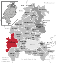
List of natural monuments in Wolfhagen

The list of natural monuments in Wolf Hagen called the in the field of city Wolf Hagen in the district of Kassel, in Hesse located natural monuments . These are currently trees at 17 locations as well as 6 extensive natural monuments, including the "Basalt Cone Bilstein" near Istha.
Trees
| image | designation | District, location | description | Art | No. |
|---|---|---|---|---|---|
 more pictures |
1 beech "sheep beech" |
Altenhasungen 51 ° 21 ′ 3.3 ″ N , 9 ° 14 ′ 49.8 ″ E |
European beech approx. 1.5 km northeast of the outskirts of Altenhasungen. The impressive tree stands on a meadow in the northern area of the Hute nature reserve in front of the Bear Mountain . The trunk is hollow on the inside and open on one side over a length of about 1.5 m. A grille closes the opening and ensures - probably unintentionally - that the fallen leaves remain enclosed and rot within the trunk. In the crown of the linden tree, safety measures were carried out using ropes. Trunk circumference: 6.45 m Height: 15 m Planting year: approx. 1805 OSM -Link to the map display: "Shepherd's beech " near Altenhasungen |
Fagus sylvatica | 6.33.861 |
 more pictures |
3 linden trees |
Altenhasungen 51 ° 20 ′ 33.4 ″ N , 9 ° 13 ′ 50.2 ″ E |
Winter linden trees on the northern outskirts of Altenhasungen. The 3 trees are in the cemetery, two of them next to each other, the third to the west of it. The southeastern tree: trunk circumference: 3.05 m height: 20 m year of planting: approx. 1905 OSM link to the map display: the south-east linden tree in the Altenhasungen cemetery The north-east tree: trunk circumference: 3.10 m height: 20 m planting year: approx 1905 OSM link to the map display: the north-eastern linden tree in the Altenhasungen cemetery The western tree: trunk circumference: 3.55 m Height: 20 m Year planted : approx. 1905 OSM link to the map display: the western linden tree in the Altenhasungen cemetery |
Tilia cordata | 6.33.862 |
 more pictures |
1 linden tree |
Ippinghausen 51 ° 16 ′ 42.7 " N , 9 ° 8 ′ 37.3" E |
Summer linden tree on the southern outskirts of Ippinghausen. The location is a meadow near the cemetery on Berghofstrasse. There is an information board on site that describes the tree as "Friedenslinde", so that it connects to the Franco-Prussian War from 1870 to 1871 and indicates the year of planting as 1871. Trunk circumference: 6.00 m (2005: 5.65 m) Height: 24 m Planting year: approx. 1855 OSM -Link to the map display: Summer linden tree in Ippinghausen |
Tilia platyphyllos | 6.33.863 |
 more pictures |
1 ash |
Niederelsungen 51 ° 23 ′ 28 " N , 9 ° 10 ′ 29.3" E |
Common ash approx. 500 m west of the outskirts of Niederelsungen. The tree stands on a sloping meadow next to a farm road. On this path, the Märchenlandweg (stage 19) and another hiking trail lead directly past the natural monument. Trunk circumference: 4.10 m Height: 19 m Planting year: approx. 1905 OSM link to the map display: Ash west of Niederelsungen |
Fraxinus excelsior | 6.33.866 |
 more pictures |
1 oak |
Niederelsungen 51 ° 22 ′ 24.1 ″ N , 9 ° 12 ′ 22.6 ″ E |
Sessile oak approx. 1.5 km southeast of the outskirts of Niederelsungen. The location is a meadow between fields, by a stream, which here has the character of a drainage canal. Trunk circumference: 3.55 m Height: 17 m Planting year: approx. 1905 OSM link to the map display: Sessile oak southeast of Niederelsungen |
Quercus petraea | 6.33.867 |
 more pictures |
1 beech |
Nothfelden 51 ° 21 ′ 3.2 ″ N , 9 ° 12 ′ 1.8 ″ E |
European beech approx. 500 m west of the outskirts of Nothfelden. The tree stands in a meadow near the edge of the forest "Bei dem Thalpfad". Trunk circumference: 3.15 m Height: 20 m Planting year: approx. 1855 OSM -Link to the map display: European beech near Nothfelden |
Fagus sylvatica | 6.33.868 |
 more pictures |
1 silver linden tree |
Viesebeck 51 ° 21 '31.2 " N , 9 ° 8' 0.2" E |
Silver linden tree on the northern outskirts of Viesebeck. The tree is in the southern corner of the cemetery on Wolfhager Strasse. Trunk circumference: 4.15 m Height: 15 m Planting year: approx. 1905 OSM -Link to the map display: Silver linden tree in the cemetery of Viesebeck |
Tilia tomentosa | 6.33.870 |
 more pictures |
1 oak |
Viesebeck 51 ° 21 '8.4 " N , 9 ° 8' 53" O |
Pedunculate oak approx. 900 m southeast of the outskirts of Viesebeck. The tree stands on a small green area between fields, "Am Mühlenwege". Trunk circumference: 2.90 m Height: 10 m Planting year: approx. 1905 OSM link to the map display: Oak south-east of Viesebeck |
Quercus robur | 6.33.871 |
 more pictures |
1 oak |
Viesebeck 51 ° 20 '53.2 " N , 9 ° 7' 15.2" E |
Pedunculate oak approx. 1 km southwest of the outskirts of Viesebeck. The impressive tree stands right on the edge of the forest. Trunk circumference: 6.20 m Height: 23 m Planting year: approx. 1755 OSM -Link to the map display: Oak south-west of Viesebeck |
Quercus robur | 6.33.872 |
 more pictures |
4 linden trees |
Wolfhagen 51 ° 18 '56 " N , 9 ° 10' 10.5" E |
Winter linden trees approx. 800 m south of the outskirts of Wolfhagen. The trees are on the east side of the L 3214, at the junction to Graner Berg . There a stream crosses the state road under a bridge. The linden trees stand on both sides, two to the north, two to the south, of this body of water. In the crown of the north-western tree, safety measures were carried out using ropes. The north-western tree: trunk circumference: 3.60 m height: 26 m planting year: approx. 1905 OSM -Link to the map display: the north-western linden tree near Wolfhagen The north-eastern tree: trunk circumference: 3.70 m height: 26 m planting year: approx. 1905 OSM -Link to the map display: the north-eastern linden tree near Wolfhagen The south-western tree: trunk circumference: 2.65 m height: 26 m Planting year: approx. 1905 OSM -Link to the map display: the south-western linden tree near Wolfhagen The south-eastern tree: trunk circumference: 3.10 m Height: 26 m Planting year: approx. 1905 OSM link to the map display: the southeastern linden tree near Wolfhagen |
Tilia cordata | 6.33.874 |
 more pictures |
4 linden trees |
Wolfhagen 51 ° 20 '0.7 " N , 9 ° 9' 31.3" E |
3 winter linden and 1 summer linden approx. 350 m northwest of the outskirts of Wolfhagen. The location is between the B 450 and the solar park. There, the 4 trees impressively flank an old stone bridge that leads over the Duse. The southern tree is a much younger replant. The farm road that leads over the bridge is part of the Volkmarser Weg hiking route . The northern winter linden tree: trunk circumference: 2.80 m height: 24 m year of planting: approx. 1905 OSM link to the map display: the northern winter linden tree at the Dusebrücke near Wolfhagen The eastern winter linden tree : trunk circumference: 3.75 m height: 24 m planting year: approx . 1905 OSM -Link to the map display: the eastern winter linden tree at the Dusebrücke near Wolfhagen The western summer linden tree : Height: 24 m Planting year: approx. 1905 OSM -Link to the map display: the western summer linden tree at the Dusebrücke near Wolfhagen The southern winter linden tree (replanting): Planting year: approx. 1985 OSM link to the map display: the southern winter linden tree at the Dusebrücke near Wolfhagen |
3 × Tilia cordata + 1 × Tilia platyphyllos |
6.33.877 |
 more pictures |
1 linden tree |
Wolfhagen 51 ° 20 '27.9 " N , 9 ° 11' 44.2" E |
Summer linden tree approx. 1.0 km northeast of the outskirts of Wolfhagen. The tree is in the Schützeberg cemetery . Trunk circumference: 4.00 m Height: 16 m Planting year: approx. 1855 OSM link to the map display: Linden tree on the Schützeberg |
Tilia platyphyllos | 6.33.878 |
 more pictures |
1 oak |
Wolfhagen 51 ° 18 ′ 41.3 ″ N , 9 ° 12 ′ 17 ″ E |
Pedunculate oak approx. 1.5 km southeast of the outskirts of Wolfhagen. The tree is located in a meadow directly north of the B 450 , “In den Stücken”. Trunk circumference: 4.00 m Height: 16 m Planting year: approx. 1885 OSM link to the map display: Oak between Wolfhagen and Istha |
Quercus robur | 6.33.880 |
 more pictures |
1 oak |
Wolfhagen 51 ° 20 '35.9 " N , 9 ° 8' 58.7" E |
Pedunculate oak approx. 1.5 km northwest of the outskirts of Wolfhagen. The tree stands in a narrow strip of green between fields, directly southeast of the Dörneberg nature reserve near Viesebeck , at the Viesebecker Warte . Trunk circumference: 4.10 m Height: 18 m Planting year: approx. 1905 OSM link to the map display: Oak north-west of Wolfhagen |
Quercus robur | 6.33.882 |
 more pictures |
1 red beech |
Ippinghausen 51 ° 14 '59.8 " N , 9 ° 7' 20" E |
European beech approx. 3.5 km southwest of Ippinghausen, west of Naumburg . The tree is isolated in the forest, near a pond. The beech has lost its tree top. Trunk circumference: 4.50 m (2005: 4.40 m) Height: 34 m (2005) year of planting: 1825 OSM link to the map display: Beech southwest of Ippinghausen |
Fagus sylvatica | 6.33.883 |
 more pictures |
1 oak |
Few chamfers 51 ° 19 ′ 11 ″ N , 9 ° 14 ′ 18.8 ″ E |
Pedunculate oak approx. 1.0 km south of the outskirts of Wenigenhasungen. The tree stands on an asphalt farm road west of the Isthaberges and the L 3312. Trunk circumference: 4.40 m (2005: 4.30 m) Height: 14 m Plant year: approx. 1905 OSM link to the map display: Oak south of Wenigenhasungen |
Quercus robur | 6.33.884 |
 more pictures |
Large tree population in the Burggarten (1 Li, 1 RBu, 1 BlBu, 2 RKa) |
Wolfhagen 51 ° 19 ′ 21 ″ N , 9 ° 9 ′ 51.5 ″ E |
1 linden, 1 red beech and 1 copper beech in the castle garden, as well as 2 horse chestnuts in front of the castle garden in Wolfhagen. The Linde: trunk circumference: 3,40 m Height: 24 m Year of planting: 1855 OSM link to the map display: Linde in the castle garden , the beech: trunk circumference: 3,35 m Height: 22 m Year of planting: 1855 OSM link to the map display : European beech in Burggarten The Blutbuche: trunk circumference: 4.10 m height: 24 m planting year: 1855 OSM link to the map display: Blutbuche in Burggarten The northern horse chestnut before Burggarten: trunk circumference: 2.85 m height: 21 m planting year: 1855 OSM link to the map display: northern horse chestnut in front of the castle garden The southern horse chestnut in front of the castle garden: trunk circumference: 3.65 m height: 23 m Planting year: approx. 1855 OSM link to the map display: southern horse chestnut in front of the castle garden |
1 × Tilia + 1 × Fagus sylvatica + 1 × Fagus sylvatica f. purpurea + 2 × Aesculus hippocastanum |
6.33.885 |
Extensive natural monuments
| image | designation | District, location | description | No. |
|---|---|---|---|---|
 more pictures |
Basalt cone Bilstein |
Istha 51 ° 18 ′ 49.2 " N , 9 ° 13 ′ 31.4" E |
Basalt cone with poor grass approx. 1 km north of Istha. The natural monument lies in front of the Isthaberg to the southwest . It consists of a striking basalt rock that is surrounded by grassland and trees. From the area there is a good view of Istha in the south and Wolfhagen in the west. Area: approx. 0.35 ha OSM link to the map display: "Basalt cone Bilstein" north of Istha |
6.33.864 |
 more pictures |
Rohrberg |
Lesser bevels 51 ° 20 ′ 28.8 ″ N , 9 ° 16 ′ 26.3 ″ E |
Basalt dome with two basalt rubble cones, rock walls, basalt rubble fields and basalt block heaps , approx. 2.0 km northeast of Wenigenhasungen. The summit is in the surrounding deciduous forest. At a distance, graveled forest roads lead around the top of the "Rohrberg". These are part of the regional hiking trail “Rund um den Rohrberg”, circular hiking trail 1 of the Habichtswald Nature Park . Area: approx. 4.9 ha OSM -Link to the map display: "Rohrberg" northeast of Wenigenhasungen |
6.33.873 |
 more pictures |
Rauenstein |
Wolfhagen 51 ° 17 '22.9 " N , 9 ° 10' 0.2" E |
Hill with 4 fissured red sandstone rocks approx. 4.0 km south of Wolfhagen. The natural monument is located in a mixed forest on the Monschein ridge , not far to the south is the Wolfsfährte circular hiking trail . Area: approx. 0.5 ha OSM link to the map display: "Rauenstein" near Wolfhagen See also the Wikipedia article Raue Steine . |
6.33.875 |
 more pictures |
High back |
Wolfhagen 51 ° 19 '25.6 " N , 9 ° 11' 45.5" E |
Lean lime lawn approx. 500 m east of the outskirts of Wolfhagen. The natural monument is located northeast of the Wolfhagen district clinic. The area is a slope facing south with a gentian-schillergrass lawn , a plant community also known as the Gentiano-Koelerietum . A typical wood for this plant community is the juniper , which can also be found on the high ridge. Area: approx. 3.5 ha OSM link to the map display: "Hoher Rück " near Wolfhagen |
6.33.879 |
 more pictures |
Sand pit |
Wolfhagen 51 ° 18 '36.2 " N , 9 ° 8' 2.1" E |
Abandoned quarry approx. 3.0 km southwest of Wolfhagen. The area is located in the eastern area of the city forest, directly on the paved road that cuts through it. At the entrance there is an information board that explains the importance of the natural monument. In the former quarry, layers of the middle red sandstone that are almost 250 million years old are exposed. In 1999 dinosaur tracks were discovered there. The larger of these footsteps could be assigned to the Chirotherium ("hand animal") group. The Wolfhager finds indicated an original and previously unknown type up to about 3.0 m long. This was then given the name Protochirotherium wolfhagense ("Urhandtier aus Wolfhagen"). In 2010 another previously unknown type of tracking was found. Traces from the Wolfhager Stadtwald can be found in the Wolfhager Land Regional Museum , the Habichtswald Nature Park Center and the Kassel Natural History Museum . It was placed under protection as a natural monument in 2005. Area: approx. 0.5 ha OSM -Link to the map display: "Sand pit" in the city forest of Wolfhagen |
6.33.886 |
 more pictures |
Basalt fractures Plattekopf and Schierenkopf |
Wolfhagen 51 ° 18 ′ 5.1 " N , 9 ° 6 ′ 47.5" E |
Former basalt quarry Plattenkopf approx. 4.0 km southwest of Wolfhagen. The area is located in the city forest, south of the paved road that cuts through it. On the edge of the abandoned quarry, the basalt rock is clearly visible. In the north, at the former driveway, the area is developing into a wetland biotope. The former basalt quarries Plattenkopf and Schierenkopf are about 1.1 km apart; they were jointly placed under protection in 2005. Total area Plattenkopf and Schierenkopf: approx. 2.35 hectares OSM -Link to the map display: "Basaltbruch Plattenkopf" in the city forest of Wolfhagen |
6.33.887 |
 more pictures |
Basalt fractures Plattekopf and Schierenkopf |
Wolfhagen 51 ° 18 ′ 41.3 " N , 9 ° 6 ′ 40.3" E |
Former basalt quarry Schierenkopf approx. 4.0 km southwest of Wolfhagen. The area is in the urban forest, north of the paved road that cuts through it. On the edge of the abandoned quarry, the basalt rock is clearly visible. The former basalt quarries Plattenkopf and Schierenkopf are about 1.1 km apart; they were jointly placed under protection in 2005. Total area Plattenkopf and Schierenkopf: approx. 2.35 hectares OSM -Link to the map display: "Basaltbruch Schierenkopf" in the city forest of Wolfhagen |
6.33.887 |

Web links
City of Wolfhagen: Nature conservation map , accessed July 19, 2016
supporting documents
- ↑ According to the official cadastre of the Lower Nature Conservation Authority of the district of Kassel and on-site research 2016 - June 2017.
- ↑ Measurement 2017-03-05 in h = 1.30 m
- ↑ a b c d e f g h i j k l m n o p q r s t u v w x y z aa ab Information on trunk circumference (if no own measurement), size and planting year according to Rüdiger Germeroth, Horst Koenies, Reiner Kunz: Natural cultural assets - past and future of natural monuments in the district of Kassel , publisher: District Committee of the District of Kassel, Lower Nature Conservation Authority, Wolfhagen, 2005, Appendix "Trees" p. 186 ff. The year of planting was determined by the age estimated there and the year of publication (2005 ) of the publication.
- ↑ Measurement 2017-03-05 in h = 1.30 m
- ↑ Measurement 2017-03-05 in h = 1.30 m
- ↑ Measurement 2017-03-05 in h = 1.30 m
- ↑ Measurement 2017-03-11 in h = 1.30 m
- ↑ Measurement 2017-06-17 in h = 1.30 m in the middle of the slope
- ↑ Measurement 2017-06-17 in h = 1.30 m
- ↑ Measurement 2020-08-20 in h = 1.30 m
- ↑ Measurement 2017-04-16 in h = 1.30 m
- ↑ Measurement 2017-03-12 in h = 1.30 m
- ↑ Measurement 2017-03-12 in h = 1.30 m
- ↑ Measurement 2017-03-12 in h = 1.30 m
- ↑ Measurement 2017-03-12 in h = 1.30 m
- ↑ Measurement 2017-06-11 in h = 1.30 m at the middle of the slope
- ↑ Measurement 2017-06-11 in h = 1.30 m at the middle of the slope
- ↑ estimate 2017-06-11
- ↑ Measurement 2017-03-19 in h = 1.30 m
- ↑ Measurement 2019-03-09 in h = 1.30 m at the middle of the slope
- ↑ Measurement 2017-06-15 in h = 1.30 m
- ↑ Measurement 2017-05-19 in h = 1.30 m at the middle of the slope
- ↑ Measurement 2017-06-11 in h = 1.30 m
- ↑ Measurement 2017-06-11 in h = 1.30 m
- ↑ Measurement 2017-06-11 in h = 1.30 m
- ↑ Measurement 2017-03-16 in h = 1.30 m
- ↑ Measurement 2017-03-16 in h = 1.30 m
- ↑ a b c d e f g Information from Rüdiger Germeroth, Horst Koenies, Reiner Kunz: Natural cultural assets - past and future of natural monuments in the Kassel district , publisher: District Committee of the Kassel district, Lower Nature Conservation Authority, Wolfhagen, 2005, appendix "Extensive natural monuments" P. 162 ff.
- ↑ Paragraph according to Reiner Kunz and Jürgen Fichter: The Wolfhager Saurierfährten - On the traces of life in the early Triassic period , publisher: Landkreis Kassel, Building and Environment Department, Lower Nature Conservation Authority, Wolfhagen, leaflet, 2nd edition, 2013.
Ahnatal | Bad Emstal | Bad Karlshafen | Baunatal | Breuna | Calden | Espenau | Fuldabrück | Fulda Valley | Grebenstein | Habichtswald | Helsa | Hofgeismar | Immenhausen | Kaufungen | Liebenau | Lohfelden | Naumburg | Nieste | Niestetal | Reinhardshagen | Reinhardswald Manor District | Schauenburg | Söhrewald | Trendelburg | Vellmar | Wesertal | Wolfhagen | Zierenberg