List of natural monuments in Fuldabrück
The list of natural monuments in Fuldabrück called on the municipality Fuldabrück in Kassel district in Hesse located natural monuments . There are currently 4 trees, including the "Big Oak" in Dörnhagen , as well as the extensive natural monument "Wetland Rinderplatz" near Dörnhagen.
Trees
| image | designation | District, location | description | Art | No. |
|---|---|---|---|---|---|
 more pictures |
1 linden tree |
Bergshausen , Kasseler Strasse No. 41 51 ° 15 ′ 56.9 ″ N , 9 ° 29 ′ 42 ″ E |
Winter linden tree on the western outskirts of Bergshausen. The tree is in the front garden of the property at Kasseler Straße No. 41. Trunk circumference: 4.00 m Height: 27 m Year planted : approx. 1875 OSM -Link to the map display: Winter linden tree in Bergshausen |
Tilia cordata | 6.33.211 |
 more pictures |
1 oak |
Dörnhagen 51 ° 13 ′ 29.1 ″ N , 9 ° 30 ′ 13.8 ″ E |
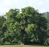
Pedunculate oak in a green corridor on the southern outskirts of Dörnhagen. The impressive tree is known under the name "Thick Oak" and is a landmark of the place. In the adjacent residential area, a street is called "An der Dicken Eiche". The trunk of the oak is hollow and open on one side. The tree was set on fire in November 2016. It is assumed, however, that the fire primarily extended to the hollow inner area of the tree and only dead heartwood was affected. The tree could thus survive the fire. In May 2017 the oak formed new leaves. Trunk circumference: 5.80 m Height: 26 m Planting year: approx. 1755 OSM -Link to the map display: "Thick Oak" in Dörnhagen |
Quercus robur | 6.33.212 |
 more pictures |
1 oak |
Dörnhagen 51 ° 13 ′ 42.9 ″ N , 9 ° 29 ′ 27.2 ″ E |
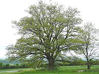
Pedunculate oak on the western outskirts of Dörnhagen. The tree stands on private property south-east of the “Zum Grenzberg” farm road. Trunk circumference: 2.60 m Height: 20 m Planting year: approx. 1885 OSM -Link to the map display: Pedunculate oak in Dörnhagen |
Quercus robur | 6.33.213 |
 more pictures |
1 oak |
Dörnhagen 51 ° 14 ′ 12 ″ N , 9 ° 30 ′ 1.2 ″ E |
Pedunculate oak about 300 m north of the outskirts of Dörnhagen. The tree forms the western end of an avenue-like row of trees on the edge of a (abandoned) farm road that leads from the L 3460 to the east, to the edge of the forest. Trunk circumference: 3.20 m Height: 21 m Planting year: approx. 1855 OSM -Link to the map display: Pedunculate oak near Dörnhagen |
Quercus robur | 6.33.215 |
Extensive natural monuments
| image | designation | District, location | description | No. |
|---|---|---|---|---|
 more pictures |
Wetland Rinderplatz |
Dörnhagen 51 ° 13 ′ 30.6 ″ N , 9 ° 30 ′ 41.5 ″ E |
The course of the "Stritzgraben" creek with pools and trees on the southern outskirts of Dörnhagen. The brook only carries water periodically. Immediately to the north of the natural monument, the “Goldene Aue” development area has emerged in recent years. The "Thick Oak" (see above) is only about 500 m further west. Area: approx. 0.6 ha OSM link to the map display: "Wetland Rinderplatz" near Dörnhagen |
6.33.214 |
Web links
Commons : Natural monuments in Fuldabrück - collection of images, videos and audio files
supporting documents
- ↑ According to the official cadastre of the Lower Nature Conservation Authority of the district of Kassel and on-site research 2016 - May 2017.
- ↑ a b c d Information on trunk circumference (if no own measurement), size and planting year according to Rüdiger Germeroth, Horst Koenies, Reiner Kunz: Natural cultural assets - past and future of natural monuments in the Kassel district , publisher: District Committee of the Kassel District, Lower Nature Conservation Authority, Wolfhagen, 2005, Appendix "Trees" p. 186 ff. The year of planting was calculated back using the age estimated there and the year of publication (2005) of the publication.
- ↑ Consequences of the fire to the Kassel district: Glück im Unglück for the “Big Oak” , November 21, 2016, accessed on December 22, 2016.
- ↑ Measurement 2017-05-13 in h = 1.30 m
- ↑ Information according to Rüdiger Germeroth, Horst Koenies, Reiner Kunz: Natural cultural assets - past and future of natural monuments in the district of Kassel , publisher: District Committee of the district of Kassel, Lower Nature Conservation Authority, Wolfhagen, 2005, appendix " Large-scale natural monuments" p. 162 ff.

