List of natural monuments in Kaufungen
The list of natural monuments in Kaufungen called on the municipality Kaufungen in the district of Kassel, in Hesse located natural monuments . There are currently 13 trees at 10 locations, whereby a red beech (6.33.442) only exists as standing dead wood .
Trees
| image | designation | District, location | description | Art | No. |
|---|---|---|---|---|---|
 more pictures |
1 oak |
Buyings 51 ° 16 ′ 37 " N , 9 ° 36 ′ 15.7" E |
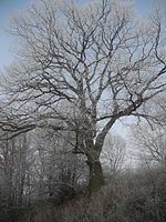
Pedunculate oak approx. 300 m south of the outskirts of Niederkaufungen. The tree is in the Haferbachtal, on a slope on the eastern edge of the “Am Haferbach” road. Trunk circumference: 4.05 m Height: 22 m Planting year: approx. 1825 OSM -Link to the map display: Pedunculate oak south of Niederkaufungen |
Quercus robur | 6.33.431 |
 more pictures |
1 linden tree, 1 oak |
Buyings 51 ° 16 ′ 8.1 ″ N , 9 ° 36 ′ 49.3 ″ E |
Winter linden tree approx. 1.0 km south of the outskirts of Niederkaufungen. The two trees of the natural monument are about 40 m apart, on the edge of the forest east of the road "Im Jagdgrund". A path leads past the trees and is part of regional hiking trails, including the Kasselsteig . Trunk circumference: 3.90 m Height: 30 m Planting year: approx. 1805 OSM -Link to the map display: Winter linden tree on the Kasselsteig |
Tilia cordata | 6.33.432 |
 more pictures |
1 linden tree, 1 oak |
Buyings 51 ° 16 ′ 7.9 ″ N , 9 ° 36 ′ 47.2 ″ E |
Pedunculate oak approx. 1.0 km south of the outskirts of Niederkaufungen. The two trees of the natural monument are about 40 m apart, on the edge of the forest east of the road "Im Jagdgrund". A path leads past the trees and is part of regional hiking trails, including the Kasselsteig .
The trunk of the oak divides into two strong main branches at a height of approx. 4.0 m. Between these, down to a height of about 2.0 m, there is a vertical gap in the trunk of the tree through which precipitation penetrates from above. It seems as if the old tree could lose one of its two main branches at this point, at some point in the future. Trunk circumference: 4.55 m Height: 32 m Planting year: approx. 1805 OSM -Link to the map display: Pedunculate oak on the Kasselsteig |
Quercus robur | 6.33.432 |
 more pictures |
1 linden tree |
Buyings 51 ° 15 ′ 52.4 " N , 9 ° 36 ′ 41.5" E |
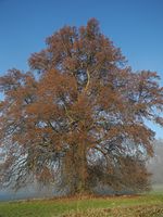
Winter linden tree approx. 1.5 km south of the outskirts of Niederkaufungen. The tree stands free in a meadow that stretches between a farm road and the wooded stream of the Ahlgraben . Trunk circumference: 3.60 m Height: 23 m Planting year: approx. 1875 OSM link to the map display: Winter linden tree south of Niederkaufungen |
Tilia cordata | 6.33.433 |
 more pictures |
Large tree population at the collegiate church (1 sycamore, 1 winter linden, 1 yew) |
Acquisitions 51 ° 16 ′ 46 ″ N , 9 ° 38 ′ 4.4 ″ E |
Sycamore maple on a green area in the monastery district of Oberkaufungen, south of the collegiate church . The tree is one of the 3 trees from the group that is spread out. Trunk circumference: 3.10 m Height: 24 m Year planted : approx. 1855 OSM -Link to the map display: Maple at the collegiate church |
Acer pseudoplatanus | 6.33.435 |
 more pictures |
Large tree population at the collegiate church (1 sycamore, 1 winter linden, 1 yew) |
Acquisitions 51 ° 16 ′ 46.4 " N , 9 ° 38 ′ 2.3" E |
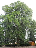
Winter linden tree in the courtyard of the monastery district of Oberkaufungen, southwest of the collegiate church . The tree is one of the 3 trees from the group that is spread out. Trunk circumference: 3.25 m Height: 24 m Planting year: approx. 1855 OSM -Link to the map display: Linden tree at the collegiate church |
Tilia cordata | 6.33.435 |
 more pictures |
Large tree population at the collegiate church (1 sycamore, 1 winter linden, 1 yew) |
Acquisitions 51 ° 16 ′ 48.4 ″ N , 9 ° 38 ′ 5.6 ″ E |
Yew tree on a green area in the monastery district of Oberkaufungen, east of the collegiate church . The tree is one of the 3 trees from the group, it is not open to the public. Trunk circumference: 2.25 m Height: 12 m Planting year: approx. 1805 OSM -Link to the map display: yew tree at the collegiate church |
Taxus | 6.33.435 |
 more pictures |
1 oak "Schulze-Boeing-Eiche" |
Acquisitions 51 ° 16 ′ 4 " N , 9 ° 37 ′ 57.6" E |
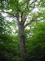
Pedunculate oak approx. 800 m south of the outskirts of Oberkaufungen. The impressive tree is in the Stiftswald, east of the quiet forest. its location is west of a forest path that runs between the calm forest and the “Pfannkuchweg”. There is no indication of the namesake on site. Trunk circumference: 5.95 m Height: 29 m Planting year: approx. 1705 OSM link to the map display: “Schulze-Boeing-Eiche” south of Oberkaufungen |
Quercus robur | 6.33.437 |
 more pictures |
1 oak "Buddelvalteneiche" |
Acquisitions 51 ° 16 ′ 10.8 " N , 9 ° 38 ′ 12.4" E |
Pedunculate oak approx. 600 m south of the outskirts of Oberkaufungen. The tree is in the Stiftswald, at the crossroads of "Pfannkuchweg" and "Triftweg". The former district forester Dilling reported in 1962 about the history of the tree name that it goes back to an old forest district name, which in turn is based on a much older oak. This "huge" oak stood about 200 m above the current tree and its remains are said to have been visible as late as the 1940s. According to the reports of "old foresters and woodcutters", the name is said to have originated in the distant past of the hat industry . The forest around Oberkaufungen had been cleared in large parts and the resulting areas were used for pasture. At that time, an immigrant cattle herdsman named Valentin Neumann is said to have lived. Since there were several shepherds with the name Valentin, he was also called the "red Valten" because of his hair color. He liked to drink schnapps and was rarely seen without his bouteille (bottle), his schnapps shots. Hence he was later nicknamed Buttelvalten . Valten and his flock regularly rested at lunchtime under the old oak, which was then free-standing, which is why it was called the Buttelvaltenseiche . The area around Valtens oak was later reforested and this forest district was called Buttelvaltenseiche for many years . According to Dilling, the naming of today's oak at the intersection of “Pfannkuchweg” and “Triftweg” was intended to remind of this old story. There is no indication of the name history on site today. Trunk circumference: 3.10 m Height: 20 m Planting year: approx. 1855 (Dilling estimated the tree to be "about 150 years old" in 1962, which speaks for a planting year of approx. 1810) OSM link to the map display: "Buddelvalteneiche" south of Acquisitions |
Quercus robur | 6.33.438 |
 more pictures |
1 oak |
Acquisitions 51 ° 18 ′ 0 ″ N , 9 ° 38 ′ 29.4 ″ E |
Pedunculate oak approx. 1.0 km north of the outskirts of Oberkaufungen. The location of the tree is not easily accessible on public roads. It is on the edge of a pasture, by a group of trees about 150 m northeast of a farm on the street "Baumgarten", and about 200 m west of "Niester Straße", the K6 between Kaufungen and Nieste. Insulators from a pasture fence and remains of barbed wire have grown into the trunk of the oak. Trunk circumference: 2.95 m Height: 15 m Planting year: approx. 1885 OSM link to the map display: Pedunculate oak north of Oberkaufungen |
Quercus robur | 6.33.439 |
 more pictures |
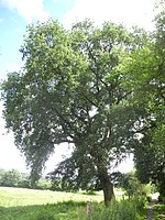
1 oak |
Acquisitions 51 ° 17 ′ 54.4 " N , 9 ° 37 ′ 43" E |
Pedunculate oak approx. 1.0 km north of the outskirts of Oberkaufungen. The tree stands on the edge of a pasture, next to a farm road that forms the extension of the "Buschbreite" street. Trunk circumference: 3.50 m Height: 22 m Planting year: approx. 1855–1885 OSM link to the map display: Pedunculate oak north of Oberkaufungen |
Quercus robur | 6.33.440 |
 more pictures |
1 oak |
Buyings 51 ° 15 '49 " N , 9 ° 36" 59.8 " E |
Pedunculate oak approx. 1.6 km south of the outskirts of Niederkaufungen. The tree stands free on a sloping meadow, about 400 m east of the Ahlgraben creek . Trunk circumference: 3.75 m Height: 22 m Year planted : approx. 1885 OSM link to the map display: Pedunculate oak south of Niederkaufungen |
Quercus robur | 6.33.441 |
 more pictures |
1 red beech |
Buyings 51 ° 15 ′ 8.5 ″ N , 9 ° 37 ′ 8.5 ″ E |
European beech approx. 2.8 km south of the outskirts of Niederkaufungen. The location is a meadow on the upper reaches of the Ahlgraben , about 100 m north-west of the “Belgerkopf Youth Home” building. Only the knotless and dead but impressive trunk of the beech tree is still standing as dead wood . Trunk circumference: 3.50 m Height: 19 m (in 2005) Planting year : approx. 1905 OSM link to the map display: Beech trunk south of Niederkaufungen |
Fagus sylvatica | 6.33.442 |
Web links
Commons : Natural monuments in Kaufungen - Collection of images, videos and audio files
Individual evidence
- ↑ According to the official cadastre of the Lower Nature Conservation Authority of the district of Kassel and on-site research 2016 - July 2017.
- ↑ a b c d e f g h i j k l m Information on trunk circumference (if no own measurement), size and planting year according to Rüdiger Germeroth, Horst Koenies, Reiner Kunz: Natural cultural assets - past and future of natural monuments in the Kassel district , publisher : District Committee of the District of Kassel, Lower Nature Conservation Authority, Wolfhagen, 2005, Appendix "Trees" p. 186 ff. The year of planting was calculated back using the age estimated there and the year of publication (2005) of the publication.
- ↑ Measurement 2018-09-30 in h = 1.30 m
- ↑ Measurement 2018-09-30 in h = 1.30 m
- ^ Paragraph after Eduard Dilling: Die Buttelvaltenseiche , in the municipality of Oberkaufungen (ed.): Oberkaufungen im Wandel der Zeiten , 1962, pp. 259–260. Dilling used the spelling "Buttelvaltenseiche" (instead of "Buddelvalteneiche").


