
List of natural monuments in Naumburg (Hessen)
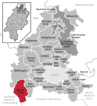

The list of natural monuments in Naumburg (Hessen) called on the territory of the town Naumburg in Kassel district in Hesse located natural monuments . These are currently trees at 8 locations, including the “Fünfbrüderbuche”, as well as 4 area natural monuments such as the “Giant Stone” near Heimarshausen.
Trees
| image | designation | District, location | description | Art | No. |
|---|---|---|---|---|---|
 more pictures |
1 oak |
Altenstädt 51 ° 16 ′ 27.4 ″ N , 9 ° 12 ′ 39.3 ″ E |
Pedunculate oak approx. 600 m east of the outskirts of Altenstädt. The location is between Altenstädt and Balhorn, directly south of the L 3215. Trunk circumference: 3.40 m (2005: 2.90 m) Height: 19 m Planting year: approx. 1885 OSM -Link to the map: Oak between Altenstädt and Balhorn |
Quercus robur | 6.33.522 |
 more pictures |
1 oak |
Elbenberg 51 ° 14 '16.8 " N , 9 ° 11' 44.5" E |
Pedunculate oak approx. 500 m northwest of the outskirts of Elbenberg. The impressive tree is in the forest, about 30 m east of a farm road that is part of two local hiking routes (E1 and N7). Trunk circumference: 4.85 m Height: 26 m Planting year: approx. 1785 OSM -Link to the map display: Oak north-west of Elbenberg |
Quercus robur | 6.33.523 |
 more pictures |
1 sequoia tree |
Elbenberg 51 ° 12 '46.6 " N , 9 ° 10' 29.8" E |
Sequoia approx. 2.5 km southwest of the outskirts of Elbenberg. The location is a meadow near the edge of the forest by the former "plant garden". Trunk circumference: 6.60 m Height: 28 m Year of planting: approx. 1905 OSM -Link to map display: Sequoia tree southwest of Elbenberg |
Sequoioideae | 6.33.526 |
 more pictures |
1 oak |
Elbenberg 51 ° 13 ′ 43.1 ″ N , 9 ° 12 ′ 21 ″ E |
Pedunculate oak on the outskirts of Elbenberg. The tree stands at the edge of the forest west of the castle ponds. The actually impressive oak is unfortunately badly mutilated: The branches of the crown were removed by numerous saw cuts. The remains of the treetop can be found on the forest floor. Trunk circumference: 5.75 m (2005: 5.65 m) Height: 28 m Planting year: approx. 1705 OSM -Link to the map display: Oak near Elbenberg |
Quercus robur | 6.33.527 |
 more pictures |
2 linden trees |
Heimarshausen 51 ° 10 '59.7 " N , 9 ° 12' 40.2" E |
Winter linden on the northeastern outskirts of Heimarshausen. The two trees are right next to each other, on a grassy knoll, the Hasenberg. The western tree: trunk circumference: 2.75 m height: 12 m year of planting: approx. 1905 OSM link to the map display: the western winter linden tree on the Hasenberg in Heimarshausen The eastern tree: trunk circumference: 2.90 m height: 12 m planting year: approx 1905 OSM link to the map display: the eastern winter lime tree on the Hasenberg of Heimarshausen |
Tilia cordata | 6.33.529 |
 more pictures |
2 linden trees |
Heimarshausen 51 ° 10 '53 " N , 9 ° 12' 46.7" E |
Summer linden trees on the eastern outskirts of Heimarshausen. The trees flank the entrance to the cemetery on K 114, Züschener Straße. The western tree: trunk circumference: 4.05 m height: 25 m year of planting: approx. 1905 OSM link to the map display: the western summer linden tree in the Heimarshausen cemetery The eastern tree: trunk circumference: 2.60 m height: 25 m year of planting: approx 1905 OSM link to the map display: the eastern summer linden tree in the Heimarshausen cemetery |
Tilia platyphyllos | 6.33.530 |
 more pictures |
1 beech "Fünfbrüderbuche" |
Naumburg 51 ° 13 '0.5 " N , 9 ° 9' 13.7" E |
European beech approx. 3.0 km south of the outskirts of Naumburg. The tree is in the forest about 20 m east of a forest path. At a height of around 2 m, the trunk divides into 5, roughly equal-thickness sub-trunks, which strive close to each other and almost vertically upwards. The "Fünfbrüderbuche" is one of the most remarkable trees in the Kassel district. Trunk circumference: 4.70 m (2005: 4.35 m) Height: 32 m Planting year: approx. 1855 OSM -Link to the map display: "Fünfbrüderbuche" |
Fagus sylvatica | 6.33.534 |
 more pictures |
1 oak |
Altendorf 51 ° 13 ′ 6.2 ″ N , 9 ° 12 ′ 37.9 ″ E |
Pedunculate oak approx. 400 m northeast of the outskirts of Altendorf. The tree stands on the edge of a sloping pasture. Trunk circumference: 4.00 m Height: 26 m Planting year: approx. 1885 OSM -Link to map display: Oak near Altendorf |
Quercus robur | 6.33.535 |
Extensive natural monuments
| image | designation | District, location | description | No. |
|---|---|---|---|---|
 more pictures |
Giant stone |
Heimarshausen 51 ° 11 '48.1 " N , 9 ° 12' 42.7" E |
Red sandstone rocks, approx. 1.5 km north of Heimarshausen. The natural monument is located in the surrounding forest, to the east, next to a ridge that forms a small cliff on the Riesenstein. In front of this cliff is the actual rock. A hiking trail runs to the west in a north-south direction, directly past the giant stone. Area: approx. 1 ha OSM link to the map display: "Riesenstein" near Heimarshausen |
6.33.528 |
 more pictures |
At the ox head |
Heimarshausen 51 ° 10 '57.3 " N , 9 ° 13' 25.1" E |
Kalkmagerrasen -Kuppe, approx. 1 km west of Heimarshausen. The area is located directly east of the L 3214. The summit is currently completely overgrown with trees. To the west there is an open, small orchard meadow . Area: approx. 0.83 ha OSM link to the map display: "Am Ochsenkopf" near Heimarshausen |
6.33.531 |
 more pictures |
Bielstein sandstone dome (also known and signposted as "Bildstein") |
Naumburg 51 ° 15 ′ 49.3 " N , 9 ° 9 ′ 40.5" E |
Red sandstone rocks in a beech forest approx. 1.5 km north of Naumburg. The natural monument is located on a wooded slope east of the L 3214. At the foot of the slope there is a farm road that is part of the Hessian long-distance cycle route R4 and several hiking trails. Area: approx. 0.7 ha OSM -Link to the map display: "Sandsteinkuppe Bielstein" near Naumburg |
6.33.532 |
 more pictures |
Limestone grasslands |
Altendorf 51 ° 12 ′ 46 ″ N , 9 ° 12 ′ 23.5 ″ E |
Lean grass on shell limestone on the outskirts of Altendorf. The site is on a slope and is partly covered with bushes. The limestone of the subsoil is only faintly visible in a few places. The status of a natural monument has existed since 2005. Area: approx. 0.8 ha OSM -Link to the map display: " Lean lime grassland" near Altendorf |
6.33.536 |
Web links
Commons : Naturdenkmale in Naumburg (Hessen) - Collection of pictures, videos and audio files
supporting documents
- ↑ According to the official cadastre of the Lower Nature Conservation Authority of the district of Kassel and on-site research 2016 - June 2017.
- ↑ Measurement 2017-05-14 in h = 1.30 m
- ↑ a b c d e f g h i j Information on trunk size 2005, size and year of planting according to Rüdiger Germeroth, Horst Koenies, Reiner Kunz: Natural cultural assets - past and future of natural monuments in the Kassel district , publisher: District Committee of the Kassel District, Lower Nature Conservation Authority , Wolfhagen, 2005, Appendix "Trees" p. 186 ff. The year of planting was calculated back using the age estimated there and the year of publication (2005) of the publication.
- ↑ Measurement 2017-06-15 in h = 1.30 m at the middle of the slope
- ↑ Measurement 2017-06-15 in h = 1.30 m
- ↑ Measurement 2017-05-14 in h = 1.30 m at the middle of the slope
- ↑ Measurement 2017-03-24 in h = 1.30 m
- ↑ Measurement 2017-03-24 in h = 1.30 m
- ↑ Measurement 2017-03-24 in h = 1.30 m
- ↑ Measurement 2017-03-24 in h = 1.30 m
- ↑ Measurement 2017-06-15 in h = 1.30 m
- ↑ Measurement 2017-05-14 in h = 1.30 m at the middle of the slope
- ↑ a b c d Information from Rüdiger Germeroth, Horst Koenies, Reiner Kunz: Natural cultural assets - past and future of natural monuments in the district of Kassel , publisher: District Committee of the district of Kassel, Lower Nature Conservation Authority, Wolfhagen, 2005, appendix "Extensive natural monuments" p. 162 ff.
Ahnatal | Bad Emstal | Bad Karlshafen | Baunatal | Breuna | Calden | Espenau | Fuldabrück | Fulda Valley | Grebenstein | Habichtswald | Helsa | Hofgeismar | Immenhausen | Kaufungen | Liebenau | Lohfelden | Naumburg | Nieste | Niestetal | Reinhardshagen | Reinhardswald Manor District | Schauenburg | Söhrewald | Trendelburg | Vellmar | Wesertal | Wolfhagen | Zierenberg