
List of natural monuments in Ahnatal

The list of natural monuments in Ahnatal called on the municipality Ahnatal in the district of Kassel, in Hesse located natural monuments . These are currently 2 linden trees in Weimar and 2 areal natural monuments, including “Der Hohlestein”, a basalt cone southwest of Weimar.
Trees
| image | designation | District, location | description | Art | No. |
|---|---|---|---|---|---|
 more pictures |
2 linden trees |
Weimar 51 ° 22 ′ 1.6 ″ N , 9 ° 23 ′ 46.4 ″ E |
Winter linden trees on the eastern outskirts of Weimar. The two trees flank the north-west entrance to the cemetery on Heckershäuser Strasse. In the opposite direction, they frame the view of the lower town and the open landscape behind. Trunk circumference: 2.95 m + 3.45 m height: 26 m Planting year: approx. 1885 OSM -Links to the map display: western linden tree + eastern linden tree |
Tilia cordata | 3633002 |
Extensive natural monuments
| image | designation | District, location | description | No. |
|---|---|---|---|---|
 more pictures |
Upper Rinnbach Valley |
Heckershausen 51 ° 21 ′ 6.9 ″ N , 9 ° 25 ′ 58.6 ″ E |
Ground cut with a small brook floodplain forest and wetland, approx. 1.2 km south of the outskirts of Heckershausen. The site is located on the edge of the forest north of Lambert . Fields cleared of natural vegetation are directly north of the natural monument. The Rinnbach flows through the damp central area . The local hiking trail H3 leads west along the site. Area: approx. 3.0 ha OSM -Link to the map display: "Upper Rinnbachtal" near Heckershausen |
3633001 |
 more pictures |
The hollow stone |
Weimar 51 ° 21 ′ 4.9 ″ N , 9 ° 21 ′ 48.5 ″ E |
Basalt cone with basalt rubble southwest of Weimar. At the foot of the slope of the basalt formation there is a population of old beech trees , in the block heap there is also hardwood . To the west and south of the elevation, a forest path leads within sight around the natural monument. It is part of several hiking trails, including the Fulda-Diemel-Weg and Märchenlandweg . A steep path branches off from there and leads into the block dump and closer to the basalt rocks. Area: approx. 1.1 ha OSM -Link to the map display: "Basalt cone Hohlestein" southwest of Weimar See also the Wikipedia article Hohlestein |
3633003 |
Web links
Commons : Natural monuments in Ahnatal - Collection of images, videos and audio files
supporting documents
- ↑ According to the official cadastre of the Lower Nature Conservation Authority of the district of Kassel and on-site research at the beginning of 2017. Update number + designation and control for currency according to Natureg 2019-04-05.
- ↑ Information on trunk circumference, size and planting year according to Rüdiger Germeroth, Horst Koenies, Reiner Kunz: Natural cultural assets - past and future of natural monuments in the district of Kassel , publisher: District Committee of the District of Kassel, Lower Nature Conservation Authority, Wolfhagen, 2005, Appendix "Trees" p. 186 ff. The year of planting was calculated back using the estimated age and year of publication (2005) of the publication.
- ↑ a b Information according to Rüdiger Germeroth, Horst Koenies, Reiner Kunz: Natural cultural assets - past and future of natural monuments in the district of Kassel , publisher: District Committee of the district of Kassel, Lower Nature Conservation Authority, Wolfhagen, 2005, appendix "Extensive natural monuments" p. 162 ff.
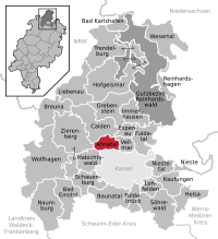
Ahnatal | Bad Emstal | Bad Karlshafen | Baunatal | Breuna | Calden | Espenau | Fuldabrück | Fulda Valley | Grebenstein | Habichtswald | Helsa | Hofgeismar | Immenhausen | Kaufungen | Liebenau | Lohfelden | Naumburg | Nieste | Niestetal | Reinhardshagen | Reinhardswald Manor District | Schauenburg | Söhrewald | Trendelburg | Vellmar | Wesertal | Wolfhagen | Zierenberg