
List of natural monuments in Grebenstein
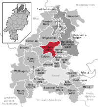

The list of natural monuments in Grebenstein called the in the field of city Grebenstein in Kassel district in Hesse located natural monuments . These are currently trees at 10 locations.
Trees
| image | designation | District, location | description | Art | No. |
|---|---|---|---|---|---|
 more pictures |
1 linden tree |
Grebenstein 51 ° 27 '21.8 " N , 9 ° 26' 53" E |
Winter linden tree approx. 1.8 km northeast of the outskirts of Grebenstein. The tree stands on a tiny green space between empty fields, with no other trees or shrubs in the vicinity. Trunk circumference: 3.95 m Height: 18 m Planting year: approx. 1905 OSM -Link to the map display: Linden tree northeast of Grebenstein |
Tilia cordata | 6.33.271 |
 more pictures |
1 chestnut, 1 linden tree |
Grebenstein 51 ° 26 '59.9 " N , 9 ° 25' 1.5" E |
Horse chestnut and winter linden in the east of Grebenstein. The location of the two trees is on the “Steinerne Brücke” road, on a meadow by the bridge over the Esse . Horse chestnut: trunk circumference: 4.15 m (2005: 4.10 m) height: 25 m planting year: approx. 1855 OSM -Link to the map display: horse chestnut at the stone bridge in Grebenstein Winter linden: trunk circumference: 3.60 m height: 25 m Year of planting: approx. 1855 OSM link to the map display: Winter linden tree at the stone bridge in Grebenstein |
Aesculus hippocastanum + Tilia cordata | 6.33.272 |
 more pictures |
2 linden trees with historic church ruins |
Grebenstein 51 ° 27 ′ 51.8 ″ N , 9 ° 26 ′ 24 ″ E |
Winter linden and summer linden approx. 1.8 km northeast of the outskirts of Grebenstein. The two linden trees stand side by side to the west of the pond on the “Oberhalnahm” road. The summer linden is the much older tree, it is already showing clear signs of decay. Winter linden tree (the southern tree): trunk circumference: 4.40 m height: 18 m year of planting: approx. 1855 OSM -Link to the map display: winter lime tree Upper half of the summer linden tree (the northern tree): trunk circumference: 5.70 m height: 10 m planting year: approx 1705 OSM link to the map display: Sommerlinde Oberhalalis |
Tilia cordata + Tilia platyphyllos | 6.33.273 |
 more pictures |
2 linden trees |
Grebenstein 51 ° 26 '39.1 " N , 9 ° 21' 58.3" E |
2 winter linden trees in the center of the Friedrichsthal district, west of the core town of Grebenstein. The two trees are in front of the cemetery, directly south of the L 3233. They mark the entrance there. The western winter lime tree: trunk circumference: 3.10 m height: 21 m planting year: approx. 1925 OSM -Link to the map display: the western winter linden tree in Friedrichsthal The eastern winter linden tree : trunk circumference: 2.60 m height: 21 m planting year: approx. 1925 OSM -Link to the map display: The eastern winter lime tree in Friedrichsthal |
Tilia cordata | 6.33.274 |
 more pictures |
1 linden tree "court linden tree" |
Shafts 51 ° 26 ′ 21.9 ″ N , 9 ° 23 ′ 49.2 ″ E |
Summer linden tree between Schachten and Grebenstein. The impressive tree stands in a meadow south of the K 50. The huge trunk of the old linden tree is open on one side and hollow on the inside. The " judicial linden tree" near Schachten is one of the trees for which the age has not only been estimated, but also scientifically determined (see list of natural monuments in the Kassel district # Age-determined trees ). An examination in 2005 found it to be around 350 years old. Trunk circumference: 9.35 m (2005: 9.30 m) Height: 19 m Planting year: approx. 1655 OSM -Link to the map display: "Judicial linden tree " near shafts |
Tilia platyphyllos | 6.33.275 |
 more pictures |
1 oak |
Shafts 51 ° 25 ′ 51.6 ″ N , 9 ° 23 ′ 14.5 ″ E |
Pedunculate oak on the south-eastern outskirts of Schachten. The tree is on Caldener Straße, the former connection route to Calden. At the location, the importance of the "1000-year-old" oak is emphasized with a bench, signage and flower bed. However, this does not prevent the adjacent field, which is cleared of natural vegetation, from being led almost to the tree trunk. Many branches of the oak are pruned or sawed off. About 300 m southwest, on the edge of the forest south of Schachten, there is an even older natural monument oak (see below). About 500 m to the southwest is a small field wood island with a walnut and two chestnuts, also a natural monument (see below). Trunk circumference: 5.50 m (2005: 5.40 m) Height: 20 m Planting year: approx. 1835 OSM link to the map display: Oak on the outskirts of Schachten |
Quercus robur | 6.33.276 |
 more pictures |
1 oak |
Shafts 51 ° 25 ′ 45.3 ″ N , 9 ° 23 ′ 0.4 ″ E |
Pedunculate oak approx. 200 m southwest of the outskirts of Schachten. The impressive tree stands, difficult to reach, directly on the eastern edge of a small forest. About 300 m to the northeast, on the outskirts of Schachten, there is another natural monument oak (see above). About 150 m to the west is a small field wood island with a walnut and two sweet chestnuts, also a natural monument (see below). Trunk circumference: 6.65 m (2005: 6.50 m) Height: 20 m Planting year: approx. 1685 OSM link to the map display: Oak near shafts |
Quercus robur | 6.33.277 |
 more pictures |
Group of trees 1 walnut, 2 sweet chestnuts |
Shafts 51 ° 25 ′ 44.8 " N , 9 ° 22 ′ 51.5" E |
Grove of trees approx. 300 m southwest of the outskirts of Schachten. The 3 trees form a tiny field wood island in the middle of a field. The two crouched chestnuts are much smaller, but also much older than the walnut tree. The trunk of the eastern chestnut is hollow and shows clear signs of decay. Only a few hundred meters west of the group of trees there are 2 locations with natural monument oaks (see above). Walnut: trunk circumference: 2.70 m height: 16 m planting year: approx. 1915 OSM link to the map display: walnut near Schachten Western sweet chestnut: trunk circumference: 5.05 m planting year: approx. 1805 OSM link to the map display: western sweet chestnut near Schachten Eastern sweet chestnut: trunk circumference: 4.25 m Planting year: approx. 1805 OSM -Link to the map display: Eastern sweet chestnut near Schachten |
Juglans regia + Castanea sativa (2 ×) |
6.33.278 |
 more pictures |
1 oak "Friedenseiche 1870/71" |
Udenhausen 51 ° 27 '26.8 " N , 9 ° 28' 2.3" E |
Pedunculate oak approx. 300 m south of the outskirts of Udenhausen. The tree stands, with 2 other oaks, on a lawn in front of the “Drei-Eichenhütte”, a refuge operated by the “Heimatverein Udenhausen”. As the "Peace Oak 1870/71", the tree is reminiscent of the Franco-German War from 1870 to 1871 . Trunk circumference: 3.35 m (2005: 3.10 m) Height: 20 m Planting year: approx. 1875 OSM -Link to the map display: Friedenseiche south of Udenhausen |
Quercus robur | 6.33.279 |
 more pictures |
1 horse chestnut |
Grebenstein 51 ° 27 '48.9 " N , 9 ° 25' 11.7" E |
Horse chestnut approx. 1 km north of the outskirts of Grebenstein. The tree stands on the edge of a farm road that runs between fields south of Niederhalalis. Trunk circumference: 3.80 m Height: 22 m Planting year: approx. 1885 OSM -Link to the map display: Horse chestnut north of Grebenstein |
Aesculus hippocastanum | 6.33.280 |
Web links
Commons : Naturdenkmale in Grebenstein - Collection of pictures, videos and audio files
supporting documents
- ↑ According to the official cadastre of the Lower Nature Conservation Authority of the district of Kassel and on-site research April 2017 - May 2017.
- ↑ Measurement 2017-05-26 in h = 1.30 m
- ↑ a b c d e f g h i j k l m n o Information on trunk circumference (if no own measurement), size and planting year according to Rüdiger Germeroth, Horst Koenies, Reiner Kunz: Natural cultural assets - past and future of natural monuments in the Kassel district , Editor: District Committee of the District of Kassel, Lower Nature Conservation Authority, Wolfhagen, 2005, Appendix "Trees" p. 186 ff. The year of planting was calculated back using the age estimated there and the year of publication (2005) of the publication.
- ↑ Measurement 2017-05-27 in h = 1.30 m at the middle of the slope
- ↑ Measurement 2017-05-27 in h = 1.30 m at the middle of the slope
- ↑ Measurement 2017-05-26 in h = 1.30 m
- ↑ Measurement 2017-05-26 in h = 1.30 m
- ↑ Measurement 2017-05-27 in h = 1.30 m at the middle of the slope
- ↑ Measurement 2017-05-27 in h = 1.30 m at the middle of the slope
- ↑ Measurement 2017-05-27 in h = 1.30 m
- ↑ Measurement 2017-04-02 in h = 1.30 m
- ↑ Measurement 2017-04-02 in h = 1.30 m
- ↑ Measurement 2017-04-02 in h = 1.30 m
- ↑ Measurement 2017-04-02 in h = 1.30 m
- ↑ Measurement 2017-04-02 in h = 1.30 m
- ↑ Measurement 2017-05-26 in h = 1.30 m
- ↑ Measurement 2017-05-01 in h = 1.30 m
Ahnatal | Bad Emstal | Bad Karlshafen | Baunatal | Breuna | Calden | Espenau | Fuldabrück | Fulda Valley | Grebenstein | Habichtswald | Helsa | Hofgeismar | Immenhausen | Kaufungen | Liebenau | Lohfelden | Naumburg | Nieste | Niestetal | Reinhardshagen | Reinhardswald Manor District | Schauenburg | Söhrewald | Trendelburg | Vellmar | Wesertal | Wolfhagen | Zierenberg