
List of natural monuments in Schauenburg
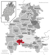

The list of natural monuments in Schauenburg called on the municipality Schauenburg in the district of Kassel in Hesse located natural monuments . There are currently 6 trees and 2 natural landmarks, including the "Martinstein" in Martinhagen.
Trees
| image | designation | District, location | description | Art | No. |
|---|---|---|---|---|---|
 more pictures |
1 oak "memory oak of 1870/71" |
Breitenbach 51 ° 16 ′ 52.1 ″ N , 9 ° 18 ′ 32.5 ″ E |
Pedunculate oak on the western outskirts of Breitenbach, the intersection of “Hauptstraße” and “Im Grund”. The tree stands on a narrow strip of green along the course of the river Ems , which here has the character of a drainage canal. The cemetery or its asphalt parking lot is located directly to the west of the tree location. The tree was planted in memory of the Franco-Prussian War from 1870 to 1871 . Immediately in front of the memorial oak stands a stone stele with the inscription: "In memory of the glorious campaign of 1870-71 Dedicated to the veterans of the municipality of Breitenbach in 1895". Trunk circumference: 3.60 m Height: 25 m Planting year: approx. 1875 OSM -Link to the map display: Memorial oak of 1870/71 in Breitenbach |
Quercus robur | 6.33.701 |
 more pictures |
1 pyramidal oak |
Breitenbach 51 ° 16 ′ 51.1 ″ N , 9 ° 19 ′ 13.1 ″ E |
Pyramid oak east of Breitenbach, in the garden of the Emserhof. The location is not open to the public. Trunk circumference: 3.50 m Height: 28 m Planting year: approx. 1875 OSM -Link to the map display: Pyramid oak at the Emserhof in Breitenbach |
Quercus robur 'Fastigiata' | 6.33.702 |
 more pictures |
1 linden tree |
Elmshagen 51 ° 15 ′ 42.4 " N , 9 ° 18 ′ 45.3" E |
Summer linden tree on the western outskirts of Elmshagen. The tree stands on private property south of Falkensteinstrasse, across from the estate. Trunk circumference: 4.70 m Height: 23 m Planting year: approx. 1855 OSM -Link to the map display: Linde in Elmshagen |
Tilia platyphyllos | 6.33.703 |
 more pictures |
1 horse chestnut |
Hoof , Korbacher Str. 312 51 ° 16 ′ 59.1 ″ N , 9 ° 20 ′ 39.4 ″ E |
Horse chestnut in the garden of the property at Korbacher Straße 312, in the center of Hoof. On the private property there are also 2 impressive oaks in the immediate vicinity of the chestnut. Trunk circumference: 3.50 m Height: 27 m Planting year: approx. 1885 OSM -Link to the map display: Horse chestnut in Hoof |
Aesculus hippocastanum | 6.33.705 |
 more pictures |
1 linden tree |
Hoof 51 ° 17 ′ 0.2 ″ N , 9 ° 20 ′ 28.2 ″ E |
Summer linden tree in front of the church in Hoof. The church building rises to the east of the tree, the tree itself stands on the edge of a desolate, asphalted area, the parish parking lot. Measures were taken on the tree trunk: two hollow spaces, the larger one has an area of about 1 m², were lined with bricks (!), The masonry was then also plastered on the outside. The linden tree in front of the church in Hoof is one of the trees for which the age has not only been estimated, but also scientifically determined (see list of natural monuments in the Kassel district # Age-determined trees ). An examination in 2005 found it to be around 300 years old. Trunk circumference: 6.45 m Height: 16 m Planting year: approx. 1705 OSM -Link to the map display: Linden tree in front of the church in Hoof |
Tilia platyphyllos | 6.33.706 |
 more pictures |
1 horse chestnut |
Martinhagen 51 ° 16 '49.9 " N , 9 ° 16' 54.1" E |
Horse chestnut approx. 400 m south of the outskirts of Martinhagen. The tree is in a meadow next to a farm road. Trunk circumference: 3.10 m Height: 13 m Planting year: approx. 1905 OSM -Link to the map display: Horse chestnut near Martinhagen |
Aesculus hippocastanum | 6.33.709 |
Extensive natural monuments
| image | designation | District, location | description | No. |
|---|---|---|---|---|
 more pictures |
Steinberg |
Elmshagen 51 ° 15 '8.5 " N , 9 ° 19' 7.1" E |
Basalt cone with an open basalt block dump and hardwood forest south of Elmshagen. The top of the small mountain is not accessible by paths. Area: approx. 1.5 ha OSM link to the map display: "Steinberg" near Elmshagen |
6.33.704 |
 more pictures |
Martinstein |
Martinhagen 51 ° 17 '17.4 " N , 9 ° 17' 14.5" E |
Basalt rock in the center of Martinhagen, right next to the church. The rock is completely enclosed by the historical development, the buildings and their gardens border directly on the natural monument. Area: approx. 700 m² OSM link to the map display: "Martinstein" in Martinhagen |
6.33.708 |
Web links
Commons : Natural monuments in Schauenburg - Collection of images, videos and audio files
supporting documents
- ↑ According to the official cadastre of the Lower Nature Conservation Authority of the district of Kassel and on-site research 2016 - June 2017.
- ↑ Measurement 2017-10-29 in h = 1.30 m
- ↑ a b c d Information on trunk circumference (if no own measurement), size and planting year according to Rüdiger Germeroth, Horst Koenies, Reiner Kunz: Natural cultural assets - past and future of natural monuments in the Kassel district , publisher: District Committee of the Kassel District, Lower Nature Conservation Authority, Wolfhagen, 2005, Appendix "Trees" p. 186 ff. The year of planting was calculated back using the age estimated there and the year of publication (2005) of the publication.
- ↑ a b Schauenburg. In: List of the individual objects (trees and groups of trees), status 07.09.2007 ; Yumpu.com, online pdf document. (No longer available online.) Archived from the original on June 26, 2016 ; accessed on June 24, 2016 . Info: The archive link was inserted automatically and has not yet been checked. Please check the original and archive link according to the instructions and then remove this notice.
- ↑ Measurement 2017-05-22 in h = 1.30 m
- ↑ a b Information according to Rüdiger Germeroth, Horst Koenies, Reiner Kunz: Natural cultural assets - past and future of natural monuments in the district of Kassel , publisher: District Committee of the district of Kassel, Lower Nature Conservation Authority, Wolfhagen, 2005, appendix "Extensive natural monuments" p. 162 ff.
Ahnatal | Bad Emstal | Bad Karlshafen | Baunatal | Breuna | Calden | Espenau | Fuldabrück | Fulda Valley | Grebenstein | Habichtswald | Helsa | Hofgeismar | Immenhausen | Kaufungen | Liebenau | Lohfelden | Naumburg | Nieste | Niestetal | Reinhardshagen | Reinhardswald Manor District | Schauenburg | Söhrewald | Trendelburg | Vellmar | Wesertal | Wolfhagen | Zierenberg