List of natural monuments in Bad Emstal
The list of natural monuments in Bad Emstal called on the municipality of Bad Emstal in Kassel district in Hesse located natural monuments . These are currently trees at 13 locations as well as the extensive natural monument “Basaltkuppe Erzeberg” near Sand.
Trees
| image | designation | District, location | description | Art | No. |
|---|---|---|---|---|---|
 more pictures |
3 oaks |
Balhorn 51 ° 15 '51.3 " N , 9 ° 13' 22.3" E |
Pedunculate oak approx. 1 km southwest of the outskirts of Balhorn, on a meadow called "Die Landwehr". The tree is north of the Habichtswaldsteig hiking trail . It is the northern of the three oaks, each about 50 to 100 m apart. Trunk circumference: 3.75 m, 3.90 m and 4.70 m Height: 22 m Planting year: approx. 1855 OSM -Link to the map display: Northern oak |
Quercus robur | 6.33.010 |
 more pictures |
3 oaks |
Balhorn 51 ° 15 '50.4 " N , 9 ° 13' 24.7" E |
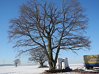
Pedunculate oak approx. 1 km southwest of the outskirts of Balhorn, on a meadow called "Die Landwehr". The tree is north of the Habichtswaldsteig hiking trail . It is the middle of the three oaks, each about 50 to 100 m apart. Recently (as of Jan. 2017) a strong branch broke off at a height of around 1.5 m. The result is a considerable hole that offers a view of the hollow interior of the trunk. Trunk circumference: 3.75 m, 3.90 m and 4.70 m Height: 22 m Planting year: approx. 1855 OSM link to the map display: medium oak |
Quercus robur | 6.33.010 |
 more pictures |
3 oaks |
Balhorn 51 ° 15 '46.7 " N , 9 ° 13' 26.1" E |
Pedunculate oak approx. 1 km southwest of the outskirts of Balhorn, on a meadow called "Die Landwehr". The tree is north of the Habichtswaldsteig hiking trail . It is the southern of the three oaks, each about 50 to 100 m apart. Trunk circumference: 3.75 m, 3.90 m and 4.70 m Height: 22 m Planting year: approx. 1855 OSM -Link to the map display: southern oak |
Quercus robur | 6.33.010 |
 more pictures |
1 oak |
Balhorn 51 ° 16 ′ 11.5 ″ N , 9 ° 13 ′ 5 ″ E |
Pedunculate oak about 1 km west of the outskirts of Balhorn. The tree stands on the edge of a field. To the east of this is the newly created field wood Am Bodenweg . Trunk circumference: 3.90 m Height: 23 m Planting year: approx. 1885 OSM -Link to the map display: Oak "Am Bodenweg" |
Quercus robur | 6.33.011 |
 more pictures |
1 linden tree |
Balhorn 51 ° 16 ′ 58.9 ″ N , 9 ° 13 ′ 10 ″ E |
Winter linden tree approx. 1 km northwest of the outskirts of Balhorn. The location is a meadow "Hinter'm Lindchen", named after the nearby forest Lindchen . Today there is the southeastern edge of a wind farm that was built in recent years. The tree branches out of a strong trunk at a height of about 3 m into a conspicuous number of comparatively small branches - similar to a pollarded willow . Trunk circumference: 2.25 m Height: 17 m Planting year: approx. 1925 OSM link to the map display: Linden tree at the wind farm |
Tilia cordata | 6.33.012 |
 more pictures |
1 oak |
Balhorn 51 ° 16 ′ 23.6 " N , 9 ° 14 ′ 10.6" E |
Pedunculate oak in the center of Balhorn. The tree is south of the church, in a meadow in a private garden. Trunk circumference: 3.60 m Height: 20 m Planting year: approx. 1855 OSM link to the map display: Oak in Balhorn |
Quercus robur | 6.33.013 |
 more pictures |
1 linden tree |
Balhorn 51 ° 16 ′ 31.5 " N , 9 ° 14 ′ 3.3" E |
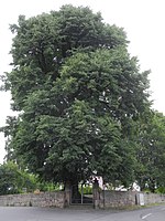
Winter linden tree on the northwestern outskirts of Balhorn. The tree impressively marks the southern entrance to the old cemetery. Trunk circumference: 3.50 m Height: 22 m Planting year: approx. 1885 OSM -Link to the map display: Linden tree at the old cemetery of Balhorn |
Tilia cordata | 6.33.014 |
 more pictures |
1 oak |
Merxhausen 51 ° 14 '7.3 " N , 9 ° 15' 31.1" E |
Pedunculate oak approx. 500 m north of the outskirts of Merxhausen, directly south of the outskirts of Sand. The tree is in the forest east of "Merxhäuser Straße", the L 3220 to Merxhausen. The trunk shows a clear gap from the root upwards. In the direction of the crown, branches were unsightly cut with a saw cut. Trunk circumference: 5.60 m Height: 28 m Planting year: approx. 1705 OSM -Link to map display: Oak between Merxhausen and Sand |
Quercus robur | 6.33.015 |
 more pictures |
3 linden trees |
Sedge 51 ° 12 ′ 28.8 ″ N , 9 ° 15 ′ 6 ″ E |
Summer linden trees on the western outskirts of Riede.The location is immediately south of the Riede Castle Park , only 100 m northeast of the linden trees there is the yew tree, protected as a natural monument 6.33.017 (see below). The 3 linden trees flank the path to the Klauskopf mountain and the Riede hiking car park . Two trees stand north and one tree south of the path. The two eastern of the 3 linden trees have lost their crown in the past and are only about half the height of the western tree. Circumference of the western linden tree: 4.30 m Circumference of the north-eastern linden tree: 3.85 m Height: up to 24 m Planting year: approx. 1885 OSM -Links to the map display: western linden tree in Riede , northeast linden tree , southeast linden tree |
Tilia platyphyllos | 6.33.016 |
 more pictures |
1 yew tree |
Sedge 51 ° 12 ′ 31.2 ″ N , 9 ° 15 ′ 9.5 ″ E |
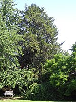
European yew tree on the western outskirts of Riede.The tree stands on the eastern edge of the Riede Castle Park . In front of the park wall, only 100 m southwest of the yew tree, there are 3 linden trees, 6.33.016 protected as natural monuments (see above). In 1939 the German Dendrological Society (DDG) went on an excursion to the palace gardens. The report says: “In Riede [...] there were rustic trees. The yew tree on the farm building had a straight shaft 2 ½ m high with a circumference of 285 cm and a magnificent screen 10 m high, [...] ”. The age of the tree was estimated at "900 years". Today, the yew tree in the Riede Castle Park is one of the trees for which the age was not only estimated, but scientifically determined (see List of Natural Monuments in the Kassel District # Age-Determined Trees ). An examination in 2005 found it to be around 350 years old. Today this tree is the oldest in the Riede Castle Park and one of the mightiest and therefore oldest examples of yew trees in Germany. Trunk circumference: 3.80 m Height: 12 m Planting year: approx. 1655 OSM -Link to the map display: Yew tree in the Riede Castle Park |
Taxus baccata | 6.33.017 |
 more pictures |
2 oaks |
Sedge 51 ° 13 ′ 12.8 " N , 9 ° 15 ′ 20.1" E |
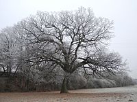
Pedunculate oak approx. 1 km north of the outskirts of Riede, on a meadow “Im Stellbach”, south of Merxhausen . The tree is the western of the two oaks, which are about 300 m apart. Trunk circumference: 3.80 m Height: 22 m Planting year: approx. 1805 OSM -Link to the map display: Western oak |
Quercus robur | 6.33.018 |
 more pictures |
2 oaks |
Riede 51 ° 13 '9.7 " N , 9 ° 15' 34.8" E |
Pedunculate oak approx. 1 km north of the outskirts of Riede, on a meadow “Im Stellbach”, south of Merxhausen , approx. 100 m west of the B 450 . The tree is the eastern of the two oaks, which are about 300 m apart. Trunk circumference: 4.95 m Height: 24 m Planting year: approx. 1805 OSM -Link to the map display: Eastern oak |
Quercus robur | 6.33.018 |
 more pictures |
1 oak |
Sedge 51 ° 12 '52.7 " N , 9 ° 15' 5.8" E |
Sessile oak approx. 500 m north of the outskirts of Riede, on a meadow called “Die alten Wiesenorte”. The tree is about 50 m west of the K 111, the road between Riede and Elbenberg , by the old water tank. Trunk circumference: 4.30 m Height: 24 m Planting year: approx. 1855 OSM -Link to the map display: Sessile oak |
Quercus petraea | 6.33.019 |
 more pictures |
1 linden tree |
Ried 51 ° 12 '43.2 " N , 9 ° 15' 6.2" E |
Winter linden tree approx. 300 m northwest of the outskirts of Riede, directly on the edge of the forest east of the Klauskopf . The tree fell around 2015. On site (as of 2019) only the stump is left, as well as the wood of the linden tree, sawn on the forest floor. The tree stood about 50 m south of the remains of the Temple of Friendship in the historic Riede castle park . Trunk circumference: 4.70 m Height: 22 m (in 2005) Planting year : approx. 1855 OSM link to the map display: stump of the winter linden tree |
Tilia cordata | 6.33.020 |
 more pictures |
1 oak |
Sand 51 ° 15 '38.7 " N , 9 ° 16' 2.3" E |
Sessile oak approx. 1.2 km northeast of the outskirts of Sand. The tree is in the forest, about 20 m north of its edge, in the "Tonkaute", east of the Erzeberg . Not far to the east of the tree runs the extra tour of the Habichtswaldsteig hiking trail, marked "H6" . The trunk divides at a height of approx. 3 m to form an impressive triple trunk. The three individual trunks strive almost vertically upwards and tower above the surrounding deciduous and coniferous trees. Trunk circumference: 5.00 m Height: 30 m Planting year: approx. 1855 OSM link to the map display: Sessile oak in the forest near sand |
Quercus petraea | 6.33.021 |
 more pictures |
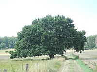
1 meadow oak |
Sand 51 ° 15 '24.1 " N , 9 ° 16' 2.6" E |
Pedunculate oak approx. 800 m northeast of the outskirts of Sand. It is located at the edge of a meadow, northeast of the Läuseküppel hill . Not far to the west of the tree runs the extra tour of the Habichtswaldsteig hiking trail marked with "H6" . Trunk circumference: 3.90 m Height: 8 m Planting year: approx. 1885 OSM -Link to the map display: meadow oak near sand |
Quercus robur | 6.33.023 |
Extensive natural monuments
| image | designation | District, location | description | No. |
|---|---|---|---|---|
 more pictures |
Basalt summit Erzeberg |
Sand 51 ° 15 ′ 36.4 " N , 9 ° 15 ′ 9.8" E |
Basalt cone with basalt rubble north of Sand, west of the summit of the Erzeberg . On the northern flank of the mountain, the regional hiking trail E10 leads past the natural monument, the basalt dome itself is not accessible by paths. The status of a natural monument has existed since 2005. Area: approx. 0.42 ha OSM -Link to the map display: Basalt hilltop Erzeberg |
6.33.024 |
Web links
Commons : Natural monuments in Bad Emstal - collection of images, videos and audio files
supporting documents
- ↑ According to the official cadastre of the Lower Nature Conservation Authority of the district of Kassel and on-site research 2016 - June 2017.
- ↑ a b c d e f g h i j k l m n o p information on trunk circumference (if no own measurement), size and planting year according to Rüdiger Germeroth, Horst Koenies, Reiner Kunz: Natural cultural assets - past and future of natural monuments in the district Kassel , Editor: District Committee of the District of Kassel, Lower Nature Conservation Authority, Wolfhagen, 2005, Appendix "Trees" p. 186 ff. The year of planting was calculated back using the age estimated there and the year of publication (2005) of the publication.
- ↑ Measurement 2017-05-14 in h = 1.30 m
- ↑ Measurement 2019-10-06 in h = 1.30 m
- ↑ Measurement 2019-10-06 in h = 1.30 m
- ↑ Paragraph and quote from Volker André Bouffier: The remarkable tree population in the castle park Riede , in: Association for the promotion of the castle in Riede eV (publisher): Landscape gardens - garden landscapes castle and village Riede , Bad Emstal - Riede, 2017, p. 26– 39
- ↑ cf. Volker André Bouffier: The remarkable tree population in the castle park Riede , in: Association for the promotion of the castle in Riede eV (Ed.): Landscape gardens - garden landscapes castle and village Riede , Bad Emstal - Riede, 2017, p. 30
- ↑ Measurement 2019-07-06 in h = 1.30 m
- ↑ Measurement 2020-04-15 in h = 1.30 m
- ↑ Information according to Rüdiger Germeroth, Horst Koenies, Reiner Kunz: Natural cultural assets - past and future of natural monuments in the district of Kassel , publisher: District Committee of the district of Kassel, Lower Nature Conservation Authority, Wolfhagen, 2005, appendix " Large-scale natural monuments" p. 162 ff.


