
List of natural monuments in Trendelburg
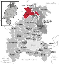

The list of natural monuments in Trendelburg called the in the field of city Trendelburg in Kassel district in Hesse located natural monuments . These are currently trees at 16 locations as well as 3 extensive natural monuments, including the “wet cloudburst”.
Trees
| image | designation | District, location | description | Art | No. |
|---|---|---|---|---|---|
 more pictures |
1 oak "Friedenseiche 1870/71" |
Deisel 51 ° 35 ′ 54.2 " N , 9 ° 24 ′ 33.6" E |
Pedunculate oak approx. 300 m north of the outskirts of Deisel. The tree is on the sports field, directly west of the B 83. This "Peace Oak" is reminiscent of the Franco-Prussian War from 1870 to 1871 . There is currently no evidence of this on site. Trunk circumference: 3.35 m (2005: 3.15 m) Height: 21 m Planting year: approx. 1875 OSM link to the map display: Oak at the Deisel sports field |
Quercus robur | 6.33.762 |
 more pictures |
1 linden tree |
Deisel 51 ° 35 ′ 33.6 " N , 9 ° 24 ′ 31.1" E |
Summer linden tree in the center of Deisel. The impressive tree is in the churchyard, directly to the north, next to the lovely Deisel church . The linden tree fills the space between the nave and the surrounding residential area. There is another old linden tree next to the west portal of the church. Trunk circumference: 5.10 m (2005: 4.80 m) Height: 23 m Year of planting: approx. 1855 OSM -Link to the map display: Summer linden tree at the Deisel church |
Tilia platyphyllos | 6.33.763 |
 more pictures |
1 linden tree |
Deisel 51 ° 35 ′ 44.6 " N , 9 ° 24 ′ 54.9" E |
Summer linden tree approx. 300 m northeast of the outskirts of Deisel. The location is a meadow within the Diemel river bend . Trunk circumference: 4.70 m Height: 16 m Planting year: approx. 1905 OSM link to the map display: Summer linden tree northeast of Deisel |
Tilia platyphyllos | 6.33.764 |
 more pictures |
1 ash |
Eberschütz 51 ° 32 ′ 11.2 ″ N , 9 ° 21 ′ 21.7 ″ E |
Common ash approx. 200 m southwest of the outskirts of Eberschütz. The tree stands in the meadows south of the Diemel . Only about 100 m further west is a second old ash tree without natural monument status, about 100 m south is the location of a horse chestnut tree, which is protected as a natural monument (see 6.33.781 below). Trunk circumference: 3.65 m Height: 23 m Year planted : approx. 1885 OSM -Link to map display: Ash near Eberschütz |
Fraxinus excelsior | 6.33.766 |
 more pictures |
1 oak "Luther oak", 1 oak |
Friedrichsfeld 51 ° 34 ′ 32.3 " N , 9 ° 27 ′ 38.5" E |
Pedunculate oaks on the northern outskirts of Friedrichsfeld. The two trees are on both sides of the Wülmerser Weg. The "Luther Oak" on the playground: Trunk circumference: 4.10 m height: 24 m Planting year: approx. 1875 OSM -Link to the map display: "Luther Oak " in Friedrichsfeld The oak in front of the "Trierlandhalle": trunk circumference: 4.00 m height: 22 m year of planting: approx. 1875 OSM link to the map display: oak in front of the “Trierlandhalle” in Friedrichsfeld |
Quercus robur | 6.33.767 |
 more pictures |
1 oak "Friedenseiche" |
Friedrichsfeld 51 ° 34 ′ 20.7 ″ N , 9 ° 27 ′ 35.2 ″ E |
Pedunculate oak on the southern outskirts of Friedrichsfeld. The location is a meadow between Wülmerser Weg and the “Am Anger” street. There is no indication of the status as a "peace oak" on site. Trunk circumference: 4.95 m Height: 24 m Year of planting: approx. 1875 OSM -Link to the map display: "Friedenseiche" on the southern edge of Friedrichsfeld |
Quercus robur | 6.33.768 |
 more pictures |
1 oak "Friedenseiche 1870/71" |
Gottsbüren 51 ° 34 ′ 43.7 ″ N , 9 ° 30 ′ 2.3 ″ E |
Pedunculate oak in the center of Gottsbüren. The tree stands in the churchyard and, as a "peace oak", commemorates the Franco-German War from 1870 to 1871 . The contemporary and probably authentic dedication is still preserved on site. On the south-west side the trunk is open to approx. 3 m, there round steel bars were installed and the wood of the trunk was painted on the inside. Trunk circumference: 4.45 m Height: 33 m Year planted : approx. 1875 OSM -Link to the map display: Pedunculate oak at the church of Gottsbüren |
Quercus robur | 6.33.769 |
 more pictures |
1 linden tree |
Langenthal 51 ° 36 '35.5 " N , 9 ° 21' 48.7" E |
Summer linden tree in the center of Langenthal. The impressive tree is at the entrance to the church, directly on the street "An den Anlagen". Trunk circumference: 5.15 m (2005: 5.00 m) Height: 27 m Planting year: approx. 1855 OSM -Link to the map display: Linden tree in front of the church in Langenthal |
Tilia platyphyllos | 6.33.770 |
 more pictures |
1 oak "Friedenseiche 1870/71" |
Langenthal 51 ° 36 '48.1 " N , 9 ° 22' 37.4" E |
Pedunculate oak on the eastern outskirts of Langenthal. The location is a meadow directly north of Helmershäuser Strasse. As a "peace oak", the tree is reminiscent of the Franco-Prussian War from 1870 to 1871 , there is no local reference to it. Trunk circumference: 4.00 m (2005: 3.85 m) Height: 20 m Planting year: approx. 1875 OSM link to the map display: Oak on the outskirts of Langenthal |
Quercus robur | 6.33.771 |
 more pictures |
3 oaks |
Sielen 51 ° 33 ′ 11.6 " N , 9 ° 22 ′ 52.6" E |
Pedunculate oak in the center of Sielen. The tree stands, with a second tree from the group of three, on a green area on the south side of the churchyard. Trunk circumference: 3.70 m Height: 25 m Planting year: approx. 1885 OSM -Link to the map display: Oak at the churchyard of Sielen, south side |
Quercus robur | 6.33.772 |
 more pictures |
3 oaks |
Sielen 51 ° 33 ′ 11.8 " N , 9 ° 22 ′ 52.9" E |
Pedunculate oak in the center of Sielen. The tree stands, with a second tree from the group of three, on a green area on the south side of the churchyard. Trunk circumference: 3.20 m Height: 24 m Planting year: approx. 1885 OSM -Link to the map display: Oak at the churchyard of Sielen, south side |
Quercus robur | 6.33.772 |
 more pictures |
3 oaks |
Sielen 51 ° 33 ′ 12.7 " N , 9 ° 22 ′ 52.4" E |
Pedunculate oak in the center of Sielen. The tree stands on a green area on the north side of the churchyard. Trunk circumference: 4.60 m Height: 22 m Planting year: approx. 1825 OSM -Link to the map display: Oak at the churchyard of Sielen, north side |
Quercus robur | 6.33.772 |
 more pictures |
2 linden trees |
Sielen 51 ° 33 ′ 17.7 " N , 9 ° 22 ′ 54.1" E |
Winter linden tree on the northern outskirts of Sielen. The tree is in the cemetery, it is the southernmost of the two linden trees. Trunk circumference: 4.55 m Height: 24 m Planting year: approx. 1805 OSM -Link to the map display: Winter linden tree in the cemetery, south |
Tilia cordata | 6.33.773 |
 more pictures |
2 linden trees |
Sielen 51 ° 33 ′ 19.6 ″ N , 9 ° 22 ′ 55.6 ″ E |
Summer linden tree on the northern outskirts of Sielen. The tree is in the cemetery, it is the northernmost of the two linden trees. Trunk circumference: 5.85 m Height: 28 m Planting year: approx. 1805 OSM -Link to the map display: Summer linden tree in the cemetery, north |
Tilia platyphyllos | 6.33.773 |
 more pictures |
1 oak |
Sielen 51 ° 33 ′ 4.5 " N , 9 ° 22 ′ 57.5" E |
Pedunculate oak on the south-eastern outskirts of Sielen. The location of the tree is a remaining area on the Diemel Bridge on Bachstrasse, in front of a contemporary, ugly industrial hall. In front of the tree is a boulder with a metal plate. The inscription reads: "PEACE OAK 1872 PLANTED AFTER THE GERMAN-FRENCH PEACE SIELEN AUG. 2004 ". Trunk circumference: 4.00 m Height: 22 m Year of planting: 1872 OSM -Link to map display: Oak at the Diemel Bridge |
Quercus robur | 6.33.774 |
 more pictures |
1 jaw |
Sielen 51 ° 33 '35.7 " N , 9 ° 21' 22.2" E |
Black pine approx. 1.2 km northwest of the outskirts of Sielen. The conifer stands in the middle of a small piece of forest "on the Bühner side". Trunk circumference: 3.05 m Height: 15 m Planting year: approx. 1875 OSM -Link to the map display: Pine near Sielen |
Pinus nigra | 6.33.775 |
 more pictures |
2 chestnuts |
Trendelburg 51 ° 34 ′ 26.2 " N , 9 ° 25 ′ 25.1" E |
Horse chestnuts in the old town of Trendelburg, in the courtyard of Burg Trendelburg . The two trees are there next to each other. The castle is a private property, but it is accessible to visitors to the restaurant. The northern horse chestnut: trunk circumference: 3.10 m height: 20 m planting year: approx. 1855 OSM -Link to the map display: the northern horse chestnut in Castle Trendelburg The southern horse chestnut: trunk circumference: 3.90 m height: 20 m planting year: approx. 1855 OSM link to map display: the southern horse chestnut in Trendelburg Castle |
Aesculus hippocastanum | 6.33.777 |
 more pictures |
1 oak "Friedenseiche 1870/71" |
Trendelburg 51 ° 34 ′ 22.8 " N , 9 ° 24 ′ 51.4" E |
Pedunculate oak on the western outskirts of Trendelburg. The tree stands on company premises on the street “Zur Siechenkirche”. Trunk circumference: 4.20 m Height: 20 m Planting year: 1875 OSM -Link to the map display: Pedunculate oak in Trendelburg |
Quercus robur | 6.33.780 |
 more pictures |
1 horse chestnut |
Eberschütz 51 ° 32 ′ 7.6 ″ N , 9 ° 21 ′ 19.8 ″ E |
Horse chestnut approx. 300 m southwest of the outskirts of Eberschütz. The tree stands in the meadows south of the Diemel , on an asphalt farm road that is part of several long-distance cycle routes. About 100 m further north is the site of an ash tree protected as a natural monument (see above 6.33.766). Trunk circumference: 4.05 m Height: 20 m Planting year: 1855 - 1875 OSM -Link to the map display: Horse chestnut near Eberschütz |
Aesculus hippocastanum | 6.33.781 |

Extensive natural monuments
| image | designation | District, location | description | No. |
|---|---|---|---|---|
 more pictures |
Red sand quarry Stein-Berg |
Deisel 51 ° 35 ′ 5.4 " N , 9 ° 25 ′ 13.6" E |
Situated Authorized red sandstone breakage with great cliff, scree and debris southeast of Deisel. So far only parts of the area have been covered by trees. Area: approx. 3.49 hectares OSM -Link to the map display: “Buntsandsteinbruch Stein-Berg” near Deisel |
6.33.765 |
 more pictures |
Wet downpour |
Trendelburg 51 ° 34 ′ 32.9 " N , 9 ° 26 ′ 46.1" E |
Sinkhole , filled with water, east of Trendelburg. The slope of the naturally created funnel is overgrown with beeches. The natural monument 6.33.674 "Dry cloudburst", also a sinkhole, is 300 m further west, see the list of natural monuments in the Reinhardswald estate . Area: approx. 1.93 ha OSM -Link to the map display: "Wet cloudburst" near Trendelburg See also the Wikipedia article Cloudbursts near Trendelburg |
6.33.778 |
 more pictures |
Diemelaltwasser Deesenfeld |
Trendelburg 51 ° 34 ′ 51.6 " N , 9 ° 25 ′ 10.5" E |
Altwasser der Diemel approx. 800 m north of the old town of Trendelburg. The dead arm has no connection to the river to the west and is partially silted up. A path leads through the area on a small dam, which is part of several hiking trails and bicycle routes. It is the old route of the disused Carlsbahn . To the east of the dam lies a body of water with a small alluvial forest . To the east adjoin intensively agriculturally used areas. In the eastern part of the natural monument you can find the typical plastic waste from this agriculture: remains of foil, ropes and pipes. Area: approx. 1.0 ha OSM link to the map display: "Diemelaltwasser Deesenfeld" near Trendelburg |
6.33.779 |
Web links
Commons : Natural monuments in Trendelburg - Collection of images, videos and audio files
supporting documents
- ↑ According to the official cadastre of the Lower Nature Conservation Authority of the district of Kassel and on-site research 2016 - May 2017.
- ↑ Measurement 2017-04-23 in h = 1.30 m
- ↑ a b c d e f g h i j k l m n o p q r s t u Information on trunk circumference (if no own measurement), size and planting year according to Rüdiger Germeroth, Horst Koenies, Reiner Kunz: Natural cultural assets - past and Future of Natural Monuments in the Kassel District , Editor: District Committee of the Kassel District, Lower Nature Conservation Authority, Wolfhagen, 2005, Appendix "Trees" p. 186 ff. The year of planting was calculated using the age estimated there and the year of publication (2005) of the publication.
- ↑ Measurement 2017-04-23 in h = 1.30 m
- ↑ Measurement 2017-05-25 in h = 1.30 m
- ↑ Measurement 2017-04-29 in h = 1.30 m
- ↑ Measurement 2017-04-22 in h = 1.30 m
- ↑ Measurement 2017-04-22 in h = 1.30 m
- ↑ Measurement 2017-04-22 in h = 1.30 m
- ↑ Measurement 2017-05-07 in h = 1.30 m
- ↑ Measurement 2017-04-23 in h = 1.30 m
- ↑ Measurement 2017-04-23 in h = 1.30 m
- ↑ Measurement 2017-04-21 in h = 1.30 m
- ↑ Measurement 2017-04-21 in h = 1.30 m
- ↑ Measurement 2017-04-29 in h = 1.30 m
- ↑ a b c Information from Rüdiger Germeroth, Horst Koenies, Reiner Kunz: Natural cultural assets - past and future of natural monuments in the district of Kassel , publisher: District Committee of the district of Kassel, Lower Nature Conservation Authority, Wolfhagen, 2005, appendix "Extensive natural monuments" p. 162 ff .
Ahnatal | Bad Emstal | Bad Karlshafen | Baunatal | Breuna | Calden | Espenau | Fuldabrück | Fulda Valley | Grebenstein | Habichtswald | Helsa | Hofgeismar | Immenhausen | Kaufungen | Liebenau | Lohfelden | Naumburg | Nieste | Niestetal | Reinhardshagen | Reinhardswald Manor District | Schauenburg | Söhrewald | Trendelburg | Vellmar | Wesertal | Wolfhagen | Zierenberg