List of natural monuments in Breuna
The list of natural monuments in Breuna called on the municipality Breuna in Kassel district in Hesse located natural monuments . These are currently trees at 6 locations and 4 area natural monuments.
Trees
| image | designation | District, location | description | Art | No. |
|---|---|---|---|---|---|
 more pictures |
2 oaks |
Breuna 51 ° 25 ′ 36.1 ″ N , 9 ° 11 ′ 3 ″ E |
Pedunculate oaks approx. 700 m north of the outskirts of Breuna. The two trees stand next to each other on the edge of the forest north of the sports field, "Im Kink". A little further north, along the L 3312, there are more old oaks. The western tree: trunk circumference: 3.70 m height: 18 m planting year: approx. 1805 OSM -Link to the map display: the western oak at the sports field The eastern tree: trunk circumference: 3.50 m height: 18 m planting year: approx. 1805 OSM -Link to the map display: the eastern oak at the sports field |
Quercus robur | 6.33.091 |
 more pictures |
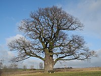
1 oak "court oak" |
Breuna 51 ° 24 '49.3 " N , 9 ° 10' 0.8" E |
Pedunculate oak approx. 700 m west of the outskirts of Breuna. The location bears the old hall designation “Auf demgericht”, which suggests that justice was done here earlier. However, this has not been proven for certain. Today the oak stands only approx. 200 m east of the over 500 m long Breuna viaduct , on Autobahn 44, which shapes the landscape with its noisy backdrop. The municipality of Breuna currently uses the “court oak” as a logo on its website. Trunk circumference: 6.80 m Height: 16 m Planting year: approx. 1685 OSM -Link to the map display: "Court oak " near Breuna |
Quercus robur | 6.33.092 |
 more pictures |
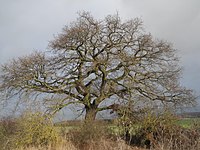
1 oak |
Breuna 51 ° 25 '4.1 " N , 9 ° 9' 48.2" E |
Pedunculate oak approx. 900 m west of the outskirts of Breuna, approx. 500 m northwest of the court oak (see above). The tree stands “Auf dem Schoren”, right next to a wind turbine and only about 250 m east of Autobahn 44. Trunk circumference: 2.75 m Height: 10 m Year of planting: approx. 1925 OSM link to the map display: Oak on Autobahn 44 |
Quercus robur | 6.33.093 |
 more pictures |
1 copper beech, 1 oak |
Oberlistingen 51 ° 26 ′ 43.6 ″ N , 9 ° 13 ′ 55.6 ″ E |
Pedunculate oak on the northwestern outskirts of Oberlistingen, in the cemetery. There was also the copper beech of the same age, but it fell in a storm on July 28, 2013. In the southeastern area of the cemetery its stump is still preserved and a small information board reminds of the tree. A new tree was planted next to the stump of the beech. The remaining oak stands in the middle of the cemetery. The impressive tree dominates the entire area. Trunk circumference: 5.10 m Height: 16 m Planting year: approx. 1875 OSM -Link to the map display: Oak in the cemetery of Oberlistingen |
(Fagus sylvatica f. Purpurea no longer present) Quercus robur |
6.33.096 |
 more pictures |
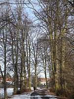
Avenue of lime trees |
Singing Competition 51 ° 27 ′ 13 ″ N , 9 ° 11 ′ 23.5 ″ E |
Summer linden trees in the center of Wettesingen. The 33 trees, including some replanting, are on both sides of a path that leads from Warburger Straße to an estate. The avenue is not straight, but slightly curved. Trunk circumference: 2.40 - 2.80 m Height: 22 - 25 m Planting year: approx. 1925 OSM -Link to the map display: The easternmost linden tree of the avenue in Wettesingen |
Tilia platyphyllos | 6.33.097 |
 more pictures |
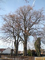
2 linden trees |
Singing Competition 51 ° 27 ′ 1 ″ N , 9 ° 11 ′ 18.7 ″ E |
Summer linden trees on the southwestern outskirts of Wettesingen. The two trees stand next to each other on the northern part of the cemetery, directly on Parkstrasse. The western tree: trunk circumference: 4.10 m height: 25 m year of planting: approx. 1885 OSM link to the map display: the western linden tree in the cemetery in Wettesingen The eastern tree: trunk circumference: 3.90 m height: 25 m planting year: approx 1885 OSM link to the map display: the eastern lime tree in the cemetery in Wettesingen |
Tilia platyphyllos | 6.33.098 |
Extensive natural monuments
| image | designation | District, location | description | No. |
|---|---|---|---|---|
 more pictures |
Behind the oak bag wetland |
Breuna 51 ° 24 ′ 25.3 " N , 9 ° 9 ′ 4" E |
Wetland with a stream southwest of Breuna, near Rhöda . The "Rhödaer Bach" flows through the area. A farm road runs along the northern edge of the area and is part of several hiking trails. Area: approx. 3.1 ha OSM -Link to the map display: " Wet area Hinterm Eichenpaket " southwest of Breuna |
6.33.094 |
 more pictures |
Key reason |
Singing Contest 51 ° 26 '32.6 " N , 9 ° 9" 56.1 " E |
Meager grassland with juniper and other trees approx. 2.0 km southwest of Wettesingen. The natural monument forms the western slope of a hill. It contains an elongated, short-grassed core area that is surrounded by hedge trains and trees. In the center there are numerous, often comparatively large, juniper plants. Circular hiking trail 5 leads through the area (from the Wettesingen hiking car park). Area: approx. 5.0 ha OSM -Link to the map display: "Key reason " southwest of Wettesingen |
6.33.099 |
 more pictures |
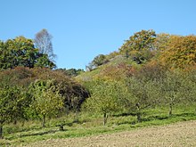
Basalt cone in front of the slopes |
Wettesingen and Oberlistingen 51 ° 27 ′ 5 ″ N , 9 ° 12 ′ 50.3 ″ E |
Basalt cone with poor grassland and orchards between Wettesingen and Oberlistingen. In the north of the natural monument there is an area with old hat trees . To the west is an abandoned quarry with a barbecue area. Area: approx. 0.6 ha OSM link to the map display: "Basalt cone in front of the slopes" between Wettesingen and Oberlistingen |
6.33.100 |
 more pictures |
Orchid meadow |
Niederlistingen 51 ° 27 ′ 14.1 ″ N , 9 ° 15 ′ 15.2 ″ E |
Small grassy lawn on shell limestone approx. 500 m north of the outskirts of Niederlistingen. The small, slightly inclined slope is south of the edge of the forest and north of a farm road that leads directly past the area. The name of the natural monument refers to the occurrence of the protected three-tooth orchid . The natural monument status has existed since 2005. Area: approx. 0.13 ha OSM -Link to the map display: “Orchideenwiese” north of Niederlistingen |
6.33.101 |
Web links
Commons : Natural monuments in Breuna - Collection of images, videos and audio files
supporting documents
- ↑ According to the official cadastre of the Lower Nature Conservation Authority of the district of Kassel and on-site research 2016/2017.
- ↑ a b c d e f Information on trunk circumference (if no own measurement), size and planting year according to Rüdiger Germeroth, Horst Koenies, Reiner Kunz: Natural cultural assets - past and future of natural monuments in the Kassel district , publisher: District Committee of the Kassel district, Untere Nature Conservation Authority, Wolfhagen, 2005, Appendix "Trees", pp. 186 ff. The year of planting was calculated back using the age estimated there and the year of publication (2005) of the publication.
- ↑ see http://www.breuna.de/cms/Tourismus/Sehensw%C3%BCrdheiten/Gerichtseiche/ accessed 2017-08-21
- ↑ Measurement 2017-08-20 in h = 1.30 m
- ↑ Measurement 2017-10-15 in h = 1.30 m
- ↑ Measurement 2017-08-20 in h = 1.30 m
- ↑ Measurement 2017-08-20 in h = 1.30 m
- ↑ a b c d Information from Rüdiger Germeroth, Horst Koenies, Reiner Kunz: Natural cultural assets - past and future of natural monuments in the district of Kassel , publisher: District Committee of the district of Kassel, Lower Nature Conservation Authority, Wolfhagen, 2005, appendix "Extensive natural monuments" p. 162 ff.
- ↑ see the route on the website of the Habichtswald Nature Park : Archived copy ( memento of the original from August 22, 2017 in the Internet Archive ) Info: The archive link has been inserted automatically and has not yet been checked. Please check the original and archive link according to the instructions and then remove this notice. accessed 2017-08-21

