
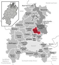
List of natural monuments in Immenhausen

The list of natural monuments in Immenhausen called the in the field of city Immenhausen in Kassel district in Hesse located natural monuments . These are currently trees at 5 locations as well as the two areal natural monuments “The Great Loh” and “The Kampteich”.
Trees
| image | designation | District, location | description | Art | No. |
|---|---|---|---|---|---|
 more pictures |
Linden and chestnut group "Wolfsgarten" with "Friedenseiche 1870/71" |
Holzhausen 51 ° 25 ′ 17.6 ″ N , 9 ° 32 ′ 17 ″ E |
Pedunculate oak in the center of Holzhausen, on Kasseler Straße. This "peace oak" is reminiscent of the Franco-Prussian War from 1870 to 1871 . To the north of the oak, there are 14 winter linden and 3 horse chestnuts in three rows on a green area. Heights: up to 22 m . Planting year : approx. 1875 OSM -Link to the map display: Friedenseiche |
Quercus robur + Tilia cordata + Aesculus hippocastanum |
6.33.401 |
 more pictures |
1 oak |
Holzhausen 51 ° 24 ′ 57.2 ″ N , 9 ° 32 ′ 10.3 ″ E |
Pedunculate oak in the Holzhausen cemetery. The tree stands in the western area of the site, on Kasseler Straße, and impressively marks the entrance there. Trunk circumference: 4.75 m Height: 19 m Planting year: approx. 1755 OSM -Link to the map display: Oak at the cemetery of Holzhausen |
Quercus robur | 6.33.402 |
 more pictures |
1 beech "Triftbuche" |
Holzhausen 51 ° 25 '8.9 " N , 9 ° 32" 39.4 " E |
European beech approx. 250 m east of the outskirts of Holzhausen. The location is the northern edge of a small wooded area to the west of the Osterbach. Trunk circumference: 5.60 m Height: 32 m Planting year: approx. 1720 OSM -Link to the map display: "Trift beech" near Holzhausen |
Fagus sylvatica | 6.33.403 |
 more pictures |
1 oak |
Immenhausen 51 ° 25 ′ 37.3 " N , 9 ° 29 ′ 32.7" E |
Pedunculate oak on the eastern outskirts of Immenhausen. The tree is on the site of a varied playground, with lots of natural vegetation, on the street “Auf der Leimenkuhle”. Trunk circumference: 4.30 m Height: 20 m Planting year: approx. 1885 OSM link to the map display: Oak in Immenhausen |
Quercus robur | 6.33.407 |
 more pictures |
1 oak |
Immenhausen 51 ° 26 ′ 43.5 " N , 9 ° 28 ′ 21.6" E |
Pedunculate oak approx. 1 km north of the outskirts of Immenhausen. The location is a sloping meadow near the Spechtenbeck brook . Trunk circumference: 4.05 m Height: 22 m Planting year: approx. 1885 OSM -Link to the map display: Oak north of Immenhausen |
Quercus robur | 6.33.408 |
Extensive natural monuments
| image | designation | District, location | description | No. |
|---|---|---|---|---|
 more pictures |
The big tan |
Immenhausen 51 ° 25 '54.1 " N , 9 ° 29' 26" E |
Quartzite blocks on the northeastern outskirts of Immenhausen. The stones come from the Oligocene and are located in a wooded area with old trees. The Märchenlandweg hiking trail leads through the area . Area: less than 0.1 ha. OSM link to the map display: "The Great Loh" in Immenhausen |
6.33.405 |
 more pictures |
The camp pond |
Immenhausen 51 ° 25 ′ 58.6 " N , 9 ° 28 ′ 25.8" E |
Pond with reed belt in the north of Immenhausen. In the southeast of the large body of water there is still a small body of water, separated by a dam. Directly to the south is the canalised stream of the Holzkape . The water areas are surrounded by trees and bushes. Paths with benches lead around the water. The area has the character of a local recreation area. Area: approx. 4.57 ha OSM link to the map display: "The Kampteich" in Immenhausen |
6.33.406 |
Web links
Commons : Natural monuments in Immenhausen - collection of images, videos and audio files
supporting documents
- ↑ According to the official cadastre of the Lower Nature Conservation Authority of the district of Kassel and on-site research 2016 - May 2017.
- ↑ a b c d e Information on trunk circumference (if no own measurement), size and planting year according to Rüdiger Germeroth, Horst Koenies, Reiner Kunz: Natural cultural assets - past and future of natural monuments in the Kassel district , publisher: District Committee of the Kassel District, Lower Nature Conservation Authority , Wolfhagen, 2005, Appendix "Trees" p. 186 ff. The year of planting was calculated back using the age estimated there and the year of publication (2005) of the publication.
- ↑ Measurement 2017-02-19 in h = 1.30 m
- ↑ Measurement 2017-02-24 in h = 1.30 m
- ↑ a b Information according to Rüdiger Germeroth, Horst Koenies, Reiner Kunz: Natural cultural assets - past and future of natural monuments in the district of Kassel , publisher: District Committee of the district of Kassel, Lower Nature Conservation Authority, Wolfhagen, 2005, appendix "Extensive natural monuments" p. 162 ff.
Ahnatal | Bad Emstal | Bad Karlshafen | Baunatal | Breuna | Calden | Espenau | Fuldabrück | Fulda Valley | Grebenstein | Habichtswald | Helsa | Hofgeismar | Immenhausen | Kaufungen | Liebenau | Lohfelden | Naumburg | Nieste | Niestetal | Reinhardshagen | Reinhardswald Manor District | Schauenburg | Söhrewald | Trendelburg | Vellmar | Wesertal | Wolfhagen | Zierenberg