List of streets in Eschelbronn
The list of streets in Eschelbronn describes the streets of the municipality of Eschelbronn in the Rhein-Neckar district .
Eschelbronn originally emerged to the west and northwest around the first settlements on today's Schloßplatz. Eschelbronn's road network consists of over 50 official roads and paths. Several streets and addresses are named after the original hallways .
Landesstraße 549 connects to the neighboring communities of Meckesheim and Neidenstein . The center of the village is the market square where Kandelstrasse, Oberstrasse, Neidensteiner Strasse, Schloßstrasse and Bahnhofstrasse meet. While Bahnhofstrasse was the first tarred street in Eschelbronn in 1938, the other streets were paved after 1954 during the tenure of Mayor Philipp Dinkel .
Eschelbronn includes the postcode area 74927.
Legend
The following table gives an overview of the existing roads and some related information. In detail these are:
- Name / location : current name of the street. The location (geoposition) indicates roughly the middle of the street.
- Length : The rounded length of the street.
- Name origin : origin of the name.
- Designation : Time of designation.
- Notes : further information regarding the route, local institutions, the history of the street or historical names.
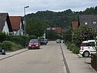
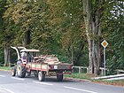
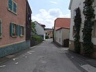
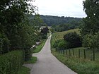
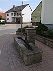
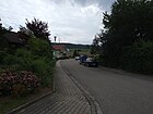
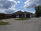
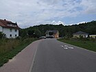
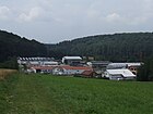
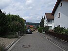
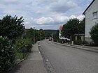
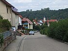
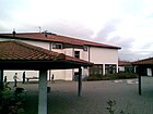
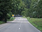
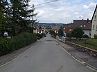
- Image : Image of the street or an adjacent object.
Overview of the streets
| Surname | Length (in meters) |
Origin of name | Emergence | Remarks | image |
|---|---|---|---|---|---|
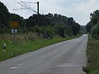
| Alte Meckesheimer Strasse ( location ) | 3300 | Neighboring community of Meckesheim | before 1794 | The Alte Meckesheimer Straße (also known locally as "Meckse Stressl") runs along the Meckesheim – Neckarelz railway to Meckesheim and passes through the Lower Schwarzbachtal nature reserve . The railway line is south of the road. To the north of the road is the Brünnleswald, one of the seven Eschelbronn forest areas. The road was the first direct road connection to the neighboring community.
On a map from 1794 a street with the designation "Straße von Meckesheim" was already noted. However, this led through the neighboring community of Mönchzell . The first plans for the construction of the direct connecting road were made in 1861. In Meckesheim, however, there was no interest in ceding land parts for road construction. On December 14, 1871, the municipality of Eschelbronn submitted an application to the Sinsheim district office, which was also signed by the municipal councils from Neidenstein , Waibstadt , Helmstadt , Neckarbischofsheim , Untergimpern , Obergimpern , Bargen , Daisbach , Spechbach and Flinsbach . After a consultation on January 13, 1872, the district office recommended the construction of a country road between Meckesheim and Eschelbronn. On March 9, 1872, however, the head office of water and road construction in Karlsruhe objected and referred to the construction costs of 25,000 guilders and the new railway line running parallel to the planned connecting road. On February 5 of the following year, the district committee of the Heidelberg district also spoke out against road construction. At the initiative of the state commissioner for the Mannheim, Heidelberg and Mosbach districts on September 18, 1877, the Sinsheim building inspectorate created a new cost plan by estimating 11,500 guilders for the construction of the road. In addition, the interested municipalities agreed to co-finance. A state subsidy applied for by Eschelbronn was rejected by the Ministry of the Interior on February 14, 1881. The road was finally completed around the mid-1890s. With the construction of the bypass in the 1970s, however, it lost its significance at that time. 1981–1982, among other things, an additional water line was laid from the local pumping station to Industriestrasse via Meckesheimer Strasse. In the street is the company Paul Ernst Maschinenfabrik GmbH, which was founded in 1960 and won the Baden-Württemberg Innovation Prize in 1993 and was sold to the Upper Austrian special machine manufacturer Wintersteiger in 2014 . |
|
| Ambelwiesenstrasse ( location ) | 300 | after the field name Ambelwiesen | 1977 | The road leads from Neidensteiner Strasse in the north to Siedlerstrasse in the south and formed the easternmost edge of the settlement area of the Eschelbronn district until the Ambelwiesen II development area was developed in 2020. The Bruchklingengraben runs along the road. It got its name in 1977. | |
| On the Schleifigrain ( location ) | 240 | after the field name Schleifigrain | The road runs as an incline from Industriestrasse to Jahnstrasse. | ||
| Am Seerain ( location ) | 650 | after the field name Seerain | 1988 | The street leads through the new development area opened in 1988 and runs from Alten Meckesheimer Straße to Spechbacher Straße. | |
| Bahnhofstrasse ( location ) | 850 | to the Eschelbronn train station on the Meckesheim – Neckarelz line | Bahnhofstrasse leads from Kandelstrasse, Schloßstrasse and Neidensteiner Strasse on the market square to Spechbacher Strasse and Alten Meckesheimer Strasse. It runs with the Schwarzbachbrücke over the Schwarzbach . The street is one of the oldest streets and the historic center of the municipality. On a map from 1794, the road was still marked with the designation "Fahrweg nach Meckesheim". Formerly there was a village well in front of the Karl-Theodor Stier estate, supplied by the thirstbütten spring.
Bahnhofstrasse is part of the Main-Stromberg-Weg , a 171.5-kilometer long- distance hiking trail that runs through Hesse and Baden-Württemberg. Opposite the train station there was a stone hammering machine to break the broken rock extracted in Kallenberg to the required size and a loading station from which the stones were delivered to the Mannheim cement factory and gravel to the railway administration. After removing the machine, a concrete wall remained at this point. Bahnhofstrasse was canalized to Schulstrasse in 1921 and was the first tarred road in Eschelbronn in 1938. Popularly it was called D Mihlgasse (Mühlengasse) because of the adjacent Ziegler'sche Mühle . Until Landstrasse 549 was completed as a bypass road for Eschelbronn in 1969, the traffic between Schwarzbachtal and Heidelberg and in particular the heavy loads from the cement works in Neckarbischofsheim-Obergimpern and the gravel works in Eschelbronn ran over Bahnhofstrasse and Neidensteiner Strasse. In 1982 the sewer was renewed and enlarged by community workers. The mayor's office in the town hall and the volunteer fire brigade are located at number 1. Towards the exit of the village are the former Ziegler'sche Mühle, where an information board can still be found today, the train station and the Kastanienallee natural monument stretching over approximately 313 meters . |
||
| Berghof ( location ) | 35 | The Berghof is located on Steinbuschweg. | |||
| Bergstrasse ( location ) | 290 | Bergstrasse runs between Friedhofstrasse and Daisbacher Strasse. It leads past the Eschelbronn cemetery . Until the felling in October 2019, the winter linden tree at the cemetery, which has been designated as a natural monument, was next to the road . In the 20th century there was an ice cellar about 20 meters long and probably about 2.80 meters high with a vaulted ceiling for the beer storage of the local breweries. Above ground there was a wooden frame on which a block of ice grew with a water sprinkler in winter, with which the beer was cooled during the warmer seasons. The ice cellar was rebuilt from May 1912 to May 1913 and filled in with the construction of a new cemetery driveway in 1962. The road was equipped with water supply lines in 1949–1951. | |||
| Bed path ( location ) | 500 | after the field name Bettweg | Starting from Bahnhofstrasse, the Bettweg leads partially parallel to Alten Meckesheimer Strasse along the Schwarzbach. On the way is the club house of the small animal breeding club and the " old lime tree " classified as a natural monument and allegedly since 1703 the footbridge over the Schwarzbach, where the legend about the "Eschelbronn footbridge" is said to have occurred. The place also served young people as a swimming area. Until Eschelbronn was connected to the Schwarzbachtalbahn in 1862, this was one of the most important crossroads to the surrounding communities. The old signpost, which was restored in 2006 with funding from Wilfried Wolf and the Heimat- und Verkehrsverein, has been preserved and shows the distance to neighboring towns. In the 1980s, a rainwater retention basin was built at the end of the bed path . In September and October 2015, the bed path with sewer and water pipe connections was renewed. |
||
| Blumenstrasse ( location ) | 130 | The road runs from the Ringstrasse to Industriestrasse. It was equipped with water supply lines in 1949–1951. | |||
| Bodemstrasse ( location ) | 450 | after the field name Bodem | Bodemstrasse leads from Industriestrasse to Oberstrasse. It was built mainly around 1927 and from 1949–1951 it was equipped with water supply lines up to the valley road. In the early 1960s, the street, along with the neighboring streets of Schulstrasse and Ringstrasse, was planted as an avenue with a total of around 30 hawthorn trees as part of the north-western development of the settlement area . | ||
| Brunnengasse ( location ) | 130 | after a village well lying there | before May 31, 1925 | Brunnengasse runs from Oberstrasse to Durstbüttenstrasse and Kandelstrasse. It is one of the oldest streets and the historic center of the municipality. A loudspeaker for the local call system installed in 1950 was attached to a building at the southern end of the street . | |
| Buhäcker ( location ) | 280 | after the field name Buhäcker | The street called Buhäcker runs southwest of the settlement on the Mühlwald. | ||
| Daisbacher Strasse ( location ) | 350 | to the neighboring community of Daisbach | The Daisbacher Straße leads from the Siedlerstraße to the Gührnweg and turns into the Daisbacher Weg. It was equipped with water supply lines in 1949–1951. The house with number 1 housed the former carpenter's trade school from its construction in 1954. From 1965 to 1989 the building was used as a secondary school. |
||
| Daisbacher Weg ( location ) | 750 | to the neighboring community of Daisbach | The Daisbacher Weg is a dirt road. It leads from Gührnweg and Daisbacher Straße to Steinbuschweg towards Daisbach. | ||
| Durstbüttenstrasse ( location ) | 400 | after the field name Durstbütten | 1974 | The street leads from Brunnengasse and Kandelstrasse to Friedhofstrasse. The Durstbütten building area was canalised from 1972 to 1975. At the intersection with Brunnengasse there has been a village well supplied by the Durstbüttenquelle since 1987. | |
| Finkenweg ( location ) | 95 | 1977 | The Finkenweg starts as a dead end from Siedlerstraße. Until 1980 it was called Im Oppenloch . | ||
| Friedhofstrasse ( location ) | 900 | to the Eschelbronn cemetery | The Friedhofstraße leads from the Neugasse out of the village and joins a field path towards Daisbach. The Weihendgrundgraben runs along the road. It is one of the oldest streets and the historic center of the municipality. On a map from 1794 the street was still marked with the name "Fahrweg von Hoffenheim". One of the first five transformer buildings with a tiled roof was located at Friedhofstrasse 21. The road was equipped with water supply lines in 1949–1951. Until 1954, the brick factory of the Maßholder family, which is more than 300 years old, and the last brick factory in Eschelbronn, was located in the street. The street was popularly known as Hinnedraus . There used to be a fountain on the corner of Weißer Berg. Friedhofstraße is part of the Main-Stromberg-Weg , a 171.5-kilometer long- distance hiking trail that leads through Hesse and Baden-Württemberg. A junction from Friedhofstraße leads south up to the cemetery and from there onto Bergstraße. This junction is also called Friedhofstrasse. |
||
| Gartenstrasse ( location ) | 500 | The street runs from Schulstraße to over Schillerstraße. It was mainly built around 1927. Together with Schulstrasse, the area around the street was popularly known as S Neij Stadtvertl (the new district). There is a transformer building at Gartenstrasse 17. | |||
| Goethestrasse ( location ) | 170 | probably after Johann Wolfgang von Goethe | 1980 | Goethestrasse is located in the Lange Äcker settlement area and leads from Jahnstrasse to Oberstrasse. In 1980 it was canalized and provided with a water supply pipe. | |
| Gührnweg ( location ) | 800 | after the field name Gührn | 1977 | The Gührnweg runs from Siedlerstraße to Daisbacher Straße. Partly it is a dirt road. The Oppenloch / Gührn building area was canalised in 1976–1978 and opened up in 1977. | |
| Haideweg ( location ) | 160 | after the field name Haide | 1974 | The Haideweg goes off the steep path. | |
| Häussenäcker ( location ) | after the field name Häussenäcker | The Häussenäcker goes from the Steinbuschweg. | |||
| Hetzenloch ( location ) | 250 | after the field name Hetzenloch | The street called Hetzenloch is a dead end from Bahnhofstrasse and leads to Schaafberg. In 1979, another line was laid there to feed water into the local network. The last of the original five transformer buildings with a tiled roof is located on the street on the Schaafberg near the gravel works. | ||
| Im Erpfel ( location ) | 150 | after the field name Erpfel | 1964 | The street Im Erpfel leads from the Ringstraße to Schleifigrain. It was channeled from 1964 to 1966. Since a canal had to be laid as a receiving water with a diameter of 160 centimeters from Bahnhofstrasse through Industriestrasse and Wiesental into the Schwarzbach, the community borrowed the cost of 1.4 million marks. In 1966, the area was also connected to the public drinking water supply network. There is a public children's playground on the street, which is prepared and maintained by the SPD local association. | |
| In the ground ( location ) | 130 | after the field name reason | The reason runs from Bergstrasse to Kreuzstrasse. After the arrival of several war refugees, the street was the first new housing estate in Eschelbronn and, along with the commuter settlement in Bad Rappenau, was the first to be mentioned in the Sinsheim district . 1949-1951 it was equipped with water supply lines and canalized in the early 1950s. | ||
| In the helmet ( location ) | 140 | after the field name Broad Helmet | The helmet runs from Industriestrasse to Gartenstrasse. | ||
| In the Kirchwiesen ( location ) | 340 | after the field name Untere Kirchwiesen on which there was once a wooden church | The street was laid out in the 2000s and runs from Bahnhofstrasse to Neidensteiner Strasse. Almost all building sites previously owned by the municipality had been sold by 2015. | ||
| Industriestrasse ( location ) | 1400 | industrial and commercial enterprises located there | Industriestraße leads from Bahnhofstraße on the outskirts into the industrial area and ends there as a dead end. It was originally named Helmetweg after the hallway Im Helmet . At the beginning of the street was one of the first five transformer buildings with a tiled roof, which was demolished in 1988 and replaced by a one-story container. In 1976 it was extended for the first time for other companies and in 1988 it was extended to the adjacent forest. | ||
| Jahnstrasse ( location ) | 350 | Jahnstrasse leads from Bodemstrasse to Schillerstrasse. It was equipped with water supply lines from 1955 to 1956 up to the Ringstrasse. In 2015 plans were made for the renewal of Jahnstrasse and Ringstrasse for an estimated 500,000 euros. | |||
| Kandelstrasse ( location ) | 210 | probably after the drainage name Kandel | Kandelstrasse leads from Bahnhofstrasse, Neidensteiner Strasse and Schloßstrasse on the market square past the Protestant church to Brunnengasse and Durstbüttenstrasse. It is one of the oldest streets and the historic center of the municipality. On a map dated May 31, 1925, it is still listed as "Kandelgasse". Formerly there was a village well supplied by the thirstbütten spring in the street. It was dismantled as the last village well in 1952/1953 during the renovation of the road and canalization of the village ditch (Dolengraben).
The Laule bakery with a house and barn once existed at Kandelstrasse 7. After its demolition, the Eiscafe Reichert was opened in a new building in 1965, which was initially continued by her husband after the owner's death and was run by a new owner as Pizzeria Da Tina from 1988 to 1992. Her sister ran the Pizzeria Salento there from 1994 to 2000. In 2015, an electrical engineering office for measurement and control technology was opened in the building. Kandelstrasse is part of the Main-Stromberg-Weg , a 171.5-kilometer long- distance hiking trail that leads through Hesse and Baden-Württemberg. |
||
| Kreuzstrasse ( location ) | 140 | The road leads from Rosengartenstrasse to Lerchenweg. It was equipped with water supply lines in 1949–1951. | |||
| Long fields ( location ) | 400 | after the field name Langeäcker | 1959 | The street goes off Jahnstraße, runs in a horseshoe shape and meets it again. The area was developed in 1959 as part of expansion work for the growing number of the population and the increasing need for private homes for small families, connected to the public drinking water supply network and canalized. | |
| Lerchenweg ( location ) | 150 | The St. Josef Church is located on Lerchenweg . It runs from Daisbacher Straße to Siedlerstraße and is only partially passable. It was equipped with water supply lines from 1955 to 1956. | |||
| Mühlweg (Wingertsberg) ( location ) | 350 | Schuhmannsmühle | The Mühlweg starts from Bahnhofstraße, runs next to the Schwarzbach and ends as a dead end. The area was developed in 1959 as part of expansion work for the growing number of the population and the increasing need for homes for small families and a water pipe was laid. Around 2015, the protected beaver spread over the Elsenz on the Schwarzbach, and left traces of willows, alders and poplars along the banks of the Mühlweg. | ||
| Neidensteiner Strasse ( location ) | 950 | to the neighboring municipality of Neidenstein | Neidensteiner Straße connects the communities of Eschelbronn and Neidenstein and merges into Eschelbronner Straße on Neidensteiner district. It leads from the market square out of the community and turns into Eschelbronner Straße in Neidenstein. From the Neugasse / In den Kirchwiesen intersection, there is a shared walking and cycling path in the right-hand direction. The street is one of the oldest streets and the historic center of the municipality. In 1962 it was connected to the public drinking water supply network.
Until Landstrasse 549 was completed as a bypass road for Eschelbronn in 1969, the traffic between Schwarzbachtal and Heidelberg and in particular the heavy loads from the cement works in Neckarbischofsheim-Obergimpern and the gravel works in Eschelbronn ran over Neidensteiner Strasse and Bahnhofstrasse. Neidensteiner Straße is part of the Kraichgau-Stromberg Castle Tour , an approximately 52 kilometer long regional cycle path. The New Apostolic Church is located at number 37. |
||
| Neugasse ( location ) | 300 | Neugasse leads from Neidensteiner Straße to Friedhofstraße. It is one of the oldest streets and the historic center of the municipality. It was popularly known as S Werdeberjisch (the Württemberg quarter). Formerly there was a village well on the corner of Siedlerstrasse, supplied by the Durstbüttenquelle. One of the first five transformer buildings with a tiled roof was also located in Neugasse. In 1951, the village ditch was overturned for the expansion of the sewer system in the Im Grund development area . In 1962 it was connected to the public drinking water supply network. On the street there was a public cattle scale ("old Waghäusel"), which was used as a tool shed for the volunteer fire brigade after it was taken out of service. At the municipal council meeting on January 28, 2014, it was decided to examine the demolition of the building instead of a renovation, which was later implemented. In addition, a loudspeaker for the local call system installed in 1950 was attached to the back wall of a residential building . |
|||
| Oberstrasse ( location ) | 650 | Oberstrasse leads from Kandelstrasse by the listed Evangelical Church and the old rectory on the market square to Zuzenhäuser Strasse and is one of the oldest streets in Eschelbronn. The oldest house in the community is also located here at number 12 . On a map from 1794, the street was still noted as the "Fahrweg von Zuzenhausen". Popularly it was also called Ewwergasse (Obergasse). The Oberstraße is part of the Kraichgau-Stromberg Castle Tour , an approximately 52 kilometer long regional cycle path. Loudspeakers for the local call system installed in 1950 were attached to houses numbered 23 and 15 . The latter no longer exists there. |
|||
| Ringstrasse ( location ) | 650 | ring-shaped course | The Ringstrasse leads from Industriestrasse to Jahnstrasse and Lange Äcker. Between 1949 and 1951, it was equipped with water supply lines from Schulstraße to Gartenstraße and in 1957 from Gartenstraße to Jahnstraße. In the early 1960s, the street, along with the adjacent streets Bodemstrasse and Schulstrasse, was planted as an avenue with a total of around 30 hawthorn trees as part of the north-western development of the settlement area . In 2015, plans were made for a renewal of the Ringstrasse and the adjacent Jahnstrasse for an estimated 500,000 euros. | ||
| Rosengartenstrasse ( location ) | 450 | Rosengartenstrasse runs from Siedlerstrasse to Südendstrasse. It was equipped with water supply lines in 1949–1951. When the Rosengartenstrasse and Siedlerstrasse were canalized in the early 1950s, existing springs caused the pipe trench to slide in several times. The resulting additional costs had to be paid by the municipality by taking out a loan. | |||
| Schillerstrasse ( location ) | 110 | probably after Friedrich Schiller | 1980 | The street is located in the Lange Äcker settlement area and connects Gartenstraße with Jahnstraße. It was canalized in 1980 and provided with a water supply pipe. | |
| Schlossstrasse ( location ) | 400 | after the Eschelbronn Castle | Schloßstraße runs from Neidensteiner Straße, Kandelstraße and Bahnhofstraße on the market square to Siedlerstraße. Eschelbronn Castle was once located on the road, and later the palace. Formerly in front of the Reichert glass factory, later the Maßholder residential building, there was a village well supplied by the Durstbütten spring. In 1921 the street was canalized and in 1982 the canal was renewed and enlarged by community workers. In 1962 the road was connected to the public drinking water supply network. On the street is the sports and culture hall built in 1973, for which the water pipe was extended in the year of construction, and a transformer building on the adjacent Schlossplatz. On a map dated May 31, 1925, the street is marked as "Schloßgasse". |
||
| Schulstrasse ( location ) | 550 | Old elementary school | 1914 | Schulstrasse leads from Bahnhofstrasse to Ringstrasse. The old school building , which today houses the Eschelbronn carpentry museum, is on the street . Initially, the road was a dirt road leading from Bahnhofstrasse or Oberstrasse. After the construction of the school, which was initially on the outskirts, it was expanded into a paved road with sidewalks at the Grand Ducal District Office in Sinsheim in 1914 at the request of several residents and their spokesman, Tüncher's Adam Butschbacher . For this purpose, the adjacent land was partly bought up by the municipality. The expansion of Schulstrasse was the first expansion of the historic city center. Together with Gartenstraße, the area around the street was popularly known as S Neij Stadtvertl (the new district). In the Second World War the house was destroyed with the number 47 in a bombing raid. The attack was carried out by the Allies on March 13, 1945 on the adjacent train station and the bomb was prematurely dropped when approaching from the west. A loudspeaker from the local call system installed in 1950 was attached to house number 20 . In the early 1960s, the street, together with the adjacent streets Bodemstrasse and Ringstrasse, was planted as an avenue with a total of around 30 hawthorn trees as part of the north-western development of the settlement area . There used to be a fountain opposite the school building entrance. From there there was an unofficial connection to Oberstrasse with the so-called “Löwenwirtgängel”. In the 1960s, a kiosk for confectionery was operated in Schulstrasse, the owner of which was known as "Zucker-Sanne" and which was driven through the streets as the village original during parish parades. In 2019 there were plans to renew the road construction, water supply and drainage systems of part of the road. |
|
| Siedlerstrasse ( location ) | 600 | 1937 | The Siedlerstraße runs from Neugasse to Ampelwiesenstraße and continues there on a dirt road. It was created by the development and expansion of the water supply in 1937. It was popularly known as S Obbeloch because of its location in the Oppenloch corridor . Formerly there was a village well on the corner of Neugasse, supplied by the Durstbütten spring. During the canalization of Siedlerstrasse and Rosengartenstrasse in the early 1950s, existing springs caused the pipe ditch to slide in several times. The resulting additional costs had to be paid by the municipality by taking out a loan. From March 17, 2014, the street, sidewalks, sewer and water pipes were completely renewed and empty pipes and a faster internet line were laid. The renovation work was carried out by a company from Mosbach, which had previously also renovated Straße Im Grund. At the intersection with Schloßstraße and Finkenweg you will find the Schlosswiesenschule at number 19, and at number 26 there is a transformer building. | ||
| Spechbacher Strasse ( location ) | 1000 | to the neighboring municipality of Spechbach | The Spechbacher Straße leads from the Bahnhofstraße in the direction of Spechbach and Epfenbach and is part of the Kreisstraße 4279. It turns into the street Bei der Neumühle. 1981–1982, among other things, an additional water pipe was laid from the local pumping station to Industriestrasse via Spechbacher Strasse. | ||
| Rise ( location ) | 150 | steep path ( path ) | 1974 | The path runs from Oberstraße to Durstbüttenstraße. | |
| Steinbuschweg ( location ) | 650 | The Steinbuschweg is a field path that goes off the Südendstraße and meets the Daisbacher Weg. | |||
| Südendstrasse ( location ) | 170 | Southern end of the settlement area | The Südendstraße leads from Daisbacher Weg to Steinbuschweg. It was equipped with water supply lines from 1955 to 1956. | ||
| Talstrasse ( location ) | 100 | The Talstraße connects the Bodemstraße with the Blumenstraße. It was equipped with water supply lines in 1949–1951. | |||
| Vorderer Weisseberg ( location ) | 300 | The mostly uninhabited field path Vorderer Weisseberg runs next to the Eschelbronn cemetery from Bergstrasse to Steinbuschweg. There is the open-air museum Sellemols Agger , which is open to the public . Since 1974/1974 a water supply line has been running along the way from the local network to the elevated reservoir in the Weißer Berg district. |
|||
| Wiesenstrasse ( location ) | 350 | The street runs from Industriestrasse to Oberstrasse. It was connected to the public drinking water supply network in 1962. | |||
| Wiesentalweg ( location ) | The Wiesentalweg runs from Bahnhofstraße along the Schwarzbach in a south-westerly direction. It is not officially dedicated and is used as a cycle path. However, a cycle path sign has been removed by the community. There are several allotment gardens along the way. A bridge connects the Wiesentalweg with the Bettweg, which partly runs parallel on the other bank of the Schwarzbach.
The Wiesentalweg is part of the Main-Stromberg-Weg , a 171.5-kilometer long- distance hiking trail that leads through Hesse and Baden-Württemberg. In April 2014, the condition of the path was criticized at a local council meeting. In addition, the allotment garden owners' cars parked on the way would lead to vehicles driving by over the adjacent meadows and damaging them. |
||||
| Wingertsberg ( location ) | 1000 | after the field name Wingertsberg | The road on Wingertsberg leads, starting from the level crossing on Bahnhofstrasse, about a thousand meters along the Meckesheim – Neckarelz railway in the direction of Waibstadt. On May 18, 2015, shortly after 5 p.m., the extension of a furniture store on Wingertsberg caught fire. It could be extinguished by the Eschelbronn volunteer fire brigade. | ||
| Zuzenhäuser Strasse ( location ) | 550 | to the neighboring municipality of Zuzenhausen | Zuzenhäuser Straße is a dirt road that leads from Oberstraße towards Zuzenhausen. Colloquially, the street is also called "Promilleweg". From 1958 to 1975/76 the former quarry in the street in Gewann Pfaffengrund served as a garbage dump and was then covered and planted. |
Corridors and districts
- Ambelwiesen
- Ant blade
- Beckershälden
- Bekershelden
- Bed path
- Bodem
- Brute blade
- Custom hole
- Breaking blade
- Butzenrain
- Daisbacherweg
- Daisberg
- Dickmanns painting
- Thirst laid paper
- Eichwiesen
- Epfenbacherweg
- Apples
- Dark ground
- Wife hole
- Frohnau
- Geisloch
- Smooth meadows
- Great gallows mountain
- reason
- Guhrn
- Haide
- Hare jump
- Blow
- Häussenäcker
- Hetzenloch
- Behind the mill
- High landmark
- Chicken field
- In the Au
- Kallenberg
- Small gallows mountain
- Koppenberg
- Herb garden
- Cowhole
- Long fields
- Lattingäcker
- Arbor tree
- Tufts of men
- Meckesheimerberg
- Meckesheimer reason
- Mönchzellerberg
- Garbage
- nightingale
- Neidensteiner Weg
- Neurott
- Above the Wingertsberg
- Above the Frohnwiese
- Above the parish meadow
- Upper Kirchwiesen
- Oppenloch
- Pfaffengrund
- rose Garden
- Schaafberg
- Abrasive grain
- lock
- Stable bracket
- Stone bush
- Sparrow tree
- Trippelberg
- Under the bridge
- Under the parish meadow
- Lower Kirchwiesen
- Cattle drive
- Car drives
- Tub clusters
- Soft garden
- Pond
- Vineyards
- Wingertsberg
- Wingerts Gardens
- Line
- Goat huts
- Interest reason
- Between the plates
- Between the woods
Web links
- Street list of Eschelbronn at Strassenweb.de (from April 25, 2013)
Individual evidence
- ↑ Wilfried Wolf: Eschelbronn in post-war Germany in 1200 years Eschelbronn, 789–1989 , p. 307 ff.
- ↑ Ordinance of the Karlsruhe regional council on the nature reserve "Unteres Schwarzbachtal"
- ↑ Joachim Friedel: "100 years of Meckse Stressl" in Howwl , home page of the carpenter's village Eschelbronn, No. 5, p. 20 ff.
- ↑ a b c d e f g h i j k l m n o p q r s t u v w x y z aa ab ac ad ae af ag ah ai aj ak al am an ao ap aq Helmut Schifferdecker: supply and Disposal facilities in 1200 years of Eschelbronn, 789–1989 , p. 327 ff.
- ↑ Eschelbronn: Austrians are "serious" about taking over the company ( memento of the original from December 22, 2014 in the Internet Archive ) Info: The archive link was inserted automatically and has not yet been checked. Please check the original and archive link according to the instructions and then remove this notice. , Rhein-Neckar-Zeitung from December 22, 2014
- ↑ a b c d Main-Stromberg-Weg | Vacation country Baden-Wuerttemberg. Retrieved June 21, 2020 .
- ^ Reply from the community of Eschelbronn to 14 questions from the Sinsheim Health Department from January 28, 1938, printed in 1200 Years Eschelbronn, 789–1989 , p. 341
- ↑ a b c d e f g Howwl No. 26, Heimatblatt Schreinerdorf Eschelbronn, March 2005, p. 12 f.
- ^ The "greatest structural event of the century" , Rhein-Neckar-Zeitung of January 5, 2020
- ↑ Kastanienallee at strassenkatalog.de
- ↑ Eschelbronn: With a hop into the cool water of the Schwarzbach , Rhein-Neckar-Zeitung from July 25, 2015
- ↑ Helmut Stier: Memories of the Eiskeller in Howwl No. 26, Heimatblatt des Schreinerdorf Eschelbronn, 2005, p. 38 ff.
- ↑ Discover Elsenz and Schwarzbachtal. Topic sheet - mills, meadows, fauna and flora ( page no longer available , search in web archives ) Info: The link was automatically marked as defective. Please check the link according to the instructions and then remove this notice.
- ↑ Eschelbronn: With a hop into the cool water of the Schwarzbach , Rhein-Neckar-Zeitung from July 25, 2015
- ↑ Eschelbronn municipality: Sights . (PDF) Elsenztal Municipal Administration Association, p. 10 , accessed on September 19, 2014 .
- ↑ Howwl No. 12, Heimatblatt des Schreinerdorf Eschelbronn, 1996, p. 29
- ↑ a b Eschelbronn: Only the long journey annoys the new local chief , Rhein-Neckar-Zeitung of October 14, 2015
- ↑ a b c d e Heimat- und Verkehrsverein: Eschelbronn - Deine Heimat , 1957, The expansion of our place in the last three decades, p. 120
- ↑ a b c http://www.rnz.de/KraichgauEschelbronn/00_20120801095040_102420915_Weg_mit_den_Baeumen_.php ( page no longer available , search in web archives ) Info: The link was automatically marked as defective. Please check the link according to the instructions and then remove this notice. Rhein-Neckar-Zeitung from August 1, 2012
- ↑ .... do isch em de Gaul durchgange - Mrs. Holzapfel tells in Howwl , Heimatblatt des Schreinerdorf Eschelbronn, No. 5, p. 3
- ↑ 1200 years of Eschelbronn, 789–1989, SPD local association Eschelbronn, p. 387 f.
- ↑ Wilfried Wolf: Eschelbronn in post-war Germany in 1200 years Eschelbronn, 789–1989 , p. 307 ff.
- ↑ Eschelbronn: City Hall chief Siesing wants to listen to the citizens , Rhein-Neckar-Zeitung from June 18, 2015
- ↑ Official Gazette of the Elsenztal Local Administration Association. Local government association Elsenztal, October 30, 2015, accessed on June 6, 2020 .
- ↑ The beaver is now gnawing his way up the Schwarzbach . ( rnz.de [accessed on February 5, 2017]).
- ↑ The beaver is now gnawing his way up the Schwarzbach . ( rnz.de [accessed on February 5, 2017]).
- ^ The "greatest structural event of the century" , Rhein-Neckar-Zeitung of January 5, 2020
- ↑ Kraichgau-Stromberg: Castle Tour | Vacation country Baden-Wuerttemberg. Retrieved June 21, 2020 .
- ^ New Apostolic Church Eschelbronn
- ↑ Gemeindeverwaltungsverband Elsenztal Official Journal ( Memento of the original from April 19, 2014 in the Internet Archive ) Info: The archive link has been inserted automatically and has not yet been checked. Please check the original and archive link according to the instructions and then remove this notice. , February 28, 2014
- ↑ Das Schreinerdorf Eschelbronn, residents brochure on the occasion of the 1200 anniversary, historical review, 1989, p. 4
- ↑ Kraichgau-Stromberg: Castle Tour | Vacation country Baden-Wuerttemberg. Retrieved June 21, 2020 .
- ↑ Eschelbronn: City Hall chief Siesing wants to listen to the citizens , Rhein-Neckar-Zeitung from June 18, 2015
- ↑ Wilfried Wolf: Eschelbronn in post-war Germany in 1200 years Eschelbronn, 789–1989 , p. 309
- ↑ Howwl , Heimatblatt des Schreinerdorf Eschelbronn, No. 10, p. 8 ff.
- ↑ Impressions of Kerwe parades from different years in 1200 Years Eschelbronn, 789–1989 , p. 327 ff.
- ↑ That is investing Eschelbronn 2019 , Rhein-Neckar-Zeitung of April 3, 2019
- ↑ Gemeindeverwaltungsverband Elsenztal Official Journal ( Memento of the original from April 19, 2014 in the Internet Archive ) Info: The archive link has been inserted automatically and has not yet been checked. Please check the original and archive link according to the instructions and then remove this notice. , March 21, 2014
- ↑ Gemeindeverwaltungsverband Elsenztal Official Journal ( Memento of the original from April 19, 2014 in the Internet Archive ) Info: The archive link has been inserted automatically and has not yet been checked. Please check the original and archive link according to the instructions and then remove this notice. , March 21, 2014
- ↑ Report from the municipal council meeting of April 1, 2014 ( page no longer available , search in web archives ) Info: The link was automatically marked as defective. Please check the link according to the instructions and then remove this notice.
- ^ [Eschelbronn: Fire in a furniture store extension] , Rhein-Neckar-Zeitung from May 19, 2015

