
Londonderry (Vermont)
| Londonderry | |||
|---|---|---|---|
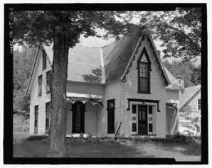 Whitman House in South Londonderry, Vermont |
|||
| Location in Vermont | |||
|
|||
| Basic data | |||
| Foundation : | April 20, 1780 | ||
| State : | United States | ||
| State : | Vermont | ||
| County : | Windham County | ||
| Coordinates : | 43 ° 12 ′ N , 72 ° 49 ′ W | ||
| Time zone : | Eastern ( UTC − 5 / −4 ) | ||
| Residents : | 1,769 (as of 2010) | ||
| Population density : | 19.1 inhabitants per km 2 | ||
| Area : | 92.9 km 2 (approx. 36 mi 2 ) of which 92.4 km 2 (approx. 36 mi 2 ) is land |
||
| Height : | 584 m | ||
| Postal code : | 05155 | ||
| Area code : | +1 802 | ||
| FIPS : | 50-40225 | ||
| GNIS ID : | 1462136 | ||
| Website : | londonderryvt.org | ||

Londonderry is a town in Windham County in the state of Vermont in the United States with 1,769 inhabitants (according to the 2010 census).
geography
Geographical location
Londonderry is in the northwest corner of Windham County in the eastern foothills of the Green Mountains . In the northwest, the Utley Brook flows into the West River . This winds in a north-south direction through the area of the town; State Route 100 partly follows its course . The waters of Lowell Lake and Lily Pond are in the northeast of the town.
Neighboring communities
All distances are given as straight lines between the official coordinates of the places from the 2010 census.
- North: Weston , 1.9 mi
- Northeast: Andover , 5.5 mi
- East: Windham 6.5 miles
- South: Jamaica , 2.7 mi
- Southwest: Winhall , 12 mi
- Northwest: Peru , 9.3 mi
climate
The mean mean temperature in Londonderry is between −8 ° C (16 ° Fahrenheit ) in January and 18.3 ° C (65 ° Fahrenheit) in July. The snowfall between October and May is up to half a meter (17 inches ) about twice as high as the mean snow depth in the USA. The daily sunshine duration is at the lower end of the range in the USA.
history

Londonderry was first founded in 1770 under the name "Kent" by the Province of New York on behalf of James Rogers . The area of today's Town Windham also belonged to Town Kent. The Vermont Republic legislature reassigned the area and Londonderry was established on April 20, 1780. Londonderry was named after Londonderry (New Hampshire) .
Londonderry had its greatest population in 1860 with 1,367 inhabitants; then the population began to decline, which was stopped by the opening of the ski area. In 1980 Londonderry was home to 1,510 people.
A weekly newspaper called The Londonderry Sifter was founded in 1883 by George T. Shanks , who was known in Londonderry as "Sifter John". He was the editor and author of the newspaper until 1903; it was published until the mid-1920s. In the early years the town also had sawmills, flour mills, workshops and a tannery.
The floods of the New England hurricanes in 1927 and 1938 caused great damage. In 1975, two F-111 fighter planes crashed over Londonderry.
Religions
Almost 69% of Londonderry residents do not belong to any religious community, around 20% are Catholic and around 10% are Protestants.
Population development
| Census Results - Town of Londonderry, Vermont | ||||||||||
|---|---|---|---|---|---|---|---|---|---|---|
| year | 1800 | 1810 | 1820 | 1830 | 1840 | 1850 | 1860 | 1870 | 1880 | 1890 |
| Residents | 330 | 637 | 958 | 1302 | 1216 | 1274 | 1367 | 1252 | 1154 | 1010 |
| year | 1900 | 1910 | 1920 | 1930 | 1940 | 1950 | 1960 | 1970 | 1980 | 1990 |
| Residents | 961 | 962 | 911 | 799 | 859 | 953 | 898 | 1037 | 1510 | 1506 |
| year | 2000 | 2010 | 2020 | 2030 | 2040 | 2050 | 2060 | 2070 | 2080 | 2090 |
| Residents | 1709 | 1769 | ||||||||
Culture and sights
Parks

The Lowell Lake State Park was established in 1981, 83.8 than the state of Vermont hectares (207 acres ) of the estate of Arline White Gardner bought up on the south end of Lowell Lakes. The area includes a dam and cemetery, as well as a boat ramp. In 1996, an additional 62.3 hectares (154 acres) were added with the help of the Vermont Land Trust . There is a former summer camp in this area. The park encompasses most of the lakeshore as well as some wetlands.
traffic
Vermont State Route 100 crosses Londonderry in a north-south direction from Jamaica and Weston in the south to Weston in the north, and Vermont State Route 11 crosses the town in an east-west direction from Windham in the east to Peru in the west. The Brattleboro – South Londonderry railway runs to South Londonderry.
Public facilities
The Grace Cottage Hospital in Townshend is the nearest hospital.
education
Londonderry is part of the Bennington-Rutland Supervisory Union with Danby, Dorset, Langrove, Manchester, Mt. Tabor, Pawlet, Peru, Rupert, Sunderland, Weston and Winhall
The Flood Brook School is a Elementary-Middle School with classes from pre-kindergarten through eighth grade. Around 270 pupils attend the school. They come from the town of Londonderry and the surrounding towns of Peru, Landgrove and Weston. Londonderry is part of the Windsor Southwest Supervisory Union.
In Londonderry, the South Londonderry Library is available to residents as a public library. It was founded in February 1902 in the family home of Judge Addison J. Cudworth . Today it is in South Londonderry.
Personalities
sons and daughters of the town
- Harrison Henry Atwood (1863–1954), politician
- Ernest Gibson Sr. (1871-1940), politician
literature
- Zadock Thompson: History of Vermont, natural, civil and statistical, in Three Parts . Part 3. Chauncey Goodrich, Burlington 1842, p. 105 f . ( Digitized version ).
Web links
- Homepage of Londonderry
- Profile of the municipality on the official portal www.Vermont.gov
- Entry on VirtualVermont (English) ( Memento from March 26, 2017 in the Internet Archive )
Individual evidence
- ^ Londonderry in the United States Geological Survey's Geographic Names Information System , accessed May 17, 2016
- ↑ Population data from the 2010 US Census in the American Factfinder
- ↑ Coordinates of the locations of the Census Authority 2010
- ↑ Climate, school and employment data at www.City-Data.com (English)
- ↑ a b c d About Londonderry. In: londonderryvt.org. Retrieved May 17, 2016 .
- ↑ Essay on the “Londonderry Sifter” , chroniclingamerica.loc.gov, accessed on May 18, 2016.
- ↑ Harro Ranter: ASN Aircraft accident 03-FEB-1975 General Dynamics F-111A 68-0280. In: aviation-safety.net. Retrieved May 17, 2016 .
- ↑ Londonderry, Vermont (VT 05155) profile: population, maps, real estate, averages, homes, statistics, relocation, travel, jobs, hospitals, schools, crime, moving, houses, news, sex offenders. In: city-data.com. www.city-data.com, accessed on May 17, 2016 .
- ↑ Population 1800–2010 according to census results
- ↑ Vermont State Parks - Lowell Lake State Park. In: vtstateparks.com. Retrieved May 17, 2016 .
- ^ Bennington-Rutland Supervisory Union , accessed July 26, 2017
- ^ Haiku Learning: FBS: About Flood Brook. In: haikulearning.com. brsu.haikulearning.com, accessed May 17, 2016 .
- ^ South Londonderry Free Library. In: londonderryvt.org. Retrieved May 17, 2016 .
| towns |
Athens | Brattleboro | Brookline | Dover | Dummerston | Grafton | Guilford | Halifax | Jamaica | Londonderry | Marlboro | Newfane | Putney | Rockingham | Somerset | Stratton | Townshend | Vernon | Wardsboro | Westminster | Whitingham | Wilmington | Windham |
 |
| villages |
Bellows Falls | Jacksonville | Newfane | Saxtons River | Westminster |
|
| CDPs |
Brattleboro (CDP) | North Westminster (CDP) | Putney (CDP) | West Brattleboro (CDP) | Wilmington (CDP) |
|
| More settlements |
Algiers | Cambridgeport | East Dover | South Newfane | West Dummerston | West Halifax | West Wardsboro | Williamsville |