Nockhöfe
| Nockhöfe (location component ) | ||
|---|---|---|
|
|
||
| Basic data | ||
| Pole. District , state | Innsbruck-Land (IL), Tyrol | |
| Judicial district | innsbruck | |
| Pole. local community | mothers | |
| Locality | mothers | |
| Coordinates (K) | 47 ° 13 '4 " N , 11 ° 21' 17" E | |
| height | 1200 m above sea level A. | |
| Building status | 8 (addresses 2015 ) | |
| Post Code | 6162 mother | |
| Statistical identification | ||
| Counting district / district | Mother (70331 000) | |
| Source: STAT : index of places ; BEV : GEONAM ; TIRIS ;
(K) Coordinate not official
|
||
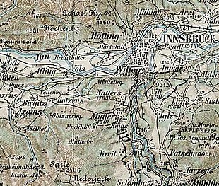
The Nockhöfe are located in the Tyrolean Inn Valley and part of the municipality of Mutters in the Innsbruck-Land district .
geography
The Nockhöfe are located 7½ kilometers southwest of Innsbruck city center, 2 kilometers west above the municipal capital of Mutters . They are located above the southwest low mountain range and the entrance to the Wipptal at around 1200 m above sea level. A. Height at the shoulder of the Saile (Nockspitze) ( 2404 m above sea level ).
About 10 buildings belong to the location (addresses Nockhofweg ). The two old farms are the Untere Nockhof (approx. 1160 m above sea level ) and the Obere Nockhof (today Almgasthaus, approx. 1260 m above sea level ).
The houses can be reached from Mutters via the Nockhofweg and the Muttereralmbahn (only uphill), and also from Neu-Götzens on the forest and hiking trails .
| Neu-Götzens (Gem. Götzens ) | mothers | |

|
||
| Mutterer Alm | Raitiser Alm | Scheipenhof |
History, infrastructure and sights

The Nockhöfe are probably named after the Nockspitze (today mostly Saile) - Nock is an old mountain name that stands for rock peaks here. They are already listed as a cam on the Anich maps from 1765 and 1774, the Atlas Tyrolensis , and have always been considered a separate district. Originally there were three farms here, above were the Siltenschmied and, towards the wide valley of the Mühlbach , the Inethöfe , which no longer exist today.
The farms were already popular as a place to relax in the 1840s because of their healing spring, and offered “moderate accommodation”, but a “healing bath in the mountain air and abundance of herbs” and a “refreshing view”. The listed Obere Nockhof Chapel also dates from the second half of the 19th century .
In 1953 the Muttereralmbahn was built via the Nockhöfe to the Mutterer Alm (new construction in 2006). Today the Untere Nockhof is still managed, the Obere Nockhof an alpine inn , the other houses are holiday homes.
Web links
literature
- Eduard Widmoser: Tirol A to Z. Südtirol-Verlag, 1970, Nockhöfe , p. 593, column 2 f.
Individual evidence
- ↑ A connection with the Ampasser peasant family of the Nocker , who were mentioned as early as 1471, appears unclear.
- ^ Historical maps of Tyrol .
- ^ Nockhöfe , in the history database of the association "fontes historiae - sources of history"
- ^ Eduard Widmoser: Tirol A to Z. Südtirol-Verlag, 1970, Mutters , p. 562.
- ↑ a b c Beda Weber: Handbook for travelers in Tyrol. Verlag Wagner, 1842, p. 74 ( Google eBook, full view ; quotations ibid).
- ↑ For example in the Special Map of the Austro-Hungarian Monarchy , 1878, scale 1: 75,000; Layer in historical maps of Tyrol
- ↑ The Austrian map leads this today below, on the hiking trail from Mutters up to about 1040 m above sea level. A.
- ↑ Court Chapel, Chapel of St. Maria, Marienkapelle, Obere Nockhofkapelle. In: Tyrolean art register . Retrieved November 15, 2015 .

