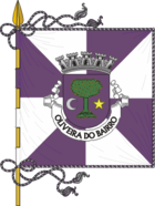
Oliveira do Bairro
| Oliveira do Bairro | ||||||
|---|---|---|---|---|---|---|
|
||||||
| Basic data | ||||||
| Region : | Centro | |||||
| Sub-region : | Aveiro Region | |||||
| District : | Aveiro | |||||
| Concelho : | Oliveira do Bairro | |||||
| Coordinates : | 40 ° 31 ′ N , 8 ° 30 ′ W | |||||
| Residents: | 6250 (as of June 30, 2011) | |||||
| Surface: | 22.55 km² (as of January 1, 2010) | |||||
| Population density : | 277 inhabitants per km² | |||||
| Postal code : | 3770 | |||||
| politics | ||||||
| Website: | www.jf-oliveiradobairro.pt | |||||
| Oliveira do Bairro district | ||||||
|
||||||
| Residents: | 23,028 (as of June 30, 2011) | |||||
| Surface: | 87.32 km² (as of January 1, 2010) | |||||
| Population density : | 264 inhabitants per km² | |||||
| Number of municipalities : | 4th | |||||
| administration | ||||||
| Administration address: | Câmara Municipal de Oliveira do Bairro Praça do Município Ed. Paços do Concelho 3770-851 Oliveira do Bairro |
|||||
| President of the Câmara Municipal: | Mário João Ferreira da Silva Oliveira ( PSD ) | |||||
| Website: | www.cm-olb.pt | |||||
Oliveira do Bairro ( Portuguese for: olive tree of the district) is a municipality and city in Portugal with 6250 inhabitants (as of June 30, 2011).
history
Celtiberians settled in the district area, today's municipality of Mamarrosa . Finds show the presence of the Romans in the present-day communities of Palhaça and Bustos . The current location is documented for the first time in a deed of donation from the year 922, under the name Ulveira . Oliveira do Bairro received its first city rights in 1514 by King Manuel I , who elevated the place to a vila (small town). In 1836 it became an independent district ( concelho ). In 2003 Oliveira do Bairro was elevated to a city ( Cidade ).
administration
The circle
Oliveira do Bairro is the seat of a district of the same name. The neighboring districts are (starting clockwise in the north): Aveiro , Águeda , Anadia , Cantanhede and Vagos .
With the territorial reform in September 2013 , the municipalities ( Freguesias ) Bustos , Troviscal and Mamarrosa were combined to form the new municipality União das Freguesias de Bustos, Troviscal e Mamarrosa . Since then, the district has consisted of the following four municipalities:
| local community | Population (2011) |
Area km² |
Density of population / km² |
LAU code |
|---|---|---|---|---|
| Bustos, Troviscal e Mamarrosa | 6,429 | 28.42 | 226 | 011407 |
| Oiã | 7,722 | 26.32 | 293 | 011403 |
| Oliveira do Bairro | 6,250 | 22.55 | 277 | 011404 |
| Palhaça | 2,627 | 10.03 | 262 | 011405 |
| Oliveira do Bairro district | 23,028 | 87.32 | 264 | 0114 |
Population development
| Population in Oliveira do Bairro County (1801–2011) | |||||||||
|---|---|---|---|---|---|---|---|---|---|
| 1801 | 1849 | 1900 | 1930 | 1960 | 1981 | 1991 | 2001 | 2011 | |
| 1939 | 5086 | 9540 | 14,362 | 16,699 | 17,517 | 18,660 | 21,164 | 23,028 | |
Municipal holiday
- Ascension of Christ
Town twinning
traffic
Long-distance transport
Oliveira do Bairro has its own train station on the country's most important railway line, the Linha do Norte from Lisbon to Porto.
The national road N235 crosses Oliveira do Bairro and leads to junction N.15 ( Aveiro Sul ) of the A1 motorway 8 km to the north .
Local transport
Local public transport is operated by the municipal transport company Transportes de Oliveira do Bairro (TOB) in three lines with a minibus, which runs through the districts from 7:25 am to 7:10 pm on weekdays and connects them with the district town of Oliveira do Bairro. A trip costs € 0.50 (as of August 2015). In addition, private bus routes offer regional and national connections.
sons and daughters of the town
- António de Cértima (1894–1983), writer and diplomat
- Arlindo Vicente (1906–1977), lawyer and painter
- Arsénio Mota (* 1930), writer
- Arsélio Pato de Carvalho (* 1934), biochemist and neurobiologist
- Fernando Filipe (* 1944), theater director
- Ilda Figueiredo (* 1948), economist and politician
- Luís Novo (* 1970), Olympic long-distance runner
- João Tomás (* 1975), football player
- Anália Rosa (* 1976), marathon runner
Web links
- Map of the Freguesia Oliveira do Bairro at the Instituto Geográfico do Exército
- Official website
Individual evidence
- ↑ www.ine.pt - indicator resident population by place of residence and sex; Decennial in the database of the Instituto Nacional de Estatística
- ↑ a b Overview of code assignments from Freguesias on epp.eurostat.ec.europa.eu
- ↑ www.ine.pt - indicator resident population by place of residence and sex; Decennial in the database of the Instituto Nacional de Estatística
- ↑ www.verportugal.net , accessed January 31, 2013
- ^ Publication of the administrative reorganization in the Diário da República gazette of January 28, 2013, accessed on March 16, 2014
- ↑ www.anmp.pt , accessed on January 31, 2013
- ^ Website of the TOB urban bus route on the Oliveira do Bairro County Council website, accessed on August 8, 2015
| ← Previous location: Águeda |
|
Next town: Albergaria-a-Velha → |


