Virú province
| Virú province | |
|---|---|
 Location of the province in the La Libertad region |
|
| Basic data | |
| Country | Peru |
| region | La Libertad |
| Seat | Viru |
| surface | 3,218.7 km² |
| Residents | 92,324 (2017) |
| density | 29 inhabitants per km² |
| founding | January 5, 1995 |
| ISO 3166-2 | PE-LAL |
| Website | www.muniviru.gob.pe/web/ (Spanish) |
| politics | |
| Alcalde Provincial | Andrés Ostino Chávez Gonzáles (2019-2022) |
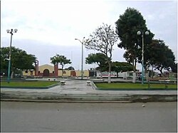
| Plaza de Armas in Guadalupito | |
Coordinates: 8 ° 32 ′ S , 78 ° 39 ′ W
The province of Virú is located in the La Libertad region in northwestern Peru . The province was established in 1995. It has an area of 3218.74 km². At the 2017 census, 92,324 people lived in the province. In 1993 the population of the area was 34,674, in 2007 76,710. The administrative seat is the small town of Virú .
Geographical location
The province of Virú is located 35 km southeast of the city of Trujillo in the arid coastal region of Peru. It extends over an approximately 65 km wide stretch of coast on the Pacific coast in the southwest of the La Libertad region. The province extends up to 45 km inland. The rivers Río Virú and Río Chao flow through the province. The Río Santa runs along the southern provincial border . Inland the mountains of the Peruvian Western Cordillera rise .
The province of Virú borders in the northwest on the province Trujillo , in the east on the province Contumazá ( region Cajamarca ), in the east on the provinces Julcán and Santiago de Chuco and in the south on the province Santa ( region Ancash ).
Administrative division
The province of Virú is divided into the following three districts. The district of Virú is the seat of the provincial administration.
| District | Administrative headquarters |
|---|---|
| Chao | Chao |
| Guadalupito | Guadalupito |
| Viru | Viru |
Web links
- Peru: Region La Libertad (provinces and districts) at www.citypopulation.de
- INEI Perú
