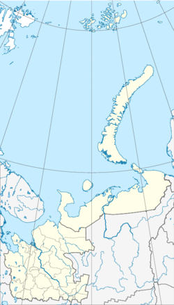
Nyandomski rajon
| Rajon
Njandomski rajon
Няндомский муниципальный район
|
||||||||||||||||||||||||||||||||||||||||||||
The Njandomski rajon ( Russian: Ня́ндомский муниципа́льный райо́н Njandomski munizipalny rajon ) is an administrative unit within the Arkhangelsk Oblast , Russia . It is located south of the Oblast capital Arkhangelsk . The administrative center is the city of Njandoma .
geography
The Nyandomsky rajon is located in the southwestern part of Arkhangelsk Oblast. In the west of the Rajon borders the Kargopolski rajon , north of the Plesezki rajon , east of the Schenkurski rajon , southeast of the Welski rajon and south of the Konoschski rajon . The area of the Rajons is 8100 km².
history
The Njandomski rajon was founded on July 15, 1929 as part of the newly created Njandomski okrug ( Няндомский округ ), the Northern Krai . The center became Njandoma, which at that time had the status of a workers' settlement . From 1936, the Rajon became part of the Northern Oblast . On September 23, 1937, the Rajon went into the territory of the newly founded Arkhangelsk Oblast.
Population development
The following overview shows the development of the population of the Njandomski rajon.
| year | Residents |
|---|---|
| 1959 | 47,376 |
| 1970 | 44,484 |
| 1979 | 39,051 |
| 1989 | 40,601 |
| 2002 | 33,465 |
| 2010 | 30,244 |
Note: census data
Administrative division
The Rajon is divided into three municipalities ( муниципальное образование ), one of which is an urban municipality ( городское поселение ) and two rural municipalities ( сельское поселение ). With Njandoma as the administrative center, there is only one place with city status within the Rajon . The Nyandomski rajon has 30,244 inhabitants (as of October 14, 2010), which corresponds to 2.6% of the population of Arkhangelsk Oblast.
| local community | Russian name | Residents (October 14, 2010) |
Administrative center |
|---|---|---|---|
| Municipality of Nyandomskoje | Няндомское городское поселение | 23,878 | Nyandoma |
| Rural municipality of Moshinskoye | Мошинское сельское поселение | 2,249 | Makarovskaya |
| Shalakushskoye commune | Шалакушское сельское поселение | 4.117 | Shalakusha |
Economy and Transport
The main industries of the Rajon are forestry, agriculture and rail transport. In the rural community of Schalakuschskoje in particular , the forest industry and wood processing companies play an important role in the economy. Rail transport is the most important means of transport and transport in the region. The most important railway connection is the Konosha – Nyandoma – Arkhangelsk line of the Northern Railway . In addition, there were numerous smaller narrow-gauge railway lines during the Soviet Union , which were mainly used in the forest industry. Today, of these lines, only the Lepscha Narrow Gauge Railway ( Ле́пшинская узкоколейная железная дорога ) and the Iwakscha Narrow Gauge Railway ( Ивакшазянская уезназколежерд ). The road network is not very well developed in the region. There is a road connection from Njandoma to Kargopol and the M8 trunk road via the R2 regional road .
Remarks
- ↑ The information relates to the Arkhangelsk Oblast without the Nenets Autonomous Okrug
Web links
- The Nyandomsky rajon on the official site of Arkhangelsk Oblast (Russian)
Individual evidence
- ↑ a b Gosudarstvennyj archive Archangel'skoj oblasti . Tom 1. Putevoditel 'v dvuch tomach., Archangelsk 2000, ISBN 5-85879-052-6 , pp. 264-273
- ↑ Law on the Status and Limits of Territories of Municipal Constructions of Arkhangelsk Oblast. / "О статусе и границах территорий муниципальных образований в Архангельской области" Russian; accessed on October 17, 2016
- ↑ Itogi Vserossijskoj perepisi naselenija 2010 goda. Tom 1. Čislennostʹ i razmeščenie naselenija (Results of the All-Russian Census 2010. Volume 1. Number and distribution of the population). Tables 5 ( Memento of the original from May 23, 2013 on WebCite ) Info: The archive link was inserted automatically and has not yet been checked. Please check the original and archive link according to the instructions and then remove this notice. (PDF; 6.0 MB), pp. 12-209; 11 (PDF; 17.5 MB), pp. 312–979 (download from the website of the Federal Service for State Statistics of the Russian Federation); Čislennost 'naselenija po municipal'nym obrazovanijam i naselennym punktam Archangel'skoj oblasti, vključaja Neneckij avtonomnyj okru Itogi Vserossijskoj perepisi naselenija 2010 Goda (population number of municipal structure and places the Arkhangelsk including the Autonomous circles Nenets results of the All-Russian census 2010.) Table ( Page no longer available , search in web archives ) Info: The link was automatically marked as defective. Please check the link according to the instructions and then remove this notice. (Download from the website of the Federal Service for State Statistics of Arkhangelsk Oblast)
- ↑ Information about the economy of the Nyandomski rajon on nyan-doma.ru (Russian); Retrieved October 5, 2012
- ↑ Narrow- Gauge Railways of Arkhangelsk Oblast on Sergei Bolashenko's website (Russian); Retrieved October 5, 2012


