
River Swale
| River Swale | ||
 The Swale at Whitecliffe Wood, above Richmond |
||
| Data | ||
| location | North Yorkshire , England | |
| Drain over | River Ure → River Ouse → Humber → North Sea | |
| source | Confluence of the Great Sleddale Beck and Birkdale Beck 54 ° 24 ′ 11 ″ N , 2 ° 13 ′ 22 ″ W |
|
| Source height | 366 m | |
| muzzle | at Myton-on-Swale in the River Ure Coordinates: 54 ° 5 ′ 16 ″ N , 1 ° 20 ′ 36 ″ W 54 ° 5 ′ 16 ″ N , 1 ° 20 ′ 36 ″ W |
|
| Mouth height | 11 m | |
| Height difference | 355 m | |
| Bottom slope | 3 ‰ | |
| length | 117.8 km | |
| Left tributaries | Arkle Beck, Wiske, Cod Beck | |
| Small towns | Richmond | |
 Kisdon Force waterfall in the upper reaches, east of Keld |
||

The River Swale is a river in Yorkshire , England . It is one of the main tributaries of the River Ure , which merges into the River Ouse and eventually flows into the Humber and thus into the North Sea . Swaledale , the valley through which the Swale flows in the upper and middle reaches, is part of the Yorkshire Dales and, with its side valleys, forms the northernmost part of the Yorkshire Dales National Park .
The river and valley are inhabited by many species of flora and fauna typical of the Yorkshire Dales. Like its neighboring rivers, the Swale has also dug its way through different layers of rock; the valley shows characteristic features of both river and glacial erosion. The fertile and water-rich area of the Swale was settled early on and used for agriculture and livestock. In addition, mineral resources were extracted in Swaledale as early as Roman times.
Surname
The name of the river goes back to the Anglo-Saxon word sualuae , which means a raging river that is prone to flooding. That fits the circumstances: In the area of the upper reaches 1800, in the lower reaches 1300 mm of precipitation per year; in the upper reaches of the Swale falls by 148 m over a length of 32 km, which results in a bed gradient of 4.6 ‰. In the lower reaches, level increases of three meters are recorded within 20 minutes. The Swale is considered to be the fastest flowing river in England.
River course

The Swale is formed by the confluence of the Birkdale Beck and Great Sleddale Beck near the ridge of the Pennines . It initially flows in a north-easterly direction, passes former lead mines on its north side, takes on the Whitsundale Beck , which is roughly the same size from the left , which drains an extensive upland moor in the north, and then turns to the east, towards a series of waterfalls: Wain Wath Force and Cartrake Force at Keld, then East Gill Force and Kisdon Force . Behind Keld he leaves the wide main valley, which turns south here, and instead follows a narrow gorge to the east, Kisdon Gorge ; it flows around Mount Kisdon north and east, while the main valley runs around Kisdon west and south.
After the mouth of the Swinner Gill from the left, the Swale turns south before the ridge of Black Hill , towards the village of Muker, where it picks up the Straw Beck from the right , re-entering the main valley and turning sharply to the east. Now the river becomes flatter, passes the places Gunnerside, Feetham, Healaugh, Reeth and Grinton (where Arkle Beck , the largest tributary, joins from the left), describes a loop around the villages of Marrick and Marske, and then flows eastwards towards Richmond , the largest city of its course.
The actual Swaledale ends here, as the river enters the wide Vale of Mowbray below Richmond , which it initially flows through to the east in sometimes sweeping meanders . After crossing the A1 at Catterick Bridge, he turns right again. Constantly meandering, it now runs roughly south-southeast between the A1 and the East Coast Main Line , passing the towns of Maunby, Skipton-on-Swale, Catton, Topcliffe, Asenby, Helperby and Myton-on-Swale until it reaches the River Ure flows into it. Between Maunby and Skipton it takes the River Wiske from the left , south of Topcliffe the Cod Beck .
Level values
Low and high tide are average values.
| Level station | Height of the station | Low tide | Flood | Maximum historically documented flood |
|---|---|---|---|---|
| Park Bridge | 325 m | 0 m | 2.50 m | 3.04 m |
| Grinton Bridge | 187 m | 0 m | 1.50 m | 2.51 m |
| Richmond Lownthwaite Bridge | 114 m | 0 m | 2.00 m | 4.19 m |
| Catterick Bridge | 60 m | 0.30 m | 2.40 m | 3.48 m |
| Morton-on-Swale | 27 m | 0.13 m | 5.80 m | 6.47 m |
| Crakehill | 16 m | 0.22 m | 3.00 m | 5.45 m |
| Myton-on-Swale | 12 m | 0.44 m | 3.44 m | 6.02 m |
flora
The biotopes along the River Swale include deciduous, mixed and coniferous forests as well as hay meadows and grasslands. Limestone cliffs, ferns and bushes can also be found. In the high areas there is only the so-called moorland : treeless land overgrown with heather, ferns and hard grasses.
The predominant tree species in the valley are common ash , birch , rowan and common bird cherry , in bushes also hawthorn , common hazel and holly . Smaller sections are populated by yews or maples . Scots pine , larch and spruce mainly grow on artificially afforested areas. The river banks are lined with alders and willows .
The buttercup and the forest cranesbill stand on the hay meadows .
geology
The upper course of the river crosses unfolded carboniferous sedimentary rocks , which are deposited on the old Paleozoic ( Caledonian ) basement . These are rich in mineralization such as B. metal-containing sulphide ores: galena , zinc blende , copper pyrites and pyrite . There are also deposits of fluorspar , barite , witherite , calcite , dolomite and barytocalcite .
The valley slopes show the shapes characteristic of the Yorkshire Dales, with alternating layers of limestone and gritstone , a coarse-grained sandstone. Small coal deposits have been discovered and mined, particularly around Tan Hill.
During the last glacial period, glaciers widened the valley and shifted the course of the river in the area of Keld and Round Howe. This is where the Kisdon Gorge was created . Further down the valley, at Gunnerside and Grinton Bridge, moraines mark retreat stages for the glacier.
history

The first signs of settlement in the river valley come from the Middle and Neolithic Age , where arrowheads and tools for making fire were found. Around Harkerside there are some small stone circles that were created in the Bronze Age and signs of mining during the Iron Age .
Lead ore was extracted on the slopes around Swaledale as early as Roman times, as can be seen from the mines around Hurst. This activity seems to have declined after the occupation by the Normans . It was only when the monasteries expanded around the 12th and 13th centuries that lead ore became interesting again as an economic asset, and mining flourished again. Lead ore mining can be seen most clearly in the remains of the 18th century, when a technique called hushing was used for this : dammed water was poured down the slope, which carried away the surface layers and thus exposed the mineable layers.
By the 8th century the valley was inhabited by the Angles who founded the towns of Reeth , Stainton, Grinton and Fremington. The Normans came 200 years later. After the Norman occupation, the valley was awarded to Alain de Bretagne, 1st Earl of Richmond , who built Richmond Castle from 1071 to 1091 on a hill overlooking the lower reaches of the Swale.
economy
Mining and agriculture

Throughout the centuries lead ore mining and animal husbandry were the main industries in Swaledale, but towards the end of the 19th century they could no longer hold their own against global competition. Grain used to be grown in Swaledale, mostly in the warm period of the 13th century; today grain cultivation takes place only below Richmond.
A special breed of sheep is bred in Swaledale and the surrounding area, the Swaledale Sheep , which is very hardy. Its wool is strong and robust, but not very "fine" and therefore does not have a high market value. The meat of the Swaledale sheep is in turn valued. The Yorkshire Dales National Park logo abstracts the mask of a Swaledale Sheep.
Swaledale Cheese , the local cheese specialty , is produced on farms .
tourism
Today tourism plays an important role. The establishment of the Yorkshire Dales - National Parks has made numerous hotels and private pensions arise. Swaledale is advertised for its pristine wilderness and is considered the least affected by economic development among the Yorkshire Dales.
Several recreational routes of national importance cross or touch the valley:
- The Yorkshire Dales Cycle Way , a cycle path, from Fremington to Gunnerside
- The Coast to Coast Walk , a long distance hiking trail, follows Swaledale from Keld to Richmond
- The Pennine Way , England's oldest and longest long-distance footpath, crosses the Swale at Keld, follows the valley to Muker and then turns southwest
Many of the villages hold a Village Show once a year , a combination of a village festival and a performance show, where, in addition to sporting competitions and demonstrations, local products are also exhibited and awarded. These events draw visitors from all over England and beyond.
Numerous exterior shots of the TV series The Doctor and the Dear Cattle were filmed in Swaledale.
Web links
Pictures along the course of the river

Mouth of the Whitsundale Beck (from opposite) into the Swale (from left)

Wain Wath Force near Keld, in the background the limestone cliffs of Cotterby Scar

Catrake Force

Kisdon Force

At Muker, look upstream to Swinner Gill
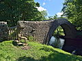
Ivelet Bridge

Reeth Swing Bridge

Grinton Bridge

Downholme Bridge

Richmond rapids

At Brompton-on-Swale

Morton Bridge: the A684 crosses the Swale

At Brafferton, just before the estuary


Individual evidence
- ^ Origin of name . Retrieved January 28, 2011.
- ^ River Swale - Yorkshire Dales Rivers Trust . Yorkshire Dales Rivers Trust. Retrieved October 27, 2015.
- ^ River levels . Retrieved December 23, 2010.
- ^ Flora of the valley . Retrieved on February 7, 2011. ( Page no longer available , search in web archives ) Info: The link was automatically marked as defective. Please check the link according to the instructions and then remove this notice.
- ↑ C. Scrutton: Yorkshire Rocks and Landscapes, A Field Guide . Ellenbank Press, 1994, ISBN 1-873551-08-8 .
- ↑ R. Pattrick, D. Polya: mineralization in the British Isles . Springer, 1993, ISBN 0-412-31200-X .
- ^ Dunham, Wilson: Geology of the North Pennine Orefield Vol 2: Stainmore to Craven . HMSO London, 1985, Unknown ID: 0L254726M.
- ↑ a b A. Raistrick, B. Jennings: History of Lead Mining in the Pennines . G. Kelsall, 1966, ISBN 0-946571-01-5 .
- ^ A b R. Fieldhouse, B. Jennings: History of Richmond & Swaledale . Phillimore & Co Ltd, London 1978, ISBN 1-86077-364-8 .
- ^ Information from the breeders' association , accessed on January 3, 2015.
- ↑ www.yorkshire.com : "At the tip of the Dales stands the unspoilt wilderness of Swaledale", accessed on April 2, 2019
- ↑ for example Muker Show or Reeth Show