Sury-aux-Bois
| Sury-aux-Bois | ||
|---|---|---|

|
|
|
| region | Center-Val de Loire | |
| Department | Loiret | |
| Arrondissement | Orleans | |
| Canton | Châteauneuf-sur-Loire | |
| Community association | Loges | |
| Coordinates | 47 ° 58 ′ N , 2 ° 21 ′ E | |
| height | 109-160 m | |
| surface | 38 km 2 | |
| Residents | 792 (January 1, 2017) | |
| Population density | 21 inhabitants / km 2 | |
| Post Code | 45530 | |
| INSEE code | 45316 | |
| Website | http://suryauxbois.pagesperso-orange.fr/ | |
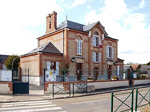
 Town hall (Mairie) of Sury-aux-Bois |
||
Sury-aux-Bois is a French commune in the department of Loiret in the region Center-Val de Loire . It has 792 inhabitants (as of January 1, 2017) who call themselves Suryens . Sury-aux-Bois belongs to the Arrondissement Orléans and the Canton of Châteauneuf-sur-Loire .
geography
Sury-aux-Bois is located about 33 kilometers east-northeast of Orléans on the Canal d'Orléans . Sury-aux-Bois is surrounded by the neighboring municipalities of Nesploy in the north, Bellegarde and Quiers-sur-Bézonde in the northeast, Auvilliers-en-Gâtinais in the east and northeast, Châtenoy in the east and southeast, Saint-Martin-d'Abbat in the south, Vitry-aux-Loges in the southwest, Combreux in the west and Nibelle in the northwest.
Population development
| 1962 | 1968 | 1975 | 1982 | 1990 | 1999 | 2006 | 2012 |
|---|---|---|---|---|---|---|---|
| 475 | 421 | 387 | 392 | 433 | 508 | 689 | 782 |
| Source: Cassini and INSEE | |||||||
Attractions
- Saint-Georges church
Web links
Commons : Sury-aux-Bois - collection of images, videos and audio files

