
Ruhbach (Sulzbach)
| Ruhbach | ||
 Meander of the Ruhbach |
||
| Data | ||
| Water code | DE : 2643544 | |
| location | Germany | |
| River system | Rhine | |
| Drain over | Sulzbach → Saar → Moselle → Rhine → North Sea | |
| source | near Elversberg 49 ° 19 ′ 8 ″ N , 7 ° 6 ′ 53 ″ E |
|
| Source height | 342 m above sea level NN | |
| muzzle | in the Sulzbach (Saar) coordinates: 49 ° 18 '28 " N , 7 ° 4' 58" E 49 ° 18 '28 " N , 7 ° 4' 58" E |
|
| Mouth height | 247 m above sea level NN | |
| Height difference | 95 m | |
| Bottom slope | 24 ‰ | |
| length | 3.9 km | |
| Catchment area | 5.05 km² | |
The Ruhbach is a brook in the Saarland.
geography
course
The Ruhbach rises at the Kummelbrunnen in Elversberg and forms the Sulzbach near Schnappach together with the Moorbach . The Ruhbachtal is accessible from the St. Ingberter district Schüren , from Elversberg and from Schnappach and lies in the southern border area of the Saarkohlenwald .
Tributaries
- Kunnenbrunnenbach ( right ), 0.2 km
- Oberer Elmersbach (left), 0.2 km
- Unterer Elmersbach (left), 0.2 km
- Schürerbach ( left ), 0.4 miles
- Grenzbach ( right ), 0.6 km
- Birkelbach ( left ), 1.0 km
- Fuchsbruchbach ( right ), 0.9 km
geology
The Ruhbach flows through a valley that consists of brown earth and podsolic brown earth over red sandstone or Kreuznach layers of the Rotliegend . In the north-west, the carbon lies over these layers .
nature and environment
Water quality
The water quality of the Ruhbach has improved by one category from bad (2009) to unsatisfactory (2015) according to the 5-stage classification of the EU Water Framework Directive . The reason given is the reduced wastewater pollution of the body of water due to the modernization of the nearby Elversberg sewage treatment plant .
fauna
Butterflies (Lepidoptera): Since the Ruhbachtal is not listed in the Lepidoptera Atlas of Saarland itself, the 37 species of butterflies documented there for the municipalities of Spiesen-Elversberg and Schnappach serve as an orientation aid for possible occurrences.
List (selection) of rare butterflies that have been identified in the Ruhbachtal
- Little forest porter
- Wollafter
- Shiny earth owl
- Little spruce owl
- Gold owl
- Yellow ribbon

Dragonflies (Odonata):
Amphibians (Amphibia): The following amphibians can be observed especially at the pond of the former swimming pool
Birds (aves)
vegetation
The forest areas adjacent to the Ruhbach consist mainly of deciduous forest with smaller areas of coniferous forest. The glass industry and mining in the neighboring communities have been using the raw material wood in their kilns and tunnels since the early 18th century. Over time, entire forests disappeared in the mines of the region, so that today's forest appearance is reforestation after extensive clearing. 150 years ago, conifers that did not belong to the original tree population were planted because of their faster growth. The few old wood stocks also date from this time, which can be clearly seen from the fact that old beech trees grow on older sunken paths on some of the banks of the Ruhbach. Oak, beech, spruce and pine mixed deciduous stands as well as mixed deciduous and coniferous stands as young growth, poles and weak and medium-sized trees characterize today's forest.
- Oak (Quercus)
- European beech (Fagus)
- Alder (Alnus)
Ruhbachtal nature reserve
In the Ruhbachtal, approx. 37 hectares are designated as a nature reserve. The protective purpose is named:
“(...) the maintenance, promotion and development of a near-natural stream valley with its side valleys. This is characterized by a diverse, small-area changing mosaic of the habitats alluvial forest, quarry forest, spring meadows, reed beds, tall herbaceous meadows, large sedge meadows, wet meadows, transition moor and Winkelseggen alder forest. The area offers a large number of rare and endangered animal and plant species their natural habitat. "

Recovery dump Victoria | Birzberg, Honigsack / Kappelberghang near Fechingen | The Ruthenstücker | Heidhübel | Kleinblittersdorfer Forest | Lohbergerbachtal - Bauernkuppe | Oberwürzbach-Hirschental | Ruhbachtal | Saar coal forest | St. Arnualer meadows | Warndt | Woogbachtal | Wusterhang and Beierwies near Fechingen
history
.jpg)
The Ruhbachtal was already settled in prehistoric times, as a burial mound from the Hallstatt period attests to. Depressions and holes in the area come from the kilns of well-known Celtic smelting sites and settlement facilities. Alfons Kolling , former state archaeologist of the Saarland, describes a stone relief of an anthropomorphic depiction found in the Ruhbach river bed in 1950 , which suggests a Gallo-Roman sanctuary in the valley. At the time of the industrial revolution , its water was fed to the prosperous Heinitz mine . In the valley itself, several sand pits served as sources of raw materials for the early glass industry at that time. From 1821 to 1858 the iron stone pits Raversfund and Friedrich were in the northern Ruhbachtal. Several charcoal burner sites are known. The Mariannenthaler Glashütte was located at the western end of the valley on the Bavarian side . The Ruhbach also fed an open-air swimming pool that was located below the Bavarian Zell inn until the middle of the 20th century.
The border between the former Prussian Rhine province and the Palatinate (Bavaria) ran through the Ruhbachtal and is still recognizable today by the old boundary stones.
Recreational infrastructure
The Ruhbachtal is a popular local recreation area with Bayrisch Zell as an excursion restaurant. The 12 km long Karl May hiking trail has been signposted for hikers.
Within the Ruhbachtal recreation area there are locally well-developed forest paths with benches and two shelters. Three wooden bridges, renewed in 2016, enable the bank to change at the start of the water and in the middle of the valley. Life-size wood carvings and numerous information boards refer to the work of Karl May. Riding trails are signposted.
photos
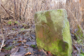
Boundary stone in the Ruhbachtal: Bavarian side

Border stone in the Ruhbachtal: Prussian side


Web links
- Ruhbachtal hiking map (PDF) , accessed on February 26, 2015
Individual evidence
- ↑ Self-measurement on the GeoPortal Saarland
- ↑ GeoPortal Saarland
- ↑ 2. Management plan according to Article 13 of Directives 2000/60 / EC of the European Parliament and of the Council of October 23, 2000 (PDF) , accessed on December 9, 2016
- ↑ Werno, A: Lepidoptera Atlas. Distribution maps of butterflies in the Saarland and peripheral areas. (No longer available online.) 2016, archived from the original on April 3, 2016 ; accessed on December 18, 2016 . Info: The archive link was inserted automatically and has not yet been checked. Please check the original and archive link according to the instructions and then remove this notice.
- ↑ Saarland; National collection of Jakob Berker (1878–1953)
- ↑ Dominik Weber 2014
- ↑ Ordinance on the "Ruhbachtal" nature reserve , accessed on December 9, 2016
- ↑ Ordinance on the "Ruhbachtal" nature reserve, accessed on February 27, 2015
- ^ Early use of resources in the vicinity of the "Hunnenring" in Otzenhausen - A methodical commentary. In: S. Hornung (Hrsg.), Mensch und Umwelt I. Universitätsforsch. Prehist. Arch. 192 (Bonn 2010) 253-274 , accessed on December 9, 2016
- ^ Municipality of Spiesen-Elversberg (ed.): Heimatbuch Spiesen-Elversberg , Ottweiler Druckerei, Spiesen-Elversberg 1995.
- ↑ Bayrisch Zell ( Memento of the original dated February 6, 2015 in the Internet Archive ) Info: The archive link was inserted automatically and has not yet been checked. Please check the original and archive link according to the instructions and then remove this notice.
- ↑ Karl-May-Weg