
Kremser expressway
| Expressway S33 in Austria | ||||||||||||||||||||||||||||||||||||||||||||||||||||||||||

|
||||||||||||||||||||||||||||||||||||||||||||||||||||||||||
| map | ||||||||||||||||||||||||||||||||||||||||||||||||||||||||||
 |
||||||||||||||||||||||||||||||||||||||||||||||||||||||||||
| Basic data | ||||||||||||||||||||||||||||||||||||||||||||||||||||||||||
| Operator: |
|
|||||||||||||||||||||||||||||||||||||||||||||||||||||||||
| Overall length: | 28 km | |||||||||||||||||||||||||||||||||||||||||||||||||||||||||
|
State : |
||||||||||||||||||||||||||||||||||||||||||||||||||||||||||
 |
||||||||||||||||||||||||||||||||||||||||||||||||||||||||||
| The heart of the S33 - the Danube bridge Traismauer | ||||||||||||||||||||||||||||||||||||||||||||||||||||||||||
|
Course of the road
|
||||||||||||||||||||||||||||||||||||||||||||||||||||||||||
The Kremser Schnellstraße S33 is an expressway in Lower Austria . It leads from the St. Pölten junction ( A1 ) via Herzogenburg and the Traismauer Danube bridge to the Jettsdorf junction , where it joins the Stockerauer Schnellstraße (S5). At the Traismauer junction , the Kremser Straße (B37) branches off, which leads to the eponymous city of Krems an der Donau and was part of the S33 until 2010. The Krems expressway also belongs to the Märchenschlossstraße and the Straße der Kaiser und König .
In terms of road traffic law, the S33 has the status of a motorway and requires a vignette or toll . The state-owned motorway operator ASFINAG is responsible for operation and maintenance .
history
The expressway was opened on December 12, 1980 between Krems- South and Hollenburg and extended to Traismauer- North on November 18, 1981 . This section was designed with a motorway cross-section right from the start, but only signposted as a car road. Also on November 18, 1981, the line from St. Pölten to St. Pölten-Ost was opened and one year later it was extended to St. Pölten-Nord. From the start, this section was ranked as a motorway .
The other sections between St. Pölten-Nord and Traismauer-Nord were built without a structural center separation or emergency lane for reasons of cost and opened until 1983. It was not until 2004 that, due to the many and serious accidents, this stretch of the so-called Sparautobahn began to be upgraded to a road with the character of an autobahn, including a central division and hard shoulder. During the construction of the S33, the bridges were designed in such a way that the second carriageway could be built without having to build new bridges over the S33. The full expansion of the S33 was completed on September 22, 2006.
| opening | Route section | length |
|---|---|---|
| 12/12/1980 | HASt Hollenburg - ASt Krems Süd | 3.489 km |
| 11/18/1981 | ASt Traismauer Nord - HASt Hollenburg | 4,436 km |
| 11/18/1981 | St. Pölten node - ASt St. Pölten Ost | 2.152 km |
| 11/19/1981 | ASt St. Pölten Ost - ASt St. Pölten Nord | 3.803 km |
| 11/19/1981 | ASt Traismauer Süd - ASt Traismauer Nord (right RFB ) | 2.950 km |
| 11/23/1983 | ASt St. Pölten Nord - ASt Traismauer Süd (right RFB) | 13,170 km |
| 08/27/2004 | ASt St. Pölten Nord - ASt Herzogenburg Süd (left RFB) | |
| 12/13/2004 | ASt Traismauer Süd - ASt Traismauer Nord (left RFB) | |
| 10/27/2005 | ASt Herzogenburg Nord - ASt Traismauer Süd (left RFB) | |
| 10/27/2005 | ASt Herzogenburg Süd - ASt Herzogenburg Nord (left RFB) |
Danube bridge Traismauer
Between 2008 and 2010, the S33 at the Traismauer junction was decoupled from the line to Krems and extended over the Danube bridge Traismauer to the Stockerauer Schnellstraße (S5) at the Jettsdorf junction. The road from the Traismauer junction to Krems was abandoned as an expressway and part of the Kremser Straße (B37). Since the construction work was completed on October 31, 2010, the entire S33 has been ranked as a motorway in terms of the road traffic regulations .
The aim of the bridge near Traismauer is to guide transit traffic north of the Danube via the S33 – S5 – A22 to Vienna, thereby relieving, among other things, the Tullner Straße (B19). Right at the start of construction of the Danube Bridge difficulties arose because in the area of southern ramp a minefield of Red Army is. Both the ordnance clearance and archaeological rescue excavations in the project area were completed in 2007.
After the completion of the new route over the Danube bridge, the Krems expressway will form part of the so-called regional ring around Vienna in connection with other expressways and motorways .

S33 at Traismauer-Süd

Exit Herzogenburg-Süd
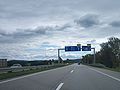
The S33 at the St. Pölten junction


literature
- Bernd Kreuzer: The construction of the autobahns and expressways in Austria. - In: ASFINAG (Ed.): The motorway network in Austria. 30 years of Asfinag. - Vienna, 2012, p. 118
Individual evidence
- ↑ Full expansion completed on ORF
- ↑ Minefield almost completely cleared
- ^ Donaubrücke Traismauer: Project jams ( Memento of the original from December 3, 2010 in the Internet Archive ) Info: The archive link has been inserted automatically and has not yet been checked. Please check the original and archive link according to the instructions and then remove this notice. , accessed September 3, 2010