Saale-Elster sandstone slab
| Saale-Elster sandstone slab | ||
|---|---|---|
| Highest peak | Kulm ( 481.9 m above sea level ) | |
| location | Thuringia , Saxony-Anhalt | |
| Edge plate of the | Thuringian basin (with edge plates) | |
| Classification according to | Handbook of the natural spatial structure of Germany | |
|
|
||
| Coordinates | 50 ° 48 ' N , 11 ° 44' E | |
| rock | Red sandstone , ( shell limestone ) | |
Saale-Elster sandstone slab describes part of the south-eastern framing of the Thuringian Basin between the Saale in the west and the White Elster in the east in East Thuringia and a small portion in southern Saxony-Anhalt . Geologically, it consists mainly of red sandstone and, according to the handbook of the natural spatial structure of Germany, represents the main unit 471 of the main unit group Thuringian Basin (with edge plates) .
A distinction must be made between the Saale-Elster-Platte in the narrower sense, which extends to the Saale Valley in the west , from the geological plate, which also includes the red sandstone roofing of the Ilm-Saale-Platte on the left-hand side of the Saale-Elster-Platte (Saale-Elster-Platte in the broader sense). This article describes the legal part.
Geographical location
The Saale-Elster sandstone slab, which occupies around 916 km², extends over the Thuringian districts of Greiz , Saale-Holzland , Saalfeld-Rudolstadt , Saale-Orla and the independent city of Gera as far as the southern Burgenland district in Saxony-Anhalt . It lies between the urban centers of Saalfeld in the southwest, Jena in the northwest, Zeitz in the northeast and Gera in the east.
The most important partial landscapes are the wooded woodland in the center and the heath to the southwest . In the northeast the landscape crosses the White Elster Valley .
Natural allocation
The Saale-Elster sandstone slab is naturally allocated according to the manual as follows:
-
(for 47/48 Thuringian basins (with edge plates) )
-
471 Saale-Elster sandstone slab
- (Rudolstädter) Heath
- Woodland
- Northeast part
- (left hall part)
-
471 Saale-Elster sandstone slab
It is delimited by the following landscapes and natural spaces:
- Middle Saale valley with the Ilm-Saale-Platte in the west
- Jenaer Scholle in the northwest
- Altenburg-Zeitzer loess area in the northeast
- Orlasenke and northern roofing of the East Thuringian Slate Mountains in the south
Allocation according to TLUG
The Thuringian State Institute for Environment and Geology (TLUG) has its own Thuringia-internal structure The natural areas of Thuringia , within which the landscape is managed as a unit 2.6 Saale sandstone slab .
From a geological point of view, the red sandstone roofing of the Ilm-Saale-Platte to the left of the Saale is added and covers an area of 1044 km² limited to Thuringia.
geology

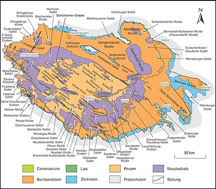
The Saale-Elster sandstone slab consists of a relatively homogeneous slab of middle and lower red sandstone. Only in the area of smaller fault zones near Kahla ( Leuchtenburg , Dohlenstein) and Saalfeld ( Kulm ) shell limestone protrudes over the sandstone slabs. At Gera, as on the entire southern edge, Zechstein and dolomite emerge . Parts of the landscape are covered by sandy loam soils and to the north at the flowing transition to the Leipzig lowland bay, the loess cover increases significantly.
nature
The sandstone slab, sloping from west to east from 450 m to 300 m, is strongly structured by numerous rivers ((Lower) Orla , Roda , Saarbach, Rauda, Erlbach ). While the northern parts have a more pronounced plateau character, the southern parts of the landscape are characterized by deep and steep valleys. Large parts of this landscape are forested because of the poor quality of the soil (mainly pine and spruce forests), but valleys and some plateaus are also used for agriculture.
mountains
Below are the highest mountains and peaks in order of height:
- Kulm (481.9 m), Zeugenberg north of Saalfeld
- Johannihut (450.5 m), north of Oberelle
- Pfannberg (427.9 m), north of Neustadt
- Scheitberg (425 m), south of Uhlstedt
- Wittchensteiner Höhe (414.3 m), northeast of Triptis
- Dachsberg (400 m), north of Lausitz
- Leuchtenburg (400.0 m), east of Kahla
- nameless (396.8 m), west of St. Gangloff
- Schubertshöhe (383 m), north of Langendembach
- Pfalzberg (376.4 m), south of Stadtroda
- Cheese mountain (360 m), north of Eisenberg
- Lessener Höhe (300.7 m), west of Lessen
Left Saal mountains are the Culmsen (418 m, west of Orlamünde ), the Buchberg (409 m, north of Uhlstädt ) and the Hohe Berg (402 m, north of Kirchhasel ).
Individual evidence
- ↑ a b E. Meynen and J. Schmithüsen : Handbook of the natural spatial structure of Germany - Federal Institute for Regional Studies, Remagen / Bad Godesberg 1953-1962 (9 deliveries in 8 books, updated map 1: 1,000,000 with main units 1960)
- ↑ A detailed breakdown is not available because the corresponding single sheets for the eastern parts of the country have not been published. The manual only describes the large planed areas (page 730).
-
^ Walter Hiekel, Frank Fritzlar, Andreas Nöllert and Werner Westhus: The natural spaces of Thuringia . Ed .: Thuringian State Institute for Environment and Geology (TLUG), Thuringian Ministry for Agriculture, Nature Conservation and Environment . 2004, ISSN 0863-2448 . → Natural area map of Thuringia (TLUG) - PDF; 260 kB → Maps by district (TLUG)
- ↑ Map services of the Federal Agency for Nature Conservation ( information )

