
Seelisberg
| Seelisberg | |
|---|---|
 |
|
| State : |
|
| Canton : |
|
| District : | No district division |
| BFS no. : | 1215 |
| Postal code : | 6377 |
| Coordinates : | 687 310 / 203 388 |
| Height : | 801 m above sea level M. |
| Height range : | 433–2116 m above sea level M. |
| Area : | 13.29 km² |
| Residents: | 661 (December 31, 2018) |
| Population density : | 50 inhabitants per km² |
|
Proportion of foreigners : (residents without citizenship ) |
15.2% (December 31, 2,014) |
| Mayor : | Judith Durrer-Ziegler (independent) |
| Website: | www.seelisberg.ch |
 Seelisberg |
|
| Location of the municipality | |
  |
|
Seelisberg is a municipality in the canton of Uri in Switzerland .
geography

Seelisberg lies on the eastern slope of a mountain, the highest point of which is Brandegg ( 1108 m above sea level ). The village is about 400 m above Lake Lucerne and is the northernmost municipality in the canton of Uri. It consists of the parts Sunnenberg, Oberdorf and Unterberg. The lowest point in the community is 434 m above sea level. M. on the shores of Lake Lucerne, which at 2117 m above sea level. M. highest point is on the Oberbauenstock .
Seelisberg also includes the ships landing stage in Treib ( 436 m above sea level ) on Lake Lucerne , the hamlet of Volligen ( 508 m above sea level ) also on the lake, Schattenhalb on the northern slope of the Zingelberg (both northwest of the village), Beroldingen ( 864 m above sea level ) and Wyssig ( 761 m above sea level ) south of the village and Geissweg ( 793 m above sea level ; southwest of the village on the road to Emmetten ). The most famous part of the municipality is certainly the Rütli , where, according to mythical tradition, Switzerland was founded. The Rütli is a meadow on the shores of Lake Lucerne with a restaurant, not an actual settlement.
Only 53 ha or 4.0% of the municipality is settlement area. Of this, 26 ha are buildings and 17 ha are traffic areas. The agricultural area is more extensive with 454 hectares or a share of 34.3%. Among them are larger alpine areas. These cover an area of 132 ha. In contrast, 313 ha are meadow and arable land. In addition, 645 hectares or 48.7% are covered by forest and wood. Unproductive area comprises the rest of the municipal area, more precisely 173 ha or 13.1%. It concerns almost exclusively areas without vegetation (high mountains) or areas with unproductive vegetation (high alpine vegetation).
Seelisberg borders in the west on the Nidwalden community of Emmetten , in the north and east on Lake Lucerne and in the south on Isenthal and Bauen .
population
Between 1850 and 1860 there was a minor decrease in population. Thereafter, the population grew to a record 717 people by 1880 (1860-1880: + 18.3%). After ups and downs over the next few decades, the number of residents in 1920 was at the same level as in 1880 and 1888. After that, the number of residents fell - only interrupted by short-term growth in the 1930s - incessantly and massively until 1980 (1920– 1980: -24.9%). The 533 inhabitants in 1980 were the absolute low point. Since then the number of residents has increased again (1980–2005: +13.9%). The reasons for the massive emigration between 1920 and 1980 lay in the remote location. Since the community has become more accessible on the road (by motorway and post bus), people have been moving to Seelisberg again because of its beautiful location.
| Population development | |||
|---|---|---|---|
| year | Residents | year | Residents |
| 1850 | 649 | 1960 | 560 |
| 1860 | 606 | 1980 | 533 |
| 1880 | 717 | 1990 | 569 |
| 1888 | 713 | 2000 | 592 |
| 1900 | 635 | 2005 | 607 |
| 1920 | 710 | 2010 | 662 |
| 1941 | 681 | 2011 | 685 |
languages
The population speaks a highly Alemannic dialect. Almost the entire population speaks German as the everyday language. In the last census in 2000, 97.13% said German, 0.84% French and 0.51% English were their main languages.
Religions - denominations
The population used to be fully members of the Roman Catholic Church. The denominational relationships in 2000 still show the original structure. 475 people were Catholic (80.24%). In addition, there were 4.73% Evangelical Reformed Christians and 9.97% non-denominational. 25 people (4.22%) did not provide any information about their creed.
Origin - nationality
Of the 607 residents at the end of 2005, 561 (92.42%) were Swiss citizens. The majority of the immigrants come from Germany, Italy and Macedonia. At the 2000 census, 555 people (93.75%) were Swiss citizens; eight of them had dual citizenship.
age structure
The community has a high proportion of older adults (45–59 years; 23.48%). The proportion of people under the age of twenty of 24.83% of the local population is slightly higher than the proportion of people of senior age (60 years and older; 22.47%). The small number of residents between 20 and 29 years of age is striking.
The last census in 2000 showed the following age structure:
| Age | 0–6 years | 7-15 years | 16-19 years | 20-29 years | 30–44 years | 45–59 years | 60–79 years | 80 years and more |
|---|---|---|---|---|---|---|---|---|
| number | 32 | 82 | 33 | 49 | 124 | 139 | 107 | 26th |
| proportion of | 5.41% | 13.85% | 5.57% | 8.28% | 20.95% | 23.48% | 18.07% | 4.39% |
Personalities
- Alfons Lutz (born July 25, 1903 in Seelisberg; † June 9, 1985 in Basel), pharmacist and pharmacy historian
politics
Legislature
The legislative body of the community of Seelisberg is the open village community assembly , which takes place in May and December.
Executive
The seven-member municipal council forms the executive . He works part-time. Mayor the non-party Judith Durrer Ziegler is since 1 January 2018 (as of 2018).
economy
In 2005 there were 31 farms offering 72 jobs. Industry and trade employed 18 people in 7 workplaces, the service sector in 29 companies 151 people (employment converted to full-time positions). The 2000 census showed 37 agricultural and forestry businesses with 93 employees. The 2001 company census came to 6 industrial and commercial enterprises with 19 and 32 service companies with 144 employees. Of the 309 gainfully employed people in Seelisberg in 2000, 153 (49.51%) worked in their own community. In total, the place offered work to 181 people, of whom 153 (84.53%) were locals.
Most of the 156 commuters do their work in municipalities in the canton of Nidwalden. This peculiarity can be explained with the road connections. 34 of them worked in Stans , 18 in Emmetten, 12 each in Beckenried and Buochs and 8 in Ennetbürgen . 21 people were employed in the city of Lucerne , 6 in the Schwyz municipalities of Ingenbohl and 5 in Schwyz, and 9 in the Uri canton capital. There were only 28 commuters. These came mainly from Emmetten (10 people) and Beckenried (4).
traffic
Seelisberg can be reached all year round by car from Lucerne via the A2 , exit Beckenried Süd via Emmetten - the community has no direct road connection to the rest of the canton. The Treib -Seelisberg-Bahn , a funicular railway , leads from Treib on Lake Lucerne to the town. From Nidwalden , Seelisberg can also be reached by post bus (around 45 minutes from Stans).
tourism
In a larger mountain lake, the Seelisbergsee , you can swim in summer; a campsite (only tents) is right by the Seeli. The Rütli is the starting point of the Swiss Path . The landscaped hiking trail , which leads from Rütli via Seelisberg, Bauen, Flüelen and Sisikon to Brunnen , was a gift from the cantons to the people of Switzerland to mark the 700th anniversary of the Confederation . The route offers wide views, leads up the mountain from the Rütli, past the Beroldingen castle and later along Lake Uri through forests and over meadows. Well-developed picnic areas with benches and fountains are available.
Stories
- Below Seelisberg lies the Rütli , according to legend the birthplace of the Swiss Confederation.
- The Elbst is a water spirit who is said to live in a mountain lake near Seelisberg.
Attractions
photos

The Seeli near Seelisberg
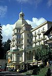
Seelisberg: Maharishi European Research University

Pilgrimage chapel Maria Sonnenberg


literature
- Helmi Gasser : The art monuments of the canton Uri, Volume 2: The lakeside communities. Edited by the Society for Swiss Art History GSK. Bern 1986 (Art Monuments of Switzerland Volume 78). ISBN 3-7643-1811-2 . Pp. 359-464.
Web links
- Official website of the community of Seelisberg
- Hans Stadler: Seelisberg. In: Historical Lexicon of Switzerland .
- Swiss cable car inventory No. 61.048 Treib - Seelisberg
Individual evidence
- ↑ Permanent and non-permanent resident population by year, canton, district, municipality, population type and gender (permanent resident population). In: bfs. admin.ch . Federal Statistical Office (FSO), August 31, 2019, accessed on December 22, 2019 .
- ↑ pxweb.bfs.admin.ch
Altdorf | Andermatt | Attinghausen | Build | Bürglen | Erstfeld | Flüelen | Göschenen | Belt pins | Hospental | Isenthal | Realp | Schattdorf | Seedorf | Seelisberg | Silenen | Sisikon | Spiringen | Undercuts | Water
Canton of Uri | Districts of the canton Uri | Municipalities of the Canton of Uri