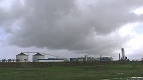
Sidi Bennour (Province)


The province of Sidi Bennour (Arabic: إقليم سيدي بنور), with a size of about 3270 km² and about 460,000 inhabitants , belonged to the historical region of Doukkala and was created in 2009 by separating areas from the province of El Jadida and has been part of the Moroccan region of Casablanca since 2015. Settat (before Doukkala-Abda ). The provincial capital is Sidi Bennour . The province consists of two cities (Sidi Bennour and Zemamra ) and about 23 rural communities ( communes rurales ).
geography
location
The province of Sidi Bennour borders in the north with the province El Jadida , in the east with the province Rehamna , in the southeast with the province Youssoufia and in the south with the province Safi . A narrow coastal strip with the fishing village of Oualidia connects the province with the Atlantic .
landscape
The landscape profile is flat with an average height of around 200 m above sea level. d. M .; only in the south-east does the small mountain range of Jbel Lakhdar reach a maximum height of about 687 m.
climate
Located only a short distance from the Atlantic, the climate of the province is largely determined by the sea. Nevertheless, the maximum daily temperatures in summer rise to over 40 ° C; at night it cools down to around 15 to 20 ° C, depending on the cloudiness. In the four winter months from November to February, over 90% of the annual rainfall falls - on the many sunny days the thermometer nevertheless rises to 25 to 30 ° C; at night it is usually around 15 ° C.
population
Over 90% of the population are members of various Berber tribes . The men work as farm workers, taxi drivers or in construction; many also try their luck in Europe. The leading positions in business and administration as well as in health and education are mostly in the hands of the Arab minority. Moroccan Arabic is spoken .
Places (selection)
Only the cities of Sidi Bennour and Zemamra are classified as urban settlement areas ( municipalités ); the other places are considered rural communities ( cummunes rurales ).

| local community | 1994 residents |
2004 residents |
Residents 2014 |
|---|---|---|---|
| Sidi Bennour (M) | 34,225 | 39,593 | 55,815 |
| Zemamra (M) | 10,310 | 11,896 | 13,279 |
| Oualidia | 13,076 | 15,433 | 18,616 |
| Bni Hilal | 16,663 | 17,288 | 17,843 |
| Bouhmame | 23,401 | 30,540 | 23,234 |
| Lgharbia | 23,127 | 23,074 | 22,729 |
| Oulad Sbaita | 20,251 | 24,967 | 25,650 |
economy
Until well into the 20th century, the economy was almost exclusively based on the principles of self-sufficiency. It was only through the improvement of the infrastructure (construction of roads and railways) and the emergence of small and medium-sized towns during the French colonial period and after Moroccan independence (1956) that products were also produced for the surrounding markets. In addition, larger monocultures ( sugar cane ), melons etc. emerged in which workers were needed.
history
No information is available on the medieval history of the region. However, it is likely that it must have been nomadic or semi-nomadic area. Larger settlements or even cities have only existed since the colonial era. The province of Sidi Bennour was only created in 2009 when it was separated from the province of El Jadida.
Attractions
In the province of Sidi Bennour there are no scenic, historical or culturally significant sights.
Web links
Individual evidence
- ^ Province of Sidi Bennour - map and statistics
- ↑ Oualidia - climate tables
- ↑ Sidi Bennour - Climate tables
- ↑ Population statistics Morocco ( Memento from March 3, 2016 in the Internet Archive )
