Smolnícka Huta
| Smolnícka Huta | ||
|---|---|---|
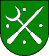
| coat of arms | map | |

|
|
|
| Basic data | ||
| State : | Slovakia | |
| Kraj : | Košický kraj | |
| Okres : | Gelnica | |
| Region : | Spiš | |
| Area : | 37.325 km² | |
| Residents : | 473 (Dec. 31, 2019) | |
| Population density : | 13 inhabitants per km² | |
| Height : | 495 m nm | |
| Postal code : | 055 65 | |
| Telephone code : | 053 | |
| Geographic location : | 48 ° 45 ' N , 20 ° 46' E | |
| License plate : | GL | |
| Kód obce : | 543551 | |
| structure | ||
| Community type : | local community | |
| Administration (as of November 2018) | ||
| Mayor : | Marián Pohly | |
| Address: | Obecný úrad Smolnícka Huta 1 05565 Smolnícka Huta |
|
| Website: | www.smolnickahuta.sk | |
| Statistics information on statistics.sk | ||
Smolnícka Huta (German Schmöllnitzhütte or Schmöllnitzer Hütte , Hungarian Szomolnokhuta - until 1902 Szomolnokhutta ) is a municipality in eastern Slovakia . It is located in the valley of the Smolník River in the northeastern foothills of the Slovak Ore Mountains , about 22 km from Gelnica and connects to the northeast to the place Smolník .
The place was mentioned as part of Schmöllnitz (Smolník) as early as 1681, but only became an independent mining town in 1828. It developed into a processing facility for the ores mined here and in the surrounding area, especially for copper, mercury, lead, silver and iron. A blast furnace was built in 1863 and can still be seen today as a ruin.
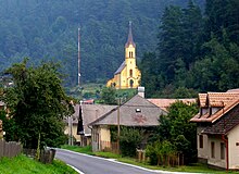
The Catholic church in neo-Romanesque style from 1751 rises on a hill above the village , which was built on the foundations of an older complex. The tower was renewed in 1924. The area around the place is very wooded; spruce trees in particular dominate nature here.
From 1884 to 1965 the place was the end point of the Göllnitz Valley Railway from Margecany .
Until the end of the Second World War , mainly German-speaking residents lived in the village (1930: 879 Germans out of 1069 inhabitants), today (2001 census) 84% of the population are Slovaks, 8% Germans and 4% Gypsies.

